Table of Contents
Argentina (and South American Partners)
China
France
Germany
Japan
Austria
Canada
Italy
South Korea
Mongolia
Norway
Poland
Romania
Russia
Spain
Sweden
Switzerland
United Kingdom
United States of America
Argentina (and South American Partners)
One of the most important activities in Argentina was the thorough development of regional inventories of Andean rock glaciers, which were associated with Andean river basins, and according to federal law to protect glaciers, covered glaciers and rock glaciers. Thus the provinces of Mendoza and San Juan show their wealth of creeping mountain permafrost. Working steps in the inventory in these cases are well advanced. In other cases as in the province of Chubut, in the Southern or Humid Andes, cryoforms occurrences are not outstanding. Data and information that is coming from this mentioned Inventory are submitted to the World Glacier Monitoring Service (WGMS).

Figure 1. In blue glaciers and in brown covered glaciers and rock glaciers or active rock glaciers (Cordón del Plata, Mendoza).
While the doctoral thesis of Lucas Ruiz -about a statistical model of mountain permafrost distribution based on measured BTS (Bottom Temperature of Snow cover) in the Andes of the Northwestern Chubut- was successfully presented at the Universidad de Buenos Aires, new works in periglacial environments of the Andes of Mendoza and San Juan have begun.
Estefanía Bottegal continues with her doctoral thesis about cryodynamics. Noelia Sileo began hydrogeochemical investigations of groundwater and surface water related to covered glaciers and rock glaciers in the basin of the Vallecitos river, Cordón del Plata Mountains range, Mendoza. The results will be presented as a doctoral thesis at the University of Buenos Aires. Carla Tapia Baldis began with analyses of the hydrological significance of cryoforms in the Espinacito Belt (32° to 32°20’S and 69°45’ to 70°O), Calingasta region, San Juan. These studies will be presented as a future doctoral thesis at the Universidad National de San Juan.
Two new joint research projects of the Geocryology Unit (Dr. Dario Trombotto ) at the IANIGLA institute, Mendoza, were approved and will begin in 2014: 1) CMIRA, in collaboration with Dr. Xavier Bodin of the Laboratoire EDYTEM – CNRS – Environnements, Dynamiques et Territoires de la Montagne, Université de Savoie (France), and 2) a project with the Altai State University (Barnaul), Siberia, Rusia, with the participation of Dr. Oleg Ostanin, Ph. D., Head of the Department of Physical Geography and GIS.
At the University of Waterloo, G. Azócar developed a model of potential permafrost distribution in the semiarid Chilean Andes in his Master’s research supervised by A. Brenning.
Report prepared by Dario Trombotto (dtrombot@mendoza-conicet.gob.ar)
China
The report is mainly on the project activities and meetings related to the studies of permafrost and cold regions engineering in China during the period of 2012-2013.
Major programs/projects on permafrost
During the 2012-2013, 20 major research program/projects were initiated or ongoing on permafrost and cold regions engineering in China (Table 1), in addition to many smaller projects from various funding sources. The research and development funding from all levels of governments and industry increased in 2012-2013 in order to meet the demands for socioeconomic development in cold regions and for basic research in geocryology and cold region science and technology. In perspective, the research funding in the next two years should be somewhat cut back in certain areas while an appreciable growth of funding is expected from the Natural Science Foundation of China (NSFC) and the Chinese Academy of Sciences (CAS). This is a result of a consolidation of all funding sources in China for a better managerial purpose and also from an expected slowed growth of economy in China during the 2014-2015 period.
Table 1. Summary on the major project/programs on permafrost and cold regions engineering in China during 2012-2013 (in a descending order of funding strength from 6.00 to 0.25 M USD).

Overall, most of the key research projects and programs are still related to the direct needs in cold regions engineering survey, design and construction, and the related before- and post-construction environmental impact statements, long-term monitoring of foundation soil stabilities and mitigative techniques of frost hazards, and environmental management or response contingency plans (Figure 1). Additionally, some major surveys for baseline and assessment of cold regions environments have been initiated to better understand the permafrost and seasonally frozen ground in China for national and regional planning purposes, and some major basic research projects for cryospheric changes in cascading scales of the Qinghai-Tibet Plateau, China, Northern Hemisphere and the Globe. The NSFC and Chinese Academy of Sciences (CAS) also launched a major research program on the Third Pole (QTP) with a focus of cryospheric water cycling. However, with a focus on mountain glaciers and polar ice sheets, this program has insignificant investment on water resources in permafrost regions and even more limited consideration is given to groundwater. The last is that the CAS designed and implemented a permafrost hydrology program on studying the water resources in the sources area of the Yellow River on the northeastern Qinghai-Tibet Plateau, with a focus of the controlling role of permafrost and its changes in the surface water bodies and groundwater flow systems. Some smaller projects have a wide range of interests in geocryology, alpine ecology, frozen soils mechanics and physics.

Figure 1. Ponding of deep water in the subsided right-of-way zone along the China-Russia Crude Oil Pipeline.
973 projects and programs
Three MOST 973 programs have projects on permafrost, including the “Basic research on the key permafrost engineering on the Qinghai-Tibet Plateau”, “Cryospheric change and adaptive strategies in the Northern Hemisphere” and “Cryospheric changes and their impacts”. They cover a wide range of permafrost-related issues, such as the thermal state and active layer processes, biogeochemical cycles and carbon in permafrost regions, stability and vulnerability of cold regions engineering and environments, water resources and engineering, and adaptive strategies and polices at site to global scales. In addition to permafrost, the programs also study the arctic and Antarctic ice sheets and mountain glaciers, sea ice, snow cover and cold regions ecology.
The 973 program of the Key Permafrost Engineering on the Qinghai-Tibet Plateau is mainly focused on the Qinghai-Tibet Engineering Corridor (QTEC) in a systematic and integrated manner. The program has been a joint collection of projects by the CAREERI, CAS, the Harbin Institute of Technology, Lanzhou University, and the First Highway Design Institute of the Ministry of Transportation. It aims at better understanding of the group interactions of linear infrastructures in the QTEC, interactions between the engineered infrastructures and fragile and stressed alpine environments, and those between the QTEC and surrounding cold regions environments, at the stochastical processes involved in the modeling and predictions of the physical and mechanical processes and properties of foundation soils, and at the better serviceability of the engineered works in their lifespan. This study is also aimed at providing an important support for the proposed Qinghai-Tibet Express Highway from Golmud to Lhasa, as a part of the Beijing-Lhasa Express Way.
Permafrost surveys on the QTP
The MOST specially supported program on the “Baseline survey of the five representative permafrost regions on the QTP”, led by Professor Lin Zhao, the Director of the QTP Cryospheric Station of China, was officially launched in 2010 and came to a conclusion in 2013, with many fruitful results and new findings. Although there have been many maps of permafrost on the QTP since 1970s, this survey has obtained much basic data on the features of distribution and thermal states of permafrost, alpine ecology, and carbon contents in the cryosols and in shallow permafrost. On the basis of the extended surveys, many new monitoring boreholes have been established on five representative parts of the QTP, namely; the Wenquan discontinuous permafrost regions on northeastern QTP, the continuous permafrost zone at the Sources Areas of the Three (Yangtze, Lancang-Mekong and Nujiang) rivers, the Hoh Xil Mountains continuous permafrost zone on the northern QTP, Gerze discontinuous permafrost zone on southwestern QTP, and the continuous permafrost zone in the Tianshuihai Lake area in the West Kunlun Mountains in western QTP. In addition to permafrost studies, hydro-meteorological stations have also been established to automatically monitoring the land surface processes. For example, in April 2013, two automatic weather stations with drilled boreholes were installed in the Zhuonai Lake area (Figure 2) and the Ayake Lake area in the heartland of the QTP. Each station includes ground temperature monitoring system and 15-m high automatic weather station. The recorded environmental variables consist of wind, air temperature and air humidity gradient (at heights of 2, 4, 10 and 15 m above ground), radiation, photosynthetically active radiation (PAR), snow depth, precipitation, surface temperature, thermal flux at 5 cm, 10 cm and 20 cm depths, and geothermal gradient.

Figure 2. Permafrost automatic monitoring stations at the Zhuonai Lake on the western QTP.
This program has been monumental in the sense that permafrost studies have taken a long step away from the major engineering corridors such as those along the Qinghai-Tibet Highway, and the Qinghai-Kang Highway. In addition to the baseline permafrost and active layer data, the recently established monitoring network will also ensure the continuous inflow of data for permafrost monitoring, mapping and modeling. On the basis of the laborious work, a new map of permafrost and related results will be available soon. Some progress brief reports are available at http://www.crs.ac.cn/brief_proj.asp.
Hydrological impacts of the degrading permafrost hydrology in the Sources Area of the Yellow River (SAYR) supported by the CAS Key Strategic Program
On the basis of earlier studies on the thermal state and distribution of permafrost and active layer mainly along the National Highway 214 from Xi’ning to Yushu, this new program aims at more detailed understanding of the status quo and changes in trends of climate, frozen ground and water resources in the Sources Area of the Yellow River (SAYR) on the northeastern QTP, at better understanding of the mechanisms for and processes in ground ice melting, runoff generation and discharge processes under a degrading permafrost environment, and at scientifically assessing the impacts from the degrading permafrost on the hydrological processes and spatio-temporal redistribution of water resource components in the SAYR. The program was officially launched in October 2013, and has four projects: 1) Frozen ground in the SAYR and its changes; 2) Hydro-meteorology, land-atmosphere interactive processes, modelling and its change trends; 3) Experimental studies on the runoff generation and dynamic changes of flow systems resulting from a degrading permafrost in the SAYR, and; 4) Permafrost hydrological models for the SAYR and its applications in evaluating the hydrological processes and water resources dynamics. The program aims at an integrated understanding, simulation and prognosis of the hydrological and hydrogeological processes and dynamics of the atmosphere-land-surface waters-groundwater flow systems in the SAYR with a more intensive field observation network over a longer term.
Since the summer 2013, some new field stations and boreholes have been installed and are in operations, such as on pingos and lithalsas at Harqiong on the western bank of the Ngöring Lake (Figure 3), and in the Wanlong Worma River watershed in the heart of the SAYR.

Figure 3. Lithalasa in the SAYR on the northeastern QTP.
Major interactions of China and the IPA in 2012
In June-July 2012, China sent a delegation of 12 people headed by Professor Wei Ma to attend the Tenth International Conference on Permafrost (TICOP) in Salekhard, Russia. China contributed the invited plenary and session reports and posters, with its scopes covering the permafrost and cold regions environments in China, high-speed highways and railways, crude oil pipelines, and cryospheric changes and adaption. Professor Wei Ma was re-elected as one of the six-member IPA Executive during the period of 2012-2016. China proposed to host the 11th International Conference on Permafrost (ICOP) in 2016, but failed to receive approval, but will keep working on the 12th ICOP (EICOP) in 2020. Professor Fujun Niu was appointed the Co-Chair of the Permafrost Engineering Working Group. Under the auspices of the IPA and in cooperation with Dr. Inga May, Professor Huijun Jin initiated the Permafrost Outreaching Action Group (POWG). In November 2012, China actively participated in the GTN-P Meeting in Potsdam, Germany, with foci on the implementation plan of the GTN-P and the next four year strategic development plan of the IPA. The IPA reminded China to enhance the leaderships of research and outreach for permafrost and cold regions in China and East Asia. In December, the IPA President Lewkowicz visited the Cold and Arid Regions Environmental and Engineering Research Institute (CAREERI), CAS at Lanzhou, and delivered an excellent presentation on Canadian studies on arctic permafrost. In the same time, he actively interacted with permafrost specialists and fledgling geocryologists and discussions with the new permafrost leaderships of the CAREERI, SKLFSE and State Key Laboratory of Crysopheric Science (SKLFCS) to foster the cooperation between the IPA, China and Canada.
In the period from the late December 2012 to the mid-January 2013, Dr. Inga May visited China under the auspices of the IPA and the SKLFSE, to facilitate the research on permafrost and climate change, as well as for outreach activities related to permafrost changes and adaption. The POWG members visited and made presentations at 12 research and educational institutions, including CAREERI (plus SKLFSE and SKLCS) and Lanzhou University in Northwest China; CAS Northeast Institute of Geography and Agro-ecology and Jilin University at Changchun, Harbin Institute of Technology, Northeast Normal University, CAS Institute of Applied Ecology at Shenyang, Northeast China; Polar Research Institute (Center) of China at Shanghai and Shanghai Jiaotong (Transportation and Communications) University, and Shanghai Normal University in East China, and; CAS Institute of Tibetan Plateau Research at Beijing and Beijing Jiaotong University. The presentations were mainly on permafrost studies in the Arctic and Antarctic, IPA activities, and major research institutions outside China, but tailored to different needs for professors, engineers, graduate and undergraduate students from different disciplines. These presentations were well received among Chinese scholars, and youth scholars and graduate students in particular, with noticeable advancement for the PYRN expansion in China.
Although IPA has been engaged in permafrost and cryospheric changes and their adaption, its engineering sector has been relatively weak. As a result, many Chinese researchers (who are more involved with permafrost engineering) have shown less enthusiasm for the IPA activities. IPA also has been trying to work with other organizations both at global, continental and national levels, such IUGG, AGU, EGU, IACS, IASC, and SCAR, and has a special focus on the GTN-P establishment and expansion. China is firmly supporting the IPA initiatives of these strategic plans and implementations, and would like to assume more responsibilities and take initiatives to deal with relevant issues. Two of the most active geocryologists, Professor Qingbai Wu (President-elect of the SKLFSE) and Lin Zhao (Head of the QTP Cryospheric Station) have been nominated the Chinese national contacts for the GTN-P, and they are aiming at advancing the studies of elevational permafrost in the Central and High Asian Mountains.
China has long been trying to build the international projects on permafrost study as well as the cryospheric science. However, the newly launched 973 programs in this regard are very limited in funding permafrost research and some other associated disciplines due to the fact that most of the project leaders are glaciologists. China now is primarily focused on internal geocryological studies to meet the domestic needs, but it has formed research teams and establishments. Although the science policies, cooperation mechanisms and communications channels await further improvement for direct investment of Chinese funding in international projects, Chinese geocryologists and leaderships have been working hard on designing and initiating major international permafrost science program.
Major meetings and international visits in China in 2013
On 25 January, Academician Vladim V. Pendin of the Russian Academy of Sciences (RAS), Professor Victor M. Kuvshinnikov of the Moscow State Geological Prospecting University (Московский Государственный Геологоразведочный Университет), and Vice-Director Dmitry S. Drozdov of the RAS Institute of Earth Cryosphere visited CAREERI, CAS at Lanzhou. They respectively gave presentations on “Development and early warning of the adverse engineering geological processes”, “Impacts of hazardous geological processes on ancient architectures” and “Cold regions engineering hazards in Russia”.
On 6-8 May, Global Terrestrial Network for Permafrost (GTN-P) held meeting in Geneva, Switzerland, with more than 100 participants, and a main theme on National Correspondents Workshop on GTN-P Implementation and Data Policy. A four-member Chinese delegation attended the workshop, and introduced the history, current status and development plans for GTN-P in China, and discussed the databank establishment and policy. Professors Lin Zhao and Qingbai Wu were nominated as the China contacts for the GTN-P.
On 2-7 June, Professor Ochirbat Batkhishig from the Institute of Geography, Mongolia Academy of Sciences visited the QTP Cryospheric Station, CAREERI, CAS, and gave the presentation “Climate change and environment in Mongolia”and inspected the permafrost monitoring transects along the Qinghai-Tibet Highway.
In June-July, Dr. Victor F. Bense from the University of East Anglia and now the visiting professor at the CAREERI, visited the CAREERI and SKLFSE, and gave a presentation on “Permafrost hydrogeology in a changing climate” on 16 July, and then participated in a joint team on the inspection of the Sources Area of the Yellow River (SAYR) along with the team members of the CAS Strategic Pilot Program on the “Hydrological Impacts of the degrading permafrost in the SAYR”.
On 2-4 June, Professors Wei Ma and Fujun Niu attended the 10th International Symposium on Cold Regions Development [ISCORD13], Anchorage, Alaska, and presented an invited talk on “Challenge and adaptation of permafrost engineering to changing climate on the Qinghai-Tibet Plateau”.
In June, Dr. Elizaveta Makarycheva(Елизавета Макаришева)from the Institute of Geo-environmental Science, Professor Chien-lu Ping from the University of Alaska and six CAREERI scientists jointly sampled cryosols and inspected the thaw settlement hazards along the China-Russia Crude Oil Pipeline route and in the Gulian’he coal mines in the Da Xing’anling (Hinggan) Mountains, where a thermokarst lake recently dried up and its causes to be investigated.
On 22-23 August, Harbin Institute of Technology and CAREERI jointly hosted the Second China Symposium on Engineering Hazard Mitigation, in which Professor Wei Ma gave the presentation on “Permafrost hazards and mitigation”, and Dr. Guoyu Li presented on the “Frost hazards along the China-Russia Crude Oil Pipeline route”.
On 16-20 September, the International Workshop on Remote Sensing and Eco-hydrology in Arid Regions was held in Beijing, and a post-conference field trip was organized for the Downstream Hei’he River in Gansu Province and Inner Mongolia Autonomous Region, China. During this period, Professor John Pomeroy from the Hydrology Research Center, Environment Canada, and Professor Larry D. Hinzman from the International Arctic Research Center, University of Alaska Fairbanks, Alaska, visited CAREERI, CAS, and presented talks on “Simulating cold regions hydrological processes using a modular model in the west of China”.
On 8 October, Professor Zhaohui(Joey) Yang from University of Alaska Anchorage visited the SKLFSE and presented a talk on “Cold regions aspects of geotechnical and earthquake engineering problems”.
On 9-12 October, the 1st International Symposium on Roadbed Engineering in Cold Regions was successfully hosted by the DOT, Qinghai and convened in Xi’ning, Qinghai, in which Professors Wei Ma and Academician Yuanming Lai respectively presented talks on the “Thermal processes of frozen ground engineering” and “Thermal and mechanical analysis of roadbed in cold regions”
In September –November, Professor Stuart A. Harris visited and worked with CAREERI teams on past permafrost on the northeastern Qinghai-Tibet Plateau, in the Hexi Corridor and in the Qilian Mountains with many new interesting findings. He also presented talks in CAREERI and Lanzhou University on “Permafrost and climate change”, “Distribution and mapping of permafrost”, and “Latest discoveries on past permafrost and periglacial landforms on northeastern QTP”.
On 10-12 November more than 150 scientists and managers from 12 countries attended the International Conference on the Cryosphere: Changes, Impacts and Adaption held in Beijing. It had 72 oral presentations and 56 posters in 10 sessions. Immediately prior to the Conference, the Third WCRP/CliC and the Second IUGG/IACS China Committee meetings were also held. The participants held in-depth review and discussions of related topics, including the thermal states of permafrost (TSP), GTN-P and CALM, permafrost hydrology and ecology, permafrost carbon, and adaptation in permafrost regions. Under the National Committees of China, there are several subcommittees related to permafrost: Cryospheric Climate Records, Permafrost, Cold Regions Hydrology, Cold Regions Ecology, Crysophere and Climate Modelling and Projections, Cryosphere and Sustainable Development, RS, Observation and Databanks.
At the end of the year, the Geological Survey of China (GSC) hosted a review meeting for its 8 projects for hydrogeology, engineering geology and environmental geology (HEEG) in 7 counties of the Yushu Tibetan Prefectures in permafrost regions on the northeastern QTP and along the Qinghai-Tibet Railway (QTR) route. The 8 projects were initiated by the GSC in 2008 for understanding the HEEG in the areas with scarce or no data with urgent needs for rebuilding the earthquake-shattered Yushu Prefecture and to ensure the operational safety of the QTR. After 5 years of extended field and laboratory work, in addition to previous investigations in the sources of the Three Rivers during 2001-2007, the Geological Survey Qinghai, Tibet, Sichuan, and Gansu have provided rich data on the HEEG on northeastern QTP, which would greatly benefit the study of water resources in permafrost regions.
Report prepared by Huijun Jin, SKLFSE/CAREERI, CAS (hjjin@lzb.ac.cn)
France
During 2013, the activities of French periglacial communities and permafrost researchers were undertaken in a wide range of approaches (geomorphological field study, physical modelling and numerical approach) and cover several areas (Spitsbergen, Iceland, Central Norway and Central Yakutia (Russia).
The hydrological and hydrogeological instigations carried out on the Austrelovénbreen catchment (western Spitsbergen) are still going on in 2013 and also in 2014. The projects CRYOSENSORS / GRAAL result from the collaboration of 3 French laboratories : IDES (Univ Paris-Sud / CNRS), THEMA and FEMTO (Univ. de Franche Comté/CNRS). The research work is funded by the National Research Agency of France (ANR), by the GDR Mutations polaires (CNRS) and by IPEV (French Polar Institute).
The Austre Lovén glacier catchment (10 km2) has conditions highly favorable for hydrological investigations because the drainage system forms a well-defined outlet downstream. The project aims to study both hydrological and glaciological mass-balances of the catchment. In 2013 like in 2012, field-work was conducted in order to study the water exchanges between river water and the supra-permafrost water-table. For this purpose, several monitoring have been undertaken in rivers as well as in groundwater thanks to 2 lines of piezometers (physicochemical characteristics of surface and ground-water, potentiometric level, soil temperature, geophysical investigations). The results show a seasonal evolution of the hydrographs closely linked to climatic factors. Although the meltwater from snow and glacier ice strongly contributes to the outlet flows, the discharge of subglacial river and that of the suprapermafrost water-table also controls the fluxes by constituting the river base flow, chemically more mineralized than other end-members. The new piezometers set up in Spring 2013 in the proglacial area have confirmed that the water-table reaches a thickness of 1.50 m thick for an active layer depth of 2.50 m at maximum. The contribution of the water -table towards the rivers may constitute around 10 to 20% of the total annual discharge. The increase of the active layer and therefore that of the volume of groundwater stored into the shallow, supra-permafrost aquifer may lead in the future to the increase of the contribution of groundwater, more chemically enriched, to the runoff at the outlet of land- based glaciers in the Arctic.

Figure 1. Drilling of piezometers in the proglacial area of Austre Lovén glacier close to Ny-Ålesund- Svalbard (April 2013). The piezometers are equipped with CTD probes and temperature loggers (0.5 to 4.5 m deep) – photos taken by Christelle Marlin.
In 2013, the French-Icelandic research team, with Denis Mercier, Etienne Cossart, Armelle Decaulne, Julien Coquin, Thierry Feuillet, Helgi Páll Jónsson and Þorsteinn Sæmundsson, has developed researches on the deglaciation and subsequent landsliding in the Skagafjördur area, northern Iceland. The role of paraglaciation (debuttressing, influence of post-glacial rebound) is examined and has been compared with the one of classic factors (topography, lithology, etc.) in terms of landslide occurrence and location, using a spatial analysis based on a chi-square test. Results show that landslides are over- represented in areas where post-glacial rebound was at its maximum, with a stronger concentration of landslides in the northern part of the fjord. Also, the distribution of landslides does not show any clear relationship with the pattern of glacial debuttressing. Tschuprow coefficient highlights that the influence of post-glacial rebound on landslide location is higher than the combined influence of slope gradient, curvature or geological structure. This result is supported by evidence for landslides timing in the area: most landslides occurred during the first half of the Holocene, and a period of hillslope instability was initiated when the post-glacial uplift was at its maximum. Finally, the mechanisms that link post-glacial rebound and landsliding as well as the geomorphic impacts of landslides, are investigated.
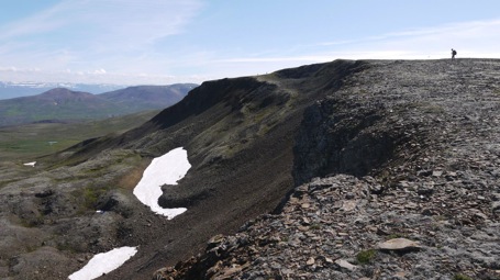
Figure 2. Photo: view of the source-area and partial body of the Vatnaöxl postglacial landslide, W of Sauðárkrókur (photo D. Mercier).
French Norwegian research team
In 2013, the French-Norwegian research team, with Armelle Decaulne, Achim A. Beylich and Katja Laute, applied tree-rings methods to snow-avalanche occurrence in two U-shaped valleys of Western Norway, Bødalen and Erdalen.
In Bødalen, the analyses of the tree-ring patterns of 91 trees highlight four extreme snow-avalanche events, extending over the entire valley floor and up to a distance of 800 m from the foot of the slope,
during the 20th century and at the beginning of the 21st century. Return periods of 15 to 20 years for the most extreme events are extracted from the analyses, and recurrence intervals of 10 to 15 years for avalanches presenting distinct deposition lobes uphill of the distal torrent. Results obtained by tree- ring analyses are successfully compared with available documents at different spatial and temporal scales. Rock-face snow-avalanche occurrences in the area, of small to medium size, are associated with heavy wintry precipitation combined with strong winds. However this normal situation is not valid for extreme snow avalanches crossing the path investigated in the paper, which result from the outlet glacier located in the starting zone; this glacier commands spatial and inter-annual variations of snow accumulation in the departure zone.
Figure 3. Photo: view of Bødalen study site, Norfjord, Western Norway (photo A. Decaulne).
In Erdalen, investigations conducted on one path (with a maximum runout distance shorter than the one investigated in Bødalen) reconstruct 17 snow avalanche winters since the 1930s, and 7 winters regarded are extreme for their snow-avalanche activity. Calculation of frequency provides return period ranging from 4.4 to 33 years. Induced spatial extent of snow-avalanche events induces flow- like snow avalanches with limited extent around the tree-less parts of the cone with a return period under 6 years, the cone is totally covered and the distal tree-limit overpassed with a return period of 16 to 33 years.
During past years, Christophe Grenier and Emmanuel Mouche from LSCE (Laboratoire des Sciences du Climat et de l’Environnement) has been developing activities in numerical modeling for permafrost issues involving coupled thermal transfer with water flow in the Cast3M code (www-cast3m.cea.fr). During the last two years, this modeling activity was complemented by laboratory experiments and field work involving collaborations with François Costard, Nicolas Roux and Antoine Sejourne at IDES (Interactions et Dynamique des Environments de Surface, Orsay) and Alexander Fedorov and Pacha Konstantinov from Permafrost Institute in Yakutsk (Yakutia, Russia). The topic studied concerns the evolution of river taliks in the context of climate change with a joint approach combining numerical simulation, analogical experiments in cold room. The field study focuses on the evolution of the soil – river continuum in an Alas valley in Yakutia. The site was equipped in 2012 with thermal, hydrological & hydrogeological sensors and the water properties and isotopic signatures were monitored. The first year of data was obtained during September 2013 field study. The main results will be presented during the next EUCOP meeting in 2014. The experimental study in cold room at IDES addresses the same issue of river – soil interaction considering a channel with a “river” flowing on a frozen porous medium. The first purpose is to identify the main controlling parameters for the progression of the 0°C isotherm into the frozen material based on thermal monitoring of the system. The second objective is to simulate the experiment with Cast3M code and identify the appropriate boundary conditions, parameters and finally validate the code for such purposes. This was the topic of the Roux et al. communication at the AGU meeting in San Francisco, December 2013.
Another line of action concerns the development of coupled Thermo-Hydrological codes. While a larger amount of publications appear on such issues, the resolution of such a coupled non-linear system with phase change still remains a difficult issue: this year, LSCE proposed and launched a TH code intercomparizon exercise to 1°) evaluate and validate codes by means of intercomparizon on test cases and experimental studies, 2°) create a research community around such issues to exchange and improve codes in view of more realistic system simulations. The INTERFROST benchmark was presented in various places this year including in particular the EGU (Vienna) and AGU (San Francisco) meetings. A web site is under construction to host the exercise at (https://wiki.lsce.ipsl.fr/interfrost). Please consider joining the benchmark.

Figure 4. Setup for the cold room experiment at IDES: water flows in a channel made on a frozen and saturated sand unit with temperature monitoring.
Report prepared by François Costard (francois.costard@u-psud.fr)
Germany
Reports from Potsdam (AWI, GFZ)
In collaboration with Jörg Hartmann at AWI Bremerhaven, the Helmholtz Young Investigators Group TEAM (Trace Gas Exchange in the Earth-Atmosphere System on Multiple Scales) led by Torsten Sachs from the German Research Centre for Geosciences, Potsdam GFZ) successfully completed the third “Airborne Measurements of Methane Flux” (AIRMETH) campaign, again covering extensive areas on the North Slope of Alaska and the Mackenzie Delta, Canada with airborne eddy covariance flux measurements of latent and sensible heat, carbon dioxide, and methane. One flight in Alaska was synchronized with a NASA CARVE (Carbon in Arctic Reservoirs Vulnerability Experiment) flight and hyperspectral and LIDAR data were collected both in Alaska and Canada in support of various others projects. Contact: torsten.sachs@gfz-potsdam.de
2013 was the second expedition of the Helmholtz Young Investigator Group led by Hugues Lantuit at the AWI (COPER, Coastal Permafrost erosion, organic carbon and nutrient release to the Arctic nearshore zone). The expedition was the eighth official expedition of the AWI in the area and took place from June 27 until August 3 on Herschel Island (NW Canada). The Expedition was part of the long-term cooperation between the AWI, McGill University and the Geological Survey of Canada (W. Pollard, G. Manson, N. Couture). A weather station and a monitoring flume, already used in 2010, 2011, and 2012 were deployed at the outlet of a retrogressive thaw slump to monitor water and sediment discharge over several weeks in the field. Additionally, water samples were taken to characterize the geochemical composition of the water. The boat of the AWI, the FS “Christine” was used as a platform to conduct bathymetrical and mapping surveys of the shore face, as well as sampling of the seafloor. Several shallow seismic lines were conducted around Herschel Island. Finally, a polygon located within the late Pleistocene glacial limit was sampled in detail to understand the link between vegetation and the late Holocene climate variability in the area. Contact: Hugues.Lantui@awi.de
As part of the Potsdam Research Cluster for Georisk Analysis and Environmental Sustainability (PROGRESS), geomonitoring capabilities of permafrost coastal erosion in the East Siberian Arctic were expanded. Using historical images with large areal coverage and new contemporary high and very high resolution remote sensing data, local, regional, seasonal, and inter-annual variations of coastal thermo-erosion along the ground ice rich Laptev Sea coast were systematically analyzed. Across a geographically broad baseline of well-distributed key areas in Eastern Siberia (Cape Mamontov Klyk, Buor Khaya Peninsula, Muostakh Island, and the continental coast of the Dmitriy Laptev Strait), the coastline retreated on average -2.2 meters per year over the past 40 years. The speed of coastal erosion has nearly doubled in the recent past and the small island of Muostakh east of the Lena Delta is especially affected by these changes. Following joint Russian-German expeditions in 2011 and 2012, Muostakh Island was visited also in 2013 for the third year in a row. Contact: Frank.Guenther@awi.de, Paul.Overduin@awi.de
CarboPerm (Carbon in Permafrost) is a new project (duration: 2013-2016), funded by the German Federal Ministry of Education and Research (BMBF) with the aim to study the formation, transformation and release of organic carbon in North Siberian permafrost. The multidisciplinary approach includes environmental and vegetation reconstruction, biogeochemical cycling studies using biomarkers, the assessment of microbial degradation in the form of CO2 and CH4 release, and modelling. Studies of the recent carbon cycle are combined with detailed reconstructions under different climatic conditions back to the Eemian Interglacial and simulated with the help of models. It will be realized in close cooperation with Russian research institutes in Moscow, Sankt Petersburg, Krasnoyarsk and Yakutsk. This research will help to anticipate the future development of permafrost landscapes in the context of global warming and its impact on the carbon and trace gas budget. Contact: empfeiffer@uni-hamburg.de, hans-wolfgang.hubberten@awi.de
Many permafrost research teams used the Russian-German Research Station on Samoylov Island in the north Siberian Lena River Delta as the operational basis of numerous expeditions to the region from 1998 to 2012. This station is now replaced by the new Samoylov Island Research Station, which belongs to the Siberian Branch of the Russian Academy of Science. The new facility provides excellent working and living conditions for the scientists year round despite the harsh environmental condition in the Siberian Arctic. The new station was officially opened on the 21st of September 2013, but already started its scientific operation on the 17th of April. Several international permafrost research teams conducted their field campaigns during spring, summer, and fall covering several disciplines and topics. These included carbon storage and turnover, trace gas emissions, permafrost degradation by thermokarst and thermal erosion, surface subsidence, water and energy balance, and snow cover properties. Contact: moritz.langer@awi.de
Related to the Postdoc project “Eurasian Arctic Ice 4k” funded by the German Research Foundation (DFG) Holocene ice wedges from several study sites in the Russian Arctic have been studied as paleoclimate archives over the last years. Ice wedges provide unique and substantial cold-period climate information for understanding the seasonal patterns of Holocene Arctic paleoclimate. The studied ice wedges reveal a general warming trend linked to increasing orbital and greenhouse gas forcing as well as an unprecedented warming in the last decades. Detailed investigations and sampling of the snow cover and its development until snow melt were conducted in spring at Samoylov Island to better understand the transformation of isotopic signals from precipitation into ground ice (i.e. ice wedges). Contact: thomas.opel@awi.de, hanno.meyer@awi.de
Just recently funded, the ERC project PETA-CARB (Rapid Permafrost Thaw in a Warming Arctic and Impacts on the Soil Organic Carbon Pool) started in November 2013 (Duration: 2013-18) and will focus on combining remote sensing of permafrost landscape dynamics, quantitative field studies, and modelling of thermokarst processes to quantify the size and vulnerability of deep permafrost SOC pools to rapid permafrost thaw. The tree major research topics include: (1) Systematic measurement of rapid permafrost thaw, (2) Determining deep permafrost SOC stocks and carbon accumulation rates, and (3) Quantification of deep permafrost SOC pools and vulnerability assessment. First field expeditions are planned in collaboration with US partners from the USGS and UAF for the Alaska Northslope in April 2014, and in collaboration with Russian partners from PIY and AARI for the Lena Delta in August 2014. Contact: guido.grosse@awi.de
In January 2013 started the three-year project “Degradation of ice-rich permafrost by thermal erosion” led by Anne Morgenstern within the Helmholtz Postdoc Program. It aims at quantifying and qualifying the impact of thermal erosion on the degradation of ice-rich permafrost in Siberian lowlands and relating it to ongoing changes of the water and carbon cycle in the Arctic. Project-related field work was carried out in July on Kurungnakh Island in the central Lena River Delta during the Expedition “Lena 2013”. Surface and relief properties of different types of thermo-erosional landforms were described and measured for a geomorphological characterization and will also serve as ground truth for consecutive remote sensing analyses. Discharge measurements and water sampling were conducted to analyze the contribution of the thermo-erosional landforms to water, organic matter, and nutrient transport to the coastal waters. Contact: Anne.Morgenstern@awi.de
The AWI Potsdam has set up new laboratories for the analyses of genetic data, in particular DNA from sedimentary archives, for which special strict precautions minimize the risk of contamination with modern DNA. The facilities include a dedicated and physically separated laboratory for the analysis of sedimentary ancient DNA and a general genetics laboratory for downstream work and work on modern samples. The new DNA lab is located a building devoid of any other molecular genetic work. It contains UV-lamps for nightly irradiation of the complete room and a separate UV-hood for sample preparation, it is subjected to a rigorous regular cleaning procedure and researchers as well as consumables do not enter other buildings prior to working in this lab. The lab is used for DNA extraction and setup of reactions that amplify the ancient DNA, but the reactions themselves, as well as all downstream work is conducted in the general genetics lab, which is located in another building. Thus a strict one-way workflow is maintained to ensure the authenticity of results. Projects conducted in these laboratories focus on the analyses of terrestrial vegetation and planktonic organisms. In a larger collaborative project we are analyzing lake sediment cores from transects that cross the arctic-boreal tree line in Siberia, as well as modern populations of trees and plankton. Genetic data offers both an additional tool to reconstruct species assemblages, as well as allowing analyses of cryptic biodiversity changes, e.g. below the level of species. The integration of genetic data into paleoecological studies can therefore add to existing approaches and allows a novel level of resolution in the study of biodiversity history. Contact: Laura.Epp@awi.de, Kathleen.Stoof-leichsenring@awi.de
PAGE21 is an EU FP7 large scale integrated project (Duration: 2011-15) that aims to understand and quantify the vulnerability of permafrost environments to a changing global climate, and to investigate the feedback mechanisms associated with increasing greenhouse gas emissions from permafrost zones. The research makes use of a unique set of Arctic permafrost investigations performed at stations that span the full range of Arctic bioclimatic zones and implements representations of permafrost-related processes and parameters in land-surface models of the most evolved European GCMs. The project brings together the best European permafrost researchers and eminent scientists from Canada, Russia, the USA, and Japan and together with partner programs and organizations, the International Permafrost Association (the Global Terrestrial Network for Permafrost (GTN-P) borehole network, and the CALM network) and the ESA’s DUE Permafrost project (remote sensing), the project contributes to the newly available unique and streamlined data portal, offering for the first time a simplified data access interface for permafrost data. During 2013 the project concluded landscape level inventories of all representative soil types and flux data measurements at all PAGE21 study areas. Remote sensing entity developed downscaling schemes for improved long term dataset integration for arctic environments and conducted site scale analyses and evaluation of long term datasets with ground data. The modeling component completed first off-line land surface model simulations using CMIP5 archive analyzing GHG emission changes. Contact: hans-wolfgang.hubberten@awi.de, Website: http://page21.eu
Two new projects are focusing on microbial communities of the carbon cycle in permafrost environments. For at least five years, the Helmholtz Young Investigators Research Group MicroCene led by Susanne Liebner, GFZ Potsdam, uncovers microbial abundance and functional diversity of organic rich subsurface environments such as peat and permafrost deposits and links this to (paleo)environmental reconstruction. A key system will thereby be submarine permafrost deposits of the Siberian Laptev Shelf. Central to MicroCene is the establishment of molecular in-depth community studies along gradients of environmental and climate change aiming at a detailed characterization and reconstruction of the microbial carbon cycle. The Helmholtz International Research Group ArcBiont investigates the association between microbial communities of the methane cycle and bryophytes of permafrost affected peatlands of Svalbard, northern Scandinavia and the Siberian Lena Delta. Central to ArcBiont is the structure and biogeography of peat moss associated methane cycling prokaryotes, as well as their relevance for the carbon and nitrogen budget of permafrost affected peatlands. Contact: sliebner@gfz-potsdam.de
News from German universities

Figure 1. PhD student Daniel Dräbing maintaining the passive seismic recording system at the Gemsstock, 2963 m, Swiss Alps in the German-Swiss Project ISPR (see below, Photo. M. Krautblatter).
The project “ISPR: Influences of Snow Cover on Thermal and Mechanic Processes in Steep Permafrost Rockwalls” went to its third year with PhDs students Daniel Draebing (University of Bonn) and Anna Haberkorn (SLF) supervised by Michael Krautblatter (TU München) and Marcia Phillips (SLF Davos). In the second field season, geophysical and geotechnical measurements were done at Steintaelli and Gemsstock (Swiss Alps). A passive seismic recording system was installed to monitor crack development and rockfall at Gemsstock. Results of 3D refraction seismic monitoring was published (doi: 10.1002/2012JF002638) showing a new method to quantify active-layer thawing in permafrost bedrock. One diploma thesis by C. Querner investigates slope stability of the permafrost-affected rockwall at Gemsstock. Contact: daniel.draebing@giub.uni-bonn.de
The newly established Chair of Landslide Research at the Technical University of Munich develops a mechanical and geophysical freezing lab capable of simulating frozen rock fracturing and shear under varying stresses and temperature conditions. Postdoc Kerry Leith published two JGR papers on feedback between tectonic stresses and glacial erosion in the Swiss Alps (DOI: 10.1002/2012JB009801 and DOI: 10.1002/2012JF002691). Michael Krautblatter published a rock-ice mechanical model for the destabilization of permafrost rock slopes and related rock slope failure (DOI: 10.1002/esp.3374). Monthly geophysical rock wall permafrost measurements at Germany’s highest peak the Zugspitze were re-established in addition to rock slope stability monitoring. Two new PhD students, Philip Mamot and Anne Voigtländer, started to investigate rock slope stability with a focus on laboratory experiments and field assessment of frozen rock and stress corrosion. Jia Hailiang, a PhD student assessing rock stability at the Three Gorges Reservoir from the China University of Geosciences, visits the Chair of Landslide Research for 1-2 years performing freeze thaw experiments and assessing rock fatigue. Contact: m.krautblatter@tum.de
The new Postdoc project “Short and long-term thermokarst dynamics due to climate changes and human impacts in Central Yakutia, Siberia” founded by the German Research Foundation (DFG) was established at the University of Leipzig (Institute for Geography) studying thermokarst dynamics in Central Yakutia. The goal is to reconstruct Holocene and recent permafrost degradation processes, their influencing factors and environmental impacts and to assess future landscape evolution and potential hazards associated with thermokarst in the populated Lena-Aldan-Amga region east and northeast of Yakutsk. Two thermokarst key sites were thus investigated in summer 2013. Both sites are located on different Lena River terraces that are geomorphologically classified with regard to differing Yedoma accumulation and degradation. At both sites, the field work included detailed sedimentological, geomorphological, and botanical surveys, as well as bathymetrical measurements. Remote sensing methods are used and combined with detailed field knowledge to investigate thermokarst processes on large spatial scales. Collaborating partners in this project are scientist of the Melnikov Permafrost Institute SB RAS in Yakutsk, the North-Eastern Federal University Yakutsk and the AWI Potsdam. Contact: mathias.ulrich@uni-leipzig.de
At the University of Giessen, the PhD students Stephan Imbery and Murataly Duishonakunow (supervised by Lorenz King, retired) continued their field work and will finish soon their PhD study on “Permafrost distribution and dynamics in the Chinese and Kyrgyz Tianshan”. Ina Keggenhoff will finish her PhD study on “Climate change and mountain hazards in the South Caucasus (Georgia)”. Contact: s.imbery@gmx.de
At the University of Cologne (Institute of Geology and Mineralogy) the team around Janet Rethemeyer continued with its research focusing on carbon dynamics in Siberian permafrost soils. A first study on the composition and potential stabilization of organic matter has been completed and published (doi: 10.5194/bg-10-3145-2013) by PhD student Silke Höfle supported by Carsten Müller (TU Munich) and two master students who fractionated numerous soil samples from the active layer and extracted lipids from these fractions. This work is continued by Silke who now is using 14C analysis of microbial lipids to identify the degradation of young/labile and old/refractory organic substrates by soil microorganisms. Postdoctoral researcher Reka Fülöp performed first promising 14C analyses of carbon dioxide and methane released from the active layer on Samoylov and Kurungnakh Island (Lena-Delta). However this work was challenged by long-transport and storage times of our sample containers – tubes with moleculare sieves – which were partly not leak-tight. Improved sampling techniques will be applied and new sample sets collected in the framework of the German-Russian research project “CarboPerm” funded by the German Federal Ministry of Education and Research (BMBF). Here the Cologne group is focusing on analyses of the age, quality, and degradability of organic material in permafrost in the Siberian Arctic. Contact: janet.rethemeyer@uni-koeln.de
At the University of Bayreuth (UBT, Department of Ecological Microbiology), Nico Roßbach continued research on peat circles in arctic tundra near Seida (Russia) in the group of Marcus A. Horn. Such peat circles have a low pH (app. 4), and are ‘hot-spots’ for the emission of the greenhouse gas nitrous oxide. Denitrifying microorganisms release nitrous oxide as an intermediate under anoxic conditions, and are abundant in peat circles. Cell numbers of nitrous oxide producers decrease with soil depth. Temperature and pH optima for nitrous oxide production were determined with soil samples and diverse nitrous oxide producing denitrifiers were isolated and characterized. The team of Michael Zech (UBT, Department of Geomorphology) developed a new approach for the analysis of sugar and n-alkane specific isotopic signatures (O, H) in an eolian permafrost paleosol sequence, NE-Siberia. Thus, a biomarker record spanning 220 ka was obtained, enabling regional paleoclimate resonstruction. The data was published in “Chemical Geology” and suggests that summer temperatures during the Weichselian glacial period were periodically higher than nowadays. Contact: marcus.horn@uni-bayreuth.de
Report prepared by Michael Krautblatter (m.krautblatter@tum.de)
Japan
In central Japan, an inter-university project on ‘Recovery of Geoenvironments in the Japanese Alps Region’ is ongoing (period: 2010–2015). The research organization consists of more than 100 scientists in various fields of geoscience, biology and agrobiology, mostly from three universities (Tsukuba, Shinshu and Gifu). The research topics include snow, permafrost and periglacial slope dynamics in the Japanese Alps and their effects on alpine ecology. The first summary of the project was published in a special issue of Journal of Geography (publisher: Tokyo Geographical Society), Vol. 122(4), 2013, entitled ‘Changing Natural Environments in the Japanese Alps region’ (Chief editor: N. Matsuoka). The issue comprises 17 papers and 3 pictorials, mostly written in Japanese with English abstract. Full texts can be downloaded at J-STAGE: https://www.jstage.jst.go.jp/browse/jgeography/122/4/_contents.
In Svalbard, a long-term monitoring campaign by N. Matsuoka (University of Tsukuba), T. Watanabe (Geological Survey of Hokkaido) and H.H. Christiansen (UNIS, Norway) has continued since 2005, targeting the dynamics of patterned ground (ice-wedge polygons, mudboils and hummocks) and a polar rock glacier. Eight years of data show significant interannual variability of ground movements superimposed on long-term trends.
In Alaska, K. Harada (Miyagi University), S. Tsuyuzaki (Hokkaido University), K. Saito (JAMSTEC) and G. Iwahana (IARC, UAF) have carried out researches at the Kougarok site near Nome since 2005 in order to monitor permafrost conditions after severe wildfire.
Mongolia is only one country where permafrost directly sustains the livelihoods of inhabitants, since discontinuous permafrost produces locally wet soils conditions. M. Ishikawa (Hokkaido University) and Y. Jambaljav (Institute of Geography, MAS) have established country-wide permafrost observatories consisted of more than 80 deep research boreholes. They are applying the results for mapping and modelling distribution of the southern boundary of Eurasian permafrost under the collaboration with B. Etzelmüller and S. Westermann (Oslo University). Since 2002, M. Ishikawa, Y. Iijima (JAMSTEC), S. Miyazaki (NIPR) and A. Dashtheren (Hokkaido University) have been continuing observational researches on permafrost eco-hydrological system, with special focuses on the contrasting hydrological regimes between permafrost and its immediately adjacent permafrost-free slopes, and on the interannual variations of heat, water and carbon fluxes over the Larch forest underlined by warm permafrost.
The project named ‘Frost tube in Japan’ has started in November 2011. This project is collaborated with the project of ‘Permafrost Outreach Programs’ operated by K. Yoshikawa (WERC, INE, UAF). We set frost tubes at 19 schools in Hokkaido area, Japan, and frost depths will be recorded at each school.
A voluntary committee (K. Saito, T. Sueyoshi, K. Watanabe, K. Takeda) was founded to make an open-access database for historical domestic ground temperature and frost depth data in Japan, and started to mime, collect, digitize and register those data from multiple institutes (including Japan Meteorological Agency, National and Prefectural Agricultural Institutes, and Univesities), some dating back to 1888.
Within the GRENE Arctic Climate Change Research Project, a modeling group in the terrestrial research sub-project (GRENE-TEA) initiated an intercomparison project for land surface process models (encompassing from physical to biogeochemical and ecological) for the Arctic region. About a dozen models are participating. During 2013, forcing data, directly applicable to models, were produced for selected GRENE sites (Fairbanks, Yakutsk, Tiksi, Kevo) and disseminated to the participants.
A frozen ground impervious wall is the possible solution to control leakage of contaminated groundwater from the Fukushima Daiichi nuclear power plant. The frozen ground subcommittee of Japanese Society of Snow and Ice is preparing publication of the review article dealing with scientific and technological backgrounds.
Report prepared by M.Ishikawa (mishi@ees.hokudai.ac.jp)
Austria
In 2013 various activities took place by Austrian permafrost researchers regarding permafrost-related conferences in Austria, permafrost organisational issues as well as research on permafrost in the Austrian Alps. Furthermore, the Austrian Permafrost Working Group (see earlier reports for details) continued to improve collaborations between different permafrost researchers in the country. In the first part of this report general permafrost activities and events are presented in a chronological order. In the second part permafrost research carried out by the different permafrost research groups in Austria is summarised.
Part 1: General permafrost activities in Austria
The 5th Symposium for Research in Protected Areas took place at the National Park Centre of the Hohe Tauern National Park in Mittersill Austria during the period 10 to 12 June 2013. One of the sessions focussed on cryosphere research (session convener G. Köck, Vienna). 50% of the presentations in this session focused on permafrost, the other 50% on glacial issues.
Between June 11 and 13, 2013 a three day conference focusing on Swiss-Austrian collaborations on mountain research was also held in Mittersill overlapping with the above mentioned symposium. These “Mountain Days” were organised within the framework of the “CH-AT Alliance” program. The program was endorsed in October 2011 by the Swiss State Secretariat for Research and Education and the Austrian Ministry of Science and Research. The intention of this 5-year program is to provide Swiss and Austrian mountain researchers an opportunity to intensify their collaborations, to enhance their visibility and to advocate for mountain research at national, Alpine and European level (for details see http://www.chat-mountainalliance.eu/de/). One of the sessions at the Mountain Days was entitled “Research on Alpine Permafrost and Periglacial Environments: Research Questions, Coordination, Monitoring and Experiments” jointly convened by A. Kellerer-Pirklbauer (Graz, Austria) and A. Rist (Bern, Switzerland). Some 20 researcher from both countries participated in this session. After overview presentations regarding national permafrost activities given by the two conveners, a fruitful discussion took place regarding possible future joint-directions in this field of research.
In October 2013 the annual meeting of the German branch of the IPA (AK Permafrost) took place in Salzburg, Austria. This was the first time that the annual AK Permafrost meeting was carried out in Austria. After two days in Salzburg (24-25 October), an attractive excursion with excellent weather continuous was offered by the organiser on the 26 October to the Kitzssteinhorn (3203 m.a.s.l) mountain located in the Hohe Tauern Range (Fig. 1). The conference was organised by I. Hartmeyer and M. Keuschnig (both Salzburg and Innsbruck). Some 60 permafrost researcher from 19 different universities and research institutes in Austria, Switzerland and Germany participated in the conference. The excursion to Kitzsteinhorn was led by I. Hartmeyer, M. Keuschnig, and J.-C. Otto (Salzburg) and focussed on rock permafrost, mass movement processes on rock walls (both related to the MOREEXPERT project) and permafrost conditions in recently deglaciated areas (related to the permAfrost-WP3000 project; see previous annual reports and further below).
Within the framework of the AK-Permafrost meeting in Salzburg, the three PYRN groups of Austria, Germany and Switzerland were merged to one PYRN-DACH (Deutschland, Austria, Confoederatio Helvetica/Switzerland) group. Until 2013 PYRN-Austria was led by M. Avian (Graz). He was one of the eleven founding members of PYRN in 2007 and was in charge of PYRN-Austria since then. M. Avian gave over this function to I. Hartmeyer who is now the national contact person. Boris Radosavljevic (Germany) was chosen to represent the PYRN-DACH members to the PYRN council. For details on this activity refer to the PYRN newsletter for November and december.

Figure 1. Participants of the “AK Permafrost 2013” (German branch of the IPA) conference in Salzburg during the excursion at the Kitzssteinhorn (3203 m.a.s.l) located in the Hohe Tauern Range, Austria. The conference took place in October 2013. Photograph provided by Robert Delleske.
Finally, in December 2013 the first Austrian CGOS (Global Climate Observing System) report was finalised. GCOS is a co-sponsored by the World Meteorological Organization (WMO), the Intergovernmental Oceanographic Commission (IOC) of UNESCO, the United Nations Environment Programme (UNEP), and the International Council for Science (ICSU). The report is written in German and deals with 23 chapters related to different atmospheric and terrestrial Essential Climate Variables (ECVs). One chapter is devoted to permafrost (written by A. Kellerer-Pirklbauer). For download of the report visit http://www.zamg.ac.at/cms/de/topmenu/ueber-uns/internationales/gcos/gcos-bericht.
Part 2: Reports from the different Austrian permafrost research groups
The national permafrost project permAfrost – Austrian Permafrost Research Initiative ended in 2013. The final report is currently in press and will be available online in the near future. General information about the project consortium and participating partners was given comprehensively in the previous national reports.
Salzburg
The University of Salzburg group of L. Schrott continued to carry out permafrost research within the projects permAfrost-WP3000 and MOREXPERT. permAfrost-WP3000 has been concluded in 2013. Please refer to earlier national reports regarding background and aims of these projects. Unfortunately for the Austrian permafrost community, Lothar Schrott quit his position at the University of Salzburg and started a new professorship position at the University of Bonn. We thank Lothar very much for all his research efforts during his Salzburg-years and wish him all the best for his future in Bonn!
In the MOREXPERT project (I. Hartmeyer, M. Keuschnig, L. Schrott, J.-C. Otto, C. Hiller, R. Delleske) – carried out in cooperation with alpS (Centre for Climate Change Adaptation Technologies, Innsbruck) – maintenance and expansion of the project’s mountain permafrost monitoring site (Kitzsteinhorn, 3.204 m a.s.l.) have been continued. Two 20m deep boreholes, both located in a tunnel, presently deliver temperatures from depths of up to 70 m below terrain surface (Fig. 2). Three further boreholes (30 m deep) are scheduled to go into operation in 2014. Furthermore, a total number of 30 sensors provide temperature data from shallow boreholes (0.1-0.8 m deep). Two permanently installed ERT arrays (one is operated by the Geological Survey of Austria) continue to automatically deliver information on near-surface ground thermal conditions. permAfrost-WP3000 (J.-C. Otto, M. Keuschnig), which focuses on permafrost-glacier interactions at the Kitzsteinhorn, has been concluded in 2013.

Figure 2. Borehole in permafrost-affected rock which is instrumented with a protective casing, Kitzsteinhorn, Hohe Tauern Range, at an elevation of 3030 m a.s.l. Photograph provided by Ingo Hartmeyer.
The Central Institute for Meteorology and Geodynamics (ZAMG) Salzburg (C. Riedl) and ZAMG Vienna (H. Hausmann, W. Schöner) continued their research around the Sonnblick Observatory at Hoher Sonnblick (3106 m a.s.l.). The ZAMG permafrost activities are carried out within the PERSON project (Permafrostmonitoring Sonnblick), which was extended by Ministry of Agriculture, Forestry, Environment and Water Management until 2017 (see also earlier annual reports regarding PERSON). A new concept has been developed that evaluates the so far applied measurement techniques and redefines main targets, according to the achieved results. One central decision based on this assessment (which was done within a one-year ZAMG ‘internal structure-project’ on permafrost) is to equip the three 20m deep boreholes with new measurement devices in 2014, since serious problems occurred with the sensors presently in use. Further measures already taken for quality improvement are the installation of new surface temperature sensors and shallow boreholes with depths between 2 and 140cm in the summit area of Hoher Sonnblick and Wintergasse.
The Geological Survey of Austria, Department of Geophysics (D. Ottowitz, B. Jochum, R. Supper, S. Pfeiler, J-H. Kim) continued the geoelectrical monitoring in the Kitzsteinhorn area (see above) at an elevation of 2940 m a.s.l. using the monitoring system Geomon4D.
Graz and Leoben
The strongly collaborating group of permafrost researcher in Graz and Leoben continued its mountain permafrost research activities in the Hohe Tauern Range, Niedere Tauern Range and in the Northern Calcareous Alps. During 2013 researcher from three institutes at the two Universities in Graz – Department of Geography and Regional Science, Institute of Remote Sensing and Photogrammetry, and Institute of Earth Sciences – (A. Kellerer-Pirklbauer, G.K. Lieb, O. Sass, M. Rode, G. Winkler, M. Pauritsch, H. Schnepfleitner, M. Avian, V. Kaufmann, T. Wagner), as well as Joanneum Research in Leoben (R. Morawetz, M. Schreilechner) were involved in permafrost and periglacial research activities. The main projects are permAfrost-WP4000, Water Resources of Relict Rock Glaciers, and ROCKING ALPS. For details about these projects please refer to earlier reports. Furthermore, two new projects were launched in 2013.
permafrost-WP4000 (A. Kellerer-Pirklbauer, M. Avian, V. Kaufmann, and B. Kühnast) was successfully accomplished in 2013. The final report will be available online in the near future. Research activities in the Hohe Tauern and Niedere Tauern Ranges related to permafrost and periglacial processes was successfully continued by various funding sources. Regarding Hohe Tauern Range, multidisciplinary monitoring at three active rock glacier sites (Weissenkar, Hinteres Langtalkar), one active rock fall site (Mittlerer and Hoher Burgstall, near Pasterze Glacier), and three marginally permafrost sites (Hintereggen Valley, Hochtor, Fallbichl) have been continued. Furthermore, the annual differential GNSS measurements at Leibnitzkopf Rock Glacier which started in 2010 were successfully repeated in summer 2013. Maximum flow velocities of 4.22 and 3.32 m/year were measured at Hinteres Langtalkar Rock Glacier and Leibnizkopf Rock Glacier, respectively. Mean annual flow velocity at Weissenkar rock glacier remained unchanged, whereas the flow velocity at the other three rock glaciers had increased in the range of 4-13%. A two years project financed by the Hohe Tauern National Park Authority was started in summer in order to investigate the partial or even complete replacement of the traditional measurement scheme (using a total station) by the modern differential GNSS measurement technique.
Research within the project Water Resources of Relict Rock Glaciers was continued by G. Winkler, M. Avian, R. Morawetz, M. Pauritsch, A. Kellerer-Pirklbauer, and T. Wagner in the Styrian part of the Niedere Tauern Range. At a regional scale, the rock glacier inventory and subsequently the rock glacier catchment inventory of the Seckauer Tauern Range was finalized based on ALS data. In addition a precipitation-run off model for the Styrian part of the Niedere Tauern Range was started to quantify the impact of rock glaciers on the hydrology of alpine catchments. At local scale the aquifer geometry of the Schöneben Rock Glacier was determined by using different geophysical methods. Based on this data it was started to simulate numerically the hydraulic behavior of the rock glacier which will be combined with existing tracer test data. Furthermore, the permafrost monitoring network in the Niedere Tauern Range (A. Kellerer-Pirklbauer) was successfully continued.
The project ROCKING ALPS started in 2012 (O. Sass, M. Rode). In this project it is intended to investigate the governing factors of frost weathering and rockfall in alpine regions. One study site is located in the Dachstein Massif, Northern Calcareous Alps, reaching a maximum elevation of 2995 m a.s.l. In north and south exposed rock walls at Koppenkarstein a measurement system was collecting moisture and temperature data from the rock surface to 30cm depth. At small scale geoelectric profiles moisture distribution and movements during freeze thaw cycles was monitored. Additional the impact of rock permafrost on weathering is investigated. For this reason, several techniques were applied in order to detect rock wall permafrost. In the winter of 2012/13, 22 i-buttons (temperature sensors) were attached to the rock walls with different orientations but at similar altitudes (2600-2700 m a.s.l.). These temperature data were used as a first indicator of permafrost presence. Additional 2D-geoelctric surveys (five ERT profiles) were measured during the summer of 2013 in selected rock walls of the mountains Koppenkarstein (2863 m a.s.l.; Fig. 3), the Dirndln (2829 m a.s.l.) and the Gjaidstein (2794 m asl). With the start of the new INFRAROCK project long term rock temperature monitoring is planned at the Dachstein Massif (H. Schnepfleitner, O. Sass). In the winter of 2013/2014 it is intended to drill 30 boreholes around the Koppenkarstein in 10, 30, 50, 100, 250m depths. To determine the spatial distribution of the surface rock temperature infrared images will be made during the summer month (from May till October).

Figure 3. Preparation works for an ERT profile in a north-facing rock wall at the Dachstein massif (2995 m a.s.l.), Northern Calcareous Alps. Results from these measurements as well as from additionally applied methods proved permafrost existence. Photograph provided by Eric Rascher.
Innsbruck
The University of Innsbruck group around K. Krainer (K. Krainer, U. Nickus, H. Thies, R.Tessadri, E. Schiestl, V. Schmidt, M. Hirnsperger) continued the monitoring program on the hydrology of active rock glaciers and permafrost-affected catchments in the Ötztal Alps and Lechtaler Alps (partly within the Interreg IV project PERMAQUA) to study the impact of climate change on the discharge pattern and water chemistry in high alpine regions. The monitoring program includes discharge measurements at several automatic gaging stations (including water temperature and electrical conductivity) and chemical analyses of water samples from several rock glacier springs (anions, cations, heavy metals). At selected rock glacier springs with extremely high electrical conductivity water samples were taken at an interval of one day by using an automatic water sampler from June until October. We also started modeling the distribution of permafrost in the Tyrolean Alps (based on the rock glacier inventory and additional data). In 2013 this group also finished detailed analysis of two cores which were drilled at rock glacier Lazaun in the southern Ötztal Alps (Schnals Valley, South Tyrol, Italy). The analyses included the amount of ice, electrical conductivity, pH, anions, cations, heavy metals, stable isotopes, palynology and radiocarbon-dating. Furthermore, hydrological measurements, geological mapping of distinct rock glacier catchments in Tyrol and the processing of a sediment core from a bog accomplished the work of this group in 2013.
The projects at the Institute of Geography (around J. Stötter) at the University of Innsbruck mainly focus on the detection and quantification of permafrost degradation in the Western Austrian and Northern Italian Alps using ALS and TLS as well as photogrammetric analysis. Detailed investigations have been carried out on rockglaciers, frozen debris and rock walls. Furthermore, based on an analysis of rock glaciers with ALS datasets, a rockglacier activity index has been developed. The project MALS (G. Kaser, L. Rieg, R. Sailer, J. Stötter) was finished by the end of 2013. The project aimed at the detection, evaluation and interpretation of surface elevation changes on glaciers and rockglaciers in the Ortler Group and the Southern Ötztal Alps (Schnalstal) from repeated ALS campaigns and geophysical techniques. Starting in September 2013, the SE.MAP project (C. Klug, L. Rieg, R. Sailer, J. Stötter) – funded by the Austrian Space Application Programme – aims at the detection of high mountain geomorphic processes including rock glacier activities based on ALS and optical tri-stereo satellite data. Concerning the detection of permafrost, the capacity of a high-end infrared camera was tested in the Ötztal Alps (B. Höflinger, M. Rutzinger, R. Sailer, J. Stötter).
Researcher at the Institute of Ecology of the University of Innsbruck (K. Koinig, B. Ilyashuk, E. Ilyashuk.,G. Köck, R. Lackner, R. Psenner) continued their investigations of sediment records, aquatic species and water chemistry in lakes affected by permafrost meltwater. Three projects are in the finishing process with articles by B. Ilyashuk et al. about the influence of permafrost on makrozoobenthos currently under review, and the interpretation of Holocene trends of permafrost variability observed in sediment cores currently compiled by K. Koinig and E. Ilyashuk.
A joint research group consisting of members of the Austrian Academy of Sciences, Innsbruck, the Department of Meteorology and Geophysics, University of Innsbruck, and Alpine Forschungstelle Obergurgl/AFO (M. Stocker-Waldhuber, L. Hartl, A. Fischer) continued to monitor flow velocity and surface elevation change at the Äußeres Hochebenkar Rock Glacier. The association Verein Gletscher-Klima supports these measurements in order to ensure the continuation of the exceptionally long time series of flow velocity data that exists for the rock glacier. In April 2013, GPR measurements were carried out at this rock glacier. These measurements are being evaluated and compared to older GPR data from 2008 and 2002 in order to gain information about the thickness of the rock glacier (L. Hartl, A. Fischer).
Vienna
Current research activities by the Geological Survey of Austria, Department of Geophysics (D. ttowitz, B. Jochum, R. Supper, S. Pfeiler, J-H. Kim) at Kitzsteinhorn and the ZAMG group in Vienna (W. Schöner, H. Hausmann) on Mt. Sonnblick were mentioned above.
A research group with focus on remote sensing applications for permafrost research lead by A. Bartsch has been established as part of the newly founded Austrian Polar Research Institute. This group unites researchers from University of Salzburg (A. Bartsch), Vienna University of Technology (B. Widhalm, E. Högström) and the Scott Polar Research Institute, UK (A.M. Trofaier). This group contributes to the FP7 Project PAGE21 (lead by AWI Potsdam). A new bi-lateral Austrian-Russian project on permafrost monitoring on the Yamal peninsula (COLD Yamal) has been approved by the Austrian Science Fund as well as the Russian Foundation for Basic Research. Remotely sensed data will be combined with field measurements for the assessment of land-surface dynamics in cooperation with partners of the Russian Academy of Science. As part of the kick-off workshop an open workshop on Permafrost on the Yamal Peninsula has been organized back-to-back with the AK-Permafrost meeting in Salzburg mentioned above. A. Bartsch also contributes to the organization of the ESA-CliC-IPA funded workshop on remote sensing of permafrost at the European Space Agency in February 2014.
Report prepared by Dr. Andreas Kellerer-Pirklbauer, Department of Geography and Regional Science, University of Graz (andreas.kellerer@uni-graz.at).
Canada
The Canadian permafrost community has had a very busy year. There is much activity with respect to initiatives to support adaptation to a changing climate in Northern Canada. A number of these projects have been led by the governments and other organizations in Canada’s northern territories (Northwest Territories, Yukon and Nunavut). A few of these are highlighted in this report.
Pan-Territorial Permafrost Workshop
One of the highlights this past year was the Pan-Territorial Permafrost Workshop held in Yellowknife NWT in November 2013. This workshop brought front-line decision makers from Nunavut, NWT and Yukon together with permafrost researchers and experts to share knowledge, form connections and investigate possibilities for adaptation in the future. The workshop included an introduction to permafrost, poster session, and sessions that included landscape change, tools for adaptation, mapping and communities, building infrastructure, transportation, mining oil and gas, traditional knowledge and outreach. A short course was also offered on Developing and Managing Transportation Infrastructure in Permafrost Regions and was taught by Don Hayley using the Transportation Association of Canada Curriculum. Approximately 200 people participated in the workshop including 33 sites that remotely participated by web cast. The workshop was organized by the Pan-Territorial Adaptation Partnership with support from Aboriginal Affairs and Northern Development Canada’s Climate Change Adaptation Program and the Canadian Northern Economic Development Agency. The Pan-Territorial Adaptation Partnership consists of the Governments of Yukon, Northwest Territories and Nunavut working together on climate change adaptation as a result of the Pan-Territorial Adaptation Strategy.
Video podcasts of all presentations including a keynote address by Sheila Watt-Cloutier as well as pdf copies of presentations are available at: http://www.northernadaptation.ca/news/pan-territorial-permafrost-workshop-webcast-available.
Further details of the Pan-Territorial Adaptation Partnership is available at: http://www.northernadaptation.ca/.
Northern Infrastructure Standardization Initiative
Another important activity involving scientists, engineers and practitioners is the development of standards addressing climate change impact on infrastructure in Canada’s far north. This initiative includes the development of four standards and is part of part of the Standards Council of Canada’s Northern Infrastructure Standardization Initiative and is coordinated by the Canadian Standards Association. Two of these standards have direct links to permafrost. The first is “Buildings in Permafrost Supported on Thermosyphon Foundations” which is chaired by Don Hayley. Public review of the draft standard was conducted at the end of 2013. The draft standard on “Moderating the effects of permafrost degradation on existing structures” is currently being revised by a Committee chaired by Toni Lewkowicz and will be publicly reviewed in early 2014.
Government of Northwest Territories Permafrost Scientist
In 2013, the Department of Industry, Tourism and Infrastructure, Government of Northwest Territories (GNWT) established a Permafrost Scientist Position at the NWT Geoscience Office. This position has been filled by Dr. Steve Kokelj, formerly of Aboriginal Affairs and Northern Development Canada (AANDC) in Yellowknife. The position was created in response to the growing need for up to date knowledge on permafrost conditions in the NWT. The aim of the position is to enhance the knowledge of permafrost in the NWT and direct research to meet the needs of the people and the Government of NWT, with emphasis on landscape change, permafrost-infrastructure interactions and sustainable communities. Another major objective is to strengthen partnerships with other government departments, including the Geological Survey of Canada at Natural Resources Canada (NRCan), academic researchers and practitioners. A brief description of current research projects is provided below.
Terrain hazards and permafrost conditions in the Peel Plateau – This project is coordinated by Steve Kokelj and supported by the NWT Cumulative Impact Monitoring Program, Department of Transport and NSERC. Permafrost conditions are being investigated in the Peel Plateau with a focus on the Dempster Highway and the geomorphic and environmental effects of large thaw slumps (see photos) now common throughout the region. These “mega slumps” are discussed in a recent paper by Kokelj et al. (2013) in Journal of Geophysical Research. Contributors include: Trevor Lantz and Harneet Gill (MSc) (University of Victoria), Brendan Oneill (PhD) and Chris Burn (Carleton University), Alex Brooker (MSc) and Denis Lacelle (University of Ottawa), Rob Fraser (NRCan).
Ground ice conditions along the Inuvik-Tuktoyaktuk Highway (ITH): Kokelj led a synthesis paper describing the regional thermal and ice-wedge conditions in upland terrain between Inuvik and Tuktoyaktuk along the ITH corridor in which an all season road is to be constructed. Contributors include Trevor Lantz (University of Victoria), Steve Wolfe and Peter Morse (NRCan), Julian Kanigan, (AANDC), Ron Coutts (Matrix Solutions) and Chris Burn (Carleton).
Mapping the distribution of thaw slump sensitive terrain: The NWT Geoscience Office in partnership with University of Victoria, and several GNWT departments have utilized an online interactive mapping tool developed by the NWT Centre for Geomatics to document the distribution of thaw slumps across northwestern Canada. Over 1.2 million km2 of terrain was assessed across the NWT, Yukon and western Nunavut. The map of slumps is also a surrogate for the spatial distribution of ice-cored terrain. NWT Geoscience Office will share the final product with NRCan and this may be utilized as a basis to improve the Permafrost Map of Canada.
The NWT Geoscience Office is also collaborating with NRCan on a project in the Great Slave region led by Steve Wolfe of the Geological Survey of Canada. This project provides essential information on permafrost to inform infrastructure development and to understand permafrost changes in a warming climate.


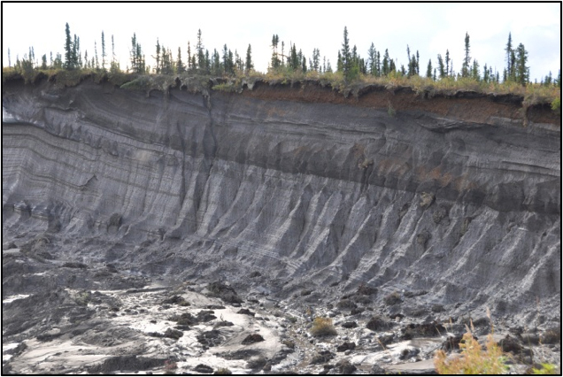
Figure 1. Photos of mega slumps in the Peel Plateau NWT. These slumps cover about 40 ha and have a headwall about 25 m high. (Photos courtesy of Steve Kokelj, NWT Geoscience Office).
A Homeowner’s Guide to Permafrost in Nunavut is a plain language guide (released in 2013) providing information and suggestions for homeowners to help maintain permafrost under their homes. The guide was developed by the Government of Nunavut Department of Environment Climate Change Section. A similar guide for NWT is currently under development and is being led by GNWT Environment and Natural Resources (ENR) Climate Change with support through the NRCan Regional Adaptation Cooperative. The Nunavut Guide is available at: http://www.climatechangenunavut.ca/en/resources/news/homeowners-guide-permafrost-nunavut-just-released.
GNWT ENR is leading several other projects foucussed on climate change vulnerability. The Centre for Geomatics leading a project to monitor, map and predict the effects of ground movements (heave and subsidence), associated with freezing and thawing ground, in NWT communities using RADARSAT differential Interferometry Synthetic Aperture Radar (DInSAR) methodologies. Public Works and Government Services is developing tools to evaluate the risk to building foundations associated with thawing permafrost. ENR is conducting a climate change vulnerability assessment to evaluate risk to hazardous waste in Beaufort Delta/High Arctic communities focussing on the impacts of slumping, coastal erosion and permafrost thaw. Information from the risk assessment will be utilized to inform prioritization of waste for removal and other management practices. The NWT Hazard Identification and Risk Assessment (HIRA), led by GNWT Municipal and Community Affairs, will provide guidance for risk assessment for natural, technological and human-caused climate change hazards. HIRA will identify potential hazards, such as permafrost thaw, in a region and assess the probability of occurrence and likely impact in order to inform development of mitigation strategies and support emergency and climate change adaptation planning. A terrain mapping project conducted through the Prince of Wales Northern Heritage Centre, is developing a vulnerability index tool for climate change-induced threats to community heritage resources in the Gwich’in Settlement Area. A GIS-based predictive model integrates spatial data on retrogressive thaw slumps, sacred sites, Gwich’in toponyms, traditional land use, archaeological sites, and landscape variables.
The Yukon Government and Yukon Research Centre (YRC) are also leading a number of research projects focussing on permafrost and climate change. The Vulnerability of the North Alaska Highway to Climate Change project is led by the Department of Transportation and Public Works and coordinated by YRC with collaborators from the University of Alberta and Montreal. The project examines the potential sensitivity of permafrost along the northern 200 km of the Alaska Highway, from Destruction Bay to the Yukon/Alaska border, to present and future climate variability. Geophysical data, geotechnical reports, highway maintenance records, air photos, and other readily available information will be combined with field investigations to identify thaw-sensitive permafrost underlying the highway and to develop a thaw sensitivity vulnerability map. YRC is also leading a project aimed at enhancing the resiliency of the transportation and mining sectors to changes in permafrost. The project involves several partners and focusses on development of knowledge products that transfer permafrost information to industry decision makers. Further information on these projects can be found at: http://www.yukoncollege.yk.ca/research/project.
Report prepared by Sharon Smith, Canadian National Committee for the International Permafrost Association (Sharon.Smith@NRCan-RNCan.gc.ca)
Italy
The Italian research in the permafrost and periglacial environments was focused on the entire Alpine arch, in the Balkans and in the Antarctic region.
Eastern Alps
Permafrost research focused primarily on the completion of the Rock Glacier Inventory and on the study of permanent ice deposits in high altitude karst caves. The Rock Glacier inventory has been realized using a geomorphological approach in the classification of the landforms (R.R. Colucci, M. Guglielmin).
Concerning permanent ice deposits in the caves, the project MONICA (integrated MONitoring of Ice within the Caves) FRA 2012 grant (Finanziamento di Ateneo per progetti di ricerca scientifica) allowed to implement various activities. In this project the Department of Mathematic and Geoscience of the University of Trieste (E Forte, coordinator, and B. Stenni), the CNR-Department of Earth System Sciences and Environmental Technologies – ISMAR, Trieste (R.R. Colucci,), the University of Milano Bicocca (V Maggi), the University of Insubria (M Guglielmin), the Unione Meteorologica del Friuli Venezia Giulia (UMFVG) and the Parco Naturale Regionale delle Prealpi Giulie (PNRPA) are involved. In the early October a 7.8 m long ice core has been extracted from the Vasto cave. The ice samples has been subsequently brought on valley by helicopter and promptly stored in a refrigerated van, made available by BoFrost. Thus the ice cores has been transported intact to the EUROCOLD laboratory in Milan. The choice of the place where to extract the ice core has been possible thanks to several GPR surveys performed on the surface of the ice deposit. This methodology allowed to visualize and avoid debris and boulder present in the ice deposit, that could have damaged the tip of the ice driller. In this way it was possible to extract the longest core ever extracted in the Italian Alps in an ice cave. The usage of different GPR antennas over the entire surface of the deposit and in the premises of the cave entrance, where a small glacieret is present, will also permit to interpret internal structure, volume and recent development of these firn/ice deposits.
The monitoring of rock, air and ice temperature at different depths in another cave interested by permanent ice deposits is furthermore still going on, while the new Automatic Weather Station of Monte Canin, installed at 2202 m asl in the fall 2012, has been implemented with 7 ground temperature probes (Figure 1).

Figure 1. Surveys and instrument checking in an ice cave of Canin massif, Eastern Alps; photo courtesy Fabrizio Giraldi.
In the Dolomites, the activities focused on a composite landform located in Val San Nicolò, in order to understand the current processes driving its evolution. Here, surface displacement (topographic survey) and ground surface temperature measurements were carried out and a new station for measuring air temperature, snow cover thickness and ground surface temperature was installed (Figure 1). In the Pordoi Pass area (Vauz catchment), several types of investigations continued (ground surface temperature measurements, snowpack measurements), in order to analyze the periglacial slope processes involved in the slow movement of the ground. The activities in the Dolomites are conducted by the universities of Padova (A. Bondesan, M. Borga, A. Carton, G. Dalla Fontana, A. Ninfo, D. Penna, T. Zanoner, G. Zuecco,) and Pavia (R. Seppi), the INOGS Trieste (R. Francese), and with the support of the Geological Survey of the Autonomous Province of Trento.

Figure 2. The station for measuring air temperature, snow cover thickness and ground surface temperature installed on the Cima Uomo rock glacier (Dolomites, Eastern Italian Alps).
Central Alps
Investigations on permafrost and periglacial environments in Trentino were mainly carried out within the MIUR project (PRIN 2010–2011) “Response of morphoclimatic system dynamics to global changes and related geomorphological hazards”. The project partners active in this region are the University of Padova (G. Dalla Fontana, A. Carton, L. Carturan, T. Zanoner, G. Zuecco and D. Penna) and Pavia (R. Seppi). In addition, several activities were carried out in the framework of an agreement between the Geological Survey of the Autonomous Province of Trento (S. Cocco and M. Zumiani) and the universities of Pavia (R. Seppi) and Padova (A. Carton).
The activities include distributed ground surface temperature measurements in Val de la Mare (Ortles-Cevedale massif), conducted over a wide range of altitudes, at different exposures and on various landforms (active and inactive rock glaciers, scree slopes, glacial deposits). In addition, hydrological investigations started in 2010 in a small permafrost-dominated catchment continued.
The measurements of the annual surface displacement of two active rock glaciers in the Adamello-Presanella massif, in progress since 2001, were repeated also in 2013, along with ground surface temperature measurements which were retrieved for nine consecutive years. On each of these rock glaciers, a new experimental station for measuring the temperature, thickness of the snow cover and ground surface temperature was installed. In addition, the maintenance of the permafrost monitoring stations installed in the Ortles-Cevedale (Cavaion site) and in the Adamello-Presanella (Lobbie Hut site) within the PermaNET project was carried out.
In the area of Mount Ortles the investigations were carried out by the Geological Office of the Autonomous Province of Bolzano (V. Mair, D. Tonidandel) and the University of Pavia (R. Seppi), in collaboration with Geomonitoring Service (G. Dragà) and the University of Padova (T. Zanoner). These activities are part of an international project on the cryosphere of Mount Ortles coordinated by the Ohio State University (P. Gabrielli, L. Thompson) and the Hydrographic Office of the Autonomous Province of Bolzano (R. Dinale). The data of the second year of measurements were retrieved, including ground surface temperature measurements, temperature of rock faces at three depths (10, 30 and 55 cm from the surface), and englacial temperature of the Alto dell’Ortles glacier and of a small ice-cap located on the “Hintergrat” ridge of Mount Ortles.
The main activities in South Tyrol have been carried out by the Provincial Office for Geology and Building materials testing (V. Mair, K. Lang, D. Tonidandel), Autonomous Province of Bolzano. All the permafrost monitoring stations, which were installed during the Alpine Space project PermaNET, are operant and are still collecting data. During the 2013 several water analysis were carried out in the permafrost areas. The ongoing Project permaqua, Interreg IV, will carry on its activities also in the 2014.
Western Alps
In the Valle d’Aosta and Piemonte Region, the monitoring and study of permafrost phenomena in the year 2013 have been carried out by the following institutions:
The Regional Agency for Environmental Protection – ARPA VdA (www.arpa.vda.it)
Fondazione Montagna Sicura – FondMS (www.fondms.org)
University of Turin – DST (www.unito.it/dst)
University of Turin – NATRISK (LNSA and geoSITLab) (www.natrisk.org)
Politecnico di Torino – DIATI (http://www.polito.it/ateneo/dipartimenti/diati/)
National Research Center (Torino) – CNR-IRPI (http://www.irpi.to.cnr.it/)
National Research Center (Torino) – CNR-IGG (http://www.csg.to.cnr.it/)
- ARPA VdA (E. Cremonese, U. Morra di Cella, P. Pogliotti) has maintained and implemented the permafrost monitoring network of Valle d’Aosta. Two new boreholes (20m deep) has been equipped in the Mont Blanc area for studying the interaction between glaciers retreat and permafrost aggradation at the lower limit of alpine permafrost occurrence belt. The new website of the Alpine Permafrost Database has been developed and is online since April 2013 at www.alpine-permafrostdata.eu. An international conference focused on the long-term monitoring of climate change effects in mountain areas has been organized in February 2013 (www.muw2013.it), permafrost has been one of the main topics. The dynamic survey of rock glaciers movement has been started in a testing site crossing high-resolution drone aerial photogrammetry and differential GPS.
- FondMS (M. Curtaz) – In the framework of the Regional monitoring plan for glacial risks, some periglacial hazardous sites were considered: data collection (photos, ortophotos, previews studies) and analysis (comparison with Alpine Permafrost Index Map and PSInSAR data, photo analysis) were done.
- NATRISK-LNSA (M. Freppaz, M. Isabellon, M. D’Amico) and ARPA VdA are carrying out (i) the monitoring of low-elevation permafrost in two talus-slope sites in the Lys valley (Monte Rosa Massif) and (ii) the monitoring of interaction between snow-cover and ground surface temperatures in several points of the Cervinia Basin. A project (I-CARE – Impact of Climate change upon water Resources in Alpine area), is focused on the monitoring and modelling the hydrological budget of the Indren glacier and the surrounding permafrost affected area (Monte Rosa). In the South-Eastern sector of the Aosta Valley, pedological investigations are being performed on selected patterned ground areas associated with permafrost with the aims of understanding the effect of lithology on patterned ground morphology and plant ecology in cold high altitude environments.
- NATRISK-GeoSITLab (M. Giardino, L. Perotti, M. Palomba). The update and digitalization of photo and aerial photo archives of periglacial areas in Piemonte region have been completed for creating a database of glacial lakes distribution (in collaboration with Comitato Glaciologico Italiano and CNR-IRPI Torino). In the framework of the “RiskNat” project, the spatial and temporal landslides frequency (IFFI database) has been investigated in the Aosta Valley Region comparing the permafrost affected areas and the rest of the territory (PhD Palomba).
- CNR-IRPI Torino (M. Chiarle, G. Mortara, E. Damiano), CNR-IGG Torino (G. Fioraso) and NATRISK-GeoSITLab (S. Bertotto, S. Lucchesi, M. Bacenetti, L. Perotti), assessed at regional and local scale the hazards potentially occurring in glacial and periglacial areas of Piemonte region within the framework of the GLARISKALP project with a focus on the relations with climate change (including permafrost degradation). CNR IRPI (M. Arattano, V. Coviello, M. Chiarle) with the support of Regione Valle d’Aosta records the microseismic activity related to rock mass deformation and movements at Capanna J.A. Carrel, 3830 m a.s.l., Matterhorn. The seismic data are analyzed in relation to climatic factors and permafrost degradation in collaboration with ARPA VdA (P. Pogliotti, U. Morra di Cella).
- DIATI (A. Godio, D. Franco, L. Sambuelli) is working, jointly with FondMS, ARPA VdA and GeoDigitalSolutions (spin-off of Parma University), to evaluate the reliability of geophysical methods (seismic and georadar) and laboratory analysis to detect the mechanical properties of the active layer of moraines materials in different seasons, that is under differing thawing and freezing conditions. The field activity is focused on two test sites in Val di Rhemes and Val d’Ayas.
Balkans
In the framework of a project devoted to the study of Younger Dryas (YD) in Europe and surroundings (B. Rea, University of Aberdeen), several sites have been visited in the Balkans, and particularly in the Former Yugoslavian Republic of Macedonia (FYROM). Here, besides moraines supposed to be YD in age, blocks from fossil rock glaciers have been sampled for exposure age determination (A. Ribolini, M. Bini, G. Zanchetta Univ. of Pisa. I. Isola , INGV, M. Spagnolo, Univ. of Aberdeeen). Moreover, to increase the chronology of cold events, samples of organic material (woods and leaves) collected in bogs dammed by moraines and speleothems are under processing (G. Zanchetta, I. Isola, E. Regattieri, L. Sadori). The idea is to compare and contrast not only glaciers ELA but also the discontinuous permafrost limit along a longitudinal transect starting from Iberia and ending in the mountains of Balkans. This may help to understand the penetration of North Atlantic influences associated with variability in the Polar Front during the YD cold period.
Antarctica
R. Raffi and S. Sega took part into the XXVIII expedition, in northern Victoria Lands, Antarctica, during austral summer 2012-2013. The expedition was carried out in the framework of “Permafrost and Climate Change in Antarctica Research Project”, funded by Italian Antarctic National Research Program (PNRA).
The research was devoted to the study of ice wedges in Victoria Land as evidence of climate change affecting permafrost and active layer. (Figure 3).
The study of ice-wedge thermal regime, started on 2004 and based on data-logger measurements, has been continued through the implementation of existing monitoring network (Figure 2). New thermistors were set up in boreholes at depth of 160 cm, according to standardized protocols for long term permafrost monitoring.
Numerous sections were excavated to define ice-wedge morphological characteristics and distribution in northern Victoria Land. Moreover, ice-wedge sampling in selected sites was performed to determine the isotopic (δ18O e δD) and petrographic properties of ice wedges (Figure 2).

Figure 3. Location of the study area. The white circle is the location of ice-wedge thermometric stations, yellow circle is the location of investigated sites.
Report prepared by Adriano Ribolini (ribolini@dst.unipi.it)
South Korea
Korea Polar Research Institute
The 19th International Symposium on Polar Sciences was held in Korea Polar Research Institute on October 16-18, 2013 with a subject of “Toward comprehensive understanding on Arctic climate change”. Over 150 participants from 12 countries joined the symposium, and six plenary speeches and about 100 oral and poster presentations were presented in six sessions: Atmosphere, Ice and Ocean, Northern Route, Permafrost-Atmosphere Interactions, Arctic Terrestrial Ecosystems, and Arctic Paleoceanogrpahy. Along with the symposium, Pacific Arctic Group (PAG) meeting, Planning Meeting for Collaborative Observational Study in the Seasonal Ice Zone near Svalbard, Permafrost study group meeting, and Arctic Terrestrial Ecosystem group meeting were held during the symposium.

Figure 1. 19th International symposium on Polar Sciences.
CAPEC Project
CAPEC (Circum Arctic Permafrost Environment Change Monitoring) Project which is supported by Korea Ministry of Science, ICT and Future Planning has been continued since 2011. Through this project, we have a plan to establish Arctic monitoring nodes to study environmental changes and develop the state-of-the-art observation techniques for terrestrial permafrost region. This monitoring project includes atmosphere-pedosphere-biosphere monitoring system with Ubiquitous Sensor Network (USN) and GPS monitoring. The research aim of this project is (1) Understanding the correlation between carbon dioxide (CO2) fluxes with soil properties, (2) Estimating the contribution of microbial respiration, and plant photosynthesis and respiration to the CO2 production from soil (3) Understanding geophysical and mechanical behavior of frozen ground correlated with environmental change. On the basis of the CAPEC project, we did Arctic exploration on three different research sites in this spring and summer: Ny-Ålesund, Svalbard Archipelago; Council, Alaska; and Cambridge Bay, Canada.
Ny-Ålesund, Svalbard Archipelago
For continuous and simultaneous monitoring for the exchanges of CO2 and CH4 between the atmosphere and the permafrost, eddy covariance flux system using open-path and closed-path gas analyzers has been continuously operating on Amundsen-Nobile Climate Change Tower through the collaboration with CNR in 2013. KOPRI’s scientists visited Ny-Alesund in May and September to maintain the measurement system at CCT this year. In addition, a data management system is under preparation to show real-time data from the flux system through the internet.


Figure 2. Eddy covariance flux system at a height of 22 m (LHS) and Cavity Ring-down Spectrometer (closed-path gas analyzer) in the cabinet (RHS) at Amundsen-Nobile Climate Change Tower
We have been monitoring plant composition in the exterior of the Vestre Lovenbreen moraine for last three years. From these continuous monitoring data, we are expecting to analyze the relationship between plant distribution and environmental factors such as geomorphology and precipitation. In addition, we are studying the distribution patterns of Silene acaulis ecotype and the habitat properties for Huperzia artica.
Council, Alaska
We have operated eddy-covariance flux system and 4-component radiometer at the Council site during summer period to monitor NEE (Net Ecosystem Exchange of CO2) over Alaskan permafrost region. Spatial variation of NEE was also measured using a manual chamber system at 99 grids on monthly basis from July to September. In addition, thaw depths at multiple points were manually measured using a probe once in July, August, and September. Besides, plant activity was monitored using a camera and NDVI sensors throughout a year. Some modifications on solar panel and battery system were applied to enhance power supply to eddy-covariance system.
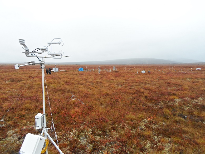
Figure 3. Eddy covariance flux system and 4-comopnent radiometer at Council, Alaska looking south
Cambridge Bay, Canada
For long-term monitoring for CO2 and energy exchanges between the atmosphere and the ecosystem at the site, eddy covariance flux system together with a net radiometer has been operated on a tower of Environment Canada about 50 m away from the climate manipulation plots this year (69o7’47.7″N, 105o3’35.3″W). For quality control of flux data and diagnosis of the impact of a garbage incineration plat southeast away from the flux tower on atmosphere quality, an aethalometer was installed to measure black carbon concentration in a building of upper air station in July this year. Maintenance of and data retrieval from the flux system and the aethalometer are supported by Hamlet of Cambridge through regular visit to the site every two weeks. In near future, this flux system will be extended to monitor CO2 and CH4 simultaneously.
To investigate the effects of increasing temperature and precipitation in arctic tundra, we have continued the climate manipulation experiment since 2012. Installing open top chambers (OTCs) to increase temperature and watering every week to increase precipitation have been started in early July. These climate manipulation treatments continued until the early of October with a help from Hamlet of Cambridge Bay. During the first field trip in July, we downloaded the data for air temperature, relative humidity, soil temperature, and soil moisture content recorded for a year. To evaluate the effects of climate manipulation on plants, soil microbes, and soil physical and chemical properties, we surveyed plant composition and cover in the plots, and soil sampling (0~5 and 5~10 depths) were conducted in early August. We are also interested in the plant metabolites changes due to climate manipulation, therefore, sterol in soil and metabolites from plant leaves and roots were extracted during the field trip. In August 23-24, there were extremely strong winds on the field site, thus, all OTCs were blown away or broken out of position. Therefore, the climate manipulation experiments were briefly stopped during the period from August 23 to September 6. Now we are conducting several experiments to investigate the short term effects of climate manipulation on soil microbes and soil organic carbon.
Figure 4. Climate manipulation plots setup in Cambridge Bay on July 5st, 2013 and air temperature data for a year
Report prepared by Yoo Kyung Lee (yklee@kopri.re.kr).
Mongolia
As mentioned in the recommendation of the second international symposium on mountain and arid land permafrost, to extend the interest group area from Central Asia to Asian countries where permafrost exists and to organize an effective international team of experts to continue the project on mapping of mountain permafrost in Asia. In January 2013, there was a meeting at Hokkaido University between the permafrost researchers from Oslo University, Norway (prof Bernd Etzelmuller, Dr Sebastian Westermann), from Hokkaido University, Japan (prof M. Ishikawa, Dashtseren Avirmed, doctoral student of Hokkaido University, Iyo Yamahashi, master student of Hokkaido University), from Geography Institute of Mongolia (Dr Ya.Jambaljav) and from EngGeoTech LLC (Dr M.Myagmarjav). Thanks to professor M. Ishikawa, we had discussed successful on the topic of permafrost mapping in Mongolian territory. As Mongolia lies in Asian ecotone from Siberian tundra to Central Asian Desert, Mongolia has permafrost in the northern part and South of Mongolia is characterized by Gobi desert. Southern or lower limit of permafrost distribution in Mongolia is one of the critical issues.
According to a climatic recording of air temperature, the mean annual air temperature has been increased by more 2 degrees over Mongolia since the 1940s. As mentioned in the recommendation of the second international symposium on mountain and arid land permafrost, the Mongolian permafrost and ecological network were recognized as critical for understanding the dynamics of permafrost. This 2013 year is the last year of the national project “Establishment of the long term permafrost network over Mongolia” and we (Mongolian permafrost researchers) have been collaborating with Japanese colleagues, such as the Japan Agency for Marine-Earth Science and Technology and Hokkaido University since 2002. In the framework of this collaborative study there were established not only some permafrost monitoring sites also ecosystem observation sites in some regions of Mongolia. Terelj J site is located in south-facing grassland slope, near the Ulaanbaatar (figure 1 AWS at the observation site near Ulaanbaatar, Terelj site).For details on this activity refer to the PYRN newsletter for November and december.

Figure 1. AWS at the observation site-Terelj J site (photo by Dr Y.Iijima)
In 2010 the Mongolian parliament adopted a national water program in which was appointed to increase the number of boreholes for permafrost monitoring. The Institute of Meteorology, Hydrology and Environment has completed drilling 30 boreholes in 2013. On the way to download the data from boreholes we have done an additional monitoring points with depths from 0 to 8 m using hand motor drill in 2013. Therefore, Mongolia has established a permafrost network over Mongolia with supports from foreign and national organizations.
Long (10-45 years) term monitoring of permafrost temperature, and active layer thickness is continued by Sharkhuu in more than 40 boreholes with mainly 10-15 m to 100-200 m depths located in the Hovsgol, Hangai and Hentei mountainous regions of Mongolia.
We have more than 100 boreholes with different depths from surface to deep boreholes (figure 2 Location of boreholes for permafrost monitoring). As shown on figure 2, the blue dots indicate the location of active monitoring points and red is newly established point.

Figure 2. Map of permafrost monitoring points.
As a growing of Mongolian economy, there are actively increasing the construction of infrastructure. The construction of road is meeting the area with continuous permafrost in Northern Hangai, Mongolia.
Sharkhuu finished two years detailed measurements for studying effects of the soil surface (different vegetation, snow and icing) covers on ground temperatures and active layer thickness in the upper Selbe River valley near Ulaanbaatar. These studies were conducted within the framework of a local project on nature protection. Currently, he is conducting ground temperature measurements within the framework of a geotechnical project, of which aim is to make a perspective plan of infrastructure around Ulaanbaatar territory. He will compile a permafrost (1: 100,000) map of the area around Ulaanbaatar (75×66 km2) and detailed permafrost maps of several settlement territories near the city.
Report prepared by Jambaljav Yamkhin (jambaljav@gmail.com)
Norway
Geology Department, UNIS
In 2013 the periglacial research group in the Geology Department of The University Centre in Svalbard, UNIS, did a winter snow mobile based hand drilling campaign as part of several research project activities in Adventdalen and at Kapp Linne. The campaign was coordinated by PhD student Stefanie Härtel, the EU Page21 project and Markus Eckerstorfer, the PermaSAR project coordinated from Norut, but also as part of our DEFROST Nordic Centre of Excellence activities. More than 35 m of permafrost cores were obtained from 20 locations down to 2.8 m depth for detailed cryostratigraphical and basic sedimentological studies.
In 2013 an UNIS PhD course AG-833 ‘High Arctic Permafrost landscape dynamics was held in Svalbard and Greenland’, in cooperation with the Center for Permafrost, CENPERM, University of Copenhagen, and as key part of the Nordic permafrost network Perma-Nordnet. 10 Nordic PhD and advanced master students travelled to research station Zackenberg in NE Greenland, and studied the periglacial landscape development in this area based on the extensive basis monitoring going on there, but also comparing permafrost conditions in NE Greenland to Svalbard. The first installations of permafrost thermal regimes from different landforms in the Zackenberg valley were recovered during the course.
An extensive analysis of the cryostratigraphical conditions in the top 60 m of Quaternary sediments obtained in a core from lower Adventdalen is being analysed in a master project. This work is part of the Longyearbyen CO2 Laboratory project activities. A working group with app. 12 scientists is studying different things in this core, and a workshop to coordinate the investigations and plan for combining the results were held at CENPERM, University of Copenhagen in November. In total 4 master students are investigating different topics down this core, with theses to be ready during 2014.

Figure 1. Students investigating a retrogressive thaw slide in the Zackenberg area, August 2013 as part of the activities of the AG-833’ High Arctic Permafrost landscape dynamics in Svalbard and Greenlan’ PhD course. Photo: Hanne H. Christiansen.
The PermaSAR project
To improve the understanding of the rockslide controlling factors and get a better overview of differential movement patterns within the unstable rockslide area, the PermaSARII project is running 2012-2014 with Norut (Markus Eckerstorfer), UNIS (Hanne H. Christiansen) and Åknes Tafjord Beredskap AS (Lars H. Blikra) as project partners. The goal is to assess periglacial landscape sensitivity to climate and meteorological variability, using satellite based InSAR. In the project repeated InSAR measurements are combined with in-situ field measurements as ground truthing.
Fractures in the Jettan rockslide area, N Norway were instrumented with temperature loggers, and the main active fracture was instrumented with a 25 m temperature string with 1 m logger spacing. Additionally geomorphological mapping of the rockslide area and the surrounding periglacial landscape was done in 1:10 000. The detailed geomorphological map will be compared to the InSAR results. We expect the InSAR maps to show differential movement patterns for different periglacial landforms. A preliminary study, carried out in a recent MSc-thesis by Harald Eriksen, showed the potential of monitoring ground deformation with InSAR at both landform and landscape scale.
As solifluction is a widespread periglacial process at Nordnes, a real-time solifluction monitoring station was installed on an active solifluction lobe, similar to the stations located at Svalbard. The station was established in August, recording hourly solifluction movement, air temperature, ground temperature, and soil moisture at different depths.

Figure 2. New solifluction station at Nordnes, Northern Norway. Photo: Markus Eckerstorfer.
Surface kinematics of periglacial sorted circles using structure-from-motion technology
Andreas Kääb, Luc Girod (University of Oslo) and Ivar Berthling (Norwegian University of Science and Technology)
Sorted soil circles are a suspicious form of periglacial patterned ground. Numerical modelling suggests that these features develop from a convection-like circulation of material in the active layer of permafrost. The related iterative burying and resurfacing of material is believed to play an important role in the soil carbon cycle of high latitudes. The connection of sorted circles to permafrost conditions and its changes over time make these ground forms to a potential paleoclimatic indicator. The photogrammetric Structure-from-Motion technology (SfM) is applied to large sets of overlapping terrestrial photos taken in Augusts 2007 and 2010 over three sorted circles at Kvadehuksletta, Western Spitsbergen. The team retrieves repeat digital elevation models (DEMs) and orthoimages with millimetre-resolution and accuracy. Changes in microrelief over the three years are obtained from DEM-differencing and horizontal displacement fields from tracking features between the orthoimages. In the inner domains of the circles, consisting of fines, material moves radially outside with horizontal surface speeds of up to 2 cm a-1. The outer circle ridges consist of coarse stones that displace towards the inner circle domain at similar rates. A number of substantial deviations from this overall radial symmetry, both in horizontal displacements and in microrelief, shed new light on the potential spatio-temporal evolution of sorted soil circles, and periglacial patterned ground in general.

Figure 3. Shaded relief (hillshade) of the 2007 DEM, resampled to 2 cm resolution, over the three sorted circles. Black dots indicate the positions of the ground control points used. Note the soil cracks on the ridge tops and in the inner domains.
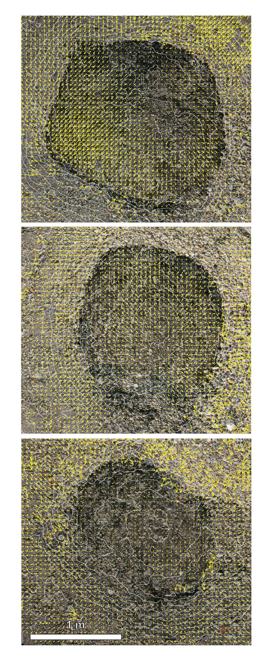
Figure 4. Horizontal surface displacements 2007-2010 on the northernmost circle. Chaotic vectors or groups of vectors are typically caused by individual stones that slide or tip, but could in some cases also be mismatches. Measurements with very low correlation coefficients have been removed. Linear vector scale with maximum vector magnitude of 2.5 cm a-1.
The Snow Patch Archeology Research Cooperation (SPARC) project
Perennial snow/ice patches fall between the main research focus of both the glaciological and permafrost research communities, and have remained little studied. Recently, global warming has caused retreat of these ice patches and revealed a wealth of archeological remains from former reindeer hunting activities in the Scandinavian mountains, Canada and Alaska. Some of these are found melting directly out of the ice and dating then confirms that the ice in these ice patches may be several kyears old. This temporal stability is baffling, as the ice patches mainly are less than 20 m thick and points towards significant negative feedback effects. The SPARC project started in 2012 and was designed to tie together archeological, permafrost and glaciological knowledge and investigation methods, and brings together of researchers from the Norwegian University of Science and Technology (University Museum and Department of Geography), and the University of Oslo (Museum of Cultural History). The snow patches investigated in the project all are situated at or above the lower permafrost altitude limit, but well below the regional glacier equilibrium line altitude.
Department of Geosciences, University of Oslo
The University of Oslo conducted fieldwork on Svalbard and in the mainland of Norway (Bernd Etzelmüller, Ole Humlum, Sebastian Westermann). The project on mountain meteorology, snow cover, vegetation, ground temperatures and interaction between permafrost and glaciers in southern Norway continues, with special focus on the Finse region in central southern Norway (O. Humlum).
In Finnmark, permafrost occurrence in mires was mapped along two transects of in total 200km length. In addition, routine maintenance of the borehole network in Southern and Northern Norway was conducted (Sebastian Westermann).
On Svalbard, a multi-year study on the spatial variability of snow depths and ground temperatures near Ny-Ålesund was finalized with the installation of an automatic camera on Scheteligfjellet and the reading out of ground surface temperature loggers (Sebastian Westermann).
Arctic coastal erosion; an overview of research fields and field surveys in the SAMCoT project
Most of the research within engineering aspects of the permafrost is performed within the Sustainable Arctic Marine and Coastal Technology (SAMCoT) project with Sintef, UNIS and NTNU as the main Norwegian parties headed by Maj Gøril Glåmen Bæverfjord.A report on main activities in 2013 is presented below
Arctic Coastal Retreat: why and how?
A main research question is what are the major mechanisms behind Arctic coastal erosion of icebounded permafrost soils and how this processes can be modelled in order to better predict future erosion rates at a given site.
Part of the work is related to field studies at selected sites, where one aims at arriving at a comprehensive description of the sites and ongoing processes. In 2013 this has been involving follow-up at the onshore site at Vestpynten, with reinstallation of some of the thermistors, logging of data and maintenance of equipment. In addition, Emilie Guegan (NTNU), Eric Caquil (Total), Lars Grande (NTNU) and Arnstein Watn (SINTEF) performed measurements of snow temperatures and snow depth in the snow bank at Vestpynten in February, in order to add more understanding of the influence of the snow bank. A fluxmeter has also been applied onshore at the Vestpynten site, aiming at gaining understanding of the thermal conductivity of the site. Emilie Guegan (NTNU) and Anatoly Sinitsyn (SINTEF and UNIS) installed shallow thermistors in the bluff front in an attempt to better understand the coastal permafrost degradation.
PhD candidate Daria Aleksuytina at Moscow State University has been visiting UNIS, meeting other SAMCoT-researchers from SINTEF and UNIS, and to have an impression of the Vestpynten research site.
Prof. Aleksey Marchenko at UNIS and SINTEF senior engineer Torgeir Jensen installed an AWAC, continuous logging the wave, currents and sea temperatures off the shoreline of the Vestpynten site. The AWAC was raised in the late summer of 2013, and the data is currently processed and will be published in 2014, adding much value to the total understanding of the coastal dynamics at Vestpynten.
As for studies of erosion at Svalbard sites, Svalbard being easy accessible providing data with high security, erosion has been monitored by Håkon Tangen (SINTEF) and Evangeline Sessford (UNIS and SINTEF) at some satellites sites, being Damesbukta, Kapp Laila and Fredheim. This is presented in a SAMCoT-report and will be published in 2014, as a contribution to the understanding of terrestrial processes to Arctic coastal erosion.
A major field excursion in the SAMCoT-project was performed at the field site of Moscow State University in Baydaratskaya Bay in June 2013. Baydara Bay is located on the coast of the Kara sea in the European part of north of Russia. A shoreline area with a length of approximately 4 km was surveyed. This year’s investigation was the second fieldwork campaign in this area.
The fieldwork was conducted in order to study:
- the destructive processes of the coastline;
- permafrost properties and stability in the area.
The fieldwork program in 2013 included:
- Observations of the area and exposures
- Hand drilling, sampling of frozen soil (about 60m)
- Installation of thermistorstrings and thermomentry
- Land surveying and levelling of slopes for mapping of erosion rates
- Thermal conductivity, density and water content measurements in situ (about 20 measurements)
- Camera installation and observations
List of participants in the field work: Khilimonyuk Vanda – Group leader , Buldovich Sergey – Science director, Aleksyutina Darya – PhD student, Valyisky Stanislav – Graduate student, Onishinko Nikita – Graduate student, Dyagterenko Maria – Graduate student, Prsuntsov Kirill – Graduate student, Finseth Jomar – SINTEF, Guegan Emilie – NTNU.
Discussion, planning and analysis participants: Brouchkov Anatoli – Director of the Geocryology Department , Motenko Rima – Senior Researcher (supervisor), Roman Lidia.
As a follow-up of the field campaign, laboratory testing of permafrost soil samples at the coastal erosion site in Baydara has been undergoing at Moscow State University, with main focus on physical and thermal properties of frozen and warming permafrost soil, by Daria Aleksuytina related to the SAMCoT-project.
Arctic Coastal Retreat: How to build sustainable constructions?
When the processes behind Arctic Coastal Retreat is understood and known, one has a better basis of developing construction solutions and construction materials adapted to the conditions and protecting shorelines and structure against such erosion processes and coastal retreats.
Some erosion protection structures have been built in the past in Svea, and their performance is monitored. A field survey was performed in September in by Håkon Tangen and Evangeline Sessford, mapping the state of existing erosion protection structures. The results from the survey are presented in a report in 2013 and will be published in 2014.
At the end of the year currents and waves measurements was performed in Svea as well as sediment sampling around the coal quay of Kapp Amsterdam, to increase understanding of sediment transport in the area. The field work was performed by Prof. Aleksey Marchenko at UNIS and Jomar Finseth from SINTEF with the UNIS research wessel Viking Explorer. The thermal regime of the quay is also monitored through continuous logging of the soil temperature at two locations of the quay.
Part of the scope of the SAMCoT Work Package on Coastal Technology is developing coastal protection structures using as much local available materials as possible together with innovative materials. One research and development project in SINTEF is based on using geosyntethics filled with local available and stabilized soil as coastal protection. The project involved laboratory tests and modelling and a planned field verification of performance. In close relation to this project, december 2nd Gunther Kassner of Münster University of Applied Sciences defended his MSc-thesis on the use of local soil as fill material for geotextile mattresses in Arctic areas at SINTEF in Trondheim. His thesis was performed as Erasmus cooperation between Münster University of Applied Sciences and SAMCoT research partner SINTEF.
Magne Wold and Maj Gøril Bæverfjord presented a paper on coastal erosion protections using geosynthetics and local available materials at the Cold Regions Engineering sessions at the Canadian Geotechnical Conference in the end of September and visited the Canadian Hydraulics Centre at the National Research Council in Ottawa. (Wold, M., Finseth, J., Tangen, H. and Bæverfjord, M.G.(2013): Coastal erosion and erosion protection using geosynthetics in the Arctic, field studies in Svalbard”, The 66th Canadian Geotechnical Conference, September 28th -October 2nd, Montreal, Canada)
Arctic Coastal Retreat: The Influence of Climate Change?
Climate change is an important challenge for engineers of today, and climate change will have a significant impact in the Arctic. In WP6 Coastal Technology we have established some thermal models for Vestpynten, taking a potential future climate into account. This will be developed further, and eventually included in the prediction model of Arctic coastal erosion. In 2014 the initial work will be presented at the 4th European conference of Permafrost in Evora, Portugal, with the title “Soil instability due to climate warming scenarios in a coastal permafrost zone at Svalbard”.
Report prepared by Gisle Håland (gish@statoil.com) and Ole Humlum (ole.humlum@mn.uio.no).
Poland
Different aspects of permafrost were investigated in 2013 in three areas: on Spitsbergen, in northern Sweden and on King George Island (Antarctica).
On Spitsbergen, permafrost research during the summer season of 2013 was conducted by the Adam Mickiewicz University in Poznań (in Petuniabukta, Billefjorden) and the Nicolaus Copernicus University in Toruń (on the Kaffiøyra Plain). Both universities’ research teams were supported by National Science Center funds within two projects: Cryosphere reactions against the background of environmental changes in contrasting high-Arctic conditions on Svalbard (led by Grzegorz Rachlewicz), and Contemporary and historical changes in the Svalbard climate and topoclimates (led by Rajmund Przybylak).
In Petuniabukta, shallow ground temperature and humidity profilers, equipped with data-loggers for year-round registration, were set up in the centre of 100×100 m test fields for active layer-thickness measurements according to CALM guidelines. The test fields are differentiated in terms of moisture content. One was dry, and set up on a raised marine terrace which thawed, on average, to 128 cm. The other was wet, set up on a proglacial river terrace with an active layer thickness well below 145 cm. Observations of periglacial processes were supported with ground-based thermal imaging in various scales (from meters to kilometres) and Terra/Aqua satellites MODIS land surface temperature analyses for the period 2000-2013, showing statistically significant rising tendencies on most of the surfaces types (especially the fjord, its coasts and glaciers at ELA). For the last few years, aeolian activity in the region has been monitored for both its erosive and accumulative features.
In Kaffiøyra, measurements of the depth of the active layer of permafrost, its thermal conditions and dynamics were carried out at the CALM project’s Site P2 (A-C), located near the Nicolaus Copernicus University’s station (Fig. 1). In addition, the same tests were also performed at two independent test sites (100×100 m), again following CALM project rules. At every test site, temperature and humidity sensors were installed at various depths (temperature sensors at 1, 5, 10, 20, 50 and 100 cm; humidity sensors at 5 and 10 cm), and connected to data-loggers. Measurements were taken of the ground-thaw rate and the thickness of the active permafrost layer at all sites, every 7-10 days in July and August. The ground temperature at Site P2 was measured at standard depths of 0-2 m in the same three different ecotopes – as were the active layer depth measurements – at the beach, the tundra, and the moraine (see Fig. 1). For this purpose, both mercury thermometers (readings taken every 6 hours, only in summer) and automatic temperature loggers (registration every 10 minutes, year-round) were installed at the measurement sites.

Figure 1. The location of the Nicolaus Copernicus University Polar Station in Kaffiøyra (NW Spitsbergen) and CALM Site P2, where active layer depth and ground temperature measurements were taken. P2A – beach, P2B – tundra, and P2C – moraine (photo by A. Araźny).
At King George Island (Antarctica), ground temperature measurements near the Henryk Arctowski Station were made at depths of 5, 20, 50 and 70 cm in two months (January and February) of the austral summer season. Ground thermal conditions, at hourly resolutions, were recorded with HOBO automatic loggers.
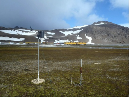
Figure 2. Automatic weather station and HOBO automatic loggers near the Henryk Arctowski Station (photo by I. Sobota).
Field research on the glacier’s permafrost interaction was conducted on Storglaciaren and its forefield in the Tarfala area of northern Sweden (Fig. 3). Research was performed with National Science Centre support, granted to the project lead by Wojciech Dobiński of the University of Silesia. GPR (ground penetrating radar) survey with 100 and 200 MHz antennas gave an insight into the glacier’s cold and warm ice, as well as its CTS (Cold-temperate Transition Surface). The presence of rock sediments, moraine inclusions and other forms of sedimentation in and on the glacier were also detected. Research on underground ice and active layer depth was conducted on the forefield of the glacier. The support of the Tarfala Scientific Station is kindly acknowledged.
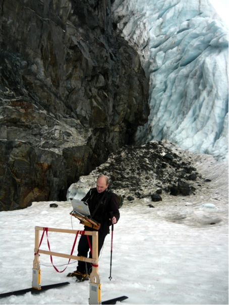
Figure 3. GPR measurements on Storglaciaren, Kebnekaise, northern Sweden, (Photo by W. Dobiński)
Publications:
Araźny A., Kejna M., Sobota I., 2013, Ground temperature at the Henryk Arctowski Station (King George Island, Antarctic) – case study from the period of January 2012 to February 2013. Bulletin of Geography, Physical Geography Series 6: 59-80.
Dolnicki P., Grabiec M., Puczko D., Gawor Ł. Budzik T., Klementowski J., 2013, Variability of temperature and thickness of permafrost active layer at coastal sites of Svalbard, Polish Polar Research 34:353–374.
Sobota I., 2013, Recent changes of cryosphere of north-western Spitsbergen based on Kaffiøyra region. Wydawnictwo UMK. Toruń, pp. 450 (in Polish, extended abstract available).
Sobota I., Araźny A., Barcikowski A., Birkenmajer K., Grześ M., Gugnacka-Fiedor W., Lankauf R.K., Plichta W., Przybylak R. and Zubel P., 2013. Geographical environment in the vicinity of the Nicolaus Copernicus University. In: Zwoliński Z., Kostrzewski A. and Pulina M. (eds), Ancient and modern geoecosystems of Spitsbergen, Bogucki Wydawnictwo Naukowe, Poznań,181-204.
Report prepared by Rajmund Przybylak (rp11@umk.pl)
Romania
In 2013 only two groups were engaged in periglacial geomorphology and permafrost researches, the University of Timisoara and Bucharest. The group of periglacial researchers from West University of Timişoara (P. Urdea, A. Onaca, F. Ardelean, A. Ardelean, R. Şerban, R. Puţan, F. Sîrbu) continued to study permafrost distribution and other significant periglacial landforms (solifluxions, block streams, talus slope deposits) in Southern Carpathians. The main goal of the approach was to capture the current amplitude of periglacial processes from Southern Carpathians, taking into account the complex relationship between the detailed morphology of analyzed landforms, their internal structure and their thermal regime and actual movement. To achieve this goal, several test sites were chosen for detailed analysis of selected periglacial phenomena and structures.
In case of permafrost distribution, several rock glaciers from Retezat (Fig. 1) and Parâng Mountains have been investigated through different techniques and methods (ERT, GPR, GST, BTS, GIS modelling), following few main objectives: identification of permafrost occurence; investigating the internal structure of rock glaciers and determining permafrost characteristics by means of geophysical investigations; establishing an effective methodology for permafrost mapping in the Southern Carpathians; long term monitoring of permafrost occupied areas for future evaluation of permafrost degradation induced by global warming; evaluating the influence of local conditions for permafrost preservation and generating a permafrost distribution model. All these results confirm the hypothesis that isolated patches of permafrost could exist in the Southern Carpathians at sites particularly favorable to permafrost conservation. The preservation of permafrost in these rock glaciers it is possible because of the openwork structure (Fig. 2) of the active layers, allowing a significant cooling beneath the bouldery mantle and the storage of cold air in winter below thick snow cover. In addition, an inventory of the rock glaciers and protalus ramparts from Southern Carpathians was realized by the team coordinated by P. Urdea.

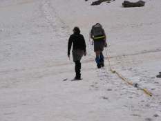
Figure 1. GPR investigations in Pietrele rock glaciers, Retezat Mountains (Photo B. Magori).
Some of the results formed the basis for two papers, important for Romanian geomorphological community, by the novelty of the approach (Onaca, A., Urdea, P., Ardelean, A., 2013, Internal Structure and Permafrost Characteristics of the Rock Glaciers of Southern Carpathians (Romania) Assessed by Geoelectrical Soundings and Thermal Monitoring, Geografiska Annaler, Series A: Physical Geography, 95 (3), 249-266, doi:10.1111-geoa.12014; Onaca, A., Urdea, P., Ardelean, A., Şerban, R., 2013, Assessement of internal structure of periglacial landforms from Southern Carpathians (Romania) using DC resistivity tomography, Carpathian Journal of Earth and Environmental Sciences, 8 (2), 113-122).

Figure 2. Openwork structure in Judele rock glaciers, Retezat Mountains (Photo F. Ardelean).
In case of the measurements performed on the talus slope deposits from Făgăraş Mountains the preliminary findings reveals evidence for a complex architecture with several clear strata. More homogeneous layers composed by fine grained deposits intercalated between coarse-grained layers were identified along the GPR profiles. Buried features like the bedrock, morainic materials, different geological structures, drainage systems in the bedrock, rockfall deposits and debris-flows materials could be recognized. The GPR data allowed us to formulate an evolution scenario of the investigated talus slopes from Făgăraş Mountains for the Holocene.
With excellent qualificative, under the coordination of the undersigned, in September was sustained two PhD thesis by A. Onaca, ,,Periglacial processes and landforms from Southern Carpathians. Geomorphological and geophysical approach’’ (237 p.) and F. Ardelean, ,,Semi-automated classification of some landforms for geomorphological mapping. Case study: Ţarcu Mountains’’ (172 p.).
Also, P. Urdea made field investigations on the periglacial forms in some middle mountain area of the Roamanian Carpathians, like Găina Mountain (Apuseni Mountains) (Fig. 4), and Ciucaş (Fig. 4), Suhard and Giumalău Mountains (Eastern Carpathians) (Fig. 5).
The permafrost research team from Bucharest (Răzvan Popescu, Mirela Vasile, Alfred Vespremeanu-Stroe, Nicolae Cruceru and Loredana Bîzgan) continued the main investigations on alpine and low altitude permafrost from Romania by combining traditional methods and new approaches. Seasonal BTS measurements were performed and the functionality of the established GST investigation points was assured. Also, topographical survey for rock glacier dynamics assessment was repeated and dendrogeomorphological investigations were initiated on Retezat Mountains. DC resistivity soundings were also initiated by our team. Besides, extensive measurements on rock deposit porosity variations were performed across different massifs of Southern Carpathians in the attempt to explain the lower permafrost altitudes in the granitic mountains (Retezat and Parâng) in comparison with the crystalline ones (Făgăraş). Several tens of vertical photographs were taken from a 3 meters height using a tripod and additional in situ measurements of clast volume were performed. Monica Voinea processed the images in GIS to obtain the characteristic mean clast volume for each site. The debris porosity was estimated by considering a direct relationship between clast volume and porosity.

Figure 3. ,,Goliath’’ a conglomeratic tor in Ciucaş Mountains (Photo P. Urdea).


Fig. 4. Frost sorting and relict altiplanation terrace in Găina Mountain, Apuseni Mountains (Photo P. Urdea).


Fig. 5. Pleistocene slope failures in Fărăoane area (Suhard Mts.) and in Giumalău Mountains (Photo P. Urdea).
Using temperature and snow depth meteorological data from alpine stations, multiple indices were computed in order to reconstruct the climate favorability for permafrost in Southern Carpathians for the last 70 years.
The researches on seasonal frost and freeze-thaw processes in the alpine environment in the Southern Carpathians also continued this year. The thermal monitoring of rockwalls has been still running, at about 20 locations, with intensive measurements in Bucegi, Făgăraş and Retezat Mountains. We concentrated more on in-depth measurement (50 cm) and on the role of the exposition and slope of the rock faces, following these parameters in more sites.
With the wide purpose of determining the temporal and spatial patterns of frost-induced phenomena such as rockfalls in the specific climate, topographic and geo-tectonic conditions of the Southern Carpathians, we have initiated in several test areas observations and measurements on the joints and cracks density and patterns on the steep rockwalls. This initiative is complementary to the temperature and crack dynamics continuous monitoring in the same rockwalls. By the GIS analysis of images and high resolution photographs taken on the field we are now trying to identify specific characteristics (explicitly the dimensions of the rocks to be detached) of these potential areas for rockfalls, mainly function of exposure and lithology. In the same time, the thickness of the fissures at the surface of the wall was measured, highlighting different joints typologies with specific role in frost propagation and rockfall generation. We are thus trying to correlate these elements (joints characteristics, frost-depth and propagation) in order to get a clear view in respect to seasonal frost as a preparing and triggering factor of such phenomena.
Members of the two universities teams participated with papers in special sessions held at the 8th IAG/AIG International Conference on Geomorphology (Paris, August 27-31) and at the Carpatho-Balkan-Dinaric Conference on Geomorphology (Stara Lesna, Slovakia, June 24-28).
In January 2013 was approved the status and structure of the National Committee for Antarctic Research (CNCA) of the Romanian Academy, in the Geonomic Section Prof. P. Urdea being appointed deputy scientific coordinator.
Report prepared by Petru Urdea (petru.urdea@cbg.uvt.ro).
Russia
Russian Academy of Science earth cryosphere Institute of Siberian Branch RAS (ECI SB RAS)
V.S. Sheinkman, V.P. Melnikov. Siberian glaciers as a component of cryolithogenic-glacial geosystems
Cold continental climate in Siberia determines peculiar conditions of glacier formation and dynamics. Interacting with permafrost, they become a new element of cryodiversity, i.e. a set of objects and phenomena produced by cold, and differ greatly from the glaciers which used to be considered from the positions of the Alpine glaciation model. Being cooled down to quite low temperature (much below 0ºС), the glaciers in Siberia acquire traits which are more inherent for the cryolithozone rather than for Alpine-type glaciers. The acquired feature calls for regarding the formed aggregation of glaciers and permafrost as a peculiar geosystems; we name them cryolithogenic-glacial systems.
Russian Academy of Science earth cryosphere Institute of Siberian Branch RAS (ECI SB RAS)
S.M.Fotiev. Underground waters of cryogenic area of Russia (classification)
During the cryogenic period (the last 3.1 million years) the geothermal and hydrogeological conditions inside the geological structures have essentially changed all over the vast circumpolar area of Russia. As a result of perennial freezing of rocks the thick low-temperature cryogenic aquicludes had formed inside the structures. They had changed considerably the conditions of water-exchange, the hydrochemical zonality and the capacity of hydrogeological structures. Basing on the contemporary scientific researches in the fields of hydrogeology and geocryology, the enormous but utterly irregular (in time and space) influence of the process of cryogenic metamorphism of rocks on the transformation of the hydrogeological conditions inside the hydrogeological structures situated in various geocryological zones has been revealed.
Elaborating the classification of the underground waters of cryogenic area, the author has proceeded from the assumption that the geological structures and the accumulation of the main types of the underground waters inside them had formed before the beginning of the cryogenic period. During the cryogenic period the underground waters had maintained the active thermal resistance to the perennial freezing of rocks. Just therefore, the classification of the underground waters of the cryogenic area has been founded on the key hydrogeological feature of the rocks – their water-permeability.
Russian Academy of Science earth cryosphere Institute of Siberian Branch RAS (ECI SB RAS)
F.E. Are. Thermal aspects of N.A. Tsytovich principle of water and ice equilibrium state in frozen ground
The applicability of the Stephen problem solutions for permafrost dynamics modeling is discussed using N.A. Tsytovich principle of water and ice equilibrium state in frozen grounds. The main external impacts controlling equilibrium, relationships between equilibrium dynamics and thermal processes in ground, possibilities of mathematical modeling of permafrost dynamics are reviewed. The dynamics of equilibrium state in saline ground is discussed using results of permafrost investigations on Yamal Peninsula and Laptev Sea shelf. It is revealed that the cryopeg temperature in equilibrium state is equal to its initial freezing point, the ice-bonded permafrost may contain cryopeg and preserve permeability, the cryopeg boundary may not coincide with the phase boundary. Free-salined permafrost on the shelf flooded by the sea undergoes fast salinization and physicochemical thawing at negative temperature. The thawing is accompanied by temperature lowering due to latent heat absorption. The ice content in salined permafrost on shelf is changing in space gradually without a clear phase boundary. It is revealed that solutions of Stephen problem are unacceptable for shelf permafrost modeling.
The Department of Cryolithology and Glaciology, Geographical Faculty, Lomonosov Moscow State University
V.N. Konishchev. Nature of the cyclic structure of ice complex, East Siberia
The features of cyclic structure in the Karga-Sartan Ice Complex deposits have been researched for coastal lowlands in the Northern Yakutia. The cycles of different genesis (cryolithological, structural, lithological, soil-vegetational) and duration have been analyzed. It has been demonstrated that the climate fluctuation had been the major factor of cyclic structure in the Ice Complex deposits. It has been revealed that the cyclic characteristics of the Ice Complex can become apparent both in subaqueous and in subaerial facies of Ice Complex. The conclusion has been made about the crucial role of the cryogenic weathering and subsequent re-deposition of eroded soils in river valleys and alas depressions in the formation of the Ice Complex.
Russian Academy of Science earth cryosphere Institute of Siberian Branch RAS (ECI SB RAS)
1) Complex researches in the sea-coastal area have been carried out, including a) the ground investigations of the structure, composition and salinity of the dispersed sediments, b) the ground investigations of the dependence of the phase transition temperature upon the water-soluble salts, upon the temperature regime of the rocks and sea water in the shallow zone, c) the high-resolution seismic investigations. These researches have allowed elaborating the conceptual structural model of the correlation between the continental and subaqual permafrost in the sea-coastal area. The successive replacement of the continental permafrost by the frozen ground of the transit zone occurs in the direction from the land towards the sea, then the continuous talik takes place, and at last there is the subaqual permafrost of the island type.
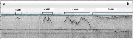
Figure 1. Interpretation of the seismogram of the high-resolution seismo-profiling(Western Yamal)
The proper technique of the shallow seismic investigations for detection and identification of the hard-frozen rocks at the offshore strips including the saline geological profile have been worked out. The technique of bottom seismic investigations allow solving engineering-geological problems in shallow waters. Assumed is the using of P- and SH-waves at the same time.
2) It has been revealed that the aggregative stability of the “dry water” dispersion in the formation/dissociation cycles of the gas hydrates is reached when the concentration of the water-repelling nanoparticles of the silicon dioxide Aerosil R202 is rising up to 10 wt%. This fact improves the opportunities of “dry water” application in the gas hydrate production technology.
3) The studying of the ice bilayer features have resulted in the pioneer determination of the new property of the hydrogen-bond net: the noninvariance of its characteristics towards the change of direction of all hydrogen bonds. As opposed to the ice-like water clasters, the external free atoms of hydrogen are absent in the ice bilayers. That’s why there we mark out quite new property of the hydrogen-bond net itself but not its peculiarities as in the case of water clasters. The founded invariance implies the presence of the asymmetry in the ice structures.
Figure 2. Ice bilayers without external atoms of hydrogen: a – “usual” hexagonal bilayer, b – displaced hexagonal bilayer. The rectangular unit cells are shown by the dotted line.
4) The score of the climate parameters have been carried out and the map of the meteorological hasards of the Russian Federation have been plotted using the developed (Earth Cryosphere Institute SB RAS) technology of the cartographic modeling for the description of the complex impact of the current climate change on the permafrost. The overlaying of this map on the landscape and geological maps permits to zone the territories according to the degree of heat inertia, and then to specify the spatial distribution of the meteorological hazards of permafrost (look at the map).

Figure 3. Map of zoning of the Russian territory according to the meteorological hazard for permafrost (red colour – maximal risk, violet colour – minimal risk)
In the conditions of the changing climate the low-temperature permafrost is warming up quickly whereas the warm-up of the ground strata at the temperatures close to 00C is retarding due to the constant phase transitions. This fact is especially considerable for the zone of discontinuous permafrost in taiga and forest-tundra.
The technique of calculation and nature verification of the wind redistribution of the snow depending on territory morphology, landscape structure and pattern, biota peculiarities has been worked out for the woodless tundra and forest-tundra regions. This technique allows lateral differentiating of the value of the winter heat exchange and the time of the snow thawing.
It has been established that the evidence of the relic thermokarst in the profiles of saline frozen sea-coastal and subaeral deposits are remained as taberal complexes. The taberal complexes of the marginal North of the Western Siberia (Belyi island) are similar to the thawed ice complex of the Eastern Arctic: the pseudomorph-type and postcryogenic-structure-type macrofeatures, and the microstructure stipulated by the initial sincryolithogenesis, thawing and secondary frozing. The relicts of singenetic cryogenesis are not observed southward (Central Yamal).
Melnikov Permafrost Institute (MPI SB RAS), Yakutsk
In 2013, the Melnikov Permafrost Institute (MPI) celebrated the 140th birthday of the pioneer of fundamental permafrost research and founder of geocryology, Mikhail Sumgin (1873-1942), with a Forum for Young Permafrost Scientists held from June 24 to July 13. This event, third in the series, consisted of a geocryological conference attended by 76 students and early career scientists from Moscow, Novosibirsk, Tyumen, Tomsk, Chita, St-Petersburg, Lensk and Chernyshevsky, and a field trip to the southern Verkhoyansk Range focusing on mountain permafrost. A biography of Mikhail Sumgin was published in “Permafrost Researchers” book series [Alekseev V.R. 2013. Sumgin Mikhail Ivanovich. Yakutsk: Permafrost Institute Press, 138 pp.].
Figure 4. Third Forum for Young Permafrost Scientists: Conference participants.
Figure 5. Third Forum for Young Permafrost Scientists: On a field trip.
Main research results
A 1:1,500,000-scale engineering-geological map of the Republic of Sakha/Yakutia was completed. The map compiled in ArcGis version 10 provides systematized data on soil/rock type, cryolithology, suprapermafrost water chemistry and properties, and permafrost-related landforms and surficial processes.
In April 2013, research groups from MPI, Pacific Oceanological Institute in Vladivostok and Moscow State University drilled two boreholes in the Buor-Khaya Gulf, Laptev Sea to determine rates of subsea permafrost degradation. Comparison with the borehole data obtained by MPI in April 1983 indicates that over the last 30 years the subsea permafrost table has lowered at an average rate of 18.5 cm/yr at a distance of 0.6 km and approximately 6 cm/yr at a distance of 2.5 km from the coastline.

Figure 6. Subsea permafrost degradation between April 1983 and April 2013 in Buor-Khaya Gulf, Laptev Sea, north of Muostakh Island
Glaciological studies provided data on the structure, isotopic composition and age of glaciers in the Suntar-Khayata Range, north-eastern Yakutia. Glacier sizes were reconstructed for different periods of glacial retreat.


Figure 7. Position of the Glacier 31 terminus derived from time lapse series of aerial and satellite images (a) and shrinkage of Mus-Khaya Mt glaciers predicted from GIS-based analysis of aerial and satellite images (b).
Samoylov Station
On 23 September 2013, the Presidium of the Siberian Branch of Russian Academy of Sciences (SB RAS) and the Government of the Republic of Sakha/Yakutia held a joint session to officially open the new Arctic research station on Samoylov Island.

Figure 8. New Samoylov Station, April 2013.
International projects
MPI continued investigations within a number of international projects and programs. One is the POLARIS Project which aims at understanding how terrestrial, aquatic and permafrost conditions in the Kolyma River watershed are changing in response to changes in climate. Observations in the northern Tien-Shan undertaken as part of the Global Terrestrial Network-Permafrost (GTNet-P) program have resulted in a database of permafrost and seasonal frost temperatures in different landscapes and evaluation of thermal response to climate change. Studies were initiated jointly with EcoLab – Laboratoire d’écologie fonctionnelle (UMR 5245 CNRS-UPS-INPT), Toulouse, France as part of a EUFP7 project, TOMCAR-Permafrost: Terrestrial organic matter characterization in Arctic River through molecular and isotopic analyses. Bilateral agreements for scientific and educational cooperation were concluded with the Woods Hole Research Center (USA) and the Department of Earth Sciences, University of Oxford (UK).
Publications
Eleven monographs authored by MPI researchers were published, including: (1) Mikhailov V.M. 2013. Floodplain Taliks in the Russian North-East. Novosibirsk: Geo, 244 pp. (2) Goncharov Y.M., Popovich A.P. 2013. Surface Spatial Ventilated Foundations on Permafrost. Yakutsk: Melnikov Permafrost Institute Press. (3) Gavriliev R.I. 2013. Thermophysical Properties of Rocks in the Russian North-East: A Catalogue. Melnikov Permafrost Institute Press. (4) Efremov V.N. 2013. Radioimpedance Sounding of Frozen Ground. Melnikov Permafrost Institute Press.
Completed Degrees
In 2013, two MPI researchers received Kandidat Nauk (Ph.D. equivalent) degrees in geology and mineralogy: Felix Zavadsky (Dissertation: Climate Change Driven Changes in the Geocryological and Hydrogeological Conditions in Southern Yakutia) and Leonid Gagarin (Dissertation: Dynamics of Thermosuffosional Processes in Permafrost, with Special Reference to Central Yakutia)
Cryolithology and Glaciology Department, Geographical Faculty, Lomonosov Moscow State University
Сyclic pattern of Ice Complex (type 3) is shown to be formed under the climatic variations of different periodicity during the Karginsky and Sartan periods. Guidelines were developed for the regulation of the permafrost conditions of the urban areas, taking into account the peculiarities of the nature-technical geocryological complexes, the latter varying by the scale and timing of changes and dominant permafrost dynamics trend. For the Norilsk area, 17 such complexes were localized, while there are 11 of them for the Yamburg area, 32 – for the linear in the north of Western Siberia. Permafrost degradation occurs nowadays within the majority of the Russian.
We also kept tracking the changes, taking place in the area of the glacial catastrophe of September 20th 2002, in the Northern Ossetia (Alaniya). Total ice accumulation in the Kolka glacial cirque exceeded since 2004, during the extended period of unfavourable climatic conditions. Former inflows (‘tributaries’) of the Kolka glacier are now separate glacial bodies; one of them has extended its terminus by 500 m during these times. It is by now the unique evidence of the glacial surge/extension in century. The recurrence probability of the 2002 glacial catastrophe is insignificant. Contemporary glaciation of the Polar Ural Mountains is shown to include 76 minor glaciers of the cirque and protalus types; 5 glaciers are newly described and 20 had ceased its existence since 1966. International Field Courses in Geocryology were organized and held by the Department in July, 2013, in the north of Middle Siberia (Igarka and Norilsk districts), attracting the participants from Russian, Canadian and U.S. universities.
Geocryology Department, Geology Faculty, Lomonosov Moscow State University
Conference “Geocryologic mapping: problems and prospects” was held June 5-6, 2013 at the Faculty of Geology of Lomonosov Moscow State University (Chairman: Brouchkov A.V., co-chairmen: Sergeyev V. I.& Laurier I.K.). 66 reports, including 3 foreign ones were presented. Participants were presenting 35 institutions and organizations from Moscow, St. Petersburg, Tyumen, Yakutsk, Irkutsk, Magadan, Ukhta, Nizhnevartovsk, Pushchino, Edmonton, Calgary (Canada), Alma-Ata, Anadyr and Krasnodar. A part of reports was devoted to transfer to an electronic version and the updating of the 1:2 500 000 scale Geocryologic Map made for the USSR territory in the eighties of the XX century. A.V. Gavrilov (MSU) presented updates within the east Arctic shelf. M.V.Zimin (SCANEX) reviewed new remote-sensing instruments and opportunities for the permafrost mapping. A technique and results of multi-scale mapping of permafrost conditions were reported by Yu.B. Badu, L.N. Kritsuk, A. Matiukhin, I. Streletskaya, E.V. Seversky and others. Maps of glaciers, snow fields (N. V. Kachurina, E.K. Serov) and stocks of organic carbon (P.A.Shary) were presented. The dynamic aspect of the phenomena, such as change of the area of glaciers and snow fields of Antarctica was reported by I.S. Yozhikov (AANII). Development of landscapes and indicator approach was considered in the report of N. V. Tumel and N. A. Koroleva. T.Yu. Zengina with co-authors reported use of various software products for mapping. Reports on constantly operating cartographical model of a thermal condition of soils of the Urengoy gas field (D. S. Drozdov with co-authors), on mapping of taliks in the northeast of the Russia (B. M. Sedov), and on landscape indication of distribution of massive ice in Yamal (A.V. Homutov, M. O. Leybman, M. V. Andreyeva) were of the great interest.
Geocryology department (head – Dr. A.Brouchkov) of Lomonosov Moscow State University has finished the project on a new software for thermal calculations of soil freezing and thawing – TUNDRA instead the older one TEPLO (or HEAT) which is widely used in the Russian research and design institutions. The new program works with latest Windows software and applicable for permafrost forecast in natural conditions and for bases of engineering structures on permafrost, including thermosiphon calculations.
Sergeev Institute of Environmental Geoscience, RAS (Moscow)
GTN-P observations program has been continued with expanding for two CALM sites in Chara Region (Fig.). They were developed in cooperation with Moscow state university geologists. The national GTN-P mirror data base was started to be installed in IEG RAS and in Yakutsk permafrost Institute.
The experimental and modeling results were obtained on the effectiveness estimation of Solar Water Heating Systems in cryolithozone.
Figure 9. Aerovisual observation of the CALM site landscape from small radiocontrol helicopter (Chara Region).
Joint-Stock Company “Funadmentproekt”
JSC “Funadmentproekt” carried out complex research for correlation laboratory methods of frozen ground testing made by international standards (ASTM) and Russian standards (GOST). Based on the analysis of the results of laboratory tests of grounds, correlation indicators of frozen ground properties obtained by uniaxial compression test and the compression are defined. Conducted research and defined limits of the comparability of methods for the determination of frozen grounds salinity. Results convergence of the different methods of assessment defined.
Mining-Geological Joint-Stock Company MIREKO
Komi Center of the Public Monitoring of the State of Bowels (KC PMSB) continued 30-45-year permafrost monitoring at five stations covering the majority of basic landscapes of European North-East of Russia. The main result in 2013 – preservation of long-term trend of degradation of permafrost and accompanying thermokarst.
The greatest thickness of cryolithozone for Subpolar Urals was determined. In its axial zone at mark 1300 m the geothermal gradient within depths 174-435 m is 0.69оС/100 m, and estimated thickness of the cryolithozone – 660 m. This value is more than twice as large as the value suggested by I. Ya. Baranov (1977). The stage thickness of the frost rocks is up to 160 m; the crack ice was determined to the depth of 300 m. The border of continuous permafrost and non-continuous permafrost was traced at mark near 1100 m.
Soil Cryology Laboratory, Institute of Physicochemical and Biological Problems in Soil Science, RAS
In the period from September 29 to October 3, 2013 Soil Cryology laboratory has successfully held the International conference «Earth Cryology: XXI century», which was attended by 130 scientists representing the leading scientific organizations from Russia, USA, Germany and Brazil.

The gas seeps in Kolyma lowland are associated with methane inclusions in permafrost. These inclusions are formed by methane squeezed by epigenetic freezing of methane saturated deposits. This is proved by the biological genesis of the methane, by the isotopic data and the lower radiocarbon age of the methane from the gas seep in comparison with the radiocarbon age of the host deposits. The experimental data and observations of methane distribution in permafrost indicate that the methane distribution in the stratum of frozen deposits is a result of methane migration during cryolithogenesis. The regularities of methane distribution in the deposits and formation of methane inclusions may change the idea of the character and volumes of emission of greenhouse gases into the atmosphere upon degradation of permafrost.
The database of total carbon, bulk density, and iciness of permafrost in North-Eastern Yakutia was compiled. Basing on the State Geological map of Quaternary Deposits (2000) and original drilling data on the main Quaternary stratigraphic units occurrence in Kolyma Lowland the total carbon (TC) storages of the upper 25 m have been estimated. Taking the morphology into account, the TC pool assessed is 38.0 ± 22.5 Gt at near 150 000 km2 area. In our calculation system of ice wedges are not included, what can reduce the total carbon pool. Mean specific carbon content is around 9.5 kg*m-3 in Kolyma Lowland permafrost. The stratigraphic unit-based approach used to compile the database and its analysis provides detailed study of carbon storage in Arctic permafrost. It is well organized for adequately forecasting of permafrost degradation consequences for carbon cycle, including activation of microbiological processes and greenhouse gases emissions.
The study resulted in creation of a collection of 16 bacterial strains from Arctic cryopegs actively producing lipolytic enzymes. Two cold-active lipases and esterase from the P.cryohalolentis strain K5T have been obtained as pure proteins and characterized. Unlike most cold-active enzymes, EstPc LipPc exhibit a rather high level of thermostability.
Report prepared by Dmitry Drozdov, Scientific secretary of Scientific Council on Earth Cryology, Russian Academy of Science (ds_drozdov@mail.ru).
Spain
The Spanish researchers continue working on permafrost and periglacial environments during the last year although the economical circumstances are not favorable because the decrease of research budgets. The different groups working on Antarctic and periglacial environments in the Iberian Peninsula, Andes or Arctic since more than 20 years ago continue working and collaborating with national and foreign research groups and the biannual meeting joint to the Portuguese group of IPA have been celebrated.
The IV Iberian Conference of the International Permafrost Association, organized by the University of Barcelona research group took place from 25 to 27 of June 2013 in Vall de Núria, in the Eastern Pyrenees (http://paisatge.wix.com/servei_ub/ipa-2013#!ipa-2013). The event was organized in four session, 1, Periglacial landscape, shaped and active and ancient processes; 2, Rock glacier study. State of art; 3, Instruments and techniques to the soil thermal survey; 4, Instruments and techniques to periglacial processes surveys. During the conference around 30 oral presentations and tens of posters were presented related to permafrost topics on polar and mountain environments as well as planetary science. The last day was mostly dedicated to a great field trip to the Puigmal massif (2913 m), the second highest peak in the Eastern Pyrenees.
The Permafrost Young Researchers Network organized the Award for best oral and best poster presentations, evaluating 5 oral presentations and 7 poster presentations. For the best oral presentation the winner was Lourenço Bandeira from the Institute for Technical Studies from the Lisbon (Portugal) who presented the communication entitled “Ultra-high resolution image acquisition with an Unmanned Aerial Vehicle for detailed mapping in Barton Peninsula (King George Island, Antarctica)”. The best Poster presentation was Manuel Gómez Lende from the University of Valladolid (Spain) with the presentation on “Orthothermograms in the study of ice caves. The Peña Castil ice cave (Picos de Europa)”.
The president of PYRN, Alexandre Nieuwendam, made a short presentation about PYRN and the plans for the ongoing organization of two workshops during EGU and EUCOP in 2014.
The research group led from the University of Barcelona keeps working in Sierra Nevada (37ºN 3ºW) and Eastern Pyrenees (42ºN 2º) under the coordination of Prof. Antonio Gómez Ortiz, Marc Oliva and Ferran Salvador-Franch. The field campaign in 2013 in Sierra Nevada was focused on the thermal monitoring of the active layer in the Veleta cirque (3150 m) where fossil ice and permafrost are distributed. The team has also maintained the monitoring activities in other sites from the high lands of the massif (Machos plateau, 3350 m, and Rio Seco cirque, 3000 m). All these data will provide a thorough understanding of the soil temperature dynamics in the National Park of Sierra Nevada, where the highest mountains in the Iberia Peninsula are located. Also have been conducted other research activities in this massif, such as the application of the Schmidt hammer in rocks from different moraine complexes. In the Eastern Pyrenees the research group continued monitoring the soil temperatures at different sites. Indeed, samples from rock glaciers for cosmogenic dating in Nuria valley (Coma de l´Embut, 2650 m) have been also collected. The results will allow to compare them with those existing for the Cerdanya area in order to better identify the palaeoenvironmental dynamics during the Late Glacial in the Eastern Pyrenees.
The University of Valladolid research group continues working in Cantabrian Mountain and Pyrenees under the coordination of Enrique Serrano and José Juan Sanjosé. The fieldwork of Pyrenees in 2013 was focused on the rock glacier monitoring in Posets and Maladeta massifs. In Picos de Europa monitoring activities on ice cave have been maintained, finishing during December 2013 the works on thermography and TLS. Geomatic surveys on debris, slide and erosional periglacial features have been made in the Áliva area in the summer fieldwork, collaborating in the research tasks on ice caves and geomorphological processes the Prof. Megan Balks (University of Waikato, New Zealand). In November María González-García submitted his Doctoral Thesis in the University of Málaga. The research, titled “The periglacial high mountain in the Central Spanish Pyrenees: processes, landforms and environments” signify a remarkable advance in the research line of the group.
In Antarctica two active groups are working on permafrost and periglacial processes, develop fieldworks during 2013.
The UAM research group leaded by Jerónimo López-Martínez worked during the austral summer in different areas of South Shetland Island and Antarctic Peninsula, four researchers in Fildes Peninsula (King George Island), Half Moon Island, Livingston Island, Deception Island and Cierva Point (Antarctic Peninsula), and two in Hope Bay (Antarctic Peninsula). During the fieldwork sampling and measurements on periglacial, soils water and permafrost was made. Works was dedicated to accurate positioning and sampling in outcrop surfaces to the Radarsat-2 satellite images identification. The research group collaborates during the fieldwork, analysis and interpretation of results with researchers of the University of Waikato (New Zealand) and the Instituto Antartico Argentino (Argentine).
The permafrost team of the Alcalá University goes on its research in the Antarctic Peninsula with the participation in the Spanish Antarctic expedition with the collaboration of the University of Lisbon, focus in the study of the thermal behavior of the permafrost by mean of the CALM-S sites and the boreholes drilled on the study area. Also the group, coordinate by Miguel Ramos and Miguel Ángel de Pablo is participating in the Mars Sciences Laboratory NASA mission (MSL) by mean of its join in the experience; Rover Environmental Monitoring Station (REMS) that is lead by the Centro de Astrobiología (CAB-INTA). Mars Science Laboratory is a rover that will assess whether Mars ever was, or is still today, an environment able to support microbial life, basically on the permafrost system. In other words, its mission is to determine the planet’s “habitability.”

Figure 1.Assistants to the IV Iberian IPA Meeting in Nuria (Spain) in June 2013.
Report prepared by Enrique Serrano (enrique.lidia@ono.com).
Sweden
Stockholm University
During 2013, Stockholm University conducted permafrost related research in the framework of the EU-FP7 PAGE 21 project, the EU COST action PERGAMON, the EU INTERACT program, the NordForsk Nordic Centre of Excellence DEFROST project, the NordForsk Nordic Permafrost Network PERMA-NORDNET, the Swedish Research Council-supported ESF CRYOCARB project, the Bolin Centre for Climate Research (Stockholm University), the US-NSF Vulnerability of Permafrost Carbon Research Coordination Network, the US-DOE Office of Biological and Environmental Research, and the US-NSF Macrosystems Biology program.
The Periglacial Research Group in the Department of Physical Geography and Quaternary Geology conducted soil carbon inventories in permafrost terrain of the Lena Delta (Russia), the Tarfala catchment and Stordalen Mire areas (Sweden), and Adventdalen (Svalbard). Ground temperature monitoring is conducted near Tarfala Research Station (Sweden) in two boreholes, PACE12 (100 m deep at 1550 m a.s.l.) and PACE3 (15 m deep at 1130 m a.s.l.), for data see http://bolin.su.se/data/tarfala/permafrost.php. Additionally, monitoring of meteorological parameters and ground temperature is also maintained in 10 shallow boreholes in a peat plateau complex in Tavvavuoma (Sweden). The Northern Circumpolar Soil Carbon Database is currently maintained by Stockholm University. The database on estimated soil carbon storage across the northern circumpolar permafrost region, recently expanded down to 3 m depth, is freely available for online download (http://bolin.su.se/data/ncscd/).
The Hydrology and Water Resources Research Group in the Department of Physical Geography and Quaternary Geology carried out ground penetrating radar (GPR) and electrical resistivity tomography (ERT) studies in the Tavvavuoma region (Sweden), and monitored hydrology and dissolved carbon in the streams around the Stordalen Mire area (Sweden). The Group also conducted investigations on the interactions between surface and subsurface hydrology with permafrost change using numerical modeling tools for partially frozen ground. Field sites considered included Tarfala (Sweden) and Kangerlussuaq (Greenland).
The Trace Gas Biogeochemistry Laboratory of the Department of Geological Sciences continued its research into the effects of permafrost thaw on the greenhouse gas exchange of disintegrating permafrost palsa peatlands, and adjacent ponds and lakes in the Stordalen Mire area (Sweden). Detailed chemistry and isotope studies of the peat deposits and lake sediments are ongoing as are molecular microbial investigations. The Stordalen Mire has also been included as an ecosystem site within ICOS-Sweden. All data are or will be available through the ICOS Carbon Portal and/or EU-INTERACT website. All amplicon and metagenomic sequencing data are archived in the read sequence archive (accession number SRA096214).
The climate-related Biogeochemical Modeling Research Group at the Department of Applied Environmental Science led an initiative of scaling information on permafrost temperature and active-layer thickness based on the Yakutsk geocryological map from fine-scale polygons to a 0.5×0.5 degree grid, a spatial resolution comparable to global modeling results and therefore useful for evaluation of global permafrost models.
For more information on permafrost research at Stockholm University, please contact peter.kuhry@natgeo.su.se.
Gothenburg
Project. “The sensitivity of carbon in Arctic permafrost soils to climate change” Mats P. Björkman and Robert Björk
This project explores and evaluates the potential release of stored soil organic carbon (SOC) in permafrost soils from Zackenberg (Greenland) and Adventdalen (Svalbard), with respect to climate change. Specifically, the aim is to a) examine the temperature sensitivity of SOC that is likely to be released, as carbon dioxide (CO2) or methane (CH4), to the atmosphere, b) explore if physical protection or chemical recalcitrance of SOC could attenuate the temperature sensitivity of the permafrost C pool, c) estimate the age of the SOC, dissolved organic C, and the respired CO2 and CH4 using AMS radiocarbon dating, and d) investigate the active part of the microbial communities and their role in degradation of new vs. old SOC. This will be accomplished during a 1.5 years incubation study (starting spring 2014), where initial and final soil conditions will be investigated along with greenhouse gas and soil microbial monitoring throughout the study period.
Report prepared by Jonas Åkerman (jonas.akerman@nateko.lu.se).
Switzerland
Switzerland 2012-2013
Swiss Permafrost Monitoring
The Swiss Permafrost Monitoring initiative PERMOS (http://www.permos.ch) maintains a network of 28 high alpine sites in order to document the state and changes of permafrost in Switzerland based on three main observation elements (ground temperatures, changes in subsurface ice and water content, and permafrost creep velocities). PERMOS is funded by the Federal Office for the Environment (FOEN), the Swiss GCOS Office at MeteoSwiss, and the Swiss Academy of Sciences (SCNAT). The PERMOS Office (at the University of Zurich) coordinates observation and reporting activities undertaken by the six partner institutions ETH Zurich (ETHZ), the Universities of Fribourg (UNIFR), Lausanne (UNIL), Zurich (UZH), the WSL Institute for Snow and Avalanche Research (SLF) and the University of Applied Sciences and Arts of Southern Switzerland (SUPSI, since 2013).
In addition to the regular field work, collaboration and reporting, major efforts in 2012 and in 2013 were related to the integration, processing and standardisation of the observational data and the build-up of a relational data base that provides raw data as well as products (various deduced parameters, indexes, processing repositories, web access, DOI registration etc.). This work was done in close collaboration with the research project TEMPS (see below) in order to organise and provide the PERMOS data set for comprehensive analyses across sites and parameters. Coordination with the Alpine Permafrost Database and the GTN-P database are ongoing. Further, the 5th two-year report on «Permafrost in Switzerland 2008/2009 and 2009/2010» was published in late 2013, which completes the reporting on the first 10 years of official PERMOS operation since 2000.
Ongoing research projects and activities
Closely related with PERMOS is the SNSF-Sinergia project «The evolution of Mountain Permafrost in Switzerland» (TEMPS, 2011-2014), consisting of more than 15 scientists from 5 Swiss research institutions (ETH Zurich, Universities of Fribourg, Lausanne, and Zurich, WSL Institute for Snow and Avalanche Research SLF). One particular aim of this project is to combine observation and model-based research approaches and to obtain an integrative view about the current state and the governing processes for recent and future mountain permafrost evolution. In addition, complementary data (mostly geophysical measurements) are acquired for the most important PERMOS monitoring sites which are necessary to quantify the ground ice and water content (Fig. 1). At two sites in the Valais Alps, automated ERT devices are being installed with the aim to analyse the freezing and thawing of the active layer and the penetration of the melt water in early summer with 2D electrical profiles at very high temporal resolution.
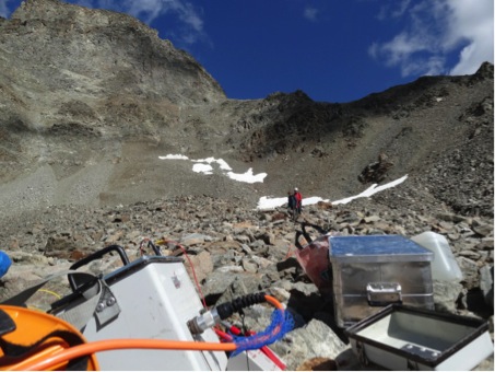
Figure 1. ERT measurements at the Schafberg rock glacier in August 2013 (Photo: B. Staub).
The work done in 2013 focused on methodological improvements of the various modelling and observation techniques, which are a necessary precondition for the synergetic data analysis, scenario generation and impact assessment of the TEMPS project. During the final year of the project, all approaches will serve jointly to link climate change data to past and future temperature and ground ice content changes and slope movements of mountain permafrost occurrences in Switzerland. In addition, two workshops and scientific meetings were organised and helped to promote the TEMPS project to a broader public. A final symposium including decision makers will take place in January 2015.
Within the project X-Sense (UZH, ETHZ, FOEN, GAMMA) 18 permanent GPS stations have been installed in 2011 in the Valais Alps to monitor slope movements of diverse landforms. Distributed near-surface ground temperature measurements, a weather station and a high resolution camera on the opposite slope provide additional information on environmental factors. The continuous high resolution (daily) data over a period of more than two years allow for studying the short-term variability of diverse slope movements (joint-project between UZH and ETH of Zurich, Wirz, Beutel, Gruber, Limpach, Purves). Two acoustic emission (AE) measurement assemblies were installed in steep alpine rock-walls in 2011 as a pre-study of a follow up project. The combination of the captured AE activity, used as a proxy of rock damage, with the rock temperature/moisture content shows that (1) liquid water content has an important impact on freezing-induced rock damage, (2) sustained freezing can yield much stronger damage than repeated freeze-thaw cycling, and (3) that frost cracking occurs over the full range of temperatures measured extending from 0 down to –15°C (Girard, Gruber, Weber, Beutel). The project X-Sense2 (UZH & ETHZ) started in November 2012 with the aim to develop and apply ultra-low-power monitoring systems for early detection of failure processes in unstable rock masses and periglacial slope movements. The project will exploit advances in MEMS technology to achieve a trigger-based duty-cycling of complex sensing systems by monitoring micro-seismic (Vieli, Faillettaz, Weber, Beutel).
The ongoing project on Alpine solifluction at the Institute of Geography at the University of Bern (GIUB, Rist & Veit) investigates the spatial and temporal dynamics of alpine solifluction and their environmental controls in seasonal frost and permafrost. The main study site is situated on the north slope of Blauberg close to Furkapass and ranges from 2380 m – 2700 m a.s.l. (Fig. 2).

Figure 2. Terrestrial geodetic survey of solifluction lobes on the north slope of Blauberg, Furka (Photo: A. Rist).
New in PERMOS is the Institute of Earth Sciences of the University of Applied Sciences and Arts of Southern Switzerland (SUPSI) with the new research group on alpine periglacial geomorphology under the coordination of Dr. Cristian Scapozza. This group is active in thermal and kinematic monitoring of active rock glaciers, 2D and 3D photogrammetrical analysis and studies focusing on the link between permafrost and mass movements.
Permafrost research activities at the University of Zurich (UZH) continue after Prof. A. Vieli has taken over the head of the group in 2013 and focus on measuring, monitoring and modeling of permafrost in Alpine terrain. UZH is actively involved in the above described PERMOS (Office hosting institution, Noetzli, Gaertner-Roer, Gruber, Hilbich, Voelksch) and the subprojects TEMPS-B (Hilbich, Noetzli, Voelksch) and TEMPS-C (Gaertner-Roer, Mueller, Schaepmann).
S. Gubler, J. Fiddes and L. Boeckli completed their PhD theses at UZH. Gubler studied the measurement variability and related model uncertainty in mountain permafrost research. An extensive small-scale study on the variablity of thermal ground surface conditions allowed to investigate the considerable variability that exists over very short distances and that makes the comparison of grid-based models with point measurements difficult. This variability indicates that physically-based mountain permafrost models should be evaluated at locations representing different environmental factors that influence permafrost occurrence. Further, several short- and longwave downward radiation parameterizations were evaluated to increase the accuracy of modeled radiative fluxes in impact models (Gubler, Gruber, Purves).
Boeckli developed strategies and methods to characterise permafrost over entire mountain regions and applied it to the European Alps. This includes a modeling approach map to provide the first fully consistent permafrost distribution map for the European Alps as well as an estimation of the total permafrost ice content in the Alps as a first step towards the understanding of permafrost hydrology in a changing climate. (Böckli, Nötzli, Brenning, Gruber). The map is available at www.geo.uzh.ch/microsite/cryodata/.
Fiddes designed two new tools to aid numerical physically-based modelling in complex and remote terrain (Fiddes, Gruber). The first tool (TopoSUB) is an efficient subgrid scheme that uses statistical methods to reduce the computational burden of large area simulations by several orders of magnitude. It works with a 1-D model and parameterises important 2-D effects. The second tool (TopoSCALE) comprises a suite of methods to downscale gridded data products from atmospheric models (e.g. ERA-Interim) in order to derive the required meteorological forcing for the numerical model. It makes use of 3-D fields on atmospheric model pressure levels and also accounts for high resolution terrain effects (e.g. solar geometry). Both tools have been evaluated independently and the scheme has been successfully applied to simulate permafrost over the entire Swiss Alps
The permafrost group of the Institute of geography and sustainability of the University of Lausanne (C. Lambiel, J.-B. Bosson, N. Deluigi) leads several research projects on mountain permafrost: One of their main activities focuses on ground ice detection, mapping and characterization. Especially large efforts are currently concentrating on glacier forefields of small high elevation glaciers, which extended during the Little Ice Age inside the periglacial belt. Many of these glaciers are dominated by high rock walls that have produced large amounts of sediments all along the Holocene. Remobilization of the sediments by the glaciers has led to the formation of thick moraine complexes, as for instance morainic dams. Another consequence is the burying of large amounts of ice during the last century.
The PhD Thesis of J.-B. Bosson, carried out in the Mont Blanc massif, the Arolla valley and the Diablerets massif, aims at 1) determining the ice content (both glacier and permafrost ice) within these complexes and 2) quantifying the past and current evolution of the debris-covered glaciers, especially the melt rate of ground ice. Electrical resistivity tomography, ground surface temperature measurements, coupled with digital photogrammetry, dGPS measurements, terrestrial laser scanning and the use of webcams are the main methods used in these studies.
Another topic is the study of slope movements within the periglacial belt. A study of the historical development of ice-supersaturated sediments with digital photogrammetry has recently started. Quantification of movements and deformation process understanding of rock glaciers and other ground ice related landforms are made using DGPS, Terrestrial Laser Scanning (Lidar), permanent GPS and webcams.
Modelling the high discontinuity of mountain permafrost is a challenging task. In order to reproduce the spatial heterogeneity of the phenomenon at the local scale, Machine Learning algorithms have been tested to propose a new approach for mountain permafrost modelling. The basic concept of Machine Learning is that the machine learns from the data (i.e., for permafrost modeling, rock glacier inventories and sectors of known permafrost thanks to geophysical or borehole data). First results show that, if the dataset is large enough, the high spatial discontinuity of mountain permafrost can be successfully represented. For instance, rock glaciers can be automatically recognized and, in some cases, permafrost is designed only in the lower part of talus slopes, which corresponds to several field data.
In the framework of permafrost characterizing and monitoring, a new borehole was drilled in the ice-cored moraine at Col des Gentianes (Verbier) during summer 2012 (Fig. 3). More generally, efforts in mountain permafrost monitoring on various sites of the Valais Alps were continued. The movements of about 10 rock glaciers are measured between 1 and 2 times/year by DGPS. Ground temperatures are recorded in 13 boreholes, whereas ground surface temperature monitoring is carried out on about 120 locations. First measurements began in 1998. Finally, electrical resistivity monitoring is led on 2 sites since 2007. A part of these measurements are included in the PERMOS network.
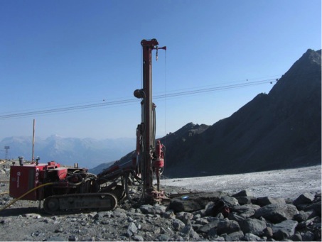
Figure 3. Drilling of a borehole in an ice-cored moraine at Col des Gentianes (Verbier, 2900 m a.s.l., Photo: C: Lambiel).
In parallel to its long-term monitoring of borehole temperatures and deformation together with PERMOS, the WSL Institute for Snow and Avalanche Research (SLF) is investigating the impact of the snow cover on the thermal regime and stability of steep rockwalls (A. Haberkorn, M. Phillips) in the context of an SNF project and in collaboration with the University of Bonn / TU Munich (D. Draebing, M. Krautblatter) at three sites in the Swiss Alps. Rockwall dynamics are also being monitored using various remote sensing techniques including terrestrial laserscanning and interferometric radar at Pizzo Cengalo (Bregaglia), in collaboration with different Swiss and Italian partners in the context of an ARGE Alp project (F. Amann, Y. Bonanomi, A. Huwiler, R. Kenner, A. Kos, R. Lüthi, V. Mair, M. Phillips). The stability and thermal regime of high mountain infrastructure such as cable cars, avalanche defence structures and buildings are monitored (M. Phillips) with various engineers and operators. The dynamics of rock glaciers are being investigated in the context of the SNF Sinergia project TEMPS and in collaboration with Italian partners in the Interreg project SloMove (R. Kenner) using in-situ and remote sensing techniques. Mountain permafrost ice from SLF study sites is currently being analysed for microorganisms in the context of an internal WSL project (B. Frey).
At the University of Fribourg, the SNSF-Project Soil moisture in mountainous terrain and its influence on the thermal regime in seasonal and permanently frozen terrain (SOMOMOUNT) started in 2013 with the setup of a soil moisture monitoring network at middle and high altitudes in the Swiss Alps. In a second step, those data sets will be used to investigate the influence of temporally and spatially changing soil moisture on the thermal regime of seasonal and permanently frozen ground. The SOMOMOUNT project is directly linked with TEMPS and PERMOS (see above).
In addition to the already mentioned projects, the University of Fribourg has currently a large research group (Hauck, Hoelzle, Delaloye, Salzmann, Hilbich, Hasler, Scherler, Schneider, Barboux, Mari, Marmy, Staub, Kummert) focussing on a wide range of topics between the analysis of rock mechanics and rock glacier dynamics, sediment transport, geomorphology, geophysics, subsurface modelling and remote sensing related with permafrost. Furthermore Martin Scherler finished his PhD on the topic “Sensitivity of Mountain Permafrost to Climate Change Scenarios: A Modelling Approach” in 2013. S Schneider (The heterogeneity of mountain permafrost: A field-based analysis of different periglacial materials) and S Mari (Tracing experiments in active rock glaciers) are finishing their PhD thesis.

Figure 4. Rockfall from Pizzo Cengalo on 24.9.2013 (Photo: D. Fuchs).

Figure 5. Interferometric radar measurements by A. Kos at Pizzo Cengalo on 13.9.2013 (Photo: M. Phillips).
Report prepared by Reynald Delaloye (reynald.delaloye@unifr.ch).
United Kingdom
NERC Arctic Research Programme
Two permafrost projects funded by NERC’s Arctic Research Programme 2010–15 have carried out their first field season of data collection in NW Canada. CYCLOPS (Carbon Cycling Linkages of Permafrost Systems) researchers collected data on vegetation characteristics, soil properties, peat and carbon gases from sites near Whitehorse, Yukon. HYDRA (Permafrost catchments in transition: hydrological controls on carbon cycling and greenhouse gas budgets) researchers collected data on hydrology and permafrost conditions near Inuvik. Further information on both projects is available at: http://arp.arctic.ac.uk/
Monitoring the thermal state of permafrost by automated time-lapse Capacitive Resistivity Imaging
Geophysical experiments on imaging of rock freezing and thawing continued at the University of Sussex Permafrost Laboratory. The experiments are due to finish in 2014, after multiple cycles of active-layer freezing and thawing above artificial permafrost. Further information is available at: http://www.sussex.ac.uk/geography/resources/labs/permafrost
The Geological Society of London, Engineering Group Working Party on ‘Periglacial and Glacial Engineering Geology.’
This working party continued to prepare a book about the ground conditions associated with UK Quaternary periglacial and glacial environments and their materials, from an engineering geological viewpoint. The draft of the book is expected to be completed in 2014. Further information about periglacial ground models and engineering geology in the UK is available from Julian Murton.
Devensian periglacial record in the mid-lower Trent valley
Colin Baker has undertaken a review of the Devensian periglacial record in the mid-lower Trent valley, identifying evidence for past permafrost (ice-wedge pseudomorphs) and aeolian activity (coversand) of Devensian age. A late Younger Dryas age for coversand known as the Spalford Sand at Girton quarry, near Newark, is confirmed, consistent with the North Lincolnshire coversand chronology and correlating with the continental Younger Coversand II. Figure 1 shows a section of this coversand sheet, here modified into a series of small transverse north-south ridges, implying reactivation by easterly palaeowinds in the Early Holocene resulting in repeated high-angle slipface bedding. While sandsheet geometry and AGCM modelling point to westerly provenance for main coversand placement in the Younger Dryas, the superficial dune structures at Girton indicate the later influence of strong reversed winter palaeowinds, probably driven by anticyclone circulation over the dwindling Scandinavian ice-sheet, during Early Holocene climatic anomalies. Further information is available in:
Baker, C.A., Bateman, M., Bateman, P. and Jones, H. 2013. The aeolian sand record in the Trent valley. Mercian Geologist, 18, 108-118.

Figure 1. Coversand of Younger Dryas age, Girton Quarry, near Newark.
Report prepared by Julian Murton (j.b.murton@sussex.ac.uk).
United States of America
US Permafrost Association
The annual meeting of the US Permafrost Association (USPA) Board of Directors and a general member meeting was held at the 2013 Fall Meeting of the American Geophysical Union. Ed Yarmak replaced Michael Lilly as the president and Gerald “JJ” Frost replaced Tom Douglas as the Treasurer.
Current USPA membership includes 34 student members, 24 regular members, and 12 corporate/non-profits/lifetime members, for a total of 70 members and includes several non US members. An email campaign was initiated at the end of 2013 for the renewal of and recruitment of new memberships.
Meeting and Workshops
American Geophysical Union (AGU): The Fall 2013 meeting of the American Geophysical Union was held December 9-13, 2013 in San Francisco. The permafrost community was well represented, with 200 posters and 112 oral presentation related to permafrost.
Association of American Geographers (AAG): The Annual 2013 meeting of the Association of American Geographers was held March 9-13, 2013 in Los Angeles, California. Nineteen permafrost related sessions were held.
ASCE 10th International Symposium on Cold Regions Development (ISCORD): The Technical Council on Cold Regions Engineering of the American Society of Civil Engineers together with IACORDS sponsored the ASCE 10th International Symposium on Cold Regions Development (ISCORD) in Anchorage, Alaska, June 2-5, 2013. The symposium theme was “Planning for Sustainable Cold Regions.” Several session tracks included presentations relating to seasonally and perennially frozen ground including sustainable development as well as climate change issues. The proceedings can be ordered at: http://ascelibrary.org/doi/book/10.1061/9780784412978. The next ISCORD symposium will be organized by the Korean Geotechnical Society and will be held in South Korea in 2016. For more information, contact Jong-Sub Lee, Korea University (jongsub@korea.ac.kr).

Figure 1. Photograph the Chairs of the 2016 ISCORD (from the left) Jong-Sub Lee, Eun Chul Shin and the Chairs of the 2013 ISCORD Thomas Krzewinski and Hannele Zubeck. Photograph is from the ISCORD 2013
50th Anniversary of the First International Conference on Permafrost
A one-day permafrost workshop was held on November 15, 2013 at Purdue University to celebrate the 50th Anniversary of the First International Conference on Permafrost that took place at Purdue the week of November 11-15, 1963. The program included a number of speakers representing topics that were discussed at the 1963 Conference and other engineering, climate-related and geotechnical subjects, and a banquet. The program and presentations can be found on the USPA web. The event also was a tribute to recently deceased C.W. (Bill) Lovell a former Purdue faculty member and supporter of many permafrost and IPA activities
Figure 2. Visiting participants and invited speakers included (from left to right): Fritz Nelson, Ed Clarke, Ed Yarmak, Jess Walker, Tom, Krzewinsjki, Mary Ellen Lovell, Eric Muller, Dick Cameron, Ken Hinkel, Jerry Brown (not in the photo Toni Lewkowicz).
Symposium on Mechanical Properties of Frozen Soils:
A Symposium on Mechanical Properties of Frozen Soils took place January 31, 2013 in Jacksonville, FL. The symposium was sponsored by ASTM International Committee D18 on Soil and Rock and Subcommittee Committee D18.19 on Frozen Soils and Rock. The symposium offered a forum for the exchange of ideas on current research as it relates to testing of mechanical properties of frozen ground; it also provided a rationale for the various details within new standards for testing of frozen soils. The peer-reviewed conference papers are published as Selected Technical Papers, 1568, Mechanical Properties of Frozen Soils, available at http://www.astm.org/DIGITAL_LIBRARY/STP/SOURCE_PAGES/STP1568.htm.
These papers portray ideas of authors from Canada, China, Norway, South Korea, Sweden and U.S.A. The papers are divided into four topics: Freeze-thaw Effects on Mechanical Properties, Testing of Mechanical Properties, Mechanical Properties, and Effects of Mechanical Properties on Performance. In addition, the symposium provided a round table meeting where future needs in the area of frozen soil research was proposed and discussed. More information is available from the Symposium Co-Chairpersons and STP Co-Editors Hannele Zubeck (hkzubeck@uaa.alaska.edu) and Zhaohui Yang (zyang2@uaa.alaska.edu), University of Alaska Anchorage, Anchorage, AK, USA.
Institution Member Activities
The Next-Generation Ecosystem Experiments (NGEE Arctic): NGEE Arctic team seeks to represent field-scale processes in global climate models. Earth System Models require process knowledge that while often obtained from data collected at the plot-scale, must be represented at a much larger scale of 10 to 100s of kilometers for use in climate projections. Scaling process knowledge and observations across several orders of magnitude is a significant component of this challenge. The problem is especially complex for highly heterogeneous Arctic landscapes where hydrologic, biogeochemical, and vegetation dynamics at sub-meter scales have large feedback effects on the regional to global climate system. A series of measurement, modeling and computational issues involved in developing a robust scaling framework must be addressed if we are to capture critical spatial and temporal feedbacks between terrestrial ecosystems and climate.
The Next-Generation Ecosystem Experiments (NGEE Arctic) team, led by Oak Ridge National Laboratory is entering their third year of integrated field, laboratory, and modeling studies on the Arctic Coastal Plain near Barrow, Alaska. This large, multidisciplinary team is conducting multi-scale observations for use in the design, parameterization, and evaluation of models operating at fine, intermediate, and global scales. The team is developing a multi-scale modeling framework to improve the representation Arctic ecosystem processes in global scale climate models through a series of nested mechanistic models. Project scientists have successfully developed high-resolution models for thermal, hydrologic and biogeochemical processes in Arctic ecosystems. A massively parallel model (PFLOTRAN) operating at sub-meter resolution solves a system of nonlinear partial differential equations describing multiphase, multicomponent and multiscale flow and reactive transport in the surface and subsurface. This model has been successfully applied to simulate seasonal changes in active layer depth, temperature, moisture content, and hydrologic flow paths in and among individual polygons and cohorts of polygons where LiDAR-derived micro-topography drives complex patterns of lateral water flow.


Figure 3. Simulation of permafrost thermal hydrology using PFLOTRAN for a watershed near Barrow, AK (frozen soils are in red vs thawed soil in blue). (a) Fine scale simulation resolving micro-topography at 0.25m spatial resolution (b) Intermediate scale simulation using a coarse mesh that captures the geomorphological features like polygon centers/ridges/troughs.
The NGEE Arctic team plans to include carbon cycle biogeochemistry, plant and microbial processes, and CO2 and CH4 dynamics to the model in the near future; scientists at Los Alamos National Laboratory are incorporating geomechanical properties into the model for the purpose of representing aspects of permafrost degradation and deformational characteristics (i.e., thermokarst). Eventually, these coupled multi-scale models will be integrated within a scaling framework where field observations will be used to parameterize and constrain the high-resolution model which captures processes and features like micro-topography and surface and subsurface hydrology. The modeling framework has been designed to capture complex local ecosystem processes and inform the global climate models via not just statistical or empirical approaches, but rather mechanistic process-based parameterization. Lessons learned from these models will be used to simulate feedbacks between surface-subsurface hydrology and biogeochemistry and the terrestrial biosphere, a task that will be greatly facilitated by the direct coupling of PFLOTRAN with the Community Land Model (CLM) which in turn is a component of a global scale Community Earth System Model (CESM).
The NGEE Arctic project (http://ngee-arctic.ornl.gov/) is supported by the Office of Biological and Environmental Research in the DOE Office of Science. Partner institutions include Brookhaven, Los Alamos, and Lawrence Berkeley National Laboratory, and the University of Alaska Fairbanks.
Geophysical Institute Permafrost Laboratory, University of Alaska Fairbanks: The Geophysical Institute Permafrost Laboratory (GIPL) research team (Vladimir Romanovsky, Sergey Marchenko, Alexander Kholodov, and William Cable) in collaboration with Russian colleagues continued the development of the observational borehole network for the thermal state of permafrost (TSP) monitoring in Alaska, Russia, and Central Asia as part of the Arctic Observing Network project. The work included data collection and maintenance of existing boreholes, instrumentation of new or recovered boreholes, and gathering of historical data. In 2013, data from 20 new shallow boreholes in northwest Alaska and 3 permafrost observatories in the western part of the Canadian Archipelago were collected. Detailed description of boreholes, link to the data, and further information on this project can be found at http://permafrost.gi.alaska.edu/, data from some of these sites are available in near-real time. The Russian-US TSP project web portal, part of GIPL web site, was further improved.
In April 2013, Guido Grosse (GIPL) participated in a snowmachine expedition for the NSF Arctic Observatory Network-sponsored CALON project (Circum-Arctic Lakes Observation Network) with Benjamin Jones (USGS), Christopher Arp (UAF) and Ben Gaglioti (UAF) on the Alaska North Slope (eastern transect between Toolik Field Station and Teshekpuk Lake Observatory; A team lead by Ken Hinkel, U Cincinnati, conducted a similar survey along a western transect starting in Barrow. The CALON team visited more than 25 lakes and permafrost sites and collected sub-ice lake water samples for biogeochemical analysis, measured talik temperatures, surveyed snow and lake ice properties, performed GPR surveys of lake ice, ground truth contemporary TerraSAR-X data, and drilled permafrost cores. In August 2013, the CALON team (including Louise Farquharson, UAF) revisited the lake sites, conducting water sampling, bathymetric surveys, DGPS surveys of lake water levels and shore profiles, maintenance of lake temperature and water level loggers, and measurements of permafrost temperature. Also, old permafrost deposits were sampled along the northern shore of Teshekpuk Lake for paleo-environmental analysis.
In June 2013, Grosse with researchers from NGEE Arctic (Stan Wullschlaeger, Rich Norby, Victoria Sloan, and Jennifer Liebig) and Oak Ridge National Lab (Dan Hayes, Santonu Goswami) conducted a week-long fieldtrip on the Seward Peninsula along the Taylor highway from Nome northwards. They collected temperature data from four permafrost boreholes located along a gradient from discontinuous to continuous permafrost. Also, they conducted surveys of thermokarst landforms using DGPS, a field spectrometer, and vegetation descriptions.
In November 2013, Grosse took a new research position at Alfred Wegener Institute Helmholtz Centre for Polar and Marine Research in Potsdam, Germany, to lead the European Research Council funded 5-year PETA-CARB project (Rapid permafrost thaw in a warming Arctic and impacts on the soil organic carbon pool) that focuses on remote sensing of thermokarst processes and quantification of associated carbon pools and fluxes in Alaska and Siberia. Grosse maintains an affiliation with the GI, UAF.
Reginald Muskett continued his research on energy and mass changes associated with changes in permafrost across the Northern Hemisphere. His latest research findings are published in Atmospheric and Climate Sciences (Muskett 2013a; 2013b) and Open Journal of Modern Hydrology (Muskett 2014). Reginald also co-convened and co-chaired Permafrost sessions (Oral and Poster) at the EGU 2013 and gave two permafrost related presentations at EGU 2013 and one at AGU 2013.
Santosh Panda, Sergey Marchenko and Vladimir Romanovsky worked on a National Park Service (NPS) funded permafrost modeling project focused on developing high-resolution (28-m) maps of near-surface permafrost temperature and active-layer thickness for national parks in Alaska. Permafrost modeling of Denali National Park and Preserve and Wrangell-St. Elias National Park and Preserve are completed. The reports will be published as NPS’ Natural Resource Technical Reports.
PhD student Prajna Regmi continued remote sensing analysis of thermokarst lake methane ebullition from Fairbanks lakes within a NASA-funded project on North American lake methane emissions and object-based lake classification using high resolution satellite imagery for the Western Alaska LCC region. PhD student Louise Farquharson worked on remote sensing-based mapping and classification of thermokarst landforms on the Alaska North Slope and Brooks Range Foothills, around the CALON lake sites. She also worked on permafrost affected coastal processes along the northern Seward Peninsula coastline. The coastal work is funded by National Park Service and the Climate Change Youth Initiative Fellowship.
References
Muskett, R.R., GOSAT CH4 and CO2, MODIS Evapotranspiration On the Northern Hemisphere June and July 2009, 2010 and 2011, Atmosphere and Climate Sciences, 3 (2), pp. 177-185, 2013a. doi:10.4236/acs.2013.32019.
Muskett, R.R., MODIS-Derived Arctic Land-Surface Temperature Trends, Atmosphere and Climate Sciences, 3 (1), pp. 55-60, 2013b. doi:10.4236/acs.2013.31008.
Muskett, R.R., ICESat-Derived Elevation Changes on the Lena Delta and Laptev Sea, Siberia, Open Journal of Modern Hydrology, 4, pp. 1-9, 2014. doi:10.4236/ojmh.2014.41001.

Figure 4. Vladimir Romanovsky (GIPL Group Leader) drilling a hole in the ground to install temperature sensors and Bill Cable preparing the sensors for installation at a permafrost observation station on North Slope of Alaska (Photo: Santosh Panda).
Figure 5. NSF CALON field team members Chris Arp and Ben Gaglioti after successful drilling through lake ice of a thermokarst lake, Alaska Northslope, in April 2013 (Photo: G. Grosse).
The George Washington University
There were major developments in interdisciplinary permafrost-related research at George Washington University during 2013. In August 2013 Dr. Dmitry Streletskiy assumed a tenure-track faculty position in the Department of Geography of GWU and Dr. Qin Yu who specializes on Arctic vegetation and landscape dynamics joined the department as a university-funded post- doctoral fellow. GWU permafrost research is focusing on three thematic areas: long- term monitoring of active-layer and near-surface permafrost (CALM), interactions between permafrost and hydrologic regimes in the Russian Arctic, and socio-economic development in Russian permafrost regions.
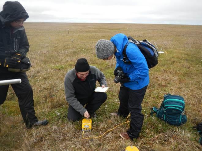

The 2013 Circumpolar Active Layer Monitoring (CALM) project field activities were conducted in Alaska and Russia. The Alaska field team consisted of Nikolay Shiklomanov, Dmitry Streletskiy (GWU), Anna Klene (University of Montana), Fritz Nelson (University of Delaware), three GWU students (K. Nyland, K.Pyne, S. Ross) and a University of Montana graduate student (J. Watts). Annual active-layer and ground-temperature observations were conducted at a series of CALM sites representative of the diverse climatic and landscape conditions on the North Slope of Alaska and Seward Peninsula. Ground- subsidence monitoring by means of differential GPS was conducted at several sites. Another University of Montana graduate student (J. Smith) successfully completed her degree and results are being prepared for publication. The GWU CALM project facilitated annual observations at 86 Russian sites. All data are available at CALM webpage at www.udel.edu/Geography/calm.
Dmitry Streletskiy, in collaboration with colleagues at the University of New Hampshire, received a three-year NSF grant titled “Interactions between air temperature, permafrost and hydrology in the high latitudes of Eurasia.” In July 2013, field-work was conducted in the vicinity of Igarka, Russia, and involved collection of climate, hydrologic, and permafrost data from several representative small watersheds in cooperation with Igarka field station operated by the Yakutsk Permafrost Institute (Russia) and Krasnoyarsk Forest Institute (Russia).


We have continued to develop methodology for quantitative evaluation of socio- economic impacts of permafrost degradation. Over the last year we have broadened this research by including political, economic, and demographic issues related to development of Russian permafrost regions. This research effort is collaborative between the GWU Geography Department, the GWU Institute for European, Russian and Eurasian Studies (IERES), and the University of Tromso, Norway. In May 2013 we organized a conference on Arctic Urbanization where several issues related to socio-economic impacts of permafrost degradation were actively discussed. An edited volume on Arctic urbanization is currently in preparation. In July 2013 Valeriy Grebenets (Moscow State University, Russia), Dmitry Streletskiy (GWU), Nikolay Shiklomanov (GWU), Marlene Laruele (GWU), Alexander Shiklomanov (UNH), Fritz Nelson (UDEL) and 12 Russian and American students participated in educational and research field activities in Central Siberia along the Yenisei River. Students were introduced to methods of permafrost investigations in natural and technogenically modified landscapes, including site evaluations, temperature and active-layer monitoring, and soil coring. Emphasis was made on relations between permafrost and other components of Arctic natural system and socio- economic problems of urbanization in permafrost regions, including migration and the effects of permafrost on urban infrastructure. We have continued our research on indigenous permafrost ice cellars in Barrow, AK, with monitoring continuing of the thermal regime in six cellars. Based upon community input, aerial photographs, and visual surveys GWU graduate student K. Nyland with assistance from Dr. Anna Klene (University of Montana) completed a senior thesis and presented results at several conferences.
Fritz Nelson has retired from teaching at the University of Delaware and now holds research appointments at the University of Wisconsin-Milwaukee and Northern Michigan University. In Milwaukee Nelson is affiliated with the American Geographical Society Library, where he is working on aspects of the history of Arctic exploration and science. His climatological and permafrost research projects, including CALM, will henceforth be administered through NMU.
US Army Cold Regions Research and Engineering Laboratory (CRREL)
Tom Douglas and Kevin Bjella report on a busy 2013 for permafrost research by U.S. Army Cold Regions Research and Engineering Laboratory (CRREL) personnel in Fairbanks, AK and Hanover, NH. Projects on permafrost hydrology and biogeochemistry continued at sites from Fairbanks to the Alaska Range. A large project was initiated to apply geophysical measurements, borehole drilling, suborbital and satellite-based imagery, and soil and vegetation mapping to identify ground state conditions on permafrost terrain around Fairbanks. Sites include the CRREL Farmers Loop Road and Permafrost Tunnel sites. A group of new projects were initiated focused on supporting infrastructure development on permafrost. Ongoing work at Thule, Greenland and Barrow, Alaska in support of Department of Defense facilities continues. Upgrades at the CRREL Permafrost Tunnel included an additional 100 feet of new excavation and the construction of a new log cabin visitor center. Planning is underway for Phase III of the tunnel expansion project with a tentative execution during the winter of 2014-5.
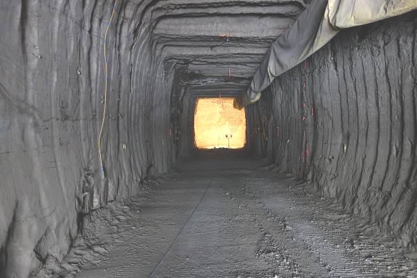

United State Geological Survey (USGS)
“USGS Permafrost Research in the Fate of Carbon in Soil Systems (FOCSSY) Project.” USGS researchers plan to quantitatively define the controls and vulnerabilities of terrestrial soil carbon (including permafrost and wetlands) using replicated studies with both long- and near-term perspectives. Northern latitudes are especially important for investigations of carbon because of the very large stocks and the impending vulnerability of soil carbon stocks to the rapid warming and increase disturbance in these regions. The past 10 years have benefited from a targeted effort by this team to address soil carbon in northern latitudes, specifically permafrost and peatland soils residing in the boreal forest biome of North America. Alaska has since become a hotspot for studies of permafrost carbon, permafrost hydrology, permafrost biota, changing fire regimes, and ecosystem vulnerability. Members of this project include Mark Waldrop, Jennifer Harden, Miriam Jones, Kristen Manies, Jack McFarland, Steve Blazewicz, Monica Haw, and Dave McGuire, with outside investigators University of Alaska, Fairbanks, University of Guelph, UC Irvine, and Lawrence Berkeley National Labs.
In the past we have demonstrated that the impacts of warming on soil carbon stocks have been particularly severe in discontinuous permafrost landscapes in the Boreal Forest Biome over the past decade due to the shift toward late season wildfires (Turetsky et al, 2010b). Permafrost degradation has increased (Grosse et al, 2011), and very large stocks of soil C are anticipated to shift from frozen to unfrozen states over coming decades, with increasing vulnerabilities to combustion, hydrologic shifts, and microbial decomposition (Harden et al, 2012; Graham et al., 2012). The impact of thawing permafrost and other global changes on the atmospheric CO2 and CH4 emissions involve complex plant-microbe-soil feedbacks (Chapin et al., 2009). Meanwhile the sheer amounts of N associated with thawing permafrost (Harden et al,
2012) caused us to focus new attention on a better understanding of C and N cycling in deep soils that are undergoing thaw. Our intensive gas measurements and our documentation of historic changes in permafrost, ecosystem processes, and carbon budgets (for example Jones et al, 2012) demonstrate that such shifts can affect soil microbial communities that impact both net C budgets (O’Donnell et al, 2010) and the balance of CO2 and CH4 (Waldrop et al., 2012; Fan et al., 2012; Turetsky et al., 2008).
Experimental tasks for this project in 2014 consist of using isotopic and molecular tools in combination with chronosequence and manipulation approaches to examine plant- microbial interactions, organic matter quality, and nutrient processing in response to permafrost thaw. Specifically, we identify sources and pathways of C fluxes to the atmosphere, rates of aerobic and anaerobic respiration and methane cycling, rates of nitrogen fixation, mineralization, denitrification and N20 production, and relate these processes to microbial community dynamics along a permafrost thaw chronosequence. These approaches will help us answer the following questions, How does permafrost that alter the sources of respired C? What are the decomposition dynamics in different soil horizons and how do microbial populations fuel anaerobic decomposition or affect the temperature sensitivity of processes? How do we link molecular microbial data to biogeochemical processes?.
Project bibliography can be found here: http://carbon.wr.usgs.gov/biblio.html.
United State Geological Survey (USGS)
“Alpine Permafrost Research” Our research on alpine permafrost in the Sierra Nevada, CA and at two sites in Alaska (adjacent to Gulkana Glacier and Wolverine Glacier) had both successes and some failures this year. We successfully measured snow depth, ground surface temperature, and meteorological variables over most of the annual cycle at all three sites. A misbehaving data logger, a vanishing solar panel, and a grizzly bear, however, did cause some setbacks. Our preliminary analysis indicates the following: 1. permafrost is extensive in the eastern Alaska Range (big surprise), and 2. permafrost may exist in patches on wind-scoured plateaus of the High Sierra but is rare to absent in the heavily snow-covered valleys where a thick, warm snowpack buffers the underlying ground. We plan to perform energy balance modeling in the coming year.
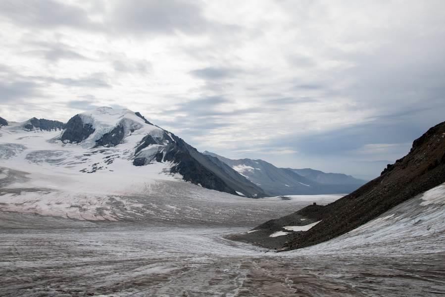
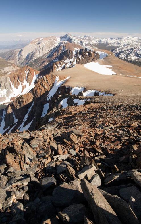
Individual Member Activities
Mark Demitroff, the University of Delaware, is planning transition to the University of Alaska Fairbanks to study the problem of Pleistocene past permafrost, wind action, and attendant fluvial system modification. High resolution geodetically corrected LiDAR data is being processed to provide a measured view of the true bare-earth ground that is otherwise hidden by thick vegetation. His goal is to add to the range of Earth analogs for Mars studies, and to conserve and preserve certain “periglacial” landscapes as critical habitat of the 700,000-hectare New Jersey Pinelands Biosphere Reserve.


Caitlin Rushlow
(Ph.D. Candidate, Dept. of Geosciences, Idaho State University): I spent my summer doing fieldwork out of Toolik Field Station in Arctic Alaska. There, I work on an NSF-funded project investigating the physical controls on water and nutrient flux from hillslopes as mediated by water tracks. This was an exciting summer because of the copious amounts of snow (see photo) that lasted later into the summer than usual, perhaps representative of future conditions if the Arctic climate becomes warmer and wetter. It was also a year with copious amounts of mosquitos, more than seen in recent memory. Enough to elicit a viral video captured by another team at the station that made it as far as the Huffington Post: http://www.huffingtonpost.com/2013/07/31/alaskan-mosquito-swarm- video_n_3682619.html

This year I was also happy to receive a grant from the USPA for travel to the AGU Fall 2013 Meeting.
Kenji Yoshikawa (UAF) and Ulli Neumann traveled along the Northwest Passage by snow mobile in spring of 2013, to cover the permafrost monitoring network of the northern communities in Canada. Yoshikawa published the community based permafrost monitoring book using their sites of nearly 300 communities mainly in North America. An electric version is available at http://issuu.com/permafrostbook/docs/piots. The hard copy book was delivered to all communities. Yoshikawa (UAF) plans to establish a permafrost outreach network in Siberia during spring, 2014, traveling 12000 km by Land Cruiser along the Russian winter road of the Arctic Siberia. Yoshikawa and Mauna Kea Management Office team visited and reoccupied Dr. Woodcock’s boreholes at the top of Mauna Kea, Hawaii.
Report prepared by Molly McGraw, Secretary US Permafrost Association (molly.mcgraw@selu.edu).