Table of Contents
Argentina (and South American Partners)
Austria
Canada
China
Denmark
France
Germany
Iceland
Italy
Japan
Kyrgyzstan
Mongolia
New Zealand
Norway
Poland
Portugal
Russia
South Korea
Spain
Sweden
Switzerland
The Netherlands
United Kingdom
United States of America
Argentina (and South American Partners)
Research Activities of the Argentinean, Chilean and Bolivian Mountain Permafrost Community
The Cryosphere session at the XIXth Congreso Geológico Argentino (Córdoba), chaired by Dario Trombotto, Ana Lía Ahumada, Sandra Barreira, Diego Araneo y Carlos Di Prinzio, was attended by more than 40 participants, mostly from Argentina, Chile and Brazil. 13 oral presentations and 10 posters were offered.
On behalf of the jury elected at the XIX Argentine Congress of Geology, held in Córdoba in 2014, a meeting was celebrated in order to choose three young scientists among 9 contributions presented in E1, the special session of cryospheric sciences, to be awarded two prizes granted by the International Association of Cryospheric Sciences as well as one special distinction conceded by the Subcommittee of Cryospheric Sciences of the Argentine Republic (abbr. SAC).
Dr. Ana Lía Ahumada (San Miguel de Tucumán) on behalf of the Subcommittee of Cryospheric Sciences of the Argentine Republic (SAC) and the Argentine and South American Permafrost Association (AASP), Dr. Gladys Ortega (Córdoba) on behalf of the Scientific and Editorial Committee of the XIX Argentine Congress of Geology 2014 and Dr. Maisa Tunik (General Roca), president of the Argentine Geological Association decided to give the awards to the following candidates:
1- First Prize: Alessa Geiger from the University of Glasgow for her innovative contributions in the technique of cosmegenic analyes applied to glacial landforms in Patagonia, Argentina.
2- Second Prize: Cristian Villarroel from the National University of San Juan, Argentina, for the adequate and efficient management of numerous scientific data on high mountain periglacial environments of the Central Andes, Argentina.
3- Special distinction: Mateo Martini from CICTERRA CONICET, National University of Córdoba, Argentina, and the Argentine Antarctic Institute for the first thermal monitoring of rock glacier surfaces in the Sierra de Zenta, Jujuy, Argentina.
In 2014 the Terminological Guide of the South American Geocryology was published in Buenos Aires (editor Vazquez Mazzini). This book is a cooperation between D. Trombotto, Pablo Weinstein (Calgary) and Lukas Arenson (Vancouver) and it is meant to contribute to a better understanding of the Periglacial Environment of the Andes.
In 2014 (October) Dario Tromboto of the Argentine Permafrost Group was invited by the World Meteorological Organization for the meeting GLOBAL CRYOSPHERE WATCH (GCW) and CryoNet South America Workshop,Santiago de Chile, Chile. Dario Trombotto was nominated as National Representative.
In San Juan, 2014 the Argentine Sub Committee of Cryospheric Sciences was invited to the XXVII Meeting of the INTERNATIONAL UNION OF GEODESY AND GEOPHYSICS of Argentina,. Its President D. Trombotto gave a talk about the detection of natural imbalances of the cryospheric system in the volcanic complex of Peteroa , Argentina/Chile.
Three PhD scholars (Director D. Trombotto) are presently working on permafrost in the Central Andes of Mendoza and San Juan. Estefanía Bottegal (National University of Córdoba) is writing her PhD about cryodymamics of the Morenas Coloradas rock glacier. Noelia Sileo (National University of Buenos Aires) is working in Vallecitos (Mendoza) about cryohydrochemistry and Carla Tapia Baldis (National University of San Juan) is elaborating the inventory of geoforms, cartography and permafrost distribution of the Río Blanco Sur basin at “Valle de los Glaciares de Escombros” and at “Cordón del Espinacito” province of San Juan.
Research operations
The permafrost research group in Mendoza has initiated a joint project between the Altai State University (Barnaul), Siberia, Russia represented by Dr. Oleg Ostanin, Ph.D., Head of the Department of Physical Geography and GIS and the IANIGLA, CCT CONICET, Mendoza, Argentina, Geocryology Unit, represented by Dr. Dario Trombotto.
ANDALP project
Provinding a framework for scientific collaborations between South American and European researchers and institutes, the ANDALP project was funded by the program CMIRA of the Région Rhône Alpes (COOPERA n°13.005522.01 and 13.005522.02) in order to improve our understanding of Andean rock glacier dynamics. The main objectives are i) improving our knowledge about the location of rock glaciers, ii) detect and analyse rock glacier dynamics and iii) set up monitoring activities to record rock glacier evolution.
The methodological framework includes : GIS and remote sensing, differential SAR interferometry and methods for monitoring thermal state (temperature datalogging) and kinematics (DGPS and terrestrial photogrammetry) of rock glaciers.
The project involves the following Argentine, Bolivian and French partners: EDYTEM laboratory (CNRS / Université de Savoie, France), IANIGLA (CONICET / CCT Mendoza, Argentine), IGEMA (UMSA, La Paz, Bolivia), GIPSA-lab (CNRS / INP Grenoble, France), LISTIC (Université de Savoie / Polytech Annecy-Chambéry).
The preliminary results include: i) a complete inventory of rock glaciers in the Tropical Andes (Chile and Bolivia, between 17 and 23°S, Anetaset al., in progress), ii) generation and interpretation of interferograms from TerraSAR satellite in the region of Cordón del Plata (33°S) and Tapado/Agua Negra (30°S) and iii) the set-up of a monitoring system of the Quebrada del Medio rock glacier (ground temperature and surface displacement; Bodin et al., 2014).
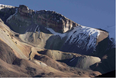
Figure 1. Caquella rock glacier, Bolivia (IRD, 2009).
Figure 2. Quebrada del Medio rock glacier (Bodin, 2014, Central Andes of Mendoza, AR).
More information is available on this webpage:
http://edytem.univ-savoie.fr/actions-de-recherche/contrats-programmes/REGION/andalp
Report prepared by Dario Trombotto Liaudat ( dtrombot@mendoza-conicet.gob.ar), Xavier Bodin and Alexander Brenning
Austria
The Austrian permafrost research community was rather active in 2014 regarding national research, international research and permafrost-related sessions at earth science conferences held in Austria. As in the previous years, the first part of this report deals with general permafrost activities and events which happened this year. The second part of the report summaries the permafrost and periglacial research activities carried out by the different research groups.
Part 1: General permafrost activities in Austria
As during the last years, the annual EGU General Assembly (www.egu2014.eu) took place in Vienna between 27 April and 3 May 2015 with about 12,500 attendees. Several sessions were dedicated to permafrost topics. Apart from this large international conference, two further conferences held in Austria are worth to mention.
The PANGEO 2014 Conference was held in Graz at the Institute of Earth Sciences, University of Graz between the 14 and 19 of September. In total some 250 attendees participated in this primarily national conference. The program was divided into 23 sessions; one of it was dedicated to mountain permafrost and periglacial processes. The session was convened by A. Kellerer-Pirklbauer and G.K. Lieb (both Department of Geography and Regional Science, University of Graz) and consisted of six oral presentations and three poster presentations. Some 50 colleagues attended this session. One week later, the DEUQUA 2014 Conference took place in Innsbruck (24 to 29 September) and was organised by members of the Institute of Geology, the Institute of Geography and the Institute of Ecology of the University of Innsbruck. A session on mountain permafrost (convener K. Krainer, Institute of Geology, University of Innsbruck) was held on 26 September with W. Haeberli as the keynote speaker and four further oral presentations.
As reported in the previous report, a first Austrian CGOS (Global Climate Observing System) report was finalised in December 2013. This report was slightly modified in early 2014. The report is written in German and consists of 23 chapters related to different atmospheric and terrestrial Essential Climate Variables (ECVs). One chapter is devoted to permafrost. The updated version is available at https://www.zamg.ac.at/cms/de/topmenu/ueber-uns/internationales/gcos/gcos-bericht.
A new nationwide project entitled permAT – Long-term monitoring of permafrost and periglacial processes and its role for natural hazard prevention: Possible strategies for Austria was was started in autumn this year (Fig. 1). The main goal of permAT is to define possible strategies, which allow the establishment of a long-term funded, maintained and efficiently working permafrost and periglacial monitoring network in Austria thereby considering also national hazard aspects. The project intends to join and adjust interests of researcher, stakeholder and policy maker. permAT is funded by the StartClim climate research program, runs until mid-2015 and is led by A. Kellerer-Pirklbauer and A. Bartsch (Central Institute for Meteorology and Geodynamics/ZAMG). StartClim is a national research program which particularly deals with adaption to climate change issues and which should help to launch larger follow-up projects.

Figure 1. The logo of the new nationwide project “permAT – Long-term monitoring of permafrost and periglacial processes and its role for natural hazard prevention: Possible strategies for Austria”. This project intends to make a further step towards a long-term financially secured permafrost and periglacial monitoring program in Austria.
On 17 September 2014 the first Austrian Assessment Report 2014 (AAR14) was published by the Austrian Panel on Climate Change (APCC). The AAR14 is based on the IPCC structure. The report consists of three volumes that present (a) the existing knowledge on climate change and affects in Austria, and (b) on the needs and possibilities for mitigation and adaptation. The 1096 pages of the report aim to present the scientific knowledge pertaining to Austria in a coherent and complete manner. Similar to IPCC reports, the AAR14 is based on the principle of being policy-relevant but not policy-prescriptive. In a joint, three-year effort some 240 Austrian scientists worked on this report. Relevant for the permafrost community is the fact that the AAR14 implies also permafrost relevant issues related to the hydrosphere and the geosphere. The report can be accessed via http://hw.oeaw.ac.at/7699-2.
Finally, we report that C. Riedl (ZAMG) was the National GTN-P Correspondent in 2014 and participated at the GTN-P meeting at EUCOP4, Évora, Portugal, in June. Furthermore, A. Bartsch participated in the 24th IPA Council Meeting at the EUCOP4 representing Austria.
Part 2: Reports from the different Austrian permafrost research groups
The national permafrost project permAfrost – Austrian Permafrost Research Initiative was ended in 2013. The final report consists of four main parts, was published in 2014, and is available online via http://epub.oeaw.ac.at/?arp=0x002f9d0b.
Salzburg
Research activities at permafrost-affected rock faces within the MOREXPERT project (M. Keuschnig, I. Hartmeyer) – carried out in cooperation with alpS (Centre for Climate Change Adaptation Technologies, Innsbruck) – have been continued at the Kitzsteinhorn summit area (3.203 m). Four boreholes (20-30 m deep) continued to deliver temperatures from deeper depths. A fifth borehole (30m deep) is planned go into operation in 2015. A total number of 32 shallow boreholes (0.1-0.8 m deep) spread across the summit pyramid of the Kitzsteinhorn provide near-surface rock temperatures. Two permanently installed ERT arrays (one is operated by the Geological Survey of Austria, contact R. Supper; see also previous reports) supply continuous information on near-surface ground thermal conditions in steep terrain. In 2014 particular attention has been devoted to (a) the LiDAR-based identification of permafrost-related rockfall events and (b) the assessment of continuous, automated ERT measurements in unstable, permafrost-affected rock faces. In 2015 monitoring efforts at the Kitzsteinhorn will be expanded by the installation of a seismic rockfall monitoring system. Furthermore crackmeters will be installed to survey permafrost-related crack movements.
The ZAMG Salzburg (C. Riedl) and ZAMG Vienna (H. Hausmann, W. Schöner) continued their research around the Sonnblick Observatory at Hoher Sonnblick (3106 m a.s.l.). Installation of new temperature sensors in borehole 3 (the borehole next to Goldbergkees at the Sonnblick summit) have been accomplished in August 2014 (carried out within a ZAMG internal structure-project). In 2015 borehole 1 (next to Zittelhaus) will be instrumented with new temperature sensors and a three component seismometer. These activities will get carried out within the new project SeisRockHT. Recent borehole data are available at http://www.sonnblick.net/portal/content/view/167/302/lang,de/.
Within the project PERSON (Permafrost Monitoring Sonnblick) six further shallow boreholes with depths between 40 and 80cm were installed. Two boreholes were established on the southern flank of Hoher Sonnblick and the remaining four within the nearby investigation area Wintergasse. Each borehole is equipped with four temperature sensors with a sensor spacing between 10 and 20cm. The boreholes are backfilled with a mixture of rock flour and polyester casting resin to provide the measurements from atmospheric influence as well as from fissure water. Additionally, 42 ground surface temperature logger were read out and redeployed. Furthermore, in the last week of February BTS measurements were carried out at 69 locations of the two investigation areas.
SeisRockHT will install two passive seismic networks of different scales to monitor rock fall activity. The large scale network will focus on the north face of Hoher Sonnblick and the small scale network will be established at the permafrost dominated Kitzsteinhorn summit region (see MOREXPERT above). Regular terrestrial laser scanning and automated cameras will deliver validation data for rock fall events. The project will start by 2015.
Graz and Leoben
The different groups of permafrost researcher in Graz and Leoben continued their research activities in the Hohe Tauern Range, Niedere Tauern Range and in the Northern Calcareous Alps. Researcher from three different institutes – Department of Geography and Regional Science, Institute of Remote Sensing and Photogrammetry, and Institute of Earth Sciences – at the two Universities in Graz (A. Kellerer-Pirklbauer, G.K. Lieb, O. Sass, M. Rode, G. Winkler, M. Pauritsch, H. Schnepfleitner, M. Avian, V. Kaufmann, T. Wagner, C. Gitschthaler, S. Hergarten), as well as Joanneum Research in Leoben (R. Morawetz, M. Schreilechner) carried out relevant research. The main present projects are Permafrost Monitoring Tauern Range, Water Resources of Relict Rock Glaciers, ROCKING ALPS, and permAT (see above for the latter).
The project Permafrost Monitoring Tauern Range (A. Kellerer-Pirklbauer, M. Avian, V. Kaufmann) is a minor-funded project intending to maintain the previously installed permafrost and periglacial monitoring network in the Hohe and Niedere Tauern Range. Multidisciplinary monitoring at three active rock glacier sites (Weissenkar, Hinteres Langtalkar), one active rock fall site (Mittlerer and Hoher Burgstall, near Pasterze Glacier), and three marginally permafrost sites (Hochtor, Fallbichl, Hochreichart area) has been successfully continued. Numerous ERT measurements have been carried out in two marginally permafrost affected areas namely the Kögele Cirque, Schober Mountains, and at several places around Mt. Hochreichart (2416 m a.s.l.), Niedere Tauern Range. The annual differential GNSS measurements at Leibnitzkopf Rock Glacier were successfully repeated in 2014. These activities were financed by the Hohe Tauern National Park Authority.
Research within the project Water Resources of Relict Rock Glaciers (in the Styrian part of the Niedere Tauern Range) was continued by G. Winkler, M. Avian, S. Hergarten, A. Kellerer-Pirklbauer, M. Pauritsch and T. Wagner. At regional scale, based on a parsimonious lumped-parameter rainfall-runoff model, twelve selected catchments and subcatchments were investigated to quantify the impact of rock glacier (or debris) sediments on the hydrology of alpine catchments. At local scale the hydraulic behavior of the aquifer of the Schöneben Rock Glacier was simulated numerically and subsequently compared with the analytic findings of hydrograph and tracer analyses at the Schöneben spring. R. Morawetz and M. Schreilechner completed their geophysical investigations at the Schöneben Rock Glacier.
The two projects ROCKING ALPS and INFRAROCK were successfully continued in 2014 (O. Sass, M. Rode, H. Schnepfleitner, C. Gitschthaler). The study area of both projects is located in the Dachstein Massif, Northern Calcareous Alps, reaching a maximum elevation of 2995 m a.s.l. The main summit of interest is named Koppenkarstein (2863 m a.s.l.), with additional activities at the mountains Dirndln (2829 m a.s.l.) and Gjaidstein (2794 m asl). For details see earlier reports. Since the winter of 2013/14 some 50 shallow boreholes were drilled around the Koppenkarstein with temperature sensors at depths of 10, 30, 50, and 100 cm. To determine the spatial distribution of the surface rock temperature, infrared images during summer 2014 were made. Furthermore, a deeper near-horizontal borehole was drilled on 13 August 2014 at the northern footslope of the Koppenkarstein (Fig. 2). A depth of 7 m was reached and temperature sensors have been installed subsequently at 10, 50, 100, 300, 500, and 700 cm depths. First results show obvious signs of permafrost. Therefore, the Dachstein area is now the third permafrost monitoring site in Austria with a borehole (following Hoher Sonnblick and Kitzsteinhorn) which reaches permafrost and is hence relevant for the GTN-P program.
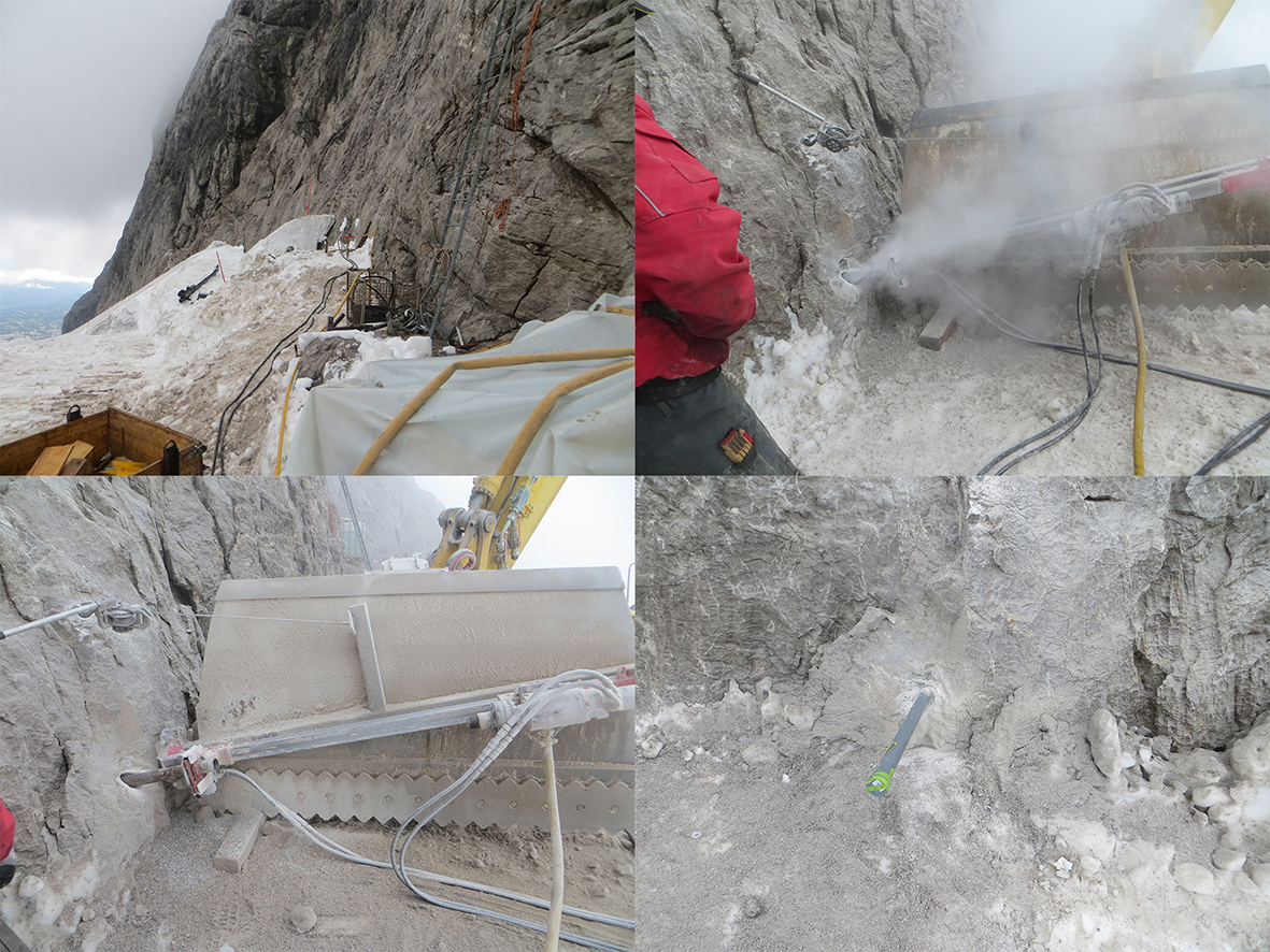
Figure 2. A new permafrost borehole in bedrock in the Dachstein massif (2995 m a.s.l.), Northern Calcareous Alps drilled on the 13 August 2014 at a north-facing rockwall site at the mountain Koppenkarstein. The 7 m deep borehole is the third permafrost borehole site in Austria (after Sonnblick and Kitzsteinhorn). Preliminary results clearly indicate permafrost conditions. Photographs provided by Harald Schnepfleitner.
Innsbruck
Activities of the Innsbruck permafrost group around K. Krainer (K. Krainer, U. Nickus, H. Thies) in 2014 were concentrated on the hydrogeology of mountain permafrost related to climate change (Project PERMAQUA; see for details earlier reports), including monitoring of discharge of active rock glaciers (gaging stations), water temperature and electrical conductivity of rock glacier springs and water chemistry of water released from active rock glaciers (anions, cations, heavy metals).
Research activities at the Institute of Geography (around J. Stötter) at the University of Innsbruck mainly focus on the detection and quantification of permafrost degradation in the Western Austrian and Northern Italian Alps using ALS/TLS as well as photogrammetric analysis. In the SE.MAP project (C. Klug, L. Rieg, R. Sailer, J. Stötter) the detection of high mountain geomorphic processes including rock glacier activities based on ALS and optical tri-stereo satellite data is assessed.
Researchers at the Institute of Ecology of the University of Innsbruck (K. Koinig, B. Ilyashuk, E. Ilyashuk.,G. Köck, R. Lackner, R. Psenner) continued monitoring water chemistry of lakes with melt water impact form rock glaciers and compared them to lakes without rock glacier influence. The very warm summer of 2013 still affected the solute content measured in 2014. Distinct bioaccumulation of metals originating from permafrost meltwater has been observed in various aquatic organisms as described in detail in an article by B. Ilyahuk et al. One additional sediment core was obtained from a lake with permafrost influence within a recently started project by B. Ilyashuk with analyses currently on their way.
The time series of the measurements of flow velocities of the Äußeres Hochebenkar Rock Glacier in the Ötztal Alps have been prolongated with a survey on 20 September 2014 (Fig. 3). The campaign was carried out by the Verein Gletscher und Klima in cooperation with the Institute of Interdisciplinary Mountain Research of the Austrian Academy of Sciences (A. Fischer, L. Hartl). After the speed up in the last years, the ongoing evaluation of the results will show if the velocity is still increasing. Nearby glacier mass balance time series showed less negative and partly even positive results despite of summer temperatures above the long term average caused by high snow accumulation and late snow melt.
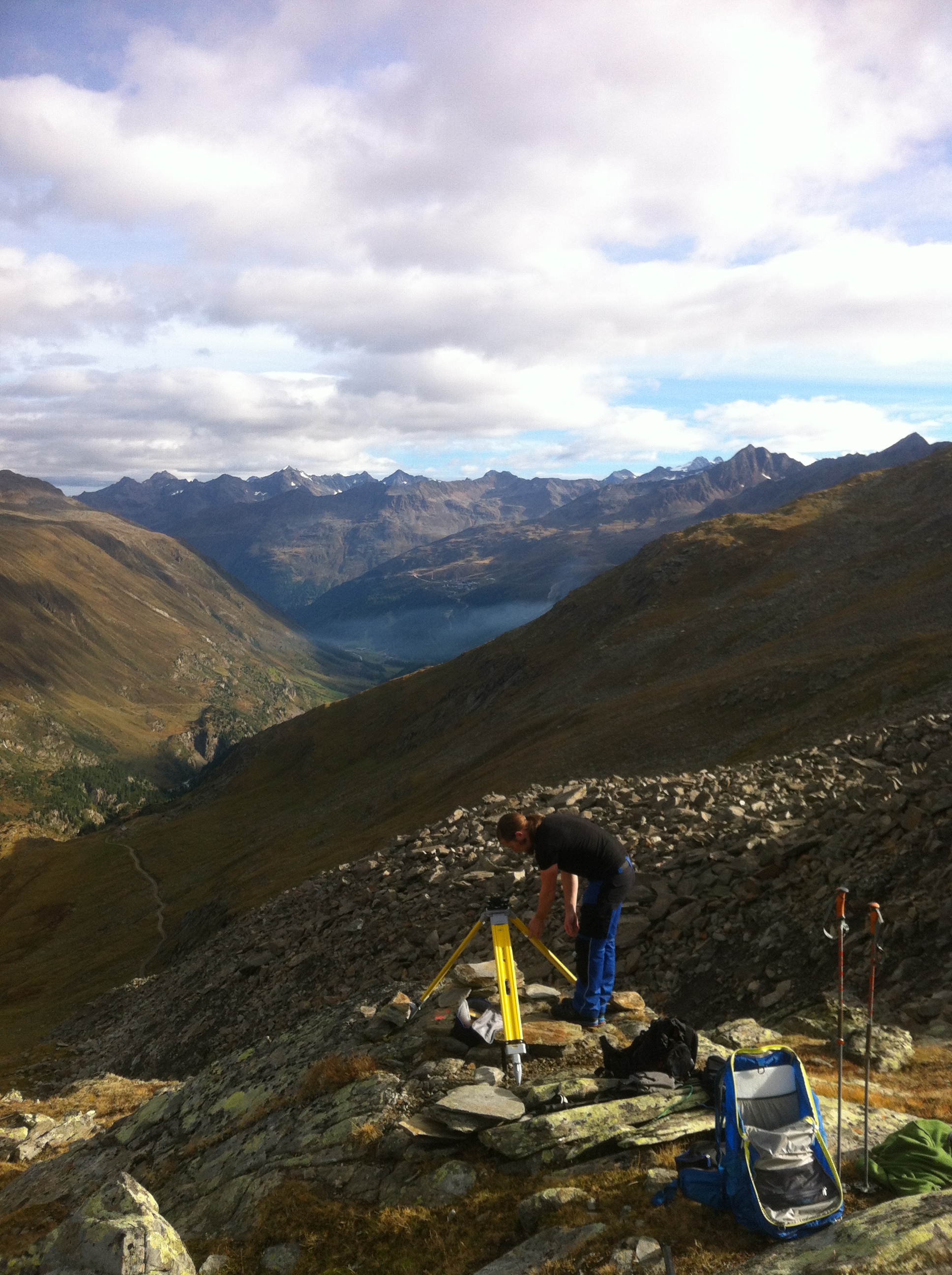
Figure 3. Velocity measurements at the Äußeres Hochebenkar Rock Glacier at the 20.09.2014. Photograph provided by Andrea Fischer.
Vienna
Current research activities by the Geological Survey of Austria, Department of Geophysics (D. Ottowitz, B. Jochum, R. Supper, S. Pfeiler, J-H. Kim) at Kitzsteinhorn and the ZAMG group in Vienna (W. Schöner, H. Hausmann) on Mt. Sonnblick were mentioned above. Noteworthy is the fact that W. Schöner has been appointed professor at the Department of Geography and Regional Science at the University of Graz in September 2014.
The land surface remote sensing research group of the Austrian Polar Research Institute lead by A. Bartsch (including members of Vienna University of Technology: B. Widhalm, E. Högström and Scott Polar Research Institute: A.M. Trofaier) has continued the maintenance of instrumentation for moisture and temperature monitoring in the Lena-Delta within the framework of PAGE21 in cooperation with AWI and ETH Zürich (supported by INTERACT). A. Bartsch has been coordinating the community white paper on Earth Observation data requirements of the permafrost community in response to a request by the WMO-Polar Space Task Group. She also co-organized the ESA CliC GNT-P/IPA Permafrost Remote Sensing workshop in Frascati, February 2014. Permafrost monitoring on the Yamal peninsula (bi-lateral Austrian-Russian project COLD Yamal) has been continued.
Report prepared by Dr. Andreas Kellerer-Pirklbauer, Department of Geography and Regional Science, University of Graz (andreas.kellerer@uni-graz.at)
Canada
The Canadian permafrost community has been very active over the past year. Plans are underway for the 7th Canadian Permafrost Conference to be held with the 68th Canadian Geotechnical Society Annual Conference in Quebec, September 20-23 2015. Many Canadian permafrost researchers will also participate in the Arctic Change Conference in Ottawa in early December 2014. Highlights from the past year, including reports on a number of permafrost science and engineering projects, are provided below.
J.Ross Mackay. 31 December 1915 – 28 October 2014
Ross Mackay, for several decades the world authority on permafrost, left us peacefully, in his sleep, early in the morning of October 28th. He was 98. A biography of Ross was published in 2006 to celebrate his 90th birthday: http://ibis.geog.ubc.ca/mackay2006/biography.html
Ross’s last field visit to the Mackenzie Delta was in 2011 at age 95. His most recent paper was also published that year in Permafrost and Periglacial Processes. His first field work in the western Arctic was based out of Paulatuk in 1951. The paper published (with coauthor Chris Burn) in 2011 concerned the pingo just west of the community. He had two other manuscripts in preparation, both of which, with Chris’ help, we hope to see completed. Ross was the recipient of many awards, most recently the inaugural IPA lifetime achievement award in 2010.
Mountain Permafrost Workshop
From 22–25 October 2014, the workshop “Impacts of permafrost thaw in mountain areas of Canada and beyond” brought together national and international senior experts from academia, industry and government near Whistler, British Columbia. The 30 attendees developed priorities for research and knowledge transfer related to permafrost and permafrost thaw in Canadian and other mountain environments. A workshop report will be made available at http://carleton.ca/permafrost/workshop-mountain-permafrost/. The workshop received support from the Natural Sciences and Engineering Research Council of Canada (NSERC), BGC Engineering Inc., the British Columbia Ministry of Forests, Lands and Natural Resource Operations, and Carleton University.
Northern Infrastructure Standardization Initiative
The Standards Council of Canada’s Northern Infrastructure Standardization Initiative, coordinated by the Canadian Standards Association Canada, continues the development of standards addressing climate change impacts on permafrost and northern infrastructure. CSA S500, “Buildings in Permafrost Supported on Thermosyphon Foundations” (chaired by Don Hayley) was published Sept. 2014. CSA S501 “Moderating the effects of permafrost degradation on existing building foundations”, chaired by Toni Lewkowicz, has been publicly reviewed with release expected by end of 2014. A standard on drainage around foundations in permafrost is also under development.
New and upcoming publications
Geocryology Book
In 2012, Emeritus Professor Stuart Harris (University of Calgary) and Professor Anatoli Brouchkov (Chair, Department of Geocryology, Moscow State University) identified the need to summarize the current state of knowledge of Geocryology, and address the lack of a good summary of permafrost landforms. They agreed to write a book in three parts summarizing the major findings in the vast literature published in Russian, Chinese, English, and other languages. Part 1 describes the characteristics and distribution of permafrost, while Part 2 deals with the main landforms. Part 3 will discuss the development and use of permafrost areas, which is becoming of great economic importance, particularly in Siberia and China. Academician Cheng Guodong joined in the writing after Part 1 was largely completed, supplying information from the literature published in Chinese. The first two parts are essentially completed in English, while Part 3 is still being written. It is intended to publish the results in the three languages if possible as both printed and e-book versions.
Last Permafrost Maximum
Hugh French (Emeritus Professor, University of Ottawa), in collaboration with Jeff Vandenberghe (Vrije Universiteit, Amsterdam), co-edited a special issue of Boreas (Vol. 43, 3) containing the results of the IPA Action Group, 2012-2014, led by Vandenberghe on the Last Permafrost Maximum (LPM, 25-17 ka BP). A summary paper (Vandenberghe et al, 2014) presents a map of the extent of permafrost in the Northern Hemisphere at this time and another (French and Millar, 2014) summarises the extent of permafrost in North America at the time of the Last Glacial Maximum (LPM, 18-22 ka BP). French and Vandenberghe are now assisting a new IPA Action Group led by Huijun Jin (China) that aims to define more precisely the extent of Pleistocene permafrost in central and eastern Asia.
References:
Vandenberghe, J., French, H. M., Gorbunov, A., Marchenko, S., Velichko, A.A., Jin, H., Cui, Z., Zhang, T., Wan, X., 2014. The Last Permafrost maximum (LPM) map of the Northern Hemisphere permafrost extent and mean annual air temperatures, 25-17 ka BP. Boreas, 43, 652-667.
French, H. M., Millar, S. W. S., 2014. Permafrost at the time of the Last Glacial Maximum (LGM) in North America. Boreas, 43, 667-677.
News from the Cold Regions Geotechnology Division
The Cold Regions Geotechnology Division of the Canadian Geotechnical Society (CGS) has had an active year and continues to move forward with initiatives aimed at increasing its visibility. The mandate of the Division is to promote and facilitate the advancement, exchange and transfer of knowledge, skills and experience in the field of Cold Regions Geotechnology for the benefit of its members and the profession.
The Roger J.E. Brown Award is presented bi-annually to an individual(s) for publishing the best paper on permafrost science or engineering in the Canadian Geotechnical Journal, Canadian Journal of Earth Sciences or Proceedings of national or international conferences, or to honour an individual for his/her excellence in the field of permafrost. This year’s winners are Isabelle de Grandpré, Daniel Fortier, and Eva Stephani for their paper entitled “Degradation of permafrost beneath a road embankment enhanced by heat advected in groundwater” published in the Canadian Journal of Earth Sciences in 2012. The award was presented at GeoRegina2014 – the 67th CGS Annual Conference in Regina, Saskatchewan.
An International Short Course on Permafrost Engineering: Effective Design and Construction in Permafrost Regions was successfully run at the University of Alberta from December 5-10, 2013. It was attended by about 30 participants. The next Short Course is being planned for April 2015.
The Engineering Institute of Canada is organizing the 4th Climate Change Technology Conference in Montréal, Québec (May 25-27, 2015) with CGS as one of the participating organizers. The Cold Regions Geotechnology Division is actively participating in the organization of the 7th Canadian Permafrost Conference in Quebec in September 2015, by working with the Local Organizing Committee and contributing to special sessions on permafrost engineering and technology.
Government of Nunavut (GN) – Permafrost Community Meetings in Arviat Nunavut
Community engagement activities held in Arviat, Nunavut August 25 to 29, 2014 allowed relevant stakeholders, to gather and share information on how permafrost is changing in Arviat. Discussions focused on how infrastructure is affected by changing permafrost and the influence on current and future community development. These activities engaged community members, including the Hamlet of Arviat, local businesses, the housing sector, elders, and youth. The consultations are part of a larger GN led project to map the suitability of land for future development in seven Nunavut communities. The overall goal is to consider climate change impacts on communities and to develop adaptation measures.

The GN worked with the following project partners:
• Memorial University of Newfoundland (MUN) through ArcticNet: provided ground truthing through geotechnical and drilling exercise
• Nunavut Tunggavik Incorporated (NTI): contributed to youth activities and provided insight into research in Nunavut
• The Arviat Wellness Centre: Provided on-site coordination, including hosting a community information night, producing a mini documentary about the project, and conducting a permafrost knowledge survey with community members
Contact: Sara Holzman, Climate Change Program Specialist, Government of Nunavut’s Department of Environment. For more information, please visit: http://climatechangenunavut.ca/en/project/arviat-climate-change-community-engagement
Geophysical and remote sensing applications for permafrost and infrastructure, Iqaluit
Natural Resources Canada (A.-M. Leblanc, G. Oldenborger of the Geological Survey of Canada and N. Short, Canada Centre for Mapping and Earth Observation), in collaboration with the Canada-Nunavut Geoscience Office, and Centre d’études Nordiques (Université Laval), is conducting research to better characterize permafrost conditions and to investigate active permafrost processes in the area of Iqaluit and at the Iqaluit International Airport. A suite of geophysical data have been collected from winter 2012 along a selected taxiway section at the airport in order to characterize the seasonal changes in ice and unfrozen water content. This innovative experiment includes time-lapse monitoring with one permanent electrical resistivity array and two boreholes equipped with thermistors, electrodes, and dielectric sensors. Preliminary results indicate that subsurface temperature fluctuations may result in significant ice formation near the base of the seasonal thaw layer and changes in unfrozen moisture content in the permafrost. Continued monitoring will help to better understand the active processes. Differential Interferometric Synthetic Aperture Radar (D-InSAR) has been applied in the Iqaluit area to map seasonal ground displacement during four consecutive summers. Results show that the D-InSAR derived seasonal ground displacement patterns align well with surficial geology units and reflect the thaw settlement characteristics of the sediments; localised displacement patterns in the vicinity of features such as ice wedges have also been identified with D-InSAR. Although D-InSAR is rapidly gaining acceptance as a source of ground displacement information for permafrost regions, the accuracy of the information is still not well established. One of the objectives is to quantitatively evaluate D-InSAR measurements of seasonal ground displacement over permafrost terrain, using ground truth data sources. Results suggest that D-InSAR ground displacement accuracy is not uniform over large areas. The true ground settlement is significantly under-estimated in areas with flooded vegetation whereas the accuracy for dry areas is in sub-centimetre agreement. The geophysical and remote sensing components of this project provide baseline information on the current and evolving permafrost conditions in Iqaluit and contribute to better understanding of permafrost processes that influence stability and degradation of land-based infrastructure.
Université Montreal, Geocryolab Studies
Geocryolab’s studies (directed by Dr. Daniel Fortier) focus on the dynamics of permafrost biogeosystems. Field work was conducted across a latitudinal transect spanning four typical permafrost settings.
1. Polar desert – Ward Hunt Island, Nunavut
Collaborative studies of the NEIGE project (Northern Ellesmere Island in the Global Environment, W.F. Vincent, ULaval) concerning periglacial mass movements and watershed geochemistry have been conducted around Ward Hunt Lake on the northern coast of Ellesmere Island. These studies are linking watershed organization and processes with the benthic ecosystems and physical characteristic of Canada’s northernmost lake (M. Paquette, PhD student, M. Verpaelst, MSc student).

Figure 2. Water tracks, sorted stripes and solifluction lobes on the slopes of Ward Hunt Lake.
2. Continuous permafrost – Bylot Island, Nunavut
Permafrost degradation dynamics are being investigated in the eastern Canadian Arctic archipelago, including assessment of the impacts of gullying on wetlands, where runoff infiltration in ice wedges is leading to rapidly enlarging gullies. The studies focused on fluxes of energy and matter during and after thermal erosion processes in ice-wedge terrains, especially on positive feedbacks accelerating permafrost degradation and negative feedbacks promoting permafrost recovery (E. Godin, PhD student, A. Veillette, MSc student) and shrub colonization (M. Tremblay, MSc student, co-sup. E. Lévesque, UQTR). Permafrost degradation under aquatic systems and how it affects carbon cycle dynamics, especially GHG emissions, was also studied (F. Bouchard, postdoctoral researcher, V. Preskienis, PhD student, co-sup. I. Laurion INRS-ETE).ÂÂ Other projects are examining: the effects of permafrost degradation on the nesting ecology and breeding of the rough-legged hawk (A. Beardsell, MSc student, co-sup. G. Gauthier, ULaval); and the vulnerability of arctic fox dens to active layer deepening (F. Lapierre-Poulin, MSc student, co-sup. D. Berteaux, UQAR). S. Coulombe (PhD student) studied the cryostratigraphic signature and physicochemical properties of buried glacier ice to better understand the impact of its degradation on landscape evolution.

Figure 3. Actively eroding thermo-erosion gully, Bylot Island (Photo: E. Godin)
3. Discontinous permafrost – southern Yukon Territory
Work in the Yukon focused on the characterization of ice-rich and carbon-rich Pleistocene yedoma deposits (L. Lapointe-Elmrabti, MSc student, co-sup. J. Talbot, UofMontreal). The Beaver Creek test site was utilized as a platform to study the degradation of this type of thaw-sensitive permafrost in response to changes in the hydrogeological and thermal regimes (M. Sliger, MSc student, J. Malenfant-Lepage, PhD student, co-sup. G. Doré ULaval). The vulnerability of permafrost in Yukon communities (Dawson, Faro, Ross River and Old Crow) to climate change was studied in collaboration with the Yukon Research Centre.

Figure 4. Permafrost core – Old Crow, Yukon
4. Sporadic mountain permafrost – southern Québec.
The parameters controlling the thermal regime of the ground surface were investigated in the Chic-Chocs range (G. Davesne, MSc student). Mt Jacques-Cartier’s permafrost was used to illustrate how climate change affected the spatio-temporal evolution of this marginal alpine permafrost body over the last 35 years and to simulate its near future evolution using numerical modeling approaches.
Collaborative Research in the Northwest Territories
Steve Kokelj and Kumari Karunaratne of the NWT Geoscience office (NTGO) have been involved in collaborative research with several Universities, Federal science agencies and Territorial Departments to advance permafrost studies and knowledge of environmental geosciences in NWT. The distribution of thaw slumps has been mapped across a 1, 300, 000 km2 area of northwestern Canada through collaboration with University of Victoria (Trevor Lantz) and Territorial Government Agencies (NWT Centre for Geomatics, Prince of Wales Heritage Centre). A grid-based mapping technique was used to identify areas where retrogressive thaw slumping is prevalent. The project provides a quantitative basis for re-evaluating the distribution of ice-cored permafrost terrain and assessment of the sensitivity of northern landscapes to climate change. The results, including the map data and metadata, are being published as a NTGO open file and will be available through the NWT Discovery Portal. NTGO has worked closely with Lantz and his students to map the distribution of ice-wedges and polygonal terrain along the Inuvik-Tuktoyaktuk Highway (ITH). The ITH is a major infrastructure project entering into the second season of construction.
NTGO has coordinated permafrost studies on the Peel Plateau, which involve collaboration with University of Ottawa (Denis Lacelle), Canadian Centre for Remote Sensing (Rob Fraser), Carleton University (Brendan O’Neill) and University of Victoria (Trevor Lantz). The multidisciplinary research has: 1) Advanced the development of remote sensing tools to better map the distribution and development of large thaw slumps prevalent on the Peel Plateau; 2) investigated the environmental and geomorphic impacts of these large disturbances; 3) assessed permafrost ground thermal conditions along the Dempster Highway; and 4) documented road dust, shrub and snow feedbacks resulting shrub proliferation and permafrost warming adjacent to the road embankment.
NTGO is collaborating with Natural Resources Canada (NRCan, Steve Wolfe) and Wilfred Laurier University (Jennifer Baltzer) to evaluate permafrost –ecological relationships in the North Slave region (see below). Research in the region will gain momentum in 2015 with a CANNor funded surficial drilling program that will support assessment of permafrost, geotechnical and ground thermal conditions in this region of infrastructure and resource development interest. Participants include Canada Research Chair, Stephan Gruber and his students from Carleton University, NRCan (Wolfe) and Kokelj and Karunaratne of NTGO.
Sub-arctic permafrost research in the Great Slave Region
An extensive collaborative network between NTGO, NRCan’s Geological Survey of Canada and Canada Centre for Remote Sensing, Carleton University, University of Ottawa and Wilfred Laurier University have undertaken research on permafrost at the discontinuous-continuous permafrost boundary of the northern Great Slave Lake region NWT, in relation to landscape sensitivities, climate change and infrastructure issues. Papers published this year include the occurrence of extensive ice-rich terrain (lithalsas) within the Great Slave Lowlands in Geomorphology; modelling and mapping of permafrost change in The Cryosphere; and detection of landscape changes in high latitude environments using Landsat trend analysis in Remote Sensing. Several theses are presently investigating the origins of ice-rich terrain, seasonal development of winter overland ice (aufeis), sub-surface material properties and improved spatial sampling of permafrost and related environmental information (Carleton University), and the occurrence and ecological relations of near-surface ground ice (Wilfred Laurier University). This research has considerable application, given notable climate warming trends, warm permafrost temperatures, and implications for extensive community and industry infrastructure in this region. Contact: Stephen Wolfe, Geological Survey of Canada, NRCan
Graduate research at Carleton University
Adrian Gaanderse has just completed a Master’s degree in Geography at Carleton University evaluating ground ice conditions in lithalsas near Yellowknife, under the supervision of S. Wolfe, C. Burn, and S. Kokelj. His project examined the geomorphic origins of a 700-metre long lithalsa; one of over 1700 newly recognized mineral permafrost mounds throughout the Great Slave Lowlands. The lithalsa is adjacent to Highway 3 near Yellowknife, where ongoing highway subsidence is being monitored.

Figure 5. Lithalsa along Highway 3
Lithalsas in the Great Slave Lowlands were formed in glaciolacustrine clay deposits of Glacial Lake McConnell. The stratigraphy of the lithalsa, described through a series of boreholes drilled to 8.4 m depth was of domed sediment layers. Segregated ice lenses, some tilted and up to 24 cm thick, were layered between the clays below 4 metres, suggesting that ice at depth is responsible for the lithalsa’s raised topography. δ18O values from ice within the lithalsa indicated modern water sources for the ice lenses. Radiocarbon dates indicate that lithalsa formation began within the last 400 years. Degradation of ice-rich lithalsas throughout the region is a likely contributor to local subsidence-related issues, especially along Highway 3, which was realigned before the significance of these mounds had been recognized.
Inuvik to Tuktoyaktuk Highway (ITH) -A Mega Project in Arctic Permafrost Construction
The Government of Canada and the Government of the Northwest Territories are collaborating on an exciting and challenging project which is to construct a 145 km extension of the National Highway System to Canada’s arctic coast. This unique infrastructure project will be completed over a permafrost rich environment, challenging the engineers, technicians, and operators. Much work was done during the pre-engineering phase to determine best practices, maximizing the design and evaluating innovative highway construction techniques aimed at addressing the difficult permafrost conditions.
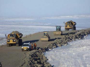
The ice rich terrain beneath the ITH is unlike any other in the world. Permafrost underlies the full length of the highway alignment and significant thermal analyses were considered in designing the highway embankment, bridge structures and alignment. Permafrost monitoring is incorporated in the construction and maintenance plans. The unique features of this project location, including ice polygons and pingos, present the opportunity to employ innovative construction techniques complementing current permafrost research initiatives in progress across the Canadian Arctic and around the world. The unique site condition also lends itself to significant research opportunities and the Government of the NWT (GNWT) and Transport Canada (TC) are keen to introduce scientific research into the project. At the moment the GNWT and TC group have two major research projects under review to include: a section of a deep fill embankment employing a geosynthetic reinforced soil (GRS) technique and a section of the highway employing a bank of high density polyethylene (HDPE) pipes in lieu of a large culvert structure. The project team hopes to install and instrument these projects in March 2015. The proposed experiments will evaluate the effectiveness and feasibility of technical options for different environments encountered along the ITH. The project spans a range of physical environments and climate zones so that results will inform embankment, right-of-way management and water course crossing construction options for a broad range of northern roads to be used elsewhere.
The Project is now into its second year of the major construction program with completion estimated in 2018. The majority of the embankment construction takes place in winter to preserve a frozen core of the roadbed. Minimum embankment height varies from 1.6m to 2m depending on the results of the thermal analysis and the region the section of highway is located.
The ITH is the first leg of the Mackenzie Valley Highway, a key priority for the GNWT. This project is generating economic and social opportunities for the region. When complete, it will decrease the cost of living in Tuktoyaktuk by enabling goods to be shipped year-round by road, increase opportunities for business development, reduce the cost of job-creating onshore oil and gas exploration, and strengthen Canada’s sovereignty to the North.
This major project greatly contributes to the creation, growth and competitive capacity of NWT businesses. Maximizing economic benefits to Northwest Territories businesses, offering opportunities for economic diversification, and training and development for residents and businesses are key goals for the GNWT.
The GNWT’s commitment to environmental sustainability is a key part of this project, and the planning involved years of research, study, and analysis. Healthy northerners depend on a healthy environment. This project is being managed to address residents’, contractors’, and regulatory bodies’ requirements.
An all-weather highway through the Mackenzie Valley to the Arctic Coast has been a strategic priority for the federal government since the 1950s. The envisioned Mackenzie Valley Highway will be the final link connecting our nation from coast to coast to coast and will open up countless opportunities for the people of the region, unlocking Northern potential and reducing the cost of living.
The project is being managed according to the GNWT’s commitments to socially responsible and environmentally sustainable development. As the northern-most segment of the envisioned Mackenzie Valley Highway, it will strengthen and diversify the NWT economy, unlocking its resource potential and improving mobility and opportunities throughout the territory.
Contact: Kevin McLeod P. Eng., Project Director
For further details see www.dot.gov.nt.ca and follow the links for the ITH.
Report prepared by Sharon Smith, Canadian National Committee for the International Permafrost Association (Sharon.Smith@NRCan-RNCan.gc.ca)
China
COMPLETED PROJECTS/PROGRAMS
In 2014, 12 projects funded by the Ministry of Science and Technology (MOST), Natural Science Foundation of China, Chinese Academy of Sciences (CAS), the China Railway Engineering Co., Ltd., the State Grid Co., Ltd., the China Communications Co., Ltd., and the Qinghai Department of Transportation (DOT) were completed.
Concerning permafrost science, major achievements included the assessment of permafrost changes and thaw settlement hazards on the Qinghai-Tibet Plateau (QTP), the stability of tower foundations for the Qinghai-Tibet DC-Circuit Systems and along National Highway 109 (Golmud to Lhasa), the mapping of changing permafrost conditions along National Highway 214 ( Xi’ning to Yushu (Gyêgu), Qinghai), the response mechanisms of permafrost to climate change and carbon cycling on the QTP, and the design of express highways in northern Northeast China. Concerning the physics and mechanics of frozen ground, accomplishments included completion of programs on physical and mechanical properties of frozen and unfrozen soils near the phase change zone, salt migration processes in cold saline soils and their impact on subgrade deformation, and moisture migration and hydrothermal coupling processes in the active layer beneath highways in permafrost regions.
The survey of plateau permafrost included the instrumentation of 108 boreholes for ground temperature measurements and two comprehensive observation sites were established. Maps of permafrost distribution were constructed using remote sensing and GIS metadata aided by ground-truthing.
The Tibet Autonomous Region has been developing very rapidly. It will be necessary to build new high-speed highways, power transmission lines and oil/gas pipelines in the immediate future (3-5 years). Additional engineering projects that will need to be deployed within the Qinghai-Tibet Engineering Corridor (QTEC) will impose increasing disturbances to the permafrost environment. This will accelerate permafrost degradation along the QTEC under a warming climate. Thus, it is important to ensure the engineering, water and ecological safety along the vulnerable QTEC and the ecologically-sensitive source areas of the Yangtze, Yellow and Lancang-Mekong rivers. Many research programs are focused on these themes.
Permafrost activities on the southern flanks of the Qilian Mountains on the northeast QTP relate to coal mining and their associated access roads and railways. This has been ongoing since the 1960s but recently coal mining has drastically expanded both horizontally and at depth. New rail and road networks have been built but geocryological and cold regions engineering problems have arisen and demand better study. On the northern and western flanks of the Qilian Mountains, permafrost studies are mainly aimed at understanding the hydrological processes in the headwaters of the major rivers in the Hexi Corridor, as well as the evolution of permafrost since the Last Glaciation.
In the source areas of the Yellow River on the northeastern QTP, permafrost studies during the last few years focused on environmental impacts and terrestrial processes, as well as the building of the Qinghai-Kang Highway (QKH) from Gong’he to Yushu. Starting in the 1990s, monitoring networks for climate, geocryology and cold regions engineering were gradually installed, mainly along the NH214 (QKH) and NH109 (QTH), and the connection road between the two. The major aim was to understand the ecological and engineering impacts arising from a changing permafrost environment.
In northern Northeast China, recent economic development has also necessitated an upgraded transportation network. Reliable roadways and railbeds that function efficiently under extremes of cold (as low as -59°C) and heat (up to more than 40°C) are necessary. Unfortunately, prior to 2009, long-term monitoring records for ground temperatures, both in natural and engineered states, were largely absent, with only an exception at Yituli’he, with a permafrost borehole from 1980-2004. The recent Harbin-Dalian high-speed railbed has proven effective in frost hazard mitigation but still experiences slight (1-3%) frost heaving in fine-grained soils. The soils along the railbed have been equipped with monitoring systems for hydrothermal and mechanical processes for a total of 909 km from Harbin to Dalian, and there are 25 monitoring transect in the southern part.
NEW AND ONGOING PROJECTS/PROGRAMS
By late November 2014, about 14 projects were recently approved with foci on permafrost hydrology, the thermal and mechanical stability of permafrost, the deformation of frozen halic soils, thaw slumping and thaw consolidation of warm and icy permafrost, coupled heat transfer models for thermosyphons, construction techniques for high-speed roadways at high elevations, creeping of permafrost soils, the frost restructuring of coal rocks, and the migration of spilled oil in thawing permafrost soils.
In 2014, there were 19 major ongoing research programs focusing on permafrost and cold regions engineering. Funding from all levels of government and industry increased in 2012-2013, but funding for the next two years is uncertain because of changing funding policies and the merging of funding organization.
In this report, three programs are briefly described.
1. CAS Key Strategic Program: Hydrological impacts of degrading permafrost and associated hydrology in the source area of the Yellow River (SAYR)
The year 2014 was important for the SAYR hydrology program. Monitoring and field sites/watersheds have now been established in areas representing continuous, discontinuous, and patchy permafrost zones, as well as an area with seasonally-frozen ground. The aim is to understand the surface and subsurface hydrology and changes in hydrological cycles and hydraulic connections under a warming scenario with permafrost changing from continuous, cold permafrost to discontinuous, patchy warm permafrost and, eventually, to seasonally-frozen ground.
Thirty-five boreholes with a total depth of 818 m were completed in 2014. In addition, GPR soundings and hand-dug pits helped to understand and map permafrost distribution and the hydrothermal state of the active layer in the study sites and the experimental watershed. All boreholes and many active-layer sites were instrumented for continuous thermal monitoring. Monitoring of terrestrial processes was also established and, on the basis of climate and hydrological records and aided with the RS/GIS data, the trends and responsiveness of the permafrost soil environment and hydrology to climate change were analyzed for the last 50 years.
Permafrost hydrology focused on supplementary surveys on permafrost, soils and active layer processes in additional to hydrological processes, isotope hydrology and groundwater dynamics.
In April-May, 2014, five more sites were set up for monitoring active-layer processes in the experimental watershed. This is in addition to the original five plots in the SAYR (at Chalaping, Maduo Village, Tangchama and northern Ngöring lakeshore) that had been established in 2010. Surface and subsurface water samples were analyzed for stable and radioactive isotopes, such as δ18O, δD, and Ra and Rn as tracers for understanding hydraulic connections between the supra-, intra- and sub-permafrost waters, and surface waters (lakes, rivers, precipitation, icings and ground ice (pingo, lake and river ice and snow cover).
2. CAS Pilot Program on Carbon Budgets: subproject on permafrost extent in China during the Last Glacial Maximum (LGM, 21±2 ka BP) & Holocene Megathermal period (HMP, 6±1 ka BP)
In 2014 this subproject undertook the survey, verification and sampling of sedimentary structures thought to reflect the previous presence of permafrost (‘past permafrost’) in Northwest China during the LGM and HMP. Previously, Pleistocene permafrost studies in China mainly focused on the QTP, and North/ Northeast China. Because Northwest China is dominated by steppe and (gobi) desert terrain, the project is trying to identify the evidence for permafrost in these cold deserts during the LGM and the criteria for when and where the sandy and silty soils were frozen and subsequently thawed, taking into account environmental proxies and mineral analysis. The lower/southern limits of permafrost during the LGM and HMP in Northwest China are poorly known. A multi-disciplinary approach is required that, in addition to geocryologists, involves specialists in glaciology, Quaternary science and tectonics.
In May 2014, Huijun Jin and Fujun Niu led a field inspection of the northern QTP covering a total distance of about 4,000 km from Lanzhou (Xi’ning, Golmud, Kunlun Mountain Pass, Beilu’he Riverside, Budongquan (unfrozen springs), Maduo Village, Sisters’ Lakes (Gyaring and Ngöring lakes), Madoi, Huang’he (Yellow River) Village, Bayan Har Mountains, Qingshui’he (Clear Water), and Mado). Emeritus Professor Hugh French (U Ottawa, Canada), Dr Sergey Marchenko (Geophysical Institute, UAF), Dr. Xiaoling Wu (Ho’hai University, Nanjing) and Dr. Julia Stanilovskaya (RAS, Moscow) participated in the trip. French, Marchenko and Stanilovskaya made presentations on past and present permafrost research prior to the trip. A group photo was taken in front of the new permafrost station (40 km east of Madoi, Qinghai) on northeastern Qinghai-Tibet Plateau (Fig. 1).

Figure 1. Group photo of the QTH-QKH trip in front of the New Huashixia Permafrost Observatory, 40 km east of Madoi, southern Qinghai along the Qinghai-Kang (West Sichuan Province) Highway (at KM456)
Several localities were visited where there was evidence of paleopermafrost (Figs. 2 and 3). After the trip, Marchenko, Jin, and others inspected permafrost in Northeast China. In November-December 2014, sand-wedge casts were inspected by Jin’s team in the Hexi Corridor in western Gansu Province, about 1200 km west of Lanzhou (Fig. 4).

Figure 2. Load casting at Huangchengzi Village, Mengyuan, northern Qinghai Province.


Figure 3. Sand wedges in slates at Huang’he Village, southeastern Sources Area of the Yellow River (SAYR, above Madoi) (Fujun Nui and Hugh French in photos)

Figure 4. Sand wedges and cryoturbations 20 km east of Guazhou, Dunhuang, western Gansu along the NH G30
3. Frost hazards along the China-Russia Crude Oil Pipeline (CRCOP, Line I): Formation mechanisms and mitigative measures
The CRCOP (Spur Line I) from Mo’he to Daqing has been in operation since late 2010. Due to unexpectedly high oil temperatures (average about 10°C; range of 1-23°C), thaw settlement of the pipeline foundation soils has been identified at several localities. The risks from frost hazards and other geohazards, such as slope failures, forest fires, landslides, and earthquakes, were evaluated as being under control. Mitigative measures, such as cooling by thermosyphons, have been monitored and regularly evaluated using GPR in addition to drilling and excavated pits. Secondary periglacial hazards, such as icings, frost mounds, thermokarst ponds and thermal slumping were surveyed in winter and spring.
MAJOR ACADEMIC EXCHANGE ACTIVITIES
The SKLFSE has signed agreements/MOUs on scientific research and educational exchange with University of Austria, Laval University, The University of Alaska System, and University of East Anglia. Joint research programs were implemented in the SAYR, Hei’he Watershed, and Northeast China. Six SKLFSE young scientists went to study abroad and conduct cooperative research: Dr. Shuping Zhao (University of Pittsburg, PA, USA), Dr. Sizhong Yang (AWI for Polar and Marine Research, Potsdam, Germany), Dr. Zhanju Lin (Carleton University, Canada), and Drs. Fan Yu, Xiaoliang Yao, Junfeng Wang, and Shujuan Zhang.
Visitors to the SKLFSE during 2014 included the following: Dr. Xicai Pan from the Global Water Security Institute at University of Saskatoon, Canada; Prof. William A. Gough from University of Toronto, Canada; Prof. Sergey S. Marchenko from Geophysical Institute, University of Alaska-Fairbanks; Prof. Victor F. Bense from University of East Anglia, Norwich, UK; Dr. Lin Liu from Hong Kong Chinese University; Prof. Ochirbat Batkhishig, Director of Soil Laboratory, Mongolian Institute of Geography; Prof. Qing Wang from Jilin University; Prof. Shilong Piao from Beijing University; Dr. Miaogen Shen from the Institute of Tibet Plateau Research, CAS; Profs. Mikhail Zhaleleniak and Lilia Prokopieva from the Melnikov Permafrost Institute, North-Eastern Federal University, Yakutsk, Russia; Prof. Qinxue Wang from National Institute of Environmental Studies, China. On 28-29 November, PetroChina Pipeline Co. reached an agreement with CAREERI on the investigation and assessment of permafrost engineering geology along the recently proposed China-Russia Natural Gas-line (East Spurline from Hei’he to Daqing, Heilongjiang Province, Northeast China).
NATIONAL AND INTERNATIONAL CONFERENCES
On 18-21 June 2014, Academician Guodong Cheng, Prof. Fujun Niu and Dr. Ji Chen attended the EUCOP IV in Evora, Portugal. They presented an invited talk on”Current status of cold regions road engineering in China”, and a session report on “Investigation on the modern permafrost in the central and west QTP” and a poster “Analysis of thermal characteristics and disturbance scopes of linear engineering construction projects in the permafrost regions of the QTP. At this meeting, Professor Guodong Cheng was awarded the IPA Lifetime Achievement Award on 19 June 2014 (see Fig. 5)
On 22-24 August 2014, more than 300 people attended the 10th International Symposium on Permafrost Engineering (TISoPE) in Harbin held by the Heilongjiang University and sponsored by Geographical Society of China, IPA Permafrost Engineering Working Group, RAS Melnikov Permafrost Institute, and Heilongjiang Cold-land Building Institute, under a theme of “Permafrost engineering and adaptive strategies”. More than 20 scholars from the SKLFSE, led by Professors Wei Ma, Yuanming Lai and Guodong Cheng, participated in or organized the symposium. Professors Wei Ma and Huijun Jin respectively presented invited talks on “Major permafrost engineering projects in China” and “Sciences in Cold and Arid Regions’.
On 24-27 October, The First Chinese Conference on Cryosphere Science was successfully convened in Beijing with a theme on “Cryospheric change, impacts and sustainable development”. It aimed at providing a platform on academic exchange on cryosphere science. This meeting was jointly held with the First IUGG Meeting China, with more than 200 people attended the cryospheric sessions, and about 1,000 people from China and overseas attend the joint IUGG meetings. Academicians Da’he Qin, Tandong Yao, Bojie Fu, Guoxiong Wu, and others, as well as Professors Wei Ma, Yongjian Ding, and Zhijiu Cui, and others, presented on the plenary sessions. Professors Wei Ma and Fujun Niu respectively presented plenary reports entitled “Permafrost engineering in China: Research and challenges” and “Permafrost problems and their solutions of the Qinghai-Tibet Railway”. Professor Huijun Jin chaired the Session on “Cryospheric Records and Paleo-environmental Reconstruction” and presented an invited session report on “Evolution of permafrost and periglacial environments in Northeast China”. Dr. Yuzhong Yang (SKLFSE) presented a paper entitled “Isotopic features of ground ice on the QTP and its implications in climatology and hydrology”.
On 1-2 November, Dr. Guoyu Li (SKLFSE) attended the Second Chinese Symposium on Multiple-Fields Interactions of Soils/Rocks and Environmental Geotechnical Engineering held in Shanghai, China, and presented a paper on “Frost hazards and mitigation of the post-construction China-Russia Crude Oil Pipeline from Mo’he to Daqing, Northeast China”.
On 19-21 November, SKLFSE held its annual academic committee meeting (5th Meeting of the 5th Academic Committee) in Lanzhou. Leaders from MOST, CAS, and CAREERI participated in and Academician Guodong Cheng, the SKLFSE Academic Director, anchored the meeting. Prof. Qingbai Wu, Director-elect of the SKLFSE, reported on the SKLFSE progress in 2014 and prospects for 2015. After the reporting, the academic committee members reviewed and granted 10 of the 32 proposals for annual research funding.
NEW FIELD STATIONS AND CAMPS FOR PERMAFROST STUDIES
Five new stations for permafrost studies in China were established in 2014:
Permafrost Ecology Station at Gen’he, Inner Mongolia
A Permafrost Ecology Station has been established at Gen’he, Inner Mongolia, northern Northeast China. The focus is on permafrost-forest ecosystems in the northern Da Xing’anling (Hinggan) Mountains. It is under the joint auspices of SKLFSE, CAREERI, CAS (Lanzhou, Gansu Province) and the College of Forestry, Inner Mongolia Agricultural University (Hoh Hot, Inner Mongolia). The station is positioned at 53.5°N latitude in order to observe the dynamics of frigid-temperate ecosystems in permafrost terrain, with a special interest in the interactive and interdependent processes associated with permafrost, boreal forests, wetland ecosystems, snow cover and cryosols. Although many of the observational sites have been in operation since 2009, the official opening of the joint station was made by President Wei Ma, Academician Yuanming Lai and Director Yushan Hao on August 19, 2014.
Basic information about the Station:
Affiliations: CAREERI, CAS and Inner Mongolia Agricultural University, Hohhot, IMAR, China
Station Masters:Professor Huijun Jin/Xiaoli Chang (SKLFSE, CAREERI, CAS), and Professor Qiuliang Zhang (Gen’he CFERN Station, Inner Mongolia Agricultural University)
Address: Gen’he CFERN Station Km 13.5 Landscape Avenue, Gen’he, Inner Mongolia 022300
Website: http://www1.imau.edu.cn/linxue/show.php?contentid=714.
More info available at: http://sklfse.casnw.net/show.asp?id=130
Joint Observatory of Permafrost Environment in Hola basin, Mo’he, Heilongjiang Province
The Joint Observatory of Permafrost Environment in the Hola basin, Northern Da Xing’anling Mountains was declared open by President Wei Ma and Sr. Eng. Futing Ma, Deputy Manager of Gulian Coal Mine Co., on August 21, 2014. More than 20 guests attended the ceremony. The focus is upon geocryology, cold regions mining and ecology, and hydrogeology.
Basic information about the Station:
Affiliations: CAREERI, CAS and Gulian Coal Mine Co., Ltd.
Station Masters: Prof. Huijun Jin/Dr. RX He (SKLFSE); Sr. Engr. Futing Ma (Gulian Coal Mine)
Address: Gulian Coal Mine Co., Mo’he County, Heilongjiang Province 165308 China
More info available at: http://sklfse.casnw.net/show.asp?id=129
SKLFSE Graduate Student Experimental Base in Wanjia, Heilongjiang Province
An Experimental Research Base on Seasonally Frozen Ground for SKLFSE graduate students was officially established at Wanjia, very close to the Harbin Airport on August 25, 2014. It is a joint program by SKLFSE and the Heilongjiang Academy of Hydraulic Science and Technology.
Monitoring Base for Permafrost Environment on Mt. Ma’hanshan, Gansu Province
A Monitoring Base for Permafrost Environment was established on Mt. Ma’hanshan, about 50 km east of Lanzhou, Gansu, China, on October 19, 2014. With the highest summit at 3670.4 m asl, the Mt. Ma’hanshan is characterized by glaciated slopes, modern periglacial landforms and permafrost. Academician Da’he Qin inspected the station Professor with Lin Zhao as the master.
New Huashixia Permafrost Station
The New Huashixia Permafrost Station, jointly operated by the Qinghai DOT and SKLFSE, is located at KM430 along NH 214 from Gong’he to Yushu, at the mid-point between the towns of Huashixia and Madoi (40 km in both directions). It was formally opened in June 2014. This station, built upon continuous permafrost, is positioned to understand permafrost conditions along the highway and to study frost hazards and their mitigative measures. The station is equipped with well-designed living quarters and experimental laboratories, an experimental road section and other segments, and has experimental sites for alpine ecology. Many of the mitigative measures and their monitoring systems along the 331-km-long permafrost segments of NH 214, and the recently built sections of the Express Highway from Gong’he to Yushu, are also important components of the station mandate. The NH 214 traverses the permafrost regions in Laji, Buqing, Bur Hanbuda, Anyemaqên and Bayan Har mountains to the north of Yushu, and extends southwards to the China and Burma borders.
ACCOMPLISHMENTS AND AWARDS
1. Academician Guodong Cheng received the IPA Lifetime Achievement Award from IPA president Toni Lewkowicz at the EUCOPIV conference in Evora, Portugal in June (Fig. 5).
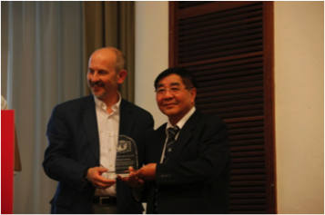

Figure 5. Professor Cheng received the IPA Lifetime Achievement Award.
2. Academician Yuanming Lai won the Prize for Scientific and Technological Progress of Ho Leung Ho Lee Foundation for his contribution to the permafrost engineering research (Fig. 6).

Figure 6. Professor Yuanming Lai received the Ho Leung Ho Lee Prize.
Report prepared by Huijun Jin, CAREERI, Lanzhou, CAS ( hjjin@lzb.ac.cn)
Denmark
Danish/Greenlandic contribution the IPA yearly report
The Center for Permafrost (CENPERM) at Copenhagen University now comprises 44 employees, and has continued investigations at sites in Greenland, Svalbard, Siberia and Sweden. In 2014 the existing research sites were expanded with two new sites, and now comprise both agriculture and sheep farming in South Greenland, as well as a new site at Brønlundhus in Peary Land, North Greenland. Furthermore, a new CALM grid was established in Ilulissat, Central West Greenland, in cooperation between CENPERM and the Arctic Technology Centre (ARTEK) at the Technical University of Denmark.
A national cooperation between CENPERM, the Department of Geoscience at Aarhus University and ARTEK completed a short term high temporal resolution electrical resistivity and induced polarization monitoring experiment at the Arctic Station research site in Central West Greenland. Six to twelve daily ERT-IP profiles were collected over a period of 8 months, showing the diurnal and seasonal variation in electrical soil properties as the ground freezes.
Three PhD projects were completed in 2014. Andreas Bech Mikkelsen (CENPERM) has successfully defended the PhD thesis “Freshwater discharge and sediment transport to Kangerlussuaq Fjord, West Greenland – processes, modelling and implications”. Andreas Westergaard-Nielsen (CENPERM) has submitted the PhD thesis “Digital cameras to large scale Arctic ecosystem dynamics”, and Frederik Ancker Agergaard (ARTEK) has submitted the PhD thesis “Strength and deformation properties of fine-grained permafrost soils in Greenland” for defense in January 2015.
Report prepared by Thomas Ingemann-Nielsen ( tin@byg.dtu.dk)
France
During 2014, the activities of the French permafrost community are going on Western Alps, Iceland and Central Yakutia (Russia). Permafrost studies in France are covering a wide range of different activities: e.g. geomorphological field study, field monitoring, laboratory simulation in cold rooms and numerical modelling of water/permafrost interactions.
These past years, researches conducted by EDYTEM Lab on the rock fall activity in the Mont Blanc Massif have raised hypotheses on the role of permafrost as triggering factor in such hazards. The resulting research questions address permafrost distribution in the steep rock walls of Mont Blanc Massif, and the understanding of its evolution under climate change, from seasonal to long-term responses.
In the framework of the European PERMAdataROC (2006-2008) and PERMANET (2008-2011) projects, followed by the CIBLE program funded by the Region Rhône-Alpes, the monitoring system at the Aiguille du Midi (Mont Blanc massif, 3842 m a.s.l) has begun in 2005 with the installation of rock surface and borehole temperature sensors, further complemented with diverse measurements such as a crack-meters network. The alpine-wide statistical model calibrated by L. Boeckli (University of Zurich) with temperature data homogenised in the PERMANET framework, has been initialized and verified with local input data by F. Magnin (EDYTEM Lab, Université de Savoie). The model has been implemented on a high-resolution DEM (4 m). A permafrost index map over steep and non glaciated slopes is then built on the basis of this statistical model. Eight electrical resistivity surveys have been conducted on six selected in order to validate the lower limits of permafrost occurrence suggested by this map. To calibrate the temperature and resistivity pathways from frozen to unfrozen ranges, laboratory experiments have been conducted (collaboration with M. Krautblatter, Technical University of Munich).
Temperature data from the Aiguille du Midi encompass four years of active layer freeze-thaw cycles, with thicknesses ranging from of 40° (Figure 1). Permafrost possibly occupies rock walls from 2300 m a.s.l. in north faces and from 2700 m a.s.l. in south faces. It is probably continuous from 3600 m a.s.l. Warm and discontinuous permafrost areas, increasingly regarded as the most unstable, are suggested to occur between 2000 to 2600 m a.s.l. in north faces and 2400 to 3200 m a.s.l. in south faces. ERT surveys on six sites between 2810 m and 3350 m a.s.l. (top of the transect), two of which measured repeatedly in 2012 and 2013, have detected discontinuous permafrost. The inverted model from the ERT transect acquired at the south face of the Gros Rognon site ( 3350 m a.s.l) is presented in Figure 1 and shows warm permafrost conditions. Permafrost occurrence indicated by resistivity values >80 kΩm at the top and steepest part, is possibly induced by the cold effect of the opposite north face. This is suggested by the high resistivity gradient along depth, possibly reflecting a high negative temperature gradient towards the north face. This interpretation is coherent with results from numerical experiments in steep bedrock permafrost that enhanced the dominant topoclimatic control on the distribution permafrost in rock walls. Close to 0°C temperature conditions are detected at the bottom and least steep part. This interpretation of permafrost conditions is based on results from laboratory temperature-resistivity calibration performed on a rock sample boulder which frozen range took place between 40 and >100 kΩm.
 Figure 1. Permafrost index map of Gros Rognon glaciers from electrical resistivity surveys.
In 2014, Charles Le Cœur from LGP (UMR 8591, Meudon, France) has pursued its researches on some synchronous rockglaciers in western Vanoise (Westesn Alps). In the Gebroulaz area, a set of rock glaciers (figure 2) offers evidence asynchronous discontinuous permafrost feature generated during post Late Laglacial maximum cold sequences. Theses debris accumulations are located on the eastern side of the Gebroulaz glacier. Pre and post Younger Dryas rockglaciers were developed either from local glacier tongues or from large scree and rockfalls. Periglacial feature were emplaced on deglaciated areas as local glaciers retreated from Older Dryas to the end of Yonger Dryas. One first set of coarse debris tongue corresponds to rock covered glacier changed into rock glacier: Chanrouge (prior than Youger Dryas), Infernet 1 and 2 (after Late Glacial). In another set, it is possible to differentiate thick rock debris tongues expanded on non-glaciated areas during Younger Dryas (Fond1 and 2) and short rockglaciers accumulated after melt of local Younger Dryas glaciers (Eaux Noires, Coua 1 and 2) comparison of debris accumulations reported to headwalls supports this differenciation. More evidence can be found on roches moutonnées, below the rockglaciers, where uneven weathering surfaces result from different durations. Therefore, these rock glaciers offer an indication for a non-synchronous periglacial evolution during post glacial cold sequences.
 Figure 2. Gebroulaz rock glaciers (Credit photo: @ Charles Le Coeur).
Romain Perrier from University Paris Denis Diderot/UMR CNRS Prodig 8586, intended to characterize the distribution, the state and the functioning of permafrost at various spatial scales and in various topoclimatic contexts. It also intends determine permafrost response(s) to actual climate change. His investigations have been carried out in two valleys (Clarée and Ubaye) of the French Southern Alps. Firstly, permafrost spatial distribution has been studied at regional scale by means of a statistico-empirical model. Results show that permafrost may be found between 2600 and 3000 m and its distribution is influenced by altitude and solar radiation. Secondly and at the local scale, the implementation of a geophysical, thermal and geodetic monitoring has helped to qualify the regional spatial model as well as to characterize actual permafrost functioning. At rockglacier scale, geophysical investigations reveal a patchy permafrost distribution and a high heterogeneity of ground ice that both may be explained by local geodynamics and recent glacial (LIA) history. Thermal monitoring has revealed the existence of 4 main thermal regimes that mainly depend on snow cover specificities and permafrost occurrence. During the two years (2010-2012) period of monitoring some sites have shown some permafrost thermal disequilibrium with current climate conditions. Geodetic monitoring of rockglaciers shows an annual velocity as well as vertical displacements that range from few centimeters up to a meter. More generally surface displacements are mainly conditioned by local topography and ground ice type. Thirdly, permafrost degradation assessment through rockglacier morphological changes is difficult to determine. Significant morphological changes have only been observed on rockglacier areas that contain ground massive ice inherited from LIA advance. However, the use of permafrost thermal disequilibrium proxies has enabled to build up a regional topo-climatic model together with a map of areas susceptible to thermal disequilibrium.
In 2014, the Icelandic slopes of coastal mountains were surveyed to locate and better understand the extent of paraglacial readjustment processes. Especially, ridge-top splitting events have been highlighted following the rapid late Weichselian deglaciation in Skagafjörður by Julien Coquin, Denis Mercier, Olivier Bourgeois and Armelle Decaulne (University of Nantes, CNRS UMR 6554 and 6112, France) and Etienne Cossart (University Paris 1, CNRS UMR 8586, FRance). It is thought that ridge-top splitting influences large-scale glacial patterns by facilitating glacial erosion along ridge-top grabens (figure 3). To pursue the work on the large postglacial landslides, to identify the main collapse factors and decipher the timing events occurred, the group also investigated the Westfjord peninsula, locating over 100 landforms.
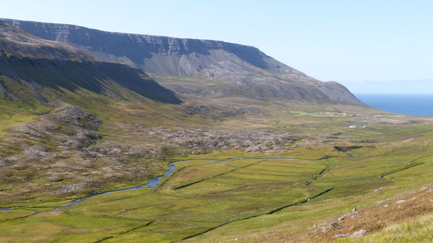 Figure 3. A series of landslides in the Vatnadalur valley, north-western Iceland (Photo A. Decaulne).
Francois Costard (GEOPS laboratory, Orsay University, France) and Emmanuèle Gautier (LGP laboratory, Meudon, France) in collaboration with F A. Fedorov and P. Konstantinov (Permafrost Institute of Yakutsk) have continued their research on the impact of the breakup on the erosional process on the head of several fluvial islands from one of the largest Arctic fluvial systems – the Lena River (Yakutia). The purpose of this work was to evaluate the role of the thermal erosion during ice breakups of the Lena River. In 2008-2011, a 4-years observation program was initiated to quantify the relative influence of fluvial thermal erosion during the ice breakup of the Lena River. During the initial stage of the ice breakup, ice pushes into riverbanks and produces huge accumulations of sediment that protect the island head against the mechanical and thermal effects of the river flow. That initial stage is relatively short, and occurs within a few days period. In a second phase after the fluvial ice thawing, the island heads are ice-free. In the case of high water levels, the flood, in permanent contact with the frozen riverbank, undergoes efficient thermal and mechanical erosion, sometime through the fall season during a secondary discharge peak. The careful analysis of the annual data shows a high variability of the erosion rate, mostly due to the variability of the duration and timing of the flood season. The heads of islands undergo strong erosion with mean values of 12 m per year and maximal values reaching 40 m. All these results were recently published in PPP Vol. 25, Issue 3, pp. 162-171.
As observed in most regions in the Arctic, the thawing of ice-rich permafrost (thermokarst) is increasing in Central Yakutia (Eastern Siberia). However, the relationship between thermokarst development and climate variations is not well understood in this area. In order to understand the current thermokarst dynamics in Central Yakutia, Antoine Sejourné (GEOPS laboratory, Orsay, France) in collaboration with A. Fedorov (Permafrost Institute of Yakutsk) studied the bank degradation of thermokarst lakes in Central Yakutia due to permafrost thaw. The retrogressive thaw slumps (figure 4) and highly degraded ice-wedge polygons (baydjarakhs) were analyzed, using 2011-2013 high resolution satellite image time series and field studies. The retrogressive thaw slump activity results in the formation of thermocirque with an average headwall retreat ranging from 0.5 to 3.16 m/year. The thermocirques and the baydjarakhs are statistically more concentrated on the south- to southwest-facing banks of thermokarst lakes. Their development and this statistical distribution indicate a control of the current permafrost thaw on the banks of thermokarst lakes by insolation. In the context of recent air temperature increase in Central Yakutia, the rate of thermocirque development may increase in the future.
 Figure 4. Thermocirques in Central Yakutia (Photo A. Sejourne, 2014).
During past years, Christophe Grenier, Nicolas Roux, Emmanuel Mouche from LSCE Gif sur Yvette, France) has been developing activities in numerical modeling for permafrost issues involving coupled thermal transfer with water flow in the Cast3M code (www-cast3m.cea.fr). This modeling activity was complemented by laboratory experiments and field work involving collaborations with François Costard at GEOPS (Univ. Paris Sud, Orsay, formerly IDES Lab.) and the Permafrost Institute in Yakutsk (Yakutia, Russia). The topic studied in the PhD work of Nicolas Roux concerns the evolution of the river’s taliks in the context of climate change with an approach combining numerical simulation, analogical experiments in cold room and field study in Yakutia. The field study focuses on the evolution of the soil – river continuum in an Alas valley in Yakutia. The site was equipped in 2012 with thermal, hydrological & hydrogeological sensors and the water properties and isotopic signatures were monitored. The second year of data was obtained during September 2014 field study. The inter-annual variability appeared strong, mainly due to a warmer winter for the second year of monitoring. The second river transect of measurements was reinforced and will be completed in April 2015. The next campaign in September 2015 will then provide a third year and hopefully a full transect monitoring of the river and ground thermal field evolution (from below the river to the sides of the valley). A paper with the main results associated with the present knowledge is under preparation. The experimental study in cold room at GEOPS addresses the same issue of river – soil interaction considering a channel with a “river” flowing on a frozen porous medium. The first objective is to identify the main controlling parameters for the progression of the 0°C isotherm into the frozen material based on thermal monitoring of the system. The second objective is to simulate the experiment with Cast3M code and identify the appropriate boundary conditions, parameters and finally validate the code for such purposes.
Another line of action concerns the development of coupled Thermo-Hydrological codes. While a larger amount of publications appears on such issues, the resolution of such a coupled non-linear system with phase change still remains a difficult issue. LSCE has proposed and launched a TH code inter-comparison exercise to 1°) evaluate and validate codes by means of inter-comparison on test cases and experimental studies, and 2°) create a research community around such issues to exchange and improve codes in view of more realistic system simulations. The kick off meeting of the INTERFROST benchmark took place in Paris on the 18th and 19th of November (figure 5) with researchers from the US, Canada, Sweden, Germany, France involving 13 simulation codes (see Picture below). The associated experiments at GEOPS were also visited. The group agreed on running the T1 and TH1 test cases as base cases (analytical solutions) and run to the TH2 and TH3 cases for inter-comparison. The next meeting is planned for the first half of April 2014 where the results will be provided by the participants for comparison. More information on test cases, actions, milestones and participants can be found on the INTERFROST web site (https://wiki.lsce.ipsl.fr/interfrost).
 Figure 5. INTERFROST benchmark meeting in Paris on the 18th and 19th of November 2014.
Report prepared by François Costard ( francois.costard@u-psud.fr)
Germany
Reports from Potsdam (AWI, GFZ)
Many permafrost research teams used the new Research Station Samoylov Island, operated by the Trofimuk Institute of Petroleum Geology and Geophysics, Siberian Branch of the Russian Academy of Science, during spring, summer, and fall covering several disciplines and topics. These included carbon storage and turnover, trace gas emissions, permafrost degradation by thermokarst and thermal erosion, surface subsidence, water and energy balance, and long term observational studies. Contact: Anne.Morgenstern@awi.de, Julia.boike@awi.de
2014 was the third expedition of the Helmholtz Young Investigator Group led by Hugues Lantuit at the AWI (COPER, Coastal Permafrost erosion, organic carbon and nutrient release to the Arctic nearshore zone). The expedition was the ninth official expedition of the AWI in the area and took place from July 16 until August 24 on Herschel Island (NW Canada). The expedition was cooperation between the AWI (H. Lantuit), the Geological Survey of Canada (G. Manson), the University of Edinburgh (I. Myers-Smith), Queen’s University (S. Lamoureux) and Virginia Tech (N. Stark). A weather station and a monitoring flume, already used in 2010, 2011, 2012, and 2013 were deployed at the outlet of a retrogressive thaw slump to monitor water and sediment discharge over several weeks in the field. The flume was relocated to a catchment located close to camp, where discharge monitoring will be performed to match measurements performed by Queen’s University at the Cape Bounty camp site (S. Lamoureux). Additionally, water samples were taken to characterize the geochemical composition of the water. In the catchments to be monitored, extensive active layer sampling for organic matter characterization was conducted (as well as permafrost coring). Additionally, vegetation surveys were conducted by I. Myers-Smith to help characterize the role of shrub growth on the ground thermal regime. To support these investigations, four shallow ground temperature measurement stations were installed. These will be reported to the Global Terrestrial Network for Permafrost (GTN-P). The boat of the AWI, the FS “Christine” was used as a platform to conduct sampling of the seafloor, testing of the sediment geotechnical properties (N. Stark), as well as geochemical water sampling in the nearshore zone. In cooperation with the Geological Survey of Canada (G. Manson), three devices were setup and later successfully retrieved around Herschel Island to monitor water level, and currents in three dimensions. Contact: Hugues.Lantuit@awi.de
The German-Russian project Arctic Ecological network (Arc-EcoNet) led by Sebastian Wetterich at AWI Potsdam and funded by the German Federal Ministry of Education and Research (BMBF) started in September 2014. The project aims in the upcoming 2 years to study the biological inventory of modern permafrost-affected landscapes and further to reconstruct palaeoenvironments using the fossil floral and faunal content of the late Pleistocene and Holocene permafrost archive. Contact: Sebastian.Wetterich@awi.de
Within the ERC project PETA-CARB (Rapid Permafrost Thaw in a Warming Arctic and Impacts on the Soil Organic Carbon Pool) led by G. Grosse, several field campaigns were conducted by the enlarged team of J. Lenz, F. Günther, I. Nitze, and M. Fuchs. In April, a joint snowmobile expedition with PETA-CARB participation together with US-based colleagues from UAF and USGS in the NSF CALON project led a four person team for three weeks through about 1400 km of Arctic tundra on the Alaska Northslope to sample thermokarst lakes, readout environmental dataloggers, and drill permafrost cores in drained thermokarst lake basins. In August, PETA-CARB participated in floatplane and helicopter-based sampling of thermokarst lakes together with the NSF CALON team, as well as coring of lakes and drained lake basins on the Alaska Northslope. At the same time a large team conducted field work for nearly four weeks on Sobo-Sise Island in the eastern Lena Delta and on the Bykovsky Peninsula to study past and current thermokarst landscape dynamics and soil carbon pools. The expedition was jointly organized and conducted with Russian colleagues from AARI St. Petersburg and PI Yakutsk investigating coastal erosion, permafrost, landscape, limnological, and hydrological dynamics as well as with other AWI colleagues investigating carbon pools in permafrost (J. Strauss), ground ice characteristics for paleoclimate reconstruction (T. Opel), and thermo-erosion processes (A. Morgenstern). Several temperature data loggers were installed in shallow boreholes in ice-rich permafrost and in thermokarst ponds. Sampling of near surface soil organic carbon was done along transects and permafrost thaw survey grids were instrumented with reference markers. Contact:guido.grosse@awi.de
Funded by the German Ministry of Education and Research (BMBF) the new CarboPerm project successfully started in the end of 2013. An excellent kick-off-meeting held in March 2014 in St. Petersburg led to creation of great cross-work package-cooperation. Two successful expeditions to Bol’shoy Lyakhovsky Island in the eastern Laptev Sea provided four frozen cores with a total length of 52 m of high quality material for further investigations. Additionally, a temperature chain was installed in one of the boreholes. Intensive geophysical investigations allowed a three dimensional image of the permafrost distribution. The coring of the channels of the Lena River Delta provided three high quality cores with a total of 24 m for further analyses by the measuring work packages. Further expeditions in summer delivered first insights into the different carbon quality transported by the channels of the Lena River Delta as well as carbon distribution within the Laptev Sea. At the study site in Chersky the effect of drainage on greenhouse gases and the global warming potential were investigated. On Samoylov Island in the Lena Delta an effect of high temperatures on summer CH4 fluxes was observed. Analyses and incubation experiments on one core showed that the quality of organic matter differ with depth (0-18 m). However, deep permafrost sequences were characterised by an increased amount of microbial communities and the microbial organic matter turnover. The data provided by the measuring work packages were used to improve the model outcomes. JSBACH model products showing the distributions and maximum depth of the active layer as well as the distribution of carbon density in the circumpolar regions are in preparation. Contact: sebastian.zubrzycki@uni-hamburg.de
Now in its third year, the Helmholtz Young Investigator Group TEAM (Trace Gas Exchange in the Earth-Atmosphere System on Multiple Scales) led by Torsten Sachs (GFZ) joined three AWI expeditions to the Lena River Delta. In April, together with colleagues at AWI, a floating eddy covariance system was set up on a thaw lake to study the seasonal dynamics of the heat, carbon dioxide, and methane exchange between the lake and the atmosphere. Additionally, methane contained within the ice cover of lakes and ponds was sampled. The main focus was on airborne measurements using the helicopter-towed “Helipod” system to quantify the regional fluxes of heat, water vapor, carbon dioxide and methane throughout the entire Lena Delta. Two flights in April characterized the winter background fluxes, followed by three flights in early June during the break-up of the Lena River and the lake ice cover, as well two more flights towards the end of the growing season in mid-August. Contact: torsten.sachs@gfz-potsdam.de
2014 was the first year of the Helmholtz International Research Group ArcBiont investigating microbial communities that are associated with Arctic peat mosses with a focus on the microbial carbon- and nitrogen cycle. AcrBiont is a bilateral collaboration between the Arctic University of Norway (UiT) and the German Research Centre for Geosciences GFZ Potsdam. In collaboration with the AWI in Potsdam, and with Norwegian financial support through the Arctic field grant extensive fieldwork and sampling was carried out between July and September 2014 in three different permafrost-affected study sites: Lena Delta/Siberia, Ny-Ålesund /Spitsbergen and Finnmark/northern Norway. Contact: sliebner@gfz-potsdam.de
2014 was the second year of the Helmholtz Young Investigators Research Group MicroCene (Microbial Communities of Terrestrial Pleistocene and Holocene Deposits) focusing on the microbial carbon cycle in subsurface peat and permafrost environments, its reconstruction and present influence of surface greenhouse gas fluxes. In 2014, two subsea permafrost cores from the Laptev Sea Shelf during the expeditions “Buor Khaya 2012” and “COAST 1 2005”, both retrieved under the umbrella of the AWI in Potsdam, were analyzed for microbial abundance and functional diversity with a focus on discriminating between intact (active) cells and free DNA. Contact: sliebner@gfz-potsdam.de
News from German universities
University of Giessen
At the University of Giessen, Stephan Imbery and Murataly Duishonakunow finished their PhD studies on Permafrost distribution and dynamics in the Chinese and Kyrgyz Tianshan, respectively. The two dissertations are published online in the Giessen University Library (GEB). Contact: Lorenz.King@geogr.uni-giessen.de
University of Cologne
The group of Janet Rethemeyer at University of Cologne continued its investigations of organic carbon dynamics in the polygonal tundra soils of the Lena-Delta (Siberia) using lipid biomarker and radiocarbon analyses. While the group’s previous expeditions into the Siberian Lena Delta focused on the turnover and storage of organic matter in the active layer, this year’s expedition had the goal to obtain information on the export of dissolved (DOC) and particulate organic carbon (POC) from the polygonal tundra soils into the Lena River. To obtain a comprehensive view on the export of DOC and POC different sites in the Delta were sampled at different times, i.e. at the beginning and end of the summer season. Two PhD students (Stephan John and Matthias Thienemann) carried out the fieldwork from July until September 2014 while being based at the new Samoylov Island Research Station. Samples were obtained from soil pore water and from discharge channels of Kurungnakh and Samoylov Islands draining into the Lena River. In a broader context, this year’s sampling strategy complements the efforts of Gesine Mollenhauer’s group at AWI Bremerhaven studying DOC and POC discharge within the Lena River and into the Laptev Sea. The samples will be analyzed by Silke Höfle as part of the German-Russian research project “CarboPerm” funded by the German Ministry of Education and Research (BMBF).
Senckenberg Research Station of Quaternary Palaeontology Weimar
Combining approaches of modern and palaeo-ecology, a new DFG funded project, named TUNDRA-STEPPE, started in June 2014 in cooperation of the Senckenberg Research Station of Quaternary Palaeontology Weimar (F. Kienast) and the Senckenberg Natural History Museum Görlitz (K. Wesche). The project aims at a better understanding of the restructuring of terrestrial ecosystems in Northern Yakutia at the transition from the last cold stage to the Holocene in relation to global climate change and megafaunal demise. For that, the response of modern vegetation on grazing in different intensities is recorded along a transect from northern taiga to tundra as well as in relict steppes in the continental part of Northern Yakutia. The results are compared with Late Quaternary vegetation changes that are to be reconstructed using plant macrofossils preserved in syngenetic permafrost deposits in the Yana Highlands- the most continental part and in Duvanny Yar at the lower Kolyma in the now more oceanic East of Yakutia. The reconstructed succession in vegetation development will then be related to the gradual extinction of large herbivores and to global climate evolution. Contact:Frank.Kienast@senckenberg.de
University of Leipzig
During the second year of the Postdoc project “Short and long-term thermokarst dynamics due to climate changes and human impacts in Central Yakutia, Siberia” lead by Mathias Ulrich (University of Leipzig, Institute for Geography) field work was conducted at our two thermokarst key sites in the Lena-Aldan-Amga region east of Yakutsk together with Russian scientist from the Melnikov Permafrost Institute and the Institute for Biological Problems of the Cryolithozone in Yakutsk. At both sites, the field work included detailed botanical and soil surveys, bathymetrical measurements of thermokarst and alas lakes, geodetic measurements of alas topography as well as readout of environmental dataloggers. Additionally, as part of a Master thesis, field spectral measurements of different alas vegetation zones were conducted using an ASD FieldSpec 4 Wide-Res Spectroradiometer. This will guide the validation of remote sensing data and the characterization and classification of ecological gradients in alas basins. A second Master thesis was established in the project, which is dealing with the reconstruction of Holocene permafrost degradation processes, their influencing factors and environmental impacts by multi-proxy analysis of sediment data cored and sampled in summer 2013. Contact:Mathias.Ulrich@uni-leipzig.de
University of Hamburg
Together with a steering group from USA, Russia, and Japan, Mathias Ulrich and J. Otto Habeck (University of Hamburg, Institute for Ethnology) established the IPA Action Group “Permafrost and Culture (PaC): Integrating environmental, geo-, and social sciences to assess permafrost dynamics and indigenous land use”. Contact: Mathias.Ulrich@uni-leipzig.de,otto.habeck@uni-hamburg.de
Leibniz University Hannover
At Leibniz Universität Hannover, Institute of Soil Science, the research group of Georg Guggenberger focused on composition of organic matter and its stabilization mechanisms in permafrost soils. The activity within the CryoCARB project (http://www.univie.ac.at/cryocarb/) founded by German Ministry of Education and Research (BMBF) passed the final stage. Within this project, the working group of Robert Mikutta, Olga Shibistova and the two PhD students Norman Gentsch and Thao Thi Dao focused on transformation and turnover of different soil organic matter pools by applying physical fractionation, biomarker analysis, isotope techniques, mineralization experiments and analysis on the mineral assemblage. Soil samples from the East, Central, and West Siberian Arctic provide insights on pool sizes, composition and organo-mineral interactions in cryoturbated permafrost soils. The second project “IGARKA” (founded by DFG) focused on storage of organic matter in soil aggregates of different size classes under different permafrost impact. The second field campaign was carried out during the summer 2014 in the little Grawijka Creek catchment, a forest tundra ecotone near Igarka, Central Siberia. Currently, the soil samples are processed by the project coordinator Leopold Sauheitl and the PhD student Ina Haase. Another project activity of the team concerned the establishment of the Laboratory of Ecophysiology of Permafrost Systems (PerSyst) at the VN Sukachev Institute of Forest with Georg Guggenberger as the leading scientist. (http://forest.akadem.ru/PerSyst/). This project is funded by the Russian Ministry of Science and Education and aims at the assessment of the response of Siberian permafrost ecosystems on climate change with respect to soil organic carbon stocks and carbon emissions from cryogenic soils. Focus is given on the so far less studied permafrost soils of the Taiga. Contact: guggenberger@ifbk.uni-hannover.de
University of Würzburg
At the University of Würzburg, a new research project led by Christof Kneisel started in July 2014. The three-dimensional internal structure and characteristics of different periglacial permafrost-affected landforms will be investigated within this project (funded by the German Research Foundation, DFG). The research approach is based on the assessment of heterogeneities in surface (terrain parameters, texture, ground surface temperatures, snow cover) and subsurface parameters (structure, frost table configuration, ground ice characteristics, ground temperature and moisture) and to correlate these with subsurface hydrological and geomorphic process dynamics. Two boreholes were drilled and instrumented with temperature loggers, additionally combined temperature and soil moisture sensors were installed at six sites in the eastern Swiss Alps at different altitudes. Adrian Emmert has started his PhD within the framework of this project and has mapped subsurface heterogeneities of different geomorphic landforms through the application of minimal-invasive 3D electrical resistivity imaging. Contact: kneisel@uni-wuerzburg.de
Technical University of Munich
The Permafrost Group at the Technical University of Munich organized within the Chair of Landslide Research (Prof. Michael Krautblatter, Dr. Kerry Leith) (http://www.landslides.geo.tum.de/news/) enhanced its research at the Zugspitze (2962 m asl, highest peak of Germany) where a new cable car station is planned. Two PhD candidates, Dipl. Geogr. Philip Mamot and MSc Geol (ETHZ) Sibylle Knapp started their research on “Mechanical behavior of permafrost affected rocks and their influence on rock stability at the Zugspitze” and “The mobility of rock avalanches: disintegration, entrainment and deposition” looking at the detachment zone of the historical Zugspitze rock avalanche and its 16 km² runout zone. MSc Geol. Lukas Paysen Petersen started his PhD on “Modelling progressive weakening and failure in carbonate rock slopes.”
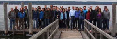 Figure 1. 7th annual meeting of the German working group on permafrost (AK Permafrost) at the Ammer Lake south of Munich with 50 researchers from Switzerland, Austria, United Kingdom, Norway, and Germany.
Shiva Pudasaini and Michael Krautblatter developed a two-phase mechanical model for rock-ice avalanches with a better representation of dynamical weakening, mass and momentum exchange between solids (rock and ice) and fluids (water) and more realistic runout lengths (http://dx.doi.org/10.1002/2014JF003183). Three other JGR-papers from the group are concerned with the feedback between tectonic stresses and glacial erosion in the Swiss Alps (http://dx.doi.org/doi/10.1002/2012JB009801, http://dx.doi.org/10.1002/2012JF002691) and the first attempt to apply seismic refraction tomography to reveal permafrost in solid rock faces http://dx.doi.org/doi/10.1002/2012JF002638).
Members of the TUM landslide Group also organized the 7th annual meeting of the German working group on permafrost (AK Permafrost) at the Ammer Lake south of Munich. The meeting brought together 50 researchers from across Europe (Switzerland, Austria, United Kingdom, Norway, and Germany) to discuss recent research, and the outlook for future change in permafrost-affected polar and alpine environments (http://www.landslides.geo.tum.de/news/). The pre-meeting excursion to the Zugspitze permafrost outdoor lab and landscapes produced by the Late-Glacial retreat of the Isar-Loisach Glacier was led by Michael Krautblatter and Ulrich Haas. Michael Krautblatter also co-organised the 8th I.A.G./A.I.G. working group SEDIBUD meeting on the Zugspitze with a several day excursion through the Reintal with its unique record of rock mass wasting and slope failure (http://www.geomorph.org/wg/wgsb.html).
The project “Influences of Snow Cover on Thermal and Mechanic Processes in Steep Permafrost Rockwalls” applied by Michael Krautblatter (TU München) and Marcia Phillips (SLF Davos) went to its last year and PhD student Daniel Draebing (University of Bonn) finished his project-integrated thesis. In the third field season, geophysical, geotechnical and nival measurements were done and monitoring devices were maintained at Steintaelli and Gemsstock (Swiss Alps). The findings of the fieldwork were incorporated and published by Draebing, Krautblatter and Dikau in a conceptual paper on the interaction between thermal and mechanical processes in permafrost rockwalls (doi:10.1016/j.geomorph.2014.08.009). Contact: Daniel Draebing, daniel.draebing@gmx.de
University of Bonn
The group of Richard Dikau (R. Dikau, D. Draebing, J. Eichel, K. Messenzehl) of the University of Bonn continued their fieldwork in the Turtmann Valley and organized the 2nd geomorphological workshop „Turtmann-Talks” in summer 2014. PhD student Karoline Messenzehl focuses her research on spatial and temporal activity of rock slope instability and rockfall processes in alpine geomorphic systems financed by the Humboldt-Ritter-Penck-Foundation by the Gesellschaft für Erdkunde zu Berlin and the British Society for Geomorphology. In summer 2014, a combination of geophysical, geotechnical and geomorphological methods were used to investigate rockwalls and scree slopes in the Turtmann Valley. Contact: Karoline Messenzehl, k.messenzehl@uni-bonn.de
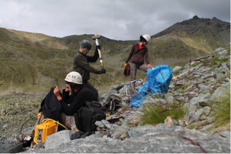 Figure 2. Refraction seismic measurement at a scree slope in the Turtmann Valley (photo by A. Ewald).
Just recently, the BIMODAL proposal (‘Biogeomorphic dynamics on lateral moraines in the Turtmann glacier forefield, Switzerland’) was successfully granted by the German Research Foundation. BIMODAL with PhD student Jana Eichel (supervised by R. Dikau und S. Schmidtlein, Karlsruhe Institute of Technology) focuses on the feedbacks between geomorphic and vegetation dynamics on alpine lateral moraines. Its main objective is to understand how small-scale interactions between plant species and geomorphic processes produce larger scale vegetation and geomorphic patterns. This also includes the investigation of interactions between plants and solifluction processes. The conceptual approach of the research was honored with the 2014 PYRN-IPA Award for outstanding poster presentation at the EUCOP 2014. Detailed geomorphological, botanical and geophysical field investigations were conducted this summer 2014 financed by the Hohmann-grant of the Gesellschaft für Erdkunde zu Köln and the Humboldt-Ritter-Penck-Foundation by the Gesellschaft für Erdkunde zu Berlin. In cooperation with C. Eling, L. Klingbeil and M. Wieland (Institute of Geodesy and Geoinformation, University of Bonn), high-resolution aerial imagery for vegetation and terrain analysis was captured in an octocopter mission. Contact: Jana Eichel, j.eichel@uni-bonn.de
 Figure 3. Octocopter measurement of an high-resolution aerial imagery in the Turtmann Glacier forefield (photo by J. Eichel).
The project ISPR (Influences of Snow Cover on Thermal and Mechanic Processes in Steep Permafrost Rockwalls) applied by Michael Krautblatter (TU München) and Marcia Phillips (SLF Davos) went to its last year and PhD student Daniel Draebing (University of Bonn) finished his project-integrated thesis. In the third field season, geophysical, geotechnical and nival measurements were done and monitoring devices were maintained at Steintaelli and Gemsstock (Swiss Alps). The findings of the fieldwork were incorporated and published by Draebing, Krautblatter and Dikau in a conceptual paper on the interaction between thermal and mechanical processes in permafrost rockwalls (doi:10.1016/j.geomorph.2014.08.009). Contact: daniel.draebing@gmx.de
Report prepared by Michael Krautblatter ( m.krautblatter@tum.de)
Iceland
Arctic Portal
In April 2014, the new Global Terrestrial Network for Permafrost (GTN-P) website has been launched along with its web-based Data Management System (DMS) – gtnp.org & gtnpdatabase.org. They are hosted at Arctic Portal, Akureyri, north Iceland, and designed in collaboration with the Arctic Portal team, the GTN-P, the International Permafrost Association (IPA) and within the framework of the Changing Permafrost in the Arctic and its Global Effect on 21st Century (Page21) European 7th Framework project and its partners. The GTN-P DMS offers a standardized repository for permafrost temperature and active layer thawing thickness metadata and times series. Researchers can create, upload, edit, visualize and download standardized datasets, metadata forms, charts and statistics. Tools are further developed to provide data processing, analysis capabilities and data quality control and assurance. The end of the distribution chain delivers, for the first time, highly structured global datasets for permafrost temperature and active layer thawing thickness in NetCDF files, format developed by UNIDATA and used by climate modellers. The horizon of the Page21 project is November 2015 but local funding are sought in order to secure the future of the GTN-P DMS and a full position for data manager of this global network in Iceland.
4 boreholes for Iceland are recorded into the GTN-P database and under the responsibility of Bernd Etzelmuller from the University of Oslo – Hagöngur, Gagnheidi, Saudafell near Snæfell, Vopnafjörður mountains. At present the boreholes have loggers only close to the surface and at the bottom. A plan for installing good loggers is waiting the opportunity of a new funding. However discussions are made in order to include the Icelandic permafrost temperature time series to the GTN-P DMS and to the global dataset in NetCDF. ( jean@acticportal.org)
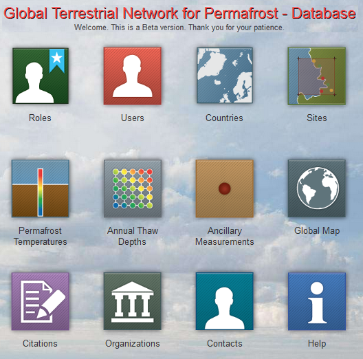
Figure 1. Global Terrestrial Network for Permafrost Data Management System.
 Figure 2. GTN-P DMS online visualization of a permafrost temperature profile.
Agricultural University of Iceland
Olafur Arnalds publishes, in 2014, a new book “the Soil of Iceland” in the World Soils Book Series, Springer. The Chapter 10 is dedicated to the Frost and the soil environment of Iceland. ( oa@lbhi.is)
The Faculty of Earth Sciences, University of Iceland, the Met Office – Avalanche Centre and the Icelandic Institute of Natural History
Þorsteinn Sæmundsson, Jon Kristinn Helgason and Halldór G. Pétursson are carrying researches about the decline of mountain permafrost and the occurrence of recent large debris slides mainly in the Tröllaskagi peninsula in central north Iceland. Recent studies of widespread palsas in the Þjórsárver region, south of Hofjökull and in the Orravatnsrústir region, north of Hofjökull in central Iceland give clear indications of decreasing of premafrost during the last decade. They presented their research at the EGU General Assembly 2014. ( steinis@hi.is, jonkr@vedur.is, hgp@ni.is)
Report prepared by Jean-Pierre Lanckman ( jean@arcticportal.org)
Italy
The Italian research in the permafrost and periglacial environments was focused on the entire Alpine arch and in the Antarctic region.
Eastern Alps
Arabba Avalanche Center (Anselmo Cagnati, Andrea Crepaz) continued to monitor the periglacial environment of Piz Boè, in Veneto region, at an altitude of 2900 m a.s.l..
AWS, thermistors chain and GST monitoring network (20 i-Buttons) worked in the area of Piz Boè. In late Spring 2014 snowpack was about 300 cm high and melted very slowly until July (as 2013), influencing partly summer near-surface temperatures. Nevertheless borehole data showed a continuous increasing trend in the lower part.
A research on permafrost distribution in Veneto Region, simulated by Alpine 3D Model (together with Slf Davos – Walter Steinkogler, Mathias Bavey, Michael Lehning – and University of Zurich – Ingo Völksch) and verified by borehole data, has been undertaken and the results are under evaluation.
Topographic survey has been repeated on the rock glaciers in September (forth year).
During Summer 2014 water samples have been collected (ARPAV and Institute for the Dynamics of Environmental Processes – CNR, Venice – Carlo Barbante, Jacopo Gabrieli) every two weeks in the inlet spring. The shallow lake (Lech Dlacé) was completely covered by snow during the summer. Water discharge, temperature and conductivity have been determined continuously by an immersed probe near V-shaped weir.
All the samples will be analysed for pH, conductivity, major ions, trace elements, heavy metals, rare earth elements (REE) and stable isotopes (δD, δ18O).
 Figure 1. Lech Dlacé (Piz Boè area, Eastern Alps) was completely covered by snow during the summer.
Central Alps
The main activities in South Tyrol have been carried out by the Provincial Office for Geology and Building materials testing (V. Mair, K. Lang, D. Tonidandel), Autonomous Province of Bolzano. All the permafrost monitoring stations, which were installed during the Alpine Space project PermaNET, during the Interreg IV Italy-Austria project permaqua and during the Ortles Ice Core project are operant and are still collecting data. During the 2014 several water analysis were carried out in the permafrost areas. The duration of the ongoing Project Permaqua was extended until March 2015.
The following institutions are currently working on permafrost and periglacial environments in Trentino and in the Mount Ortles area:
– University of Padova, Department of Geosciences and Department of Land, Environment, Agriculture and Forestry (G. Dalla Fontana, A. Bondesan, A. Carton, L. Carturan, T. Zanoner, G. Zuecco);
– University of Pavia, Department of Earth and Environmental Sciences (R. Seppi);
– Autonomous Province of Trento, Geological Service (S. Cocco, M. Zumiani);
– Autonomous Province of Bolzano, Geological Service (V. Mair, D. Tonidandel) and Hydrographic Office (R. Dinale);
– Ohio State University, Byrd Polar Research Center (P. Gabrielli)
The activities carried out during 2014 continued those initiated in previous years, mainly in the framework of the MIUR project (PRIN 2010–2011) “Response of morphoclimatic system dynamics to global changes and related geomorphological hazards”, which involves the universities of Padova and Pavia. In addition, other activities were promoted by the Geological Survey of the Autonomous Province of Trento in collaboration with the universities of Pavia and Padova. In the Mount Ortles area, permafrost investigations were carried out by the Geological Office of the Autonomous Province of Bolzano and the University of Pavia, in collaboration with the University of Padova. These activities are part of an international project on the cryosphere of Mount Ortles coordinated by the Ohio State University and the Hydrographic Office of the Autonomous Province of Bolzano.
In Val de la Mare (Ortles-Cevedale massif), GST measurements from monitoring sites located on bedrock and various landforms (active and inactive rock glaciers, scree slopes, glacial deposits) were continued, along with hydrological investigations in a small permafrost-dominated catchment.
The surface displacement of two active rock glaciers in the Adamello-Presanella massif, in progress since 2001, was measured also in 2014, along with GST measurements which are carried out since 2004. On these rock glaciers, the first data from the monitoring stations installed in 2013 for measuring the snow cover thickness and the air and ground temperature were retrieved. The two stations were repaired after the damage suffered by the heavy snowfall of the winter 2013/2014.
In the Dolomites, surface displacement and ground surface temperature measurements continued on a composite landform located in Val San Nicolò, in order to understand the current processes driving its evolution. In addition, the preliminary data on snow cover evolution were retrieved from the monitoring station installed in the previous year. This monitoring station was also repaired after the damages caused by the exceptionally heavy snowfall of winter 2013/2014.
The maintenance and the implementation of the permafrost monitoring stations installed in the framework of the PermaNET project (Cavaion site, Ortles Cevedale area and Lobbie Hut site, Adamello Presanella area) were carried out.
In the Mount Ortles area, the activities focused on the recovery of temperature data from several sites, including GST, temperature of rock faces at three depths (10, 30 and 55 cm from the surface), and englacial temperature of the Alto dell’Ortles glacier and of a small ice-cap located on the “Hintergrat” ridge of Mount Ortles.
 Figure 2. Monitoring station at the Amola rock glacier (Adamello-Presanella massif)
Western Alps
In the Valle d’Aosta and Piemonte Region, the monitoring and study of permafrost phenomena in the year 2014 have been carried out by the following institutions:
– The Regional Agency for Environmental Protection – ARPA VdA (www.arpa.vda.it)
– University of Turin – DST (www.unito.it/dst)
– University of Turin – NATRISK (LNSA and geoSITLab) (www.natrisk.org)
– Politecnico di Torino – DIATI (http://www.polito.it/ateneo/dipartimenti/diati/)
– National Research Council (Brugherio, MB)- CNR-IRSA (http:// www.irsa.cnr.it/)
ARPA VdA (E. Cremonese, U. Morra di Cella, P. Pogliotti) has implemented the permafrost monitoring network of Valle d’Aosta with 5 new boreholes. The first 2 boreholes have been drilled on an active rock glacier in Valtournenche. These boreholes will provide temperature and deformation data as complementary measures to GPS and UAV photogrammetry used for studying the surface dynamics over time (in collaboration with University of Fribourg, Switzerland). On Matterhorn, 3 new boreholes have been drilled on south and west faces of the Lyon Ridge at 3800 m of elevation. These boreholes will help to quantify the thermal effect of snow cover on deep and surface temperature in steep rockwalls.
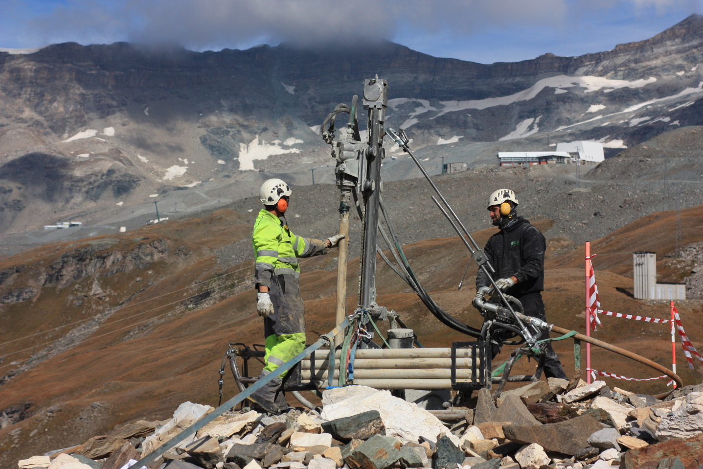 Figure 3. Drilling boreholes on the Rock Glacier of Gran Sommetta (Valtournenche, Valle d’Aosta).
DIATI Politecnico di Torino (A. Godio, D.Franco) is working, jointly with FondMS, NatRisk and University of VdA, MonteRosa Ski on a research program to estimate physical properties of snow in relation with snow-gliding phenonema. POLITO is testing electromagnetic sensors for humidity and density of snow; algoritms to convert electromagnetic data in snow properties have been developped. Polito is working, jointly with ARPA VdA, on processing of georadar data, collected on some glaciers by helicopter (Gran Etrét and Timorion), to estimate ice depth and volume by integrating geophysical and geomatic data. A thesis on Monitoring of Humidity and Density of Snow by Water Content Reflectometry has been discussed in the frame of Master of Science in Environmental Engineering at Politecnico di Torino.
NATRISK-LNSA (M. Freppaz, D. Godone, D. Said Pullicino, M. Martin, R. Gorra, I. Mania), NATRISK-GeoSITLab (M. Giardino, L. Perotti, S. Fratianni, N. Colombo, D. Guenzi), DIATI (D. Franco, L. Sambuelli), DST (C. Colombero, C. Comina) and CNR IRSA (F. Salerno, R. Balestrini, G. Viviano) are monitoring the climate change-permafrost relationships, in a test site, included into the LTER (Long Term Ecological Research) network, located in the Col d’Olen area. In particular, the working group is focused on the quantification of climatic parameter impacts on chemical and physical features of permafrost meltwater, deriving from an active rock glacier and other contributing sources. Moreover, an innovative, low cost, data transmission system for remote areas, based on smartphone devices, is under testing.
NATRISK-GeoSITLab (M. Giardino, L. Perotti, M. Palomba, S.Bertotto, C. Viani). The update and digitalization of photo and aerial photo archives of periglacial areas in Piemonte region and Valle d’Aosta Regions have been completed for creating a database of glacial lakes distribution (in collaboration with Comitato Glaciologico Italiano and CNR-IRPI Torino). A Ph.D thesis has been completed (S. Bertotto) and a new Ph.D project started (C. Viani). In the framework of the IAG-WG on Landform Evaluation for Geodiversity Studies, the “dynamic” geodiversity of glacial and periglacial environments of the Western alps has been analyzed.
Arpa Piemonte (Dept. “Geology and Natural Hazards”, Ref. Luca Paro), with the contribution of Insubriae University (Mauro Guglielmin), continued the activities developed during the European project “PermaNet” finished in September 2011. Since 2010, all the activities are included in a specific institutional topic named B3.19 “Permafrost monitoring” and new activities and collaborations have been carried out on the Piedmont Alps.
Synthetically, during the 2014 Arpa Piemonte carried out the following activities:
– Management of the regional network for permafrost monitoring. Maintenance of the permafrost monitoring stations in Piedmont Alps (changing batteries, data downloading, improving structure waterproofing, solar panels installations) and complete recovering of all monitoring sites damaged last years by water infiltration (details in the photo-report at the webpage http://www.arpa.piemonte.it/approfondimenti/temi-ambientali/geologia-e-dissesto/monitoraggio/monitoraggio-permafrost/report_11_2013). Analysis of monitoring data from 6 stations (for a total of 4 boreholes 30 m deep, 2 boreholes 5 m deep, 1 borehole 10 m deep and 1 borehole 100 m deep).
– Management of GST monitoring sites. Maintenance of the GST sites installed in 2013 (22 thermistors in 4 sites: Sabbione Lake basin – Lepontine Alps, della Capra Gl. – Graiae Alps, Sommeiller Pass, Mt. Rocciamelone – Cottian Alps) and new GST installations in Sabbione lake basin and Mt. Rocciamelone. In the latter, 4 thermistors have been installed in fractures monitored by extensimeter in order to study the relationships between ground temperature and bedrock deformation.
– Surveys. BTS surveys in different sites of Piedmont Alps (Salati Pass – Pennine Alps, La Colletta Pass and Sommeiller Pass – Cottian Alps) in order to evaluate the permafrost distribution and to validate empirical and physical models. Analysis of geophysical data (electrical tomography) collected during ERT 2013 survey at the glacial-periglacial site (della Capra Gl., Graiae Alps) aimed to analyze permafrost evolution in a rock glacier-moraine system (with the contribution of Roberto Gambillara, Insubriae University). Cave survey in Maritime Alps finalized to observe ice presence and cryotic conditions in natural underground sites. Thermal imagery analysis in different sites through infrared camera in fractures of bedrock and in debris accumulations in high alpine sites.

Figure 4. BTS and snow depth measurements at the Salati Pass (3050 m asl, Pennine Alps). Mt Rosa in the background.

Figure 5. BTS measurements at the Colletta Pass (2880 m asl, Cottian Alps).
– Alpine watersprings project. In the framework of the ARPA Piemonte activities, as environmental regional agency, it has been developed an inner project about alpine springs, voted to analyze the role as sentinel ecosystems of springs in relation to global change. Main activities concern, among others, data collection useful for the evaluation of the hydrosphere-lithosphere-biosphere relationships and of the climate change effects on high altitude spring ecosystems. During the 2014, 7 sites have been analyzed and measured in Piedmont Alps over 2000 m of altitude, and 1 of these (Maira Valley – Cottian Alps, near permafrost monitoring station of the Gardetta Pass) was subjected to monitoring (2 thermistors for air and water temperature) in order to evaluate aquifers in permafrost conditions
– Model implementation. Elaboration and development of the PERMACLIM plug-in for openGIS application (QuantumGIS, http://hub.qgis.org/projects/permaclim) based on the physical simplified model PERMACLIM (Guglielmin et al., 2003) for the potential permafrost distribution (in collaboration with Earth Sciences and Physical Depts., Torino University). In the framework of a graduation thesis (collaboration between Arpa Piemonte and Torino University, graduate: Maria Provenzale; tutor: Claudio Cassardo; co-tutor: Luca Paro and Christian Ronchi) an analysis of the thermodynamic fluxes among ground surface, snow and atmosphere has been carried out. In particular, during this thesis work, the PERMACLIM model implementation was completed and the model was applied in the Sabbione basin site (Lepontine Alps) using air temperature and snow height data for a time-frame 2001÷2009. For the studied period, due to its short length, it was not possible to identify a specific trend in the distribution of permafrost, and only oscillations were clearly observable. The model predictions hinted at an anti-correlation with the snow height and a strong anti-correlation with air temperature, as would indeed be expected according to the literature. The study of the correlation coefficients and of their statistical significance between these two variables also indicated that jointly considering the “probable” and “possible” permafrost probability classes addresses the existence of permafrost more precisely. A validation of the model was also performed, at the Salati Pass site (Pennine Alps), comparing modeled and measured surface temperature. Scatter plots, with their linear regressions, and correlation coefficients were calculated in order to evaluate the accuracy of the model. Initial results showed a good correlation between model predictions and measured data (high, statistically significant correlation coefficients), which indicated that the oscillation phases of the two variables are compatible, but also revealed a high model bias and an amplification of the oscillations in the model.
– Dissemination and education. Teaching activities in Schools, University and PhD School (lessons on permafrost and periglacial environment of Piedmont Alps). Popularizing activities addressed to the population, updating of institutional webpages, publication of videoclip and no-scientific articles on Arpa Piemonte’s activities on cryosphere topics and Antarctica expedition (further information at the webpage http://www.arpa.piemonte.it/approfondimenti/temi-ambientali/geologia-e-dissesto/monitoraggio/monitoraggio-permafrost/monitoraggio-permafrost).
Antarctica
The monitoring programme on the ice-wedge thermal regime conducted by Rossana Raffi (Sapienza University of Roma) has been continued at three sites in northern Victoria Land. The programme, started on 2004, is based on data-logger measurements of hourly temperatures of the air, the ground surface, ice-wedge top and ice-wedge bottom recorded by thermistors.
New thermistors were set up in boreholes at depth of 160 cm, according to standardized protocols for long term permafrost monitoring. Two thermistors were set up on January 2013 at Baker Rocks and Boomerang Glacier, and one on November 2014 at Mount Jackman.

Figure 6. Location of the ice-wedge thermometric stations. MZS: Mario Zucchelli Station.
Report prepared by Adriano Ribolini ( ribolini@dst.unipi.it)
Japan
In Japan, there is now growing public concerns to the frozen ground. This is because that Japanese government proposed frozen soil wall as one of the effective ways to protect diffusion of contaminated water from Fukushima Daiichi Nuclear Power Station damaged by 2011 Tohoku earthquake and tsunami. For public enlightenment, the Subcommittee on Ground Freezing of the Japanese Society of Snow and Ice has published special document dealt with basic of frozen ground and its engineering applications.
The open-access database for historical domestic ground temperature and frost depth data in Japan has digitized data from 14 Japan Meteorological Agency stations, which are going to make open in spring 2015 (K. Saito, T. Sueyoshi of National Institute of Polar Research, K. Watanabe of Mie University and K Takeda of Obihiro University of Agriculture and Veterinary Medicine).
For stage 1 of the terrestrial research sub-project (GRENE-TEA) model intercomparison project (GTMIP) in the GRENE Arctic Climate Change Research Project, model driving data that assimilates the observation data from four sites (Fairbanks, Yakutsk, Tiksi, Kevo) are produced and made open for participants (K. Saito and S. Miyazaki of NIPR). Submission of the model outputs in November 2014, and the analysis results will be presented at ISAR-4 in Toyama, Japan, April 2015.
A. Ikeda (University of Tsukuba) and G. Iwahana (UAF) has maintained the 10 m-deep borehole on the summit of Mt. Fuji. The borehole temperatures were successfully monitored since the summer of 2011.
In Alaska, K. Harada (Miyagi University), K. Narita (Akita University) and K. Saito (JAMSTEC) have carried out researches at the Kougarok site near Nome since 2005 in order to monitor permafrost conditions after severe wildfires. K. Harada also has been conducting the project named ‘Frost tube in Japan’ since November 2011, under the collaboration with the project of ‘Permafrost Outreach Programs’ by K. Yoshikawa (WERC, INE, UAF). Frost tubes were set at 19 schools in Hokkaido area, Japan, frost depth measurement will be done by school children and teachers.
In eastern Siberia, long-term permafrost monitoring at Tiksi was conducted by Y. Iijima, H. Park, and H. Yabuki (JAMSTEC) with Russian colleague A. N. Fedorov (Permafrost Institute, Russia). Measurements of vegetation and topography change at 1×1 km CALM grid revealed increases in thermokarst depression and ponding at polygonal tundra. Regional changes in active layer thickness were measured in mid-September at monitoring sites of Spasskaya-pad, Yukechi and Churapcha (newly set up) in central Yakutia.
Report prepared by M.Ishikawa ( mishi@ees.hokudai.ac.jp)
Kyrgyzstan
Intensive field studies during the years 2010 to 2014 allowed developing the rules for the permafrost distribution in the Kyrgyz Tianshan. The results are published online in the dissertation “Glaciers and permafrost in Kyrgyzstan – distribution, recent dynamics, and relevance as water resource and hazard factor for the development of Central Asian semiarid regions” by Murataly Turganalievich Duishonakunov, currently at Kyrgyz National University of Kyrgyzstan, and CAIAG Bishkek. The project was financed by Volkswagenstiftung (LUCA project), supervised by Ryskul Usubaliev/Lorenz King and logistically supported by CAIAG Bishkek.
Studies for distribution and temperature of ground ice
For the current study we investigated frozen ground in the upstream Naryn catchments, between August 2010 and August 2013. We measured the near-surface ground temperature at 18 locations at different altitudes and slopes. The objectives of this study are to estimate the distribution of permafrost, and its active layer, and to discuss the permafrost environment in the upstream Naryn catchments. The general features of mountain permafrost such as permafrost distribution and temperatures, active layer thicknesses within the upstream Naryn catchments, Tian Shan Mountains are described. The area of permafrost studies in the Naryn basin is located within the two upstream river basins (Chon Naryn and Kichi Naryn). The mountain permafrost zone in our study area belongs to the Asian mountain permafrost area, the largest in the world.
In the field we used steel rods and a hammer to dig holes up to 1.5 m deep for our thermistor strings. Ground temperature measurements were carried out in 18 locations in our study area between altitudes 3007 and 4043 meters. These ground temperature measurements performed using wireless mini thermistor sensors (M-Log5W) and data sampling continues. They have a high memory capacity (2048 kB), low energy consumption and waterproof cover. The temperature sensor has a high resolution of 0.01 °C and an overall accuracy of ± 0.1 °C. This thermistor can work more than 5 years without changing batteries depending on temperature conditions of the ground. The temperature recording started in August 2010 at an hourly interval at all locations the observation period was up to end of August 2013.
The lower altitudinal limit of the sporadic permafrost in Naryn basin is as low as 2700 meters. We have data at our disposal on location of permafrost on northern slopes at altitudes between 3334 and 3756 meters (Akshyirak, Uchemchek and Sook mountain ranges), on southern slopes at altitudes between 3007 and 3875 meters (Terskey, Sook, Uchemchek, Jetim mountain ranges), on western slopes at altitudes of 3650 to 4043 meters (Akshyirak and Sook mountain ranges) and on eastern slopes at altitudes of 3781 to 3865 meters (Terskey and Sook mountain ranges). The sporadic permafrost area is increasing by the altitude; there are more and more such areas and the area of discontinuous permafrost starts somewhere near the hypsometric line of 3300 meters. Here the area with permafrost is larger than the non-permafrost area. Permafrost is wide-spread throughout, at altitudes above 3200-3400 meters we propose to regard the contour line of 3300 meters as the lower limit of discontinuous permafrost in the Upstream Naryn basin. Above 3600 m the continuous permafrost zone starts.
High mountain permafrost and periglacial landforms may contain large quantities of fresh water in the form of ice. Especially glacier moraines and rock glaciers have high ice content. Rock glaciers are ice-rich periglacial landforms, ice can occupy up to 80% of the volume.
Our data in the Kumtor catchment during 2001-2011 show (Figure 1) that the ten years average annual ground temperatures were between -0.2 °C (at the depth of 5 cm) and -1.3 °C (at the depth of 300 cm) warmer than the mean annual air temperature (-5.73 °C; MAAT). Annual average temperatures during the last ten years at the depth of 100, 150 and 300 cm never were above 0 °C. Other measurements in 18 locations during August 2010 and August 2013 show that the average annual ground temperatures at the depth of 10 cm ranged between +4.4 °C (south slope of Uchemchek mountain, 3007 m) and -4.3 °C (north slope of Sook mountain, 4043 m).
 Figure 1: Average annual ground temperature variability at the depth of 5 cm, 10 cm, 20 cm, 50 cm, 100 cm, 150 cm and 300 cm, Tian Shan meteorological station, 3659 m a.s.l., 2001-2011). Source: processed from the Tian Than Meteo data.
The data in figure 1 show that average ground temperatures at similar depths are significantly below at Tian Shan Station. Large-amplitude temperature variations are observed at Tian Shan Station and other 17 locations.
The duration of the freezing period is increased with the depth of the active layer. The number of days which daily are crossing 0 °C in Tian Shan meteostation (3659 m) at the depth of 5 cm make up 197 days, at the depth of 50 cm 219 days, at 150 cm 271 days, and at 300 cm – 365 days (average for 2001-2011; Table 1).
Table 1: Number of days with daily crossing 0°C at a depth of 5, 10, 20, 50, 100, 150 and 300 cm in the Tian Shan meteorological station (3659 m a.s.l.) from 2001 to 2011.
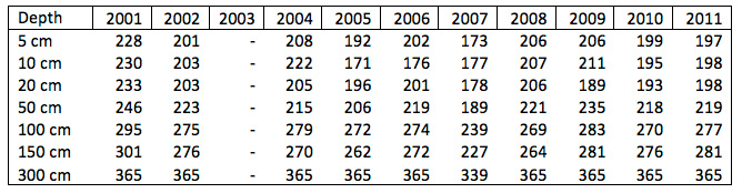
Report prepared by Ryskul Usubaliev ( r.usubaliev@caiag.kg)
Mongolia
Ground temperature had been measured in some boreholes by the 1970-1980s. Some of these boreholes were re-drilled on the same places within the establishment of permafrost network for last 5 years. In framework of national and international project and program the permafrost network with 120 boreholes has been established in Mongolia for 5-15 years. Therefore, we have a possibility to determine the changes of permafrost in Mongolia for last 30 years. As results of permafrost monitoring the permafrost warming has been registered in North and at high altitude, and the permafrost thawing has been registered in southern fringe of Mongolian permafrost regions for last 30 years. As recommended in second international symposium on mountain and arid land permafrost the Mongolian permafrost and ecological network was recognized as critical for understanding the dynamics of permafrost. Long (12-46 years) term monitoring of permafrost temperature and active layer thickness is continued by Sharkhuu in 48 boreholes with depths of mainly 10-15 m to 100-200 m, located in the Hovsgol, Hangai and Hentei mountainous regions of Mongolia.
We (permafrost team of Mongolia) have investigated the permafrost condition in local area with increase of infrastructure in Mongolia such as railway, road, new power plant, etc. Sharkhuu conducted permafrost studies within the framework of a geotechnical project, of which aim is to make a perspective plan of infrastructures in territory near Ulaanbaatar. He compiled a permafrost (1: 100,000) map of the area around Ulaanbaatar (75×66 km2) and large-scale permafrost maps of several settlements near the city based on studies of permafrost distribution pattern. Year-round measurements of ground temperature regime were made in 25 boreholes around Ulaanbaatar. A report of these studies has been prepared in detail.

Figure 1. Mud flow from melting of ice rich permafrost, Southern Hangai, Mongolia, N46 33 28.3; E99 59 27.1
Report prepared by Jambaljav Yamkhin
New Zealand
The New Zealand Antarctic Research Community was delighted to host the XXIII biennial SCAR meeting in Auckland in August 2014. Mauro Guglielmin convened the soil and permafrost sessions for the SCAR conference. There were 50 abstracts, 15 talks, 35 posters + other relevant talks in other sessions, making permafrost and soils one of the larger groups within the SCAR conference. Thanks to Mauro for his effort here.
An ANTPAS (Antarctic Permafrost And Soils) business meeting was held at the SCAR meeting. Upcoming meetings of interest to ANTPAS members include:
2015: SCAR Earth Sciences: Goa, India, 13-17 July 2015 – Goncalo Vieira will convene a permafrost and soil session.
2015 : Russia – Baikal For further information contact Sergey Goryachkin email sergey.gory@gmail.com
2015: IAG geomorphology – in Russia July 2-4 2015 Barnaul, Altai Mountains
2016: IPA, Potsdam, Germany – We will propose a session for pemafrost and soil papers within the conference and in addition we propose to hold 1 day ANTPAS workshop, at or immediately after the IPA Potsdam meeting. 20-24 June 2016. Goncalo Vieira and Mauro Guglielmin to convene. The next business meeting of ANTPAS will be held in conjunction with the IPA meeting.
2016: SCAR Malaysia 19-31 August 2016. Mauro Guglielmin to propose and convene an ANTPAS session.
2018: World Soils Congress in Brazil August 12-17 2018 will likely include a cryosol session.
Congratulations to Fiona Shanhun who won a SCAR postdoctoral award to continue her research on Antarctic soil carbonates and CO2 emissions.
The New Zealand Antarctic Research programme has had some major changes in the funding system with a new series of projects under development and mainly commencing in the 2015-16 Antarctic field season.
This southern summer Megan Balks will lead a trip to undertake maintenance and download of our 11 soil and permafrost borehole climate monitoring sites. The Craig Cary led NZTABs project is undertaking preliminary work in the Cape Adair region with plans to expand work inthe Northern ross Sea Region in coming seasons.
Report prepared by Megan Balks ( erth1270@waikato.ac.nz)
Norway
Geology Department, UNIS
In 2014 the periglacial research group in the Geology Department of The University Centre in Svalbard, UNIS, did a summer permafrost drilling campaign at Station Nord, at 81˚N in northernmost Greenland using our UNIS permafrost drill rig. Two boreholes down to 22 m were drilled, cores partially collected, the boreholes cased and instrumented for continuous ground thermal monitoring. These installations form part of the scientific observation programme of the new Villum Research Station, which was also built this summer. This building activity enabled direct air transport between Svalbard and Station Nord of the drill rig. The campaign was carried out in collaboration with Center for Permafrost, CENPERM, University of Copenhagen, Denmark.
In June-July 2014 the first of two planned AG-218/219 ‘International Bachelor Permafrost Summer Field Schools’ as part of the University of the Arctic Thematic Network on Permafrost was held at UNIS in close cooperation with University of Alaska Fairbanks and other partners in this network. 25 students from nine different countries took this 5/10 ECTS course, which had as the main aim to provide an overview of how diverse permafrost studies are in modern Earth System Science, from potential carbon release due to increased permafrost thawing to conditions for infrastructure on permafrost.
A new PhD student, Graham Gilbert, has started working our group in the DEFROST Nordic Center of Excellence Project on ground thermal analyses, but also on cryostratigraphy. He will work on the Station Nord permafrost cores. Our Page21 PhD student Stefanie Härtel continued working on geomorphological and geocryological maps from Adventdalen and Zackenberg as deliverable products for this EU project and for her PhD thesis.

Figure 1. UNIS permafrost drill rig getting ready to drill at Station Nord in northernmost Greenland, August 2014. Photo: Graham Gilbert.
Department of Geosciences, University of Oslo
The University of Oslo mainly conducted fieldwork on Svalbard and in the mainland of Norway, but Also elsewhere within a number of different projects and research initiatives, and partly in co-operation with other research institutions.
Automatic time-lapse cameras were installed on two mountain tops and the “Climate Change Tower” near Ny-Ålesund and Hornsund, Svalbard, in the project SMACS funded by the Svalbard Science Forum. With these images the timing and spatial patterns of the snow melt can be monitored for key science areas on Svalbard over large areas. (UiO: S. Westermann, B. Etzelmüller, K. Gisnås; Institute of Geophyiscs, Warsaw, Poland: B.Luks, T. Wawrzyniak, A. Nawrot; Alfred-Wegener-Institute Potsdam, Germany: J. Boike; University of Insubria, Italy: M. Guglielmin, S.Ponti).
Investigations on snow distribution, microtopography and ground thermal regime of palsa mires and peat plateaus in the county of Finnmark, Norway, were conducted during spring and summer field trips. Geophysical techniques were employed for selected palsa mires along a gradient from inland area to the coast (UiO: S. Westermann, B.Etzelmüller, A. Borge, K. Myhra, C. Steiger,L. Girod, T. Dunse).
The project CRYOMET (Bridging scales between the atmosphere and the terrestrial cryopshere) continued in 2014, with field work on Svalbard on snow distribution and northern Norway. There, a new automatic weather station was established by the Meteorological Institute in Norway (Ketil Isaksen), including a new radiation sensor (UiO, Met.no).
All automatically logged boreholes and small met-station were surveyed and sownloaded both in southern and northern Norway. These boreholes were mainly established during the IPY-TSP Norway and CRYLINK project.
The Nordic network PermaNordnet based on a cooperation between many Nordic Universities arranged a PhD course on Permafrost in the sub-arctic of Scandinavia, visiting a transect between Tromsø i Norway to Kilpisjärvi i northern Finland. The course was a cooperation between the University of Oslo and the University of Oulu (Bernd Etzelmüller, Ole Humlum, Sebastian Westermann).
 Figure 2. Rock slide monitoring installations at Nordnes, Northern Norway, visited by the The Nordic network PermaNordnet PhD course on Permafrost in the sub-arctic of Scandinavia. Photo: Ole Humlum.
Repeat terrestrial photos over three sorted soil circles on Kvadehuksletta, western Spitsbergen, were analysed using the Structure-from-Motion technology to arrive at digital elevation models, and vertical and horizontal deformations with millimetre-precision. A number of substantial deviations from the overall radial symmetry, both in horizontal displacements and in microrelief, shed new light on the spatio-temporal evolution of sorted soil circles, the soil turnover in such circles, and potentially the evolution periglacial patterned ground in general (UiO: A. Kääb, L. Girod; NTNU: I. Berthling).
Time series of X-band satellite radar images and radar interferograms over Lena delta, Siberia, were analysed to better understand the spatio-temporal patterns of frost heave, thaw subsidence, and changes in surface properties over this lowland permafrost area. (Collaboration between: AWI Potsdam (S. Antonova, J. Boike, M. Langer, B. Heim), DLR/HGF (German Space Agency), and UiO (A. Kääb, S. Westermann)).
Using growth anomalies from trees on rock glacier bodies, repeat aerial photography from Soviet archives, and high-resolution declassified and contemporary satellite imagery, the world’s longest continuous record of rock glacier movements available today was reconstructed for four rock glaciers in the Tien Shan. The distinct changes in activity found were correlated with meterological and climatic information to decipher the climate sensitivity of rock glaciers and to reconstruct periods of high and low rock glacier activity in the Tien Shan since 1895.(Collaboration between: Universities Geneva, Bern and ETH Zurich (A. Sorg, A. Roesch, C. Bigler, M. Stoffel) and UiO (A. Kääb)).
Report prepared by Ole Humlum ( ole.humlum@mn.uio.no)
Poland
Different aspects of permafrost were investigated in 2014 in three areas: on Spitsbergen, in Poland and in northern Sweden.
On Spitsbergen, permafrost research during the spring and summer seasons of 2014 was conducted by research teams of Adam Mickiewicz University in Poznań (in Petuniabukta, Billefjorden) and Nicolaus Copernicus University in Toruń (on the Kaffiøyra Plain). The teams from both universities were supported by the National Science Center funding two projects Cryosphere reactions against the background of environmental changes in contrasting high-Arctic conditions on Svalbard (led by Grzegorz Rachlewicz) and Contemporary and historical changes in the Svalbard climate and topoclimates (led by Rajmund Przybylak).
Adam Mickiewicz University in Poznań organized two expeditions in spring and summer to Petuniabukta (central Spitsbergen) in 2014. During the expedition at the end of April, a ground penetrating radar survey was initiated in the conditions of freezing over of the active layer and with the occurrence of snow cover. The GPR profiling was continued from the beginning of July until mid-September along the same profile lines, followed by metal rod sounding over two 1-hectare plots, in different ground humidity conditions (Figure 1).

Figure 1: GPR profiling in Ebba valley (central Spitsbergen) in April 2014.
The plots were also equipped with ground temperature and moisture sensors mounted in boreholes to the depths of 1.5 and 0.2 m respectively. Ground surface properties were also assessed with the use of repeated thermo-vision imaging of the surveyed plots as well as of selected units and landforms in the neighborhood. Ground temperature and mechanical active layer depth measurements were a continuation of earlier observations, started at those plots in 2010, and since 2013 they have become a part of the above-mentioned project, together with geophysical investigations.
Observations of periglacial processes were also continued in the vicinity of Petuniabukta, in Ebba valley, and so was the dynamics of active layer detachments based on photogrammetry and plant (shrub) indexes (e.g. patterns of grow registered in annual ring structures). The activity of Aeolian processes was also monitored.
In Kaffiøyra, measurements of the active layer depth of permafrost, its thermal conditions, as well as its dynamics were carried out at the CALM project Site P2 (A-C) – located near the Nicolaus Copernicus University station (Fig. 2).
 Figure 2: The location of the Nicolaus Copernicus University Polar Station in Kaffiøyra (NW Spitsbergen) and CALM Site P2 of the active layer depth and ground temperature measurements. P2A – beach, P2B – tundra, and P2C – moraine (Photo by A. Araźny).
Furthermore, these investigations were also performed at two independent test sites (100×100 m) arranged according to the CALM project rules. At every test site a set of temperature and humidity sensors was installed at various depths (1, 5, 10, 20, 50 and 100 cm for temperature and 5 and 10 cm for humidity) connected to data-loggers. The measurements of rate of the ground thawing and the thickness of the permafrost active layer at all sites were performed every 7-10 days in July and August. The ground temperature at Site P2 was measured at standard depths up to 1-2 m in the same three different ecotopes as it was in the case of the active layer depth measurements, i.e. the beach (P-2A), the tundra (P2-B), and the moraine (P-2C) (see Fig. 1). Continuous series of ground temperature measurements are available for the moraine and tundra (since 2006) and for the beach (since 2012). For this purpose, both mercury thermometers (readings taken every 6 hours, only in summer) and automatic temperature loggers (registration every 10 minutes, year-round) were installed at the measurement sites.
In addition, a new project started in the Kaffioyra region: “Cryosphere reactions against the background of environmental changes in contrasting high-Arctic conditions on Svalbard” (I. Sobota, P. Weckwerth and M. Nowak) in collaboration with Adam Mickiewicz University. A new automatic weather station (AWS) was installed in the vicinity of the ground temperature measurement site. The AWS was equipped with data loggers and sensors monitoring atmospheric pressure, air temperature and humidity, wind speed and direction, precipitation, and UV and total radiation.
In 2014, the Silesian University continued studies of glacier-permafrost relationships on the Storglaciaren in the Tarfala area in northern Scandinavia, initiated several years before by a team of researchers led by Dr. W. Dobinski. Until last year’s results of GPR surveys conducted on the glacier and foreland included in this year’s ERT survey carried out on the Storglaciaren forefield. A series of profiles of the different spacing of electrodes were performed. The profile length falls within in the range of 100 to 400 m. The results are likely to allow us to identify the different forms of permafrost occurrence around the Storglaciaren to a depth of tens of meters. The ERT method has also been used in Poland to seek local occurrences of permafrost on Babia Góra (1725 m a.s.l.).
Moreover, at a meeting in Evora in 2013 the IPA Council invited Dr. W. Dobiński to present his proposals for cooperation between the IPA and the International Association of Cryospheric Sciences (IACS) in the field of glacier-permafrost relationships.
Permafrost investigations in the area of the UMCS Polar Station in Calypsobyen (Bellsund) were conducted during the 26th Polar Expeditions of Maria Curie-Skłodowska University to Spitsbergen.
The monitoring of the thickness of the active permafrost layer in ‘P1 Calypsostranda point’ was continued in summer 2014. Measurements of solifluction rate movements on the slopes of different exposures (Fig. 2) were also conducted in the following four places:
a. Wydrzyca Stream (Tyvjobekken) – N, NE, N exposures;
b. Calypsobyen – E exposure;
c. Renifer Stream (Rensdyrbekken) – W exposure;
d. Scott River (Scottelva) – NW exposures.
The measurements were carried out using GPS receivers (Leica System 500) and a reflectorless LEICA TCR407 Power total station in cooperation with the University of Science and Technology in Krakow. Six samples were taken on the slopes of the E, W, NE (Tyvjobekken) exposures (Fig. 1) using a core probe for geotechnical investigations. In addition, ground temperature was measured in the area of the meteorological station at the following depths: 0, 5.10, 15, 20, and 50 cm.
 Figure 3: Location of the studied slopes in Calypsostranda.
Publications of 2014:
Sobota I., Nowak M. 2014. Changes in the Dynamics and Thermal Regime of the Permafrost and Active Layer of the High Arctic Coastal Area in North‐West Spitsbergen, Svalbard. Geografiska Annaler: Series A, Physical Geography 96 (2), 227-240.
Report prepared by Rajmund Przybylak ( rp11@umk.pl)
Portugal
Researchers of the project Permantar-3 (Permafrost and Climate Change in the Maritime Antarctic), led by G. Vieira (University of Lisbon) conducted field activities in Deception (G. Prates and G. Goyanes) and Livingston islands (A. Ferreira and A. David) aiming at: i. maintenance of the GTN-P and CALM-S observatories, ii. Monitoring terrain deformation in rockglaciers and stone-banked lobes, iii. Snow pit surveying for ground truthing of TerraSAR-X imagery (DLR LAN1276), iv. Geodetical surveying, v. installation of soil and air temperature arrays of sensors in order to evaluate detailed n-factors. New results have been obtained on TTOP based modelling of permafrost temperature, high resolution snow mapping using microwave remote sensing, assessment of rock glacier deformation from INSAR and on ground temperature regimes in the boundary zone between permafrost and geothermal anomalous terrains. The cooperation between the universities of Lisbon and Alcalá de Henares (Spain) was strengthened with the integration in the groups of a new PhD student (JJ Jiménez) co-supervised by G. Vieira and M. Ramos, which will be working on high resolution remote sensing of snow cover.
The Polar Research group of the University of Lisbon implemented the crowdfunding project 3DAntartida, aiming at buying a UAV for high resolution topographical and aerial photo (VIS + NIR) surveys in the Arctic and Antarctica. The project had a very high impact in the national media (TV, radio, newspapers) and allowed the team to collect 21,000 euro. This resulted in the acquisition of an ebee, which was tested successfully in Antarctica in February-March. The UAV will be used for mapping and monitoring vegetation and geomorphic phenomena and the high quality DSMs will be used for modelling purposes. The project is also an Education and Outreach project with several activities in science centers and in the field.
In January-February 2014 two researchers of the HOLOANTAR project (Holocene Environmental Change in the Maritime Antarctic. Interactions between Permafrost and the Lacustrine Environment) spent two weeks in Antarctica for field work activities. M. Oliva (University of Lisbon) and J. Ruiz-Fernández (University of Oviedo, Spain) conducted research in two ice-free environments of Livingston Island: Elephant Point and Byers Peninsula. In both areas the main objective was to examine the geomorphology and permafrost distribution in these maritime polar environments, as well as the reconstruction of past environmental conditions.
Also in the framework of HOLOANTAR, the complete sedimentary sequences collected from four lakes in Byers Peninsula during the Antarctic campaign of 2012-13 have been analyzed during this year through a wide range of biological, geochemical and geochronological studies. The ongoing analyses of their properties are providing insight about the Holocene palaeoenvironments and palaeoclimate conditions in Byers.
A team of 3 researchers from the University of Lisbon (P. Pina, L. Bandeira and G. Vieira) developed field activities in Antarctica in the frame of project HISURF2 (Very high resolution imaging for detailed surface mapping in ice-free areas of Maritime Antarctica). The campaign was took place in Barton Peninsula (King George Island) during about 6 weeks, in February-March 2014 in collaboration with KOPRI, PROANTAR and INACH. The main objective was to acquire remotely sensed images with Unmanned Aerial Vehicles (UAV) of the ice-free surfaces. Very-high resolution images (from to 2 mm to 4 cm/pixel) of true-colour and NIR types were obtained with two platforms (hexacopter and fixed-wing). Controlled flights and ground-control points collected with a D-GPS allowed obtaining large orthorectified mosaics and very detailed digital elevation models. A new collaboration with S-G Hong (KOPRI) on monitoring and modelling microclimate characteristics in Barton started with J. Branco being involved as PhD student.
M. Oliva continued research activities in seasonal frost environments in Iberian mountain ranges (Pyrenees, Sierra Nevada and Picos de Europa). A. Nieuwendam and G. Vieira, in collaboration with D. Swift (Univ. Sheffield) conducted research in the serra da Estrela (Central Portugal) focusing on Sedimentological, micromorphological, geochemical analyses and OSL dating on slope deposits in order to clarify the role of cold environment processes in the Late Quaternary, as well as to identify their chronological setting.
Permafrost research at CQE/IST/Ulisboa, coordinated by J. Canário, has focused mainly in the Canadian Arctic due to a close scientific collaboration with CEN/ULaval and to the group of Professor Warwick Vincent. During 2014 field work took place in Kuujjuarapik and near Umuijaq. Several thermokarst lakes were sampled in terms of water, sediment and soils. The objective of this work is to characterize the NOM and access their role in trace elements fate and transport. The samples are now being analysed in the CQE laboratories in Lisbon by 1H, 13C, 15N and 31P NMR, HPLC-MS and HPLC-TOF, X-Ray Diffraction, 14C datting and ICP-MS. Also the identification of dissolved and particulate sulphur compounds are on-going. With this work it is aimed also to relate the chemical composition of permafrost soils and the water chemistry of the recent thaw lakes.
G. Vieira, C. Mora and V. Paulo have been working on the analysis of landcover changes in lake catchments in the Kuujjuarapik area (sub-Arctic Canada) by using high resolution remote sensing imagery with planned application of UAVs in June/July 2015.
A highlight of the IPA Portugal group was the joint organization by the universities of Lisbon and Évora, of the 4th European Permafrost Conference (EUCOP4) in Évora from 18-21 June 2014. The conference had over 400 participants from 27 countries. It included two field trips (serra da Estrela and High Atlas), several workshops and plenary key note lectures, as well as the IPA Council meetings. A detailed report on the conference is to be published in PPP. More than 75 Early Career Researchers (ECRs) attended the ECR Workshop 2014, a one-day event held prior to EUCOP4. One of the goals of this workshop was to elaborate future avenues of permafrost research from an ECR perspective during a forum with participants from various disciplines and countries. The outcome of this workshop is a “Permafrost Priority Sheet”, which will be presented to the International Permafrost Association (IPA) and will contribute to the establishment of research priorities leading up to into the 3rd International Conference on Arctic Research Planning (ICARPIII) in 2015 in Toyama, Japan.
The Portuguese International Permafrost Association members have been very active in talks in schools, webinars and educational materials, in the framework of the educational projects Educação PROPOLAR and Profession Polar Scientist, funded by Agência Ciência Viva and coordinated by the University of Coimbra (J. Xavier) with the participation of the University of Lisboa (G. Vieira).
Report prepared by Gonçalo Vieira ( vieira@campus.ul.pt)
Russia
Geocryological monitoring in Geocryological monitoring in undisturbed condition was continued. The 2014-results were submitted in the GTN-P Database. The 298 observatories contain several boreholes or soil temperature measurements. The 61 CALM-sites present different landscape condition.
Earth Cryosphere Institute (Earth Cryosphere Institute, Siberian Branch, Russian Academy of Science (ECI SB RAS) publishes the journal “Earth’s Cryosphere” (“Kriosfera Zemli”, http://www.izdatgeo.ru). The results of the most fundamental and advanced investigations, important results on the programs of the Earth Cryosphere Institute (ECI SB RAS) and of the many others Institutes and organizations specializing on permafrost/cryosphere researches are presented in the journal “Earth’s Cryosphere” (“Kriosfera Zemli”). The abstracts of the most interesting papers are submitted for the consideration of readers.
1. F.E. Are (N.1-2014) Earth Cryosphere Institute SB RAS, 625000, Tyumen, P/O box 1230, Russia, xilefera@gmail.com
THERMAL ASPECTS OF N.A. TSYTOVICH PRINCIPLE OF WATER AND ICE EQUILIBRIUM STATE IN FROZEN GROUND
The applicability of the Stephen problem solutions for permafrost dynamics modeling is discussed using N.A. Tsytovich principle of water and ice equilibrium state in frozen grounds. The main external impacts controlling equilibrium, relationships between equilibrium dynamics and thermal processes in ground, possibilities of mathematical modeling of permafrost dynamics are reviewed. The dynamics of equilibrium state in saline ground is discussed using results of permafrost investigations on Yamal Peninsula and Laptev Sea shelf. It is revealed that the cryopeg temperature in equilibrium state is equal to its initial freezing point, the ice-bonded permafrost may contain cryopeg and preserve permeability, the cryopeg boundary may not coincide with the phase boundary. Free-salined permafrost on the shelf flooded by the sea undergoes fast salinization and physicochemical thawing at negative temperature. The thawing is accompanied by temperature lowering due to latent heat absorption. The ice content in salined permafrost on shelf is changing in space gradually without a clear phase boundary. It is revealed that solutions of Stephen problem are unacceptable for shelf permafrost modeling.
2. S.M. Fotiev (N.2-2014) Earth Cryosphere Institute SB RAS, 625000, Tyumen, P/O box 1230, Russia; kriozem@gmail.com
MASSIVE ICE BEDS IN THE MARRESALE POLAR STATION AREA (WESTERN COAST OF THE YAMAL PENINSULA)
When studying the data and materials on massive ground ice bodies in the outcrops of MarreSale Cape, we focused our scientific interests primarily on the analysis of the salt-ionic composition and mineralization of ice masses composing the lower massive ice bed in the frozen saline marine sediments, and of the upper massive ice bed, sitting in the stratum of the frozen nonsaline continental deposits. The identity of salt-ionic composition of ice masses in the upper and lower parts of the massive ice beds, as well as the kinship of the hydrochemical characteristics of massive ice beds and lake-waters have been ascertained upon comparing the mineralization and chemical composition of massive ice beds and natural waters. The research results and findings are listed that: 1) both the upper and lower massive ice bed were fed by lake-waters; 2) the formation of the lower massive ice bed in the frozen saline marine sediments proceeded with out seawater input; 3) the lower massive ice bed accumulation commenced and was taking place already in the permafrost, long after the marine regression was completed.
3. A.G. Skvortsov, M.R. Sadurtdinov, A.M. Tsarev (N.2-2014) Earth Cryosphere Institute SB RAS, 625000, Tyumen, P/O box 1230, Russia; agskvortsov@mail.ru
SEISMIC CRITERIA FOR INDENTIFYING FROZEN SOIL
Unfrozen and frozen soils of sand to clay grain sizes can be discriminated using seismic criteria, especially Poisson’s ratio. According to the available published evidence and experimental results collected for years in the areas of Arctic West Siberia and European North, Poisson’s ratios (μ) in the range 0.45–0.46 mark the boundary between frozen and unfrozen states of water-saturated soils. The values μ > 0.46 and μ < 0.45 correspond, respectively, to unfrozen and frozen soils, irrespective of their composition, temperature and salinity. Poisson’s ratio is thus an additional permafrost proxy and an effective tool of geocryological studies.
4. V.N. Konischev*, V.V.Rogov*, V.N. Golubev*, S.A. Sokratov*, I.V. Tokarev** (N.3-2014) *Lomonosov Moscow State University, Department of Geography Bld.1, Leninskie Gory, Moscow 119991, Russia; rogovvic@mail.ru
** Saint Petersburg State University, Resource Centre “Geomodel”, Bld. 9, Universitetskaya nab., St. Petersburg199034 Russia; tokarevigor@gmail.com
EXPERIMENTAL STUDY OF THE ISOTOPIC FRACTIONATION OF WATER IN THE PROCESS OF ICE SEGREGATION
The paper presents the results of the laboratory research of the isotopic composition of water and ice in dispersed soils. It has been established that isotopic fractionation occurs during soil − water interactions, water migration and ice formation during freezing, depending on the chemical composition of soil and freezing conditions.
5. Yu.B. Badu (N.3-2014) Lomonosov Moscow State University, Department of Geography, Leninskie Gory, 1 Moscow 119991 Russia; yubadu@mail.ru
THE INFLUENCE OF GAS-BEARING STRUCTURES ON THE CRYOGENIC STRATA THICKNESS IN YAMAL AREA
Cryogenic strata of the north of West Siberia is regarded as a unified cryogenic formation of the Middle and Late Neopleistocene and Holocene formed in the aftermath of the of transgression–regression rhythmic events in the polar basin in the course of cyclic changes in the harsh climate. With reliance on the current data, our research findings have given some insights into the permafrost developing in the subaerial and submarine environments, and into the gas accumulation affecting the cryogenic strata thickness in the section and within the extent of the gas-bearing structures.
6. D.A. Petrakov*, I.I. Lavrientiev**, N.V. Kovalenko*, R.A. Usubaliev*** (N.3-2014)
*Lomonosov Moscow State University, Department of Geography, 119991, Moscow, Leninskie Gory, 1, Russia;dpetrakov@gmail.com
**Institute of Geography, RAS, 119017, Moscow, Staromometniy per., 29, Russia
***Central-Asian Institute for Applied Geosciences, 720027, Bishkek, Timur Frunze Rd., 73/2, Kyrgyz Republic
ICE THICKNESS, VOLUME AND CURRENT CHANGES OF THE SARY-TOR GLACIER AREA (AK-SHYIRAK MASSIF, INNER TIAN SHAN)
In the paper we present and discuss results of radio-echo sounding and ice thickness modeling of Sary-Tor Glacier (Ak-Shyirak massif, Inner Tian Shan). Ability for correct assessment of regional glacier volume in Tian Shan is limited due to the small amount of direct ice thickness measurement data. 17 km of ice thickness measurements tracks were done on 18–20 May, 2013 using monopulse VIRL-6 GPR with central frequency 20 MHz. Maximum measured ice thickness was 159 m, whereas average thickness was 51 m. Detailed ice thickness and bedrock topography maps were compiled for Sary-Tor. The glacier volume was defined as (0.126 ± 0.001) km3. In addition, ice volume was calculated using the Glab-Top model calibrated by direct data and volume-area scaling. Both approaches could be used to determine the ice volume of the Sary-Tor glacier with high accuracy. The Sary-Tor glacier area shrinkage rate in 2003–2012 slightly decreased compared to 1977–2003.
7. V.P. Melnikov (N.4-2014) Earth Cryosphere Institute, SB RAS, 625000, Tyumen, Malygina str., 86, Russia;melnikov@ikz.ru; Tyumen State Oil and Gas University, 625000, Tyumen, Volodarskogo str., 38, Russia
ON THE CREATION OF THE INTEGRAL IMAGE OF CRYOSPHERE
The concepts of the demand to widen the cryosphere science are described and some directions of the improvement of its existing image are determined. The necessity of interdisciplinary approach in the study of cryosphere and the deepening of the theoretical-methodological bases of cryology as well as the increase of its role in the solution of fundamental sciences dealing with life and Earth are revealed. The application of systematic approach to the problems of the origin and evolution of cosmic bodies and origin of life is substantiated.
8. Yu. K.Vasil’chuk, N.A.Budantseva, A.C.Vasil’chuk, K.Yoshikawa*, Ye.Ye.Podborny**, Ju.N.Chizhova (N.4-2014) Lomonosov Moscow State University, Russia 119991, Moscow, Leninskie Gory, 1, vasilch@geol.msu.ru &vasilch_geo@mail.ru
*Water and Environmental Research Center of the Institute of Northern Engineering of the University of Alaska, Fairbanks, Alaska, the USA kyoshikawa@alaska.edu
**Center Hydroecological Research, 199406, Saint-Petersburg, Nalichnaya street, 19/A, Russia epodbornyy@yandex.ru
ISOTOPE COMPOSITION OF PINGO ICE CORE AT EVOYAKHA RIVER VALLEY, NORTH-WEST SIBERIA
Ice core of Pestsovoye pingo in the Evoyakha River valley in North-West Siberia has been studied. Thickness of the pingo ice is more than 15 m. The δ18О value of the pingo ice varies from –11.6 to –15.8‰, δD from –93.2 to –123.0‰. Comparison with isotope data of ice core of Weather pingo (Alaska) has been carried out. In Weather pingo ice δ18О values range from –15.5 to –22‰, δD values change from –132 to –170‰. Both isotope profiles of pingo ice are contrasting and arcuate-shaped as a result of isotope fractionation during freezing of sub-pingo waters in closed system. Fractionation leads to isotopic contrast of ice: by 4-6‰ of δ18О and by 20-25‰ of δD values. Radiocarbon dating of the covering peat at Pestsovoye pingo have evidenced that the heaving had occurred at two stages. At the first stage the heaving began about 5 kyr BP in distal part of the mound. At the second stage about 2.5 kyr BP the heaving recommenced actively in the central part of the pingo. The heaving rate was very high – more than 2-3 cm per year. As a result a pingo of 17 m high has been formed.
9. L.N.Kritsuk, V.A.Dubrovin, N.V.Yastreba (N.4-2014) lnkritsuk@mail.ru
RESULTS OF COMPLEX STUDYING THE KARA SEA SHORE DYNAMICS IN THE AREA OF THE METEOROLOGICAL STATION MARRE-SALE USING THE GIS-TECHNOLOGIES
The results of 44-year integrated observations of the Kara Sea shore dynamics in the area of the VSEGINGEO Marre-Sale Station have been presented. The multi-year on-land registration of the sea shoreline retreat to the distance of 4.5 km in combination with detailed drilling of the shore zone and with the use of remote research methods have enabled the authors to reveal the basic regularities in the manifestation and dynamics of destructive and accumulative processes within this area. The use of GIS-technologies have allowed to obtain for the first time the objective qualitative data about the shoreline retreat and bottom areas of the shore cliffs (average and interval values) both for the total period of observation and particular periods.
The real state of the shoreline in the station area and its dynamics are clearly registered by large-scaled aerial photos and video-images taken in different years.
Data of the remote sounding of the Earth (RSE) in the station area demonstrate the active manifestation of the geodynamic processes in the Marre-Yakha river mouths.
10. E.V. Severskiy*, V.V. Olenchenkо**, A.P. Gorbunov* (N.4-2014)
*Melnikov Permafrost Institute, SB RAS, Kazakhstan Alpine Geocryological Laboratory, 050000, Almaty, P/O box 138, Kazakhstan; permafrost.08@mail.ru
** Institute of Petroleum Geology and Geophysics SB RAS, 3 Akademika Koptyuga Prosp., Novosibirsk, 630090, Russia;OlenchenkoVV@ipgg.sbras.ru
INFLUENCE OF LOCAL FACTORS ON THE STRUCTURE OF PERMAFROST, ZHOSALYKEZEN PASS (NORTH TIEN SHAN)
The results of studies of mountain permafrost of Alpine type by the methods of thermometry and geoelectrical survey are presented. The influence of natural and anthropogenic local factors on the structure of permafrost is demonstrated using the geoelectric models. Such factors include the exposition of the slope, the tectonics, the warming and cooling effects of the foundations of buildings. Changing slope exposure is expressed on geoelectric models by the decreasing of resistivity of high-resistance horizon, the violation of its continuity and the decreasing of its thickness. In the area of faults the discontinuous or island character of high-resistance horizon (permafrost) is observed. During the seismic events the temperature of rocks increases here up to the positive values. According to geophysical data, the formation of taliks occurs in the basis of deformed buildings, in the places of accumulation of snow at snow barriers and under the sites with asphalt covering.
BY THE WAY:
Federal service for Hydrometeorology and environmental monitoring (ROSHYDROMET) is preparing for press at the end of 2014 SECOND ASSESSMENT REPORT ON CLIMATE CHANGE AND ITS CONSEQUENCES IN RUSSIAN FEDERATION. The chapter 4.3. «Permafrost» has been prepared by the scientists of Earth Cryosphere Institute, Siberian Branch, Russian Academy of Science (ECI SB RAS) – G.V. Malkova (chief author), M.O. Leibman, D.S. Drozdov, A.V. Khomutov, A.A. Gubarkov, A.B. Sherstukov.
Melnikov Permafrost Institute (MPI SB RAS), Yakutsk
http://mpi.ysn.ru/index.php/en/
1. Publications
Theoretical, experimental and field investigations carried out by MPI researchers resulted in 280 publications, including three monographs, four brochures, one map, and three patents. The monographs include:
Anisimova N.P. and Pavlova N.A. 2014. Hydrogeochemical Studies of Permafrost in Central Yakutia. Novosibirsk: Geo Academic Publishers [in Russian].
Neradovskii L.G. 2014. Estimating the Thermal State of Russian Permafrost by Electromagnetic Sounding Methods. Moscow: Nauchnoe obozrenie, 333 pp. [In Russian]
Shepelev V.V. 2014. Suprapermafrost Water in the Cryolithozone. China Water Power Press, 110 pp. [in Chinese]
2. Main research results
1) A mathematical model was developed simulating coastal and nearshore permafrost conditions in the eastern sector of the Russian Arctic over the last 4 ky (Fig. 1). The model, based on observations of thermo-abrasional coastal retreat along the Arctic seas, as well as on drilling data from the Laptev Sea shelf obtained in 2003-2014, helps facilitate a better understanding of the dynamics of subsea permafrost boundaries in the Arctic shelf (PI: Dr. Mikhail Grigoriev and Dr. Sergey Razumov).
 Figure 1. Sediment temperature, °C (a) and salinity, ‰ (b) in the Laptev Sea nearshore permafrost in an eroding coastline area. I – Quaternary sands, sandy silts and clayey silts; II – Neogene clayey silts and clays. ТЛН in graph (a) indicates the estimated time of permafrost submergence (kya) for various distances from the present coastline.
Related publication: Razumov S.O., Spektor V.B., and Grigoriev M.N., 2014. Model of the post-Cenozoic Evolution of the Cryolithozone of the Shelf of the Western Part of the Laptev Sea. Oceanology 54(5), 637-649.
2) The Late Holocene glacial-cryogenic complexes, as well as the recent glacial deposits in the Suntar-Khayata Range, eastern Yakutia, were studied. The isotopic composition of ice in the glacial-cryogenic complexes suggests the monsoon moisture origin from the Okhotsk Sea, casting doubt on the prevailing hypothesis that the westerly and Arctic transport of air masses played a primary role during the Late Pleistocene and Holocene (PI: Dr. Aleksey Galanin) (Fig. 2).
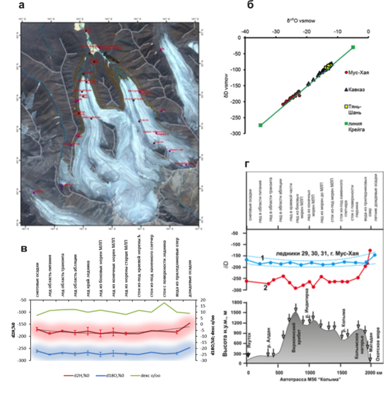 Figure 2. Generalized characteristics of the isotopic composition (δ¹⁸O and δ 2H) of different modern and fossil ice types (60 samples) from the glacial-cryogenic complex at Mt. Mus-Khaya, Suntar-Khayata Range. a – location of sampling sites; б – δ¹⁸O and δD ratio in ice of the Mt. Mus-Khaya glacial-cryogenic complex and other regions at the Craig equilibrium line; в – variations in the isotopic composition of the Mt. Mus-Khaya glacial-cryogenic complex in samples of different types; г – comparison of deuterium content in samples of various types from the Mt. Mus-Khaya glacial-cryogenic complex, Suntar-Khayata Range with changes in deuterium content in snow along the Yakutsk-Magadan transect [Kurita et al., 2005]: 1 – Mt. Mus-Khaya; 2 – Yakutsk-Magadan transect.
Related publication: Galanin A.A., Lytkin V.M., Fedorov A.N., Kadota T. 2014. Age and extent of the last glacial maximum in the Suntar-Khayata Range based on lichenometry and Schmidt Hammer Test. Earth Cryosphere XVIII(2), 72-82.
3) An engineering-geological map of the Republic of Sakha/Yakutia was compiled at a scale of 1:1,500,000-scale (edited by L.N. Kovalev and R.V. Zhang, compiled by V.B. Spektor, Ya.I. Torgovkin, A.A. Shestakova, V.V. Spektor, L.D. Ivanova and B.M. Kozmin). The map, first in its kind for the region, provides a scientific foundation for planning of economic development, construction of large engineering projects, and environmental protection in the vast Arctic region of Russia. The map shows geological, geocryological, hydrogeological and seismic conditions, as well as geotechnical hazards.
 Figure 3.
Related publication: Spektor, V.B.,Torgovkin, Ya.I., Shestakova, A.A., Spektor, V.V., Ivanova, L.D., Kozmin, B.M., 2014. Engineering Geological Map of the Sakha (Yakutia) Republic. Sciences in Cold and Arid Regions 6 (5), 484-493.
4). As part of its basic fundamental research theme, the Institute conducted investigations on seven projects funded by grants from the Russian Foundation for Basic Research, three integrated projects, and several contracts totaling over 35 mln. rubles. The latter mainly included geocryological site investigations in various areas of the East Siberian permafrost region, as well as determinations of physical, mechanical and chemical properties of soils for large engineering projects.
5). An important event for geocryology in 2014 was the 10th International Symposium on Permafrost Engineering held from 22-24 August 2014 in Harbin, China under the theme “Challenge and Adaption of Permafrost Engineering to a Changing Climate”. This symposium, co-organized by MPI, brought together about 300 researchers from six countries (Russia, China, USA, Canada, Japan, and Turkey), including 21 delegates from MPI. The symposium stressed that understanding the thermal state of permafrost and the development of worldwide standards for permafrost monitoring in a changing climate remain the priority tasks for engineering geocryology. Papers submitted to the symposium were published in special issues of the journals, Sciences in Cold and Arid Regions (Volume 6 Issue 4 August 2014 and Volume 6 Issue 5 October 2014), Journal of Engineering of Heilongjiang University (Volume 5 No. 3 September 2014) and Journal of Glaciology and Geocryology (Volume 36 No. 4 August 2014). The next, 11th symposium on permafrost engineering was decided to be held in 2017 in Magadan, Russia.
 Figure 4. MPI delegation at the 10th International Symposium on Permafrost Engineering.
MPI researchers took part in several international conferences in Potsdam and Hamburg (Germany), San-Francisco and New Orleans (USA), Frascati (Italy), Brest (France), and Brussels (Belgium).
In all, MPI researchers participated in 25 international, 13 national and 11 regional conferences.
Cryolithology and Glaciology Department, Geographical Faculty, Lomonosov Moscow State University
In 2014 Department of Cryolithology and Glaciology undertaken fundamental research on the impact of the cryospheric objects change on environment and society.
The department developed several conceptual rules for assessment and prediction of cryo-ecologicalconditions under development of crylithozone in terms of (a) landscape resistance to negative cryogenic processes, (b) type and (c) intensity the technogenic load (Monography: Tumel’ N., Zotova L. Geoecology of Cryolithozone: textbook. – Moscow, Faculty of Geography, MSU, 2014, 244 p.). Researchers formulated definitions and methods of assessment; detected main lithocryogenic and biotic factors of landscape resistance to cryogenic processes in different environmental conditions; provided a procedure of their comparison in order to calculate integral indexes with further ranking by sensitivity to development, and to make GIS-maps then.
Researchers made the “Map of the ground ice of the cryolithozone of Russia”, in which they successfully linked distribution of various means of ice with tectonic development of the Russian Arctic (Bulletin of the MSU, 2014; Geography, Environment…, 2014).
The department continued monitoring of the active layer dynamics on two sites – near Talnakh (south of the Taymir peninsula) and in Lorino (settlement on Chukotka). The monitoring was started in 2004 under the International program CALM – Circumpolar Active Layer Monitoring. Last measurement reflects the reaction of frozen ground to relatively cold, but rainy summer 2014: this year around Talnakh mean depth of thaw increased by 20%. It is 20% bigger then measured in extremely hot (but abnormally dry!) summer 2013.
Using calculations and field observations, we assessed the efficiency of different managerial strategies for thermal regime of frozen foundations in built-up areas. It is found, that the most conventional and popular way to decrease temperature – arrangement of cold ventilated cellars – is not comprehensive in regions with continental climate and scarce snow cover (e.g. Yakutia, inner areas of Magadan region, etc.). The department analyzed permafrost temperature change in dependence of density, structure and (it is critical) – the age of housing. In the areas of “old” development, regional peculiarities form significant differences in temperature trends (examples – centers of Dudinka, Salekhard, Khatanga, etc.). In general, degradation prevails. Temperature decrease can be measured due to a strong anthropogenic salinization, but it is not increasing bearing capacity of refrigerated foundations – as adfreezing force declines (EUCOP, 2014).
In the changing climate and cryosphere 62 million square kilometers are covered by ice, seasonal and perennial snow cover. Some years this square varies, as well as it changes through the cycle of seasons (Ivanov M., Glaciological symposium “The role of snow and ice in people’s lives”, The World Snow Forum, Novosibirsk, 2014).
The department studied differences and similarities in formation of “alpine” and “siberian” types of glaciers. First established, that they have no qualitative differences, existing differences (the role of infiltrationcongelation ice in their composition) have quantitative nature.
In July 2014 in Igarka and Norilsk region were held regular International field student’s courses on permafrost, which was attended by younglings from Russia, USA, Great Britain, Germany and Norway (courses are conducted by docent of Lomonosov Moscow State University Valery Grebenets and professor of The George Washington University Dmitry Streletsky).
Geocryology Department, Geology Faculty, Lomonosov Moscow State University
Geocryology department of Moscow University has finished its long-term work on a new thermal computer software for 3D permafrost forecast. First version of the digital permafrost map of Russian Federation (scale 1: 2 500 000) was done. The department was involved in projects related study of the offshore permafrost in Laptev and Kara sea. Geophysics was applied to estimate permafrost table and depth in the Arctic basin. Investigations on gas hydrates in Western Siberian permafrost were continued, and new data has been received for its distribution. as well as the gas content for offshore marine frozen deposits in the Eastern Arctic. A study the thermal mode, soils thermal properties and mechanisms of coastal erosion in the Baydara Bay (Kara sea coast) was done including coastal soil temperatures, thermal conductivity and other soil properties. A role of snow fields in the thermal erosion has been shown. Phase and salts concentration equilibrium was studied in Yamal peninsula permafrost in a range of temperatures. Deformations of thawing icy clay soils ware investigated in laboratory conditions for Western Siberian marine and alluvial deposits. A number of case studies in permafrost regions with oil and gas companies were also done. A master program specializing in permafrost studies in English has been open in 2014 in the department for the foreign students.
Institute of Physicochemical and Biological Problems in Soil Science, RAS (Soil Cryology Laboratory)
1. For the first time with using the method of amplification of 16S rRNA genes with specific to the Archaea domain PCR primers, and the analysis of the clone libraries we have obtained knowlege about archaeal community of permafrost of Holocene and Pleistocene age of coastal oases of Antarctica. The phylotypes are mainly presented with the genera related to methanogens: Methanosarcina, Methanobrevibacter , Methanogenium, Methanolobus and Methanoculleus and Methanomicrobia. (related publication: E. S. Karaevskaya, L. S. Demchenko, N. E. Demidov, E. M. Rivkina, S. A. Bulat, and D. A. Gilichinsky. 2014. Archaeal Diversity in Permafrost Deposits of Bunger Hills Oasis and King George Island (Antarctica) According to the 16S rRNA Gene Sequencing // Microbiology, Vol. 83, No. 4, pp. 379–387.)
2. For the first time in collobaration with french colleagues the giant virus, named Pithovirus sibericum, was isolated from a 34,000-y-old of Siberian permafrost. Thus, the first time it was shown that in ancient permafrost sediments along with representatives of prokaryotes and eukaryotes, which we have described earlier, saved the giant viruses. (related publication: Legendre Matthieu, Julia Bartoli, Lyubov Shmakova, Sandra Jeudy, Karine Labadie, Annie Adrait, Magali Lescot, Olivier Poirot, Lionel Bertaux, Christophe Bruley, Yohann Couté, Elizaveta Rivkina, Chantal Abergel, and Jean-Michel Claverie. 2014. Thirty-thousand-year-old distant relative of giant icosahedral DNA viruses with a pandoravirus morphology: PNAS, 111 (11), p. 4274–427.)
Mining-Geological Joint-Stock Company MIREKO
MIREKO company continues 30-45-year permafrost monitoring covering several main landscapes of European North of Russia. The main result of observations in 2014 – preservation of long-term trend of permafrost degradation. The lowering of level of underground waters, resulted from 21-year mine drainage, irregularly affects primary hypsometrical level of permafrost roof and foot. Degradation and progression of permafrost are observed depending to the thickness of technogenic aeration zone. The observations will be continued. Please see below top priorities in permafrost research that we suggested.
1. “Approbation of methodology of middling-term forecast of permafrost parameter The our methodology provides for the possibility of forecast of permafrost temperature, appearance and increasing thickness of closed taliks, thermokarst subsidence and cryogenic heaving of sediments for the nearest 15-20 years. The methodology was received by Customer – «Rosnedra», and then it was published in «Prospecting and Protection of Mineral Resources» Journal, No 7, 2009; its developments and details were reported at the Third European Conference on Permafrost. Longyearbyen, Svalbard, Norway. «Permafrost Monitoring in Northwestern Russia and a Methodology of the mid-Range Projections of Its Past and Future Degradation in Natural Conditions». N.Oberman, I.Derevyanko, V.Romanovsky, H.Vanhala, P.Lintinen.
Considering the practical importance of such forecasts for stable functioning of industrial and civil buildings in the permafrost area, we think that the evaluation of forecast accuracy and improving it, if necessary, is very timely. Such an evaluation compares the forecasted values of parameters with their actual field measurements. To perform this task we have all necessary conditions: 2 acting and 4 preserved geocryologic stations located in six different landscapes and with long-term, 30-45 years, observation periods, and also appropriate personnel. MIREKO Mining Geological Company is ready to solve this task.
2. “Evaluation of dynamics of icings of moderate and south type in the Urals and their There are more than 200 large and extra-large icings in Polar and Subpolar Urals. In the very beginning of 1980s they were observed by inspection, and some of them – by stationary observations (company MIREKO). Modern observations by inspections in some typical icings in low- and midmountains will allow to see their dynamics, connection with climate changes and to forecast their development in future.
3. Permafrost map of Pechora-Ural region, scale 1:1500000. The permafrost of European North is the most vulnerable in comparison to the Western Siberia, Yakutia to the influence of climate change, and also – of oil-gas, mining industries, due to specific climate, permafrost and hydrogeological conditions. Recently a lot of new permafrost information was accumulated. All this motivates to renew the existing permafrost maps. The suggested map could be prepared in two sheets variant: Permafrost maps of 2016 and Forecast permafrost map as of 2030. MIREKO company with its more than 40-year experience of permafrost mapping of the region (including a number of published maps) can claim to perform this object.
Joint-Stock Company “Fundamentproekt”
JSC “Funadmentproekt” carried out complex research and elaborated the methodological principles and methods of the creation of new geotechnical cartographic models into structure of the GIS engineering geocryological and permafrost cartographic models. Creation of the geotechnical cartographic models is considered as a method of adaptation and practical using of a geocryological investigation for the design and construction in the Permafrost area and in complex environment.
Completed the set of laboratory researches of frozen grounds creep properties. The frozen grounds testing made by USA standard (ASTM 5520) and Russian standard (GOST 12248-2010). It can be set that a direct correlation of frozen grounds creep properties obtained with the methods of test processing by ASTM 5520 and by GOST 12248-2010 cannot be. But tests made by ASTM 5520 standards can be handled by GOST 12248-2010. In this case, creep frozen grounds properties close to those obtained in the tests made and handled according to GOST 12248 In this case, creep frozen grounds properties close to those obtained in the tests made and handled according to GOST 12248.
Sergeev Institute of Environmental Geoscience, RAS (Moscow)
Institute of Environmental Geoscience RAS has been continued the developing of ground thermal regime model with taking into account the seepage, ground variable salinity, gas-hydrate evolution, surficial heat exchange explicit budget and climate change. The model was applied for the shelf permafrost’s distribution model.
Report prepared by Dmitry Drozdov, Scientific secretary of Scientific Council on Earth Cryology, Russian Academy of Science ( ds_drozdov@mail.ru)
South Korea
Korea Polar Research Institute
Korea Polar Research Institute has opened a web page in May 2014, (http://www.arctic.or.kr), to provide all sorts of arctic related information in Korean. The webpage introduces organizations and groups involved in arctic activities as well as scientific activities. South Korea was granted an observer status in the Arctic Council in 2013, from when interest in the Arctic has been rapidly growing among the Korean government and the general public. The web page, “Arctic N”, can satisfy the curiosity of the people by providing systematically organized Arctic information.
There was a photo exhibition showing Arctic tundra in Seoul in April 2014. In this exhibition photos concerning, the Arctic plants, animals, and research activities in Ny-Ålesund (Svalbard), Council (Alaska), Cambridge Bay (Canada), and Zackenberg (Greenland), were displayed. The public enjoyed viewing the Arctic photos which were absolutely different from the perspective that many have in South Korea.
 Figure 1. Front page of “Arctic N”.

Figure 2. Photo exhibition: Arctic tundra.
New research project in Svalbard (PI: Yoo Kyung Lee)
A new research project based on the Arctic Dasan Station in Svalbard has been initiated in 2014 by Korea Polar Research Institute. KOPRI research groups and other teams from several universities and institutes studied the glacier foreland ecosystem of Midtre Lovénbreen. The glacier foreland was surveyed by the French team 10 years ago. We repeated vegetation survey in the same sampling sites, studied by the French team, with the French and Norwegian groups in the same manner. In addition, soil samples were collected to study soil organic carbon, microbial community, plants metabolites, and fatty acids composition in the glacier foreland. Since the whole area of the glacier foreland in Midtre Lovénbreen had been investigated, we expect to see the development and changes in soil properties and biological components along the microtopography as well as soil age (glacier retreat period). Ultimately, we are aiming to produce maps for soil organic carbon stock and microbial community in this glacier foreland through multivariate analyses and modelling approaches. Furthermore, the experiments on the CO2 and CH4 between the atmosphere and permafrost have been continuously operated on Amundsen-Nobile Climate Change Tower through collaboration with CNR in 2014.
 Figure 3. Soil sampling and vegetation survey sites in Midtre Lovénbreen glacier forefield.
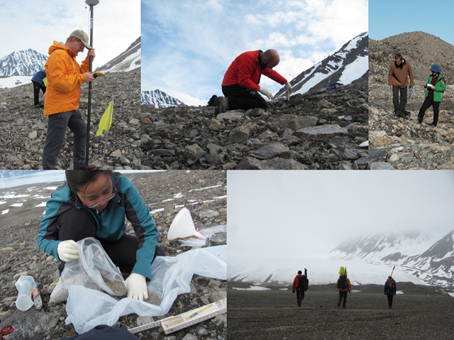
Figure 4. Field measurements (site selection, soil sampling, and vegetation survey).
CAPEC Project (PI: Bang Yong Lee)
The CAPEC (Circum Arctic Permafrost Environment Change Monitoring) Project, supported by Korea Ministry of Science, ICT and Future Planning, has been continued since 2011. Through this project, we plan to establish Arctic monitoring nodes to study environmental changes and develop the state-of-the-art observation techniques for terrestrial permafrost region. This monitoring project includes atmosphere-pedosphere-biosphere monitoring system with Ubiquitous Sensor Network (USN) and GPS monitoring. The research aims of this project are (1) to understand the correlation between carbon dioxide (CO2) fluxes and soil properties; (2) to estimate the contribution of microbial respiration, and plant photosynthesis and respiration to the CO2 production from soil; (3) to understand the geophysical and mechanical behavior of frozen ground correlated with environmental change. On the basis of the CAPEC project, we had two Arctic explorations this spring and summer: Council, Alaska; and Cambridge Bay, Canada.
CAPEC project in Council, Alaska
We operated the eddy-covariance flux system and 4-component radiometer at the Council site, during the summer period to monitor NEE (Net Ecosystem Exchange of CO2) over Alaskan permafrost region. Furthermore, methane (CH4) flux was measured in July for the first time at the site. Spatial variation of NEE was also measured using a manual chamber system with 9×9 grids on a monthly basis from July to September. In addition, thaw depths at multiple points were manually measured using a probe once in July, August, and September. Likewise, plant activity was monitored using a camera and NDVI sensors throughout the year. Multiple 1-m depth soil cores were sampled to investigate microbial community structure and organic matter composition at several points.
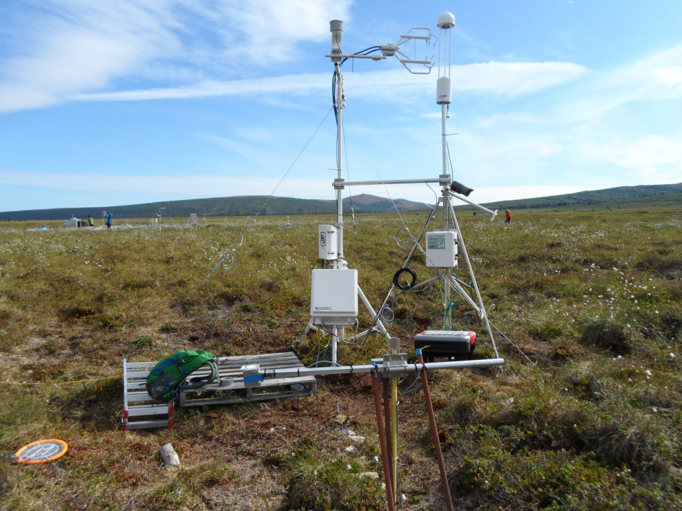 Figure 5. Eddy covariance system for green-house-gas (CO2, CH4, H2O) flux measurement at Council, Alaska.

Figure 6 .Soil coring activity at Council, Alaska in July, 2014.
CAPEC project in Cambridge Bay, Canada
For long-term monitoring of CO2 and energy exchanges between the atmosphere and the ecosystem at the site, eddy covariance flux system together with a net radiometer has been operated on a tower of Environment Canada since 2012 (69o7’47.7″N, 105o3’35.3″W). In 2014, heat flux plate (8 cm depth) and 4 temperature sensors (2, 3, 4, 6 cm depth) were installed around 5 m apart from the flux system to calculate heat exchange between air and soil. In addition, we have been continuously measuring black carbon concentration by an aethalometer since 2013.
To investigate the effects of increasing temperature and precipitation in arctic tundra, we have continued the climate manipulation experiment since 2012. This year, we just maintained climate manipulation treatments (open top chambers and watering per week) from middle June to late September with a help from Hamlet of Cambridge Bay. In July 19, there were extremely strong winds on the field site, thus, all OTCs were blown away or broken again like last year. We visited Cambridge Bay and fixed OTCs by using anchors and rope to protect them from strong wind.
 Figure 7. Installation of the heat flux plate and soil temperature sensors in June 2014.

Figure 8. Fixing open top chambers from strong wind.
Report prepared by Yoo Kyung Lee ( yklee@kopri.re.kr).
Spain
Research on periglacial environments and permafrost from the Spanish Universities and research institutes continue at the same line that previous year, working in Andes, Iceland, Antártida and Iberian mountains or Mars. In spite of hard financial restrictions the different research groups work and collaborate with institutions and researchers from USA, Germany, Iceland, New Zealand, Mexico or Portugal. Strenuous efforts, to both personal and collective, to engage in research joint to the researcher international community are being made. More than eight research groups are working in periglacial environments; we present in this report the activity of only some of them.
The permafrost team of the Alcalá University goes on its research in the Antarctic Peninsula with the participation in the Spanish Antarctic expedition with the collaboration of the University of Lisbon, focus in the study of the thermal behavior of the permafrost by mean of the CALM-S sites and the boreholes drilled on the study area.
 Figure 1. Meteo station and 25 m deep borehole, establish to characterize the thermal state of permafrost and the active layer evolution, on the top of Reina Sofia mount close to the Spanish Antarctic Station. Livingston Island (Antarctica).
Also the group, coordinated by Prof. Miguel Ramos and Miguel Angel de Pablo is participating in the Mars Sciences Laboratory NASA mission (MSL) by mean of its join in the experience; Rover Environmental Monitoring Station (REMS) that is lead by the Centro de Astrobiología (CAB-INTA).
Mars Science Laboratory is a rover that will assess whether Mars ever was, or is still today, an environment able to support microbial life, basically on the permafrost system. In other words, its mission is to determine the planet’s “habitability.”
The Research Group “Landscape and Paleoenvironments in Mediterranean Mountain” has continued with the activities focused on the monitoring of present-day geomorphological processes as well as the in reconstruction of past environments in Sierra Nevada and Eastern Pyrenees, coordinated by Prof. Antonio Gómez-Ortiz and Dr. Marc Oliva and Dr. Ferran Salvador-Franch.
Together with researchers from the Complutense University of Madrid and the University of Extremadura, the GETECO research Group leaded by José Juan Sanjosé, they have continued with the field monitoring in Sierra Nevada of present-day degradation of permafrost in the Veleta cirque, control of rock glacier dynamics, thermal monitoring of seasonal frost in several sites across the massif, distribution of late-lying snow patches, etc. Samples for cosmogenic dating have been collected in both massifs with the purpose of reconstructing the deglaciation process as well as phases with active rock glacier dynamics related to widespread permafrost conditions in these massifs.
Researchers from this Research Group also conduct research in other permafrost environments, with a special focus in Antarctica. In this continent, several activities are being carried out in ice-free areas in close collaboration with researchers from the University of Lisbon, among others.
The research Group of the University of Valladolid, leaded by Prof. E. Serrano, have continued working on mountain permafrost and periglacial geomorphology in the Cantabrian Mountains and Pyrenees. Collaborating with Ecology Pyrenean Institute (CSIC) headed by Dr. J.I. López-Moreno, and GETECO Research Group (University of Extremadura) headed by José Juan Sanjosé, all of them are working on glaciers and cold environments. Works have been made on periglacial processes and mountain permafrost in Upper Pyrenees (Tucarroya and Monte Perdido massif) and on periglacial processes and nivation in Cantabrian Mountains. Studies have focused on soil thermal regime in the Pyrenees and Cantabrian Mountains, systematic surveys of rock glaciers, icepatches and glaciers, and specially the study of ice caves as indicators of cold conditions in the high mountain of Picos de Europa, where three years of observation and data record have been obtained.

Figure 2. GPR survey on the ice body of Castil ice cave in the Picos de Europa (Cantabrian Mountains, Spain). (Picture, Manuel Gómez-Lende)
Research developed during the last four year in three big upper cirques where today glaciers exist (Infierno massifs, Posets massif and Maladeta massif) and where periglacial processes and permafrost are significant of periglacial environment of Pyrenees, have permit to obtain the Doctorate degree to María González-García. The doctoral thesis, titled “Periglacial High Mountain in the Spanish Central Pyrenees: processes, landforms and environment” -in Spanish language- was lectured in the University of Málaga. The thesis focused on the high mountain periglacial processes, their distribution and dynamic. In the three massifs have been studied relations between glaciers, deglaciation and periglacial processes emplacement, and have been made three 1:10000 scale geomorphological maps and soil thermal maps, to establish the altitude of active periglacial processes and distribution of not frozen soils, where nivation processes are dominant, seasonal frozen soils and permafrost.
The research Group of the UAM, leaded by Jerónimo López Martínez has been working in the field focusing in the study of periglacial process and permafrost. Works developed in the South Shetland Island to obtain field parameters oriented to mapping permafrost by remote sensing techniques. RADARSAT-2 data in the ultra-fine and fine quad polarization mode was evaluated to identify periglacial features within the Antarctic Peninsula region. The study was carried out within Fildes Penisula and Livingston Island. Objectives of the research are to integrate data from different sources, including field data, to optimize the selection of criteria and techniques to obtain information from RADARSAT-2 relevant to the periglacial geomorphology and permafrost distribution.
The research group of UCM (https://www.ucm.es/gfam), leaded by Prof. David Palacios is working in the study of periglacial processes and permafrost distribution by remote sensing and thermal field record. The works are part of the research project “Environmental effects of deglaciation: case studies in contrasted geographic landscapes (CRYOCRISIS)”, working in the Andean Cordillera (Perú), and Iceland. Research developed in the Peruvian Andes have permitted obtain the Doctor degree to Jesús Alcalá with the doctoral thesis titled “Volcanic, glacial and periglacial evolution of the Ampato volcanic complex (South of Perú) -in Spanish language – lectured in the Universidad Complutense de Madrid. The research has focused on the evolution of Ampato volcanic complex (15º24′-15º51’S/71°51′-73°W; 6,288 m a.s.l.), where periglacial landforms and processes until now not studied, have been analysed. From field work, thermal record and remote sensing (Landsat images) have been made a detailed geomorphological map (1/200000 scale) of Ampato massif, and rock glaciers and several periglacial landforms have been inventoried. Finally, the altitude distribution of permafrtost have been establish in a volcanic complex located in the Peruvian hiperarid plateau, place needy of water to population and farm activity. Research developed in Iceland is focused on the dynamic of little glaciers and genesis of rock glaciers using mainly liquenometry. The work is developed in collaboration with the Natural Research Centre of Northwestern Iceland and the University of Akureyri.
Report prepared by Enrique Serrano ( serranoe@fyl.uva.es)
Sweden
Dep. of Physical Geography and Ecosystem Sciences, Lund
For the 37th year in a row, the research group from Lund University has carried out active layer monitoring in the Abisko area. The last summer was very warm and especially in the degraded peat plateaus the warm summer was directly reflected in a thicker active layer. The active layer data is submitted to the CALM database. In addition, ground temperatures from five boreholes have been downloaded and submitted to the GTN-P database.
A snow manipulation experiment has been running for 9 years now. In 2010, PAR sensors were added to the monitoring and data from these measurements have now been compiled and published in Bosiö, J., C. Stiegler, M. Johansson, H.N. Mbufong and T.R. Christensen 2014. Increased photosynthesis compensates for shorter growing season in subarctic tundra – eight years of snow accumulation manipulations. Climatic Change 127 (2): 321-334. DOI 10.1007/s10584-014-1247-4. Results showed higher PAR absorption, together with almost 35 % higher light use efficiency, in treated plots (with added snow) compared to untreated plots. Estimations of GPP suggested that the loss in early season photosynthesis, due to the shortening of the growing season in the treatment plots, was well compensated for by the increased absorption of PAR and higher light use efficiency throughout the whole growing seasons, most likely due to increased soil moisture and nutrients together with a shift in vegetation composition associated with the accelerated permafrost thaw in the treated plots.
Report prepared by Margaretha Johansson, Torben Christensen, Jonas Åkerman ( jonas.akerman@nateko.lu.se).
Switzerland
Swiss Permafrost Monitoring
The Swiss Permafrost Monitoring initiative PERMOS (http://www.permos.ch) maintains a network of 28 high alpine sites in order to document the state and changes of permafrost in Switzerland based on three main observation elements (ground temperatures, changes in subsurface ice and water content, and permafrost creep velocities). PERMOS is funded by the Federal Office for the Environment (FOEN), the Swiss GCOS Office at MeteoSwiss, and the Swiss Academy of Sciences (SCNAT). The PERMOS Office (at the University of Zurich) coordinates observation and reporting activities undertaken by the six partner institutions ETH Zurich (ETHZ), the Universities of Fribourg (UNIFR), Lausanne (UNIL), Zurich (UZH), the WSL Institute for Snow and Avalanche Research (SLF) and the University of Applied Sciences and Arts of Southern Switzerland (SUPSI). 2014 is the end of a 4-year contract period and a renewed organization of the PERMOS Office will be set up in 2015 for the next 4 years.
Ongoing research projects and activities
In parallel to its long-term monitoring of borehole temperatures and deformation together with PERMOS, the WSL Institute for Snow and Avalanche Research SLF is investigating the impact of the snow cover on the thermal regime and stability of steep rock walls (A. Haberkorn, M. Phillips) at three sites in the Swiss Alps. Rock wall dynamics are also being monitored using various remote sensing techniques including terrestrial laser scanning and interferometric radar at Pizzo Cengalo (Bregaglia) and Piz Kesch (Albula Alps), in collaboration with different Swiss and Italian partners in the context of an ARGE Alp project. The stability and thermal regime of high mountain infrastructure is monitored (M. Phillips) with various engineers and operators, and in-situ GPS is being tested with the ETHZ (J. Beutel, S. Weber) to monitor creeping permafrost terrain causing damage to snow nets (Fig. 1). The dynamics of rock glaciers are being investigated in the context of the SNF Sinergia project TEMPS and in collaboration with Italian partners in the Interreg project SloMove (R. Kenner) using in-situ and remote sensing techniques. The influence of taliks and lateral liquid water fluxes on the thermal regime of rock glaciers is being simulated using the SNOWPACK model (R. Lüthi).

Figure 1. GPS mounted on a rock between snow nets which are damaged by downslope creep and subsidence in permafrost terrain at Wisse Schijen (Randa, Switzerland).
Permafrost research activities at the Institute of Earth Sciences of the University of Applied Sciences and Arts of Southern Switzerland (SUPSI) (C. Scapozza, C. Ambrosi) continued after their beginning in 2013 in affiliation with the PERMOS network. Research focused mainly on the assessment of rock glacier kinematics, with a project conducted in collaboration with the Swiss Federal Research Institute WSL in Bellinzona (M. Conedera, C. Bozzini), the University of Lausanne (C. Lambiel), and the University of Fribourg (S. Mari). In this project, the (palaeo)climatic variations of the Stabbio di Largario rock glacier, in the southern Swiss Alps, were assessed using three different timescales thanks to the Schmidt hammer exposure-age dating (SHD), the georeferentiation and orthorectification of six historical photographs of the rock glacier taken between ad 1910 and 2012 and differential global positioning system (dGPS) monitoring data available since 2009. The results show a link between periods of increase in mean air temperature on different time scales and variations in rock glacier kinematics, and provide important new insights into rock glacier development and evolution on the long-term scale. In September 2014, the quantification of movements and deformation process of rock glaciers in the Southern Swiss Alps was improved by the installation of two permanent GPS (fig. 2), in collaboration with the Federal Office for the Environment FOEN (H. Raetzo) and the ETH Zurich (J. Beutel), and by the realization of very-high resolution digital elevation models thanks to the use of drones, in collaboration with Studio di Geomatica Lehmann–Visconti (R. Visconti and D. Righetti).
 Figure 2. Permanent GPS installed on the right lobe of the Stabbio di Largario rock glacier, in the Eastern Ticino Alps (Photo: C. Scapozza).
At the University of Lausanne, the high mountain geomorphology group of the Institute of Earth Surface Dynamics (C. Lambiel, J.-B. Bosson, N. Deluigi, N. Micheletti) focuses its research on ground ice detection, mapping and characterization, on ground ice related movements and on permafrost monitoring and modelling.
Final field investigations in debris-covered glacier systems in permafrost environments have been carried out this year, resulting in a 4-year dataset. The characterization of internal structure and current surface kinematics highlights their strong relation in these complex systems. Strictly glacial zones, where the debris-cover overlies a pure sedimentary ice body are largely more dynamic and sensitive to climate signal than the marginal ice-debris mixtures, where slow surface lowering and downslope motions are observed.
The decadal and current evolution of surface movements of these small high mountain debris-covered glaciers and of active rock glaciers is carried out with several techniques, such as digital photogrammetry, Lidar and GPS measurements and monitoring with automatic cameras (Fig. 3). The decadal evolution of sediment transfer in steep valley sides is another topic on which we currently work.
As grain size in sedimentary materials is considered one of the main factors controlling the ground (surface) temperature, a new procedure was developed to automatically detect this feature and improve the dataset employed in our modelling project on the spatial distribution of mountain permafrost using machine learning algorithms. In parallel, an exploratory spatial data analysis was performed to reveal underlying structures/anomalies in the data.
Finally, a part of our activities concern the monitoring of rock glacier velocities, of ground (surface) temperatures and of electrical resistivity at several sites, mainly located in the Valais Alps. In summer 2014, a new borehole was drilled at the top of the Mont Fort (Verbier-Nendaz) at 3300 m a.s.l. The first data revealed the presence of permafrost at temperatures around -2°C. A part of these measurements are included in the PERMOS network and are used in the TEMPS project.
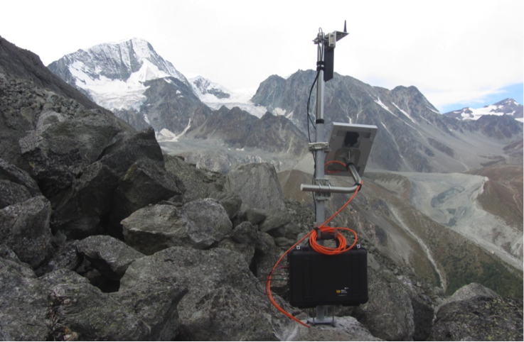
Figure 3. Permanent GPS installed in October 2014 on La Roussette rock glacier (Arolla, VS).
At the Institute for Geotechnical Engineering of ETH Zurich, the project Furggwanghorn has been successful and is coming towards an end. Thanks to geophysical surveys and 7 boreholes – the latter having temperature distributions at various depths until the cables were cut by the movements -, an excellent ground model has been created for the Furggwanghorn rock glacier. The deformations at the surface and in the boreholes are fascinating and constitute an excellent set of data for a degrading rock glacier that will be published next year. The internal structure was also explored with a 60 MHz helicopter-borne ground-penetrating radar (GPR) (fig.4) and a flight height of 15-20 m. A transition from an upper high reflective zone to an underlying layer of lower reflectivity at about 17 – 20 m depth (blue line in fig. 5). According to three inclinometer survey stations within boreholes there is at least one major shear zone at the same depth, which shows average displacement up to 1cm / day. The pore ice content is significantly lower below this transition zone. Therefore it is concluded that the deformations measured on the boreholes occurs at the transition between ice – rich and ice poor parts of the rock glacier. Xiaohai Zhou successfully finished her PhD thesis titled “Experimental and Numerical Study of Coupled Water and Heat Transport in the Freezing Ground” combining thermal modelling with controlled lab experiments. Kaspar Merz (geophysics) and Thomas Buchli will defend theirs in 2015.
 Figure 4. Ground penetrating radar (GPR) system mounted under the helicopter (Photo: Kaspar Merz)

Figure 5. Processed and depth-converted helicopter GPR section showing the main geologic units of the Furggwanhorn rock glacier. Red arrows indicate depth and direction of shear zones observed in the boreholes.
At ETH Zurich, the Geodesy and Geodynamics Lab (GGL) of the Institute of Geodesy and Photogrammetry is involved in several interdisciplinary projects and activities related to mountain permafrost (e.g. X-Sense, X-Sense2, PermaSense, PERMOS). Its major field of activities is the monitoring of displacements and deformations with continuously operated GPS stations, and especially the geodetic processing of the GPS data (P. Limpach, A. Geiger, S. Su, R. Hohensinn). At present, the data of more than 30 permafrost-related GPS stations from various projects in Switzerland are operationally processed at GGL. A large number of these stations were deployed by X-Sense (ETHZ, UZH, FOEN, GAMMA, J. Beutel, T. Gsell, S. Gruber, V. Wirz, P. Limpach). GPS techniques for real-time processing, near real-time processing and post-processing are applied, depending on the application. The GPS data allows the precise monitoring of rock glaciers, slope instabilities and rock instabilities with a high temporal resolution. With continuous observations over several years, it was possible to analyse the temporal variations of the displacements and the displacement rates. In collaboration with the Federal Office for the Environment (FOEN), GPS data was used to validate results from interferometric radar observations. In the framework of the X-Sense project, GGL has developed algorithms for automated image processing from digital cameras (F. Neyer, A.Geiger). Two cameras (ETHZ, TIK, J. Beutel, T. Gsell) have been installed at the Grabengufer rock glacier to monitor the displacement field. The advantage of areal displacement information is tested in terms of resolution and accuracy to complement the GPS data (Fig. 6).
 Figure 6. Imaged based estimates of displacements at the upper part of Grabengufer rock glacier. The steep front area shows displacements of 1.4m in 10 months (1.7m/year) (Photo: F. Neyer, T. Gsell).
In 2014 the Institute of Geography of the University of Bern continued the solifluction study at the North slope of Blauberg close to Furkapass. 250 points were surveyed by tachymeter and dGPS, infrared-photogrammetry was applied, soil water content and temperature sensors were installed, meteorological parameters were measured and the spatial disappearance of the snow cover was recorded (fig. 7). The WSL-institute for Snow and Avalanche Research SLF performed terrestrial laser-scanning and the Institute of Geography of the University of Würzburg conducted 3D-geoelectric measurements. New insights in alpine solifluction processes and controls are expected in 2015.

Figure 7. Picture from the Blauberg taken by an automatic camera showing the situation in mid June 2014 when the slope started to become snow-free.
At the University of Fribourg, the SNSF-Sinergia project «The evolution of Mountain Permafrost in Switzerland» (TEMPS, 2011-2015), which is regrouping scientists from several institutions (ETH Zurich, Universities of Fribourg, Lausanne, and Zurich, SLF) closely related with PERMOS, is entering into its final phase. A particular aim of this project was combining observation and model-based research approaches to obtain an integrative view of the current state of mountain permafrost in the Swiss Alps and the governing processes for its recent and future evolution. The work done in 2014 focused on methodological improvements of the various modelling and observation techniques, which are required for the synergetic data analysis, scenario generation and impact assessment of the TEMPS project. On the Becs-de-Bosson rock glacier in the Valais Alps (Fig. 8) an automated ERT device was installed for the first time in a remote location and first measurements have been conducted in autumn 2014.
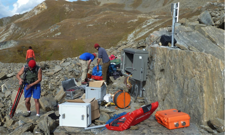
Figure 8. Installing the new A-ERT system on the Becs-de-Bosson (Réchy) rock glacier in autumn 2014. (Photo: D. Sciboz).
Within the SNSF-Project SOMOMOUNT (soil moisture in mountainous terrain and its influence on the thermal regime in seasonal and permanently frozen terrain), six entirely automatized soil moisture monitoring stations were installed between summer 2013 and autumn 2014 at Frétaz, Moléson, Dreveneuse (Fig. 9), Gemmi, Schilthorn and Stockhorn, that is along a NW-SE transect throughout Switzerland, with altitude ranging from 1200 m.a.s.l. to 3400 m.a.s.l. They cover several landform types (talus slope, rock plateau, solifluxion lobe, etc.) as well as different thermal regimes of the ground (unfrozen, seasonally frozen and permanently frozen). In parallel extensive geophysical surveys were conducted in the vicinity of each station with ERT and RST methods to expand the one dimensional soil moisture measurements to a 2D repartition of water (and ice) content in the ground.
In addition to the already mentioned projects the University of Fribourg has currently a large research group (Hauck, Hoelzle, Delaloye, Salzmann, Hilbich, Hasler, Scherler, Schneider, Barboux, Mari, Marmy, Pellet, Staub, Kummert, Braillard, Rick)focusing on a wide range of topics including the analysis of rock mechanics and rock glacier dynamics, sediment transport, geomorphology, geophysics, subsurface modelling and remote sensing related to permafrost. In 2014 Sina Schneider and Chloé Barboux finished their PhDs on the heterogeneity of mountain permafrost and the detection, mapping and monitoring of slope movements in the Alpine environment using DInSAR, respectively.

Figure 9. Permafrost is also investigated on forested sites in Switzerland: new combined PERMOS/SOMOMOUNT on-line logging station on a low elevation cold talus slope at Dreveneuse (Photo: D. Sciboz).
At the Geography department at the University of Zurich (UZH) the kinematic monitoring of several high mountain permafrost landforms has been continued. Terrestrial and airborne instruments such as terrestrial laser scanning and drone-based photogrammetry have been used to acquire multi-temporal datasets of rock glaciers which are used to assess landform kinematics and geometrical/volumetric changes (Figs. 10-11). The above mentioned datasets help to establish a model which shows rock glacier evolution in relation to rock wall properties and climatic forcing. The goal is to focus on a holistic approach to assess landform evolution on a catchment area bases.
The PermaSense project has continued the existing measurements (temperature, cleft dynamics, high-precision L1-DGPS) at Matterhorn, Mattervalley, Jungfraujoch and Aiguille du Midi to investigate kinematics of alpine rock faces and slopes. A number of improvements with regard to the data management and processing have been achieved. The PermaSense L1-DGPS technology enabling detailed surface kinematic analysis at spatial scale and high temporal resolution has been made available to PERMOS partners in a technology transfer effort. Furthermore, a new field campaign to capture micro-seismic activity as an indicator for damage in steep bedrock has been initiated and is planned to be continued over the next two years.
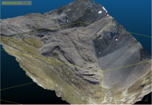 Figure 10. RGB colored 3D LAS Pointcloud derived from drone-based photogrammetry.
 Figure 11. NIR Orthophoto of rock glacier Muragl at a GSD 6.5cm.
Report prepared by Reynald Delaloye ( reynald.delaloye@unifr.ch)
The Netherlands
Paleopermafrost
Under the co-ordination of Prof. Jef Vandenberghe the IPA- Action Group has terminated the project ‘Permafrost extension during the Last Glacial Maximum in the northern hemisphere and derived mean annual temperatures’. The map of maximum permafrost extension towards the end of the last glacial is published in Boreas 43-3 (2014) together with a number of related papers. The project will be continued in a new action group, coordinated by Prof. Huijun Jin.
Carbon exchange from permafrost soils and ecosystems
Research on the carbon cycle and greenhouse gas emission of present-day permafrost environments is conducted by VU University Amsterdam (Prof A.J. Dolman, Dr. J. van Huissteden) and Wageningen University (Dr. M. Heijmans). The research projects in Siberia are conducted in close collaboration with Russian counterparts (Russian Academy of Sciences – IBPC, Dr. T.C. Maximov) and Zürich University in Switzerland, Dr. Schaepman-Strub.
At the Kytalyk reserve near Chokurdagh in the Indigirka lowlands (VU and Wageningen University) research focusses on CO2 and CH4 fluxes of tundra ecosystems on continuous permafrost. This site is a primary site in the EU Framework 7 PAGE21 project and moreover closely collaborates with Japanese researchers in the GRENE-TEA project who have established research sites in the tundra-taiga transition south of Kytalyk near Chokurdagh.
Starting in 2011, the CO2 and CH4 fluxes at the site have been measured with two eddy covariance towers, one fixed reference tower on an ancient drained thaw lake basin, and one roving tower, set up alternating at the edge of the river floodplain and the edge of a thaw lake (Figure 1). In 2014, the field activities for two PhD projects at Kytalyk, conducting eddy covariance and chamber flux measurements and monitoring of permafrost changes have finished. Flux measurements at the site will be continued in 2015, financed by PAGE21 and a new Dutch research programme, Netherlands Earth System Science Centre (NESSC). Within the framework of NESSC more focus will be laid on the carbon balance with thermokarst lakes. The site now has collected 11 years of CO2 flux data and 10 years of CH4 flux data. A synthesis publication is in progress.
 Figure 1. Eddy covariance tower for monitoring CO2 and CH4 fluxes set up near thaw lake bank at Kytalyk research station.
The Wageningen University team continued their measurements in two long-term field experiments: a Betula nana shrub removal experiment and a soil warming experiment. Removing the shrub part of the vegetation initiated thawing of ice-rich permafrost, resulting in collapse of the originally elevated shrub patches into waterlogged depressions within five years. This thaw pond development shifted the plots from a methane sink into a methane source (Nauta et al. 2014, Nature Climate Change). By 2014, one of the 10-m diameter removal plots has become almost completely a pond (Figure 2). In the soil warming experiment, solar panels feed heating cables buried at 15 cm depth in the ground (Figure 3). This additional heating increased thawing depth with consequences for soil moisture, soil available nutrients and vegetation composition. In 2014 we sampled both above and belowground biomass to test whether relatively deep-rooting graminoids expand at the cost of shallow-rooting low shrubs with increased thawing.
 Figure 2. Shrub removal plot developing into pond.
Figure 3. Soil warming experiment located in tussock tundra.
Effect of paleo-permafrost on hydraulic properties of sediments
The Dutch Geological Survey (subdivision od TNO) is conducting research on the hydraulic properties of aquifers and aquicludes in Quaternary deposits in the Netherlands. Glacial till in the northern part of the Netherlands can be an important barrier for groundwater flow. Cryoturbation locally leads to sandy intrusions in the upper part of the till, lowering the hydraulic resistance (Figure 4). Recently the excavation of a new waterway in the province of Drenthe revealed cryoturbation structures (see Figure) and allowed in-situ measurements of hydraulic resistance in these cryoturbated zones. This research uses these and other results to determine the general depth and degree of cryoturbation in till in the Netherlands, and quantify its effects on hydraulic conductivity.
 Figure 4. Cryoturbatic structures in glacial till.
Report prepared by Ko van Huissteden ( ko.van.huissteden@geo.falw.vu.nl)
United Kingdom
NERC Arctic Research Programme
Two permafrost projects funded by NERC’s Arctic Research Programme 2010–15 have carried out their second field season of data collection in northwest Canada. CYCLOPS (Carbon Cycling Linkages of Permafrost Systems) researchers collected data on vegetation characteristics, soil properties, peat and carbon gases from sites near Yellowknife, NWT. HYDRA (Permafrost catchments in transition: hydrological controls on carbon cycling and greenhouse gas budgets) researchers collected data on hydrology and permafrost conditions near Inuvik. Information on both projects is available at: http://arp.arctic.ac.uk/
Researchers from the CYCLOPS project have completed a second season in 2014 in Yellowknife. The 2014 summer was characterized by intense smoky conditions due to the several wildfires around the Northwest Territories and prolonged periods without rain. Despite the highway being frequently closed due to forest fire alerts (Figs. 1 and 2), all field sites could be accessed.
 Figure 1. Smoky conditions in the vicinity of Behchoko (Rae-Edzo). (Photograph by Cristian Estop Aragones)
As the project focuses on the carbon cycling in disturbed permafrost, CYCLOPS researchers and collaborators established sites where thawing of the permafrost resulted in the formation of wetlands and where spruce forest had been burnt in previous years, causing a potential thickening of the active layer due to the vegetation removal. Additionally, birch and spruce forested areas were also monitored to investigate vegetation controls on permafrost conditions. Fig. 2 shows the black spruce forest site at Mosquito Creek, where the effects of fire on active layer and carbon exchange were studied.
 Figure 2. Burn site at Mosquito Creek, near Behchoko. (Photograph by Cristian Estop Aragones)
Measurements of CO2 and CH4 gas exchange, monitoring of soil physical conditions and surveys of vegetation characteristics controlling the frost table were performed throughout the season. Soil cores were sampled and recent carbon accumulation rates aim to shed light on the potential feedback of permafrost thaw to climate change due to the change in soil conditions and vegetation. Fig. 3 shows the soil stratigraphy from a small wetland thought to result from the permafrost thaw in a peatland plateau.
 Figure 3. Monolith of moss and organic layer at a CYCLOPS field site. (Photograph by Cristian Estop Aragones)
Monitoring the thermal state of permafrost by automated time-lapse Capacitive Resistivity Imaging
Experiments on geophysical imaging of rock freezing and thawing finished at the University of Sussex Permafrost Laboratory. The experiments involved multiple cycles of active-layer freezing and thawing above artificial permafrost over a two-year period. They used a combination of electrical resistivity tomography, capacitive resistivity imaging and microseismic monitoring of rock fracture. Further information is available at: http://www.sussex.ac.uk/geography/resources/labs/permafrost
Okstindan Research Station, Norway
2013 marked the 45th anniversary of the completion of the Okstindan Research Station in northern Norway, which was led by personnel from the University of Reading. The Okstindan Research Project, founded at that time, continues and to date has resulted in the publication of over 60 research articles concerned with the natural environment of this region, including many on periglacial topics. In 2013 the Station (aka ‘The Norway Hut’) was occupied for three weeks by a small team led by Dr Steve Gurney, who undertook research including investigations of late-lying snow and the features associated with it (Fig. 4).
Figure 4. Small-scale pronival rampart, Okstindan, northern Norway. (Photograph by Steve Gurney)
The Geological Society of London, Engineering Group Working Party on ‘Periglacial and Glacial Engineering Geology.’
This working party continued to prepare a book about the ground conditions associated with UK Quaternary periglacial and glacial environments and their materials, from an engineering geological viewpoint. The periglacial and permafrost chapter by Julian Murton (Sussex) and Colin Ballantyne (St Andrews) has been completed, and the book is expected to be completed in 2015 or 2016. The book will provide a valuable reference work for engineering geologists carrying out site investigations in periglaciated and glaciated terrains. Further information about periglacial ground models and engineering geology in the UK is available from Julian Murton.
Pleistocene periglacial database
Mark Bateman (Sheffield) has continued collaborating with Pascal Bertran (Bordeaux) on a Pleistocene periglacial feature data base and luminescence dating of these features as part of a PhD being undertaken by Eric Andriuex. Results of luminescence dating of periglacial polygons in East Anglia were published (Journal of Quaternary Science, 29, 301-317) with Julian Murton, Jon Lee (BGS and Phil Gibbard (Cambridge), showing that all the patterns belonged to the last glacial cycle, but were multi-phased within in it.
Characterising Periglacial Ramparted Depressions (PRDs) using macroscopic and microscopic methods
Samantha Bromfield (Brighton) is researching relict perennial frost mounds e.g. pingos, palsas and lithalsas, which develop as ground ice forms in near-surface sediments, causing it to heave. The mounds decay to form PRDs. The aim of this research is to identify PRDs by characterising their internal structures at macro- (coring, logging, clast fabric analysis) and micro-scales (thin sections). Micromorphology is an innovative approach to characterising PRDs because frost processes create distinctive and resilient micro-scale features. Discrete and repetitive microstructures along with the geomorphic and sedimentological context will facilitate identification of the genetic origin of these periglacial landforms. PRDs are being investigated at three UK sites: Cledlyn Valley, west Wales; Walton Common, Norfolk; and the Olympic Park, east London. Initial results demonstrate that micromorphology enables the characterisation of suites of microstructures e.g. grain coatings and fabrics, which can be used for comparative studies. Further analysis is underway to determine diagnostic features. Further information is available from: s.bromfield@brighton.ac.uk
Active-layer failures and arctic climate
A new PhD project has started at Cardiff University, where Huw Mithan is investigating how changes to future Arctic climate will influence the frequency, magnitude, and regional distribution of active layer failures. Fieldwork commenced in 2014 on Svalbard (Fig. 5).

Figure 5. Active layer failures on the north eastern side of Adventdalen, Svalbard. (Photograph by Huw Mithan)
Archaeology and involutions at Farndon Fields (Lower Trent valley, Newark)
Recent archaeological data for an important Late Upper Palaeolithic (LUP) open air site at Farndon (near Newark, Nottinghamshire) are reported in Harding et al (2014). Analysis of in situ flint scatters assign these to both Late Magdalenian and Federmesser phases of the LUP. Lithics lie in alluvial sands that are identified as Windermere Interstadial in age. Alluvium (mapped as Holocene by BGS) is thus locally diachronous. In one trench (6003) (Fig. 6) gravel lobes push up underneath these alluvial sands from underlying Holme Pierrepont terrace sands and gravels. Detailed stratigraphic relationships between the disturbed gravels and alluvial sands however are unclear; either Last Glacial Maximum (LGM) or Younger Dryas cryoturbation may be implied. Holme Pierrepont sediments are OSL-dated in trench 2063A to 22.3±4.7 ka (op cit Fig 2.6) and primary coversands just to the south are OSL-dated in trench 2063B to 11.94±1.02 ka (op cit pg 26) with evidence of fluvio-aeolian laminations at the base. These findings match similar stratigraphy in Younger Dryas coversands at Girton (15km north of Farndon) (Baker et al 2013). Non-periglacial processes such as gypsum karst however may have been involved in the Devon valley. Sherlock (Lamplugh et al 1908) observed loams and sandy gravels “disturbed and piped down” into the irregular surface of the Mercia Mudstone (formerly Keuper Marl), and Howard et al (2009) describe pods and involutions of river gravel injected into bedrock. Mercia mudstones are locally gypsiferous with typical subsurface solution and ground subsidence. This may have accounted in part for gravel deformation in the vicinity.
 Figure 6. Stratigraphy in trench excavated in the Lower Trent Valley.
Publications
Baker, C.A., Bateman, M.D. and Bateman, P., 2013. The aeolian sand record in the Trent valley, with particular reference to Girton, near Newark. Mercian Geologist,18,108-118
Cooke, N. and Mudd, A. (2014) eds. A46 Nottinghamshire: the archaeology of the Newark to Widmerpool Improvement Scheme 2009. Cotswold Wessex Archaeology, Oxbow Books
Harding, P., Ellis, C. and Grant, M.J. 2014. Late Upper Palaeolithic Farndon Fields. Chapter 2 in A46 Nottinghamshire eds. Cooke, N. and Mudd, A. Cotswold Wessex Archaeology, Oxbow Books
Howard, A.S., Warrington, G., Carney, J.N., Ambrose, K., Young, S.R., Pharaoh, T.C., Cheney, C.S. 2009. Geology of the Nottingham District. Memoir for 1:50 000 geological sheet 126 (England and Wales). British Geological Survey, Keyworth.
Lamplugh, G.W., Gibson, W., Sherlock, R.L. and Wright, W.B., 1908. The geology of the country between Newark and Nottingham (Old Series sheet 126), Memoir of the Geological Survey of Great Britain.
Report prepared by Julian Murton (j.b.murton@sussex.ac.uk)
United States of America
US Permafrost Association
The annual meeting of the US Permafrost Association (USPA) Board of Directors and a general member meeting will be held at the 2014 Fall Meeting of the American Geophysical Union. Current USPA membership includes 37 student members, 58 regular members, and 12 corporate/non-profits/lifetime members, for a total of 107 members and includes several non US members.
Institution Member Activities
U.S. Army Cold Regions Research and Engineering Laboratory (CRREL) has increased their project activities and facilities investments in permafrost research, particularly in Alaska. Recent investments to the Permafrost Tunnel include the installation of a road for expanded access to the lands above and around the old and new tunnels. At the Farmer’s Loop Research site in Fairbanks a series of instrumented 400 meter long transects have been installed to access the variety of terrains available at the site. A large project was recently completed that focused on using remote sensing and geophysical tools to identify areas of high ice content permafrost. New research on infrastructure, isolating ancient DNA, remote sensing, and the biogeochemical signatures of permafrost has been initiated in the past year.
Additional research projects include: Revising the methods to characterize permafrost for infrastructure with collaborators at University of Alaska Fairbanks, University of Cincinnati, the Cold Climate Housing Research Center, and Atkins North America. Cost vs benefit studies on the installation of climate change neutral foundations at Thule AB, Greenland utilizing the actual construction of slab-on-grade 45,000 square foot structure. Rehabilitation alternatives for active infrastructure suffering from thaw-degradation at Thule AB. Large scale permafrost terrain characterization studies for Alaska Dept. of Transportation new roadway alignments.
DOE Next Generation Ecosystem Experiment (NGEE-Arctic): Identifying Functional Zones in an Arctic Tundra Ecosystem using Multi-Scale Datasets – Quantifying the spatial distribution of surface and subsurface properties over a range of scales is critical for improved prediction of carbon cycling and ecosystem feedbacks to the climate. This is especially important in vulnerable ecosystems such as the Arctic, which contains a vast stock of soil organic carbon that is locked up in the currently frozen but gradually warming permafrost. Scientists working with the DOE Next Generation Ecosystem Experiment (NGEE-Arctic; http://ngee-arctic.ornl.gov/) project have developed a zonation approach to characterize Arctic polygonal ground functional zones, or regions of the landscape that have unique distributions of surface and subsurface properties that lead to distinct carbon flux signatures. Using geophysical, vegetation, hydrological, thermal, and geochemical data, the team Environmental Observatory in Alaska and to assign associated above and below ground properties to the zones. A statistical approach was used to evaluate the relative explanatory power of polygon types (low, flat and high centered polygons) versus polygon features (trough, rim, centers) for describing the spatial variability of those properties. The results indicate that polygon types have more power to explain the variations in properties, including carbon fluxes, than polygon features. This approach is expected to be useful for parameterizing numerical models aimed at predicting ecosystem feedbacks to the climate, as it provides a tractable approach for characterizing multiscale zonation over large Arctic regions. Results from this study will be presented at the Fall AGU meeting in San Francisco (Wainwright et al., B54F-07).
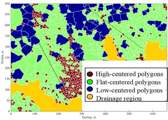 Figure 1. Data-driven delineation of polygon types at the NGEE-Arctic Barrow, AK study site. Multiple data types and a statistical approach were used to document the existence and importance of functional zones, or groups of polygons that have unique distributions of above and below ground properties that influence carbon fluxes.
High Alpine and Arctic Research Program (HAARP) at Texas A&M University has been very active in various research programs. These programs have been focusing on hydrology, mass movement and climate change in the San Juan Mountains of southwestern Colorado. The Uncompaghgre and San Miguel rivers have been studied to document the impact of river restoration on bank stability and post-restoration impact. Two studies have been focusing on the impact of mine tailings and restoration on water chemistry on the Uncompaghgre River. Streams were sampled above mining levels, in mine, on restoration and downstream from restoration efforts. Results indicate that water chemistry about the mines was the same as water chemistry post restoration. In other words, restoration of mine spoils had no impact on downstream water chemistry. A second study is currently collecting both airborne and water samples along a north-south transect to evaluate the impact of elevation and aspect on deposition pathways of airborne particles on watershed and stream chemistry.
A study of the importance of lithology on step –pool formation is being undertaken on various streams in the San Juan Mountains. Another study is using dendrogeomorphology to map movement of a large landslide on the southern side of Ouray, Colorado. In addition, the use of time-domain (TEM) electromagnetics is evaluating the internal structure of a rock glacier and comparing results with ground penetrating radar (GPR) of the rock glacier. In addition, we are comparing GPR images of a rock glacier with an exposed trench in the rock glacier to verify resolution quality.
We have been monitoring air and ground temperatures in the San Juan Mountains. We have been collecting ground temperatures (~ 1 m below grade) at 32 stations within the San Juans. To date we have detected a warming of ground temperatures of ~ 1°C from 1984 -2013.
We are beginning a new program of mapping geomorphology and associated hazards in Denali National Park with the National Park Service. The HAARP has acquired new equipment including a Leica Terrestrial LiDAR, two drones, a 4×4 five-person Teryx, 3 YSI monitors, 3 DR890 Hach Coloimeters, 3 portable weirs and 3 Rickly alpine-stream flow gages.
Geophysical Institute Permafrost Laboratory (GIPL), University of Alaska Fairbanks research team led by Prof. Vladimir Romanovsky continued the development of the observation borehole network for the thermal state of permafrost (TSP) monitoring in Alaska, Russia, and Central Asia as part of the Arctic Observing Network project. The work included data collection and maintenance of existing boreholes, instrumentation of new or recovered boreholes, and gathering of historical data. In 2014, ten shallow (10 m) boreholes were instrumented with thermistor strings for continuous temperature measurements along the Alaska Highway between Fairbanks and Tok, Alaska. These boreholes are part of a project involving approximately 120 shallow boreholes that were donated to GIPL by ExxonMobil. The transect of boreholes follows the Alaska Highway from the US/Canada border to Delta Junction and then follows the Trans-Alaska Pipeline System (TAPS) corridor north to Prudhoe Bay. GIPL will continue to instrument and collect data from the selected boreholes for the next 4 years.
GIPL team started a new project entitled “Use of AIEM permafrost module output to assess the permafrost changes in the 21st century” funded by USGS Alaska Climate Science Center. The project focusses on modeling the effects of surface disturbances, both natural and anthropogenic, on permafrost thermal dynamics over the entire North Slope of Alaska.
During April – June, 2014, Asso. Prof. Sergey Marchenko, as a member of the International team of permafrost experts, took part in field excursions from Lanzhou, Gansu, China to the Qinghai-Tibet Plateau (along the Qinghai-Tibet Transportation Corridor and upper part of the Yellow River) and to the North East China, area of the Russia-China Crude Oil Pipeline project. During the field work, permafrost, hydrological, and paleo-environmental studies were conducted, and an integrated meteorology-permafrost-hydrology observatory was established at the source of the Yellow River at elevation of 4,450 m. Dr. Marchenko continued with permafrost and hydrological monitoring in the Tien Shan Mountains, Kazakhstan and during September 2014 organized a summer school in collaboration with colleagues from the Institute of Geography of the Republic of Kazakhstan.
As an ERC funded researcher now based at AWI in Germany and in an affiliated position with the GIPL, Dr. Guido Grosse participated with USGS and UAF team members in a three week snow machine expedition on the Alaska North Slope in April 2014 within the NSF AON funded lake observation network CALON, and the ERC project PETA-CARB studying thermokarst and soil carbon dynamics. The team sampled about 30, mostly thermokarst lakes, and drilled multiple shallow permafrost cores from drained lake basins and upland sites. A research highlight was the publication of a Nature paper on thermokarst lakes as a long-term carbon sink (Walter Anthony et al., 2014) based in parts on NSF and NASA-funded work by Dr. Grosse at the GIPL.
Dr. Reginald Muskett continued investigations into the changes of the permafrost regions of the Northern Hemisphere and Alaska using methods and techniques of Space Geodesy. This year Reginald had three publications (http://permafrost.gi.alaska.edu/user/8/biblio). Dr. Muskett convened and chaired permafrost science sessions at the EGU General Assembly; the AGU Fall Meeting; and the Open Session on Permafrost at the 4th EUCOP. Dr. Muskett participated in a workshop organized by the Jet Propulsion Laboratory for a newly proposed satellite dual-band radar mission of NASA and the Indian Space Research Organization at the USGS Headquarters in Reston, Virginia. He also participated in a workshop/meeting organized by the USGS Alaska Climate Science Center with partner Alaska and Canada-based Landscape Conservation Cooperative Services held in Anchorage, Alaska.
Dr. Alexander Kholodov continued his permafrost coring efforts for cryostratigraphic, paleoenvironmental, and biogeochemical research. As a part of collaboration with Argonne National Laboratory, US Depart of Energy three boreholes (ranging from 5-11 m) were drilled in Interior Alaska. Also, two 15 meter deep boreholes were drilled at the lower Kolyma River area as part of the NSF funded “The Polaris” project. A number of laboratory analyses including soil physical properties, palynology, estimation of carbon pools, composition of organic matter, enzyme activity, and microbiology are being conducted on samples from the foregoing permafrost cores. As part of the NSF AON project, boreholes from 9 to 15 m depth were instrumented for continuous temperature measurements. Dr. Kholodov was awarded funding from NSF for a new collaborative project entitled “Vegetation and ecosystem impacts on permafrost vulnerability”; the project starts in January 2015.
Dr. Dmitry Nicolsky worked on ground temperature modeling in the Northern Hemisphere using a historical climate forcing CRU3.1 for the retrospective (1960-2009) and CCSM RCP 4.5/8.5 scenarios for the future (2009-2300) analysis of permafrost dynamics. Dr. Nicolsky also investigates effects of uncertainties in parameterization of the ground properties and climate forcing on results of the numerical simulations.
Dr. Santosh Panda continued working on a National Park Service (NPS) funded permafrost modeling project focused on developing high-resolution (30 m) maps of near-surface permafrost temperature and active-layer thickness for national parks in Alaska. Products and reports of the permafrost modeling in Denali and Wrangell-St. Elias National Park and Preserve are now available on both the GIPL and NPS websites (https://irma.nps.gov/App/). High-resolution permafrost modeling in the five Arctic national parks is currently ongoing. The modeling products and reports of Arctic parks will be available by spring 2015. Dr. Panda started a new collaborative project entitled “Hot Times in Cold Places: The Hidden World of Permafrost” funded by NSF. The project focusses on improving the delivery and effectiveness of STEM learning related to climate change.
PhD student Prajna Regmi Lindgren performed remote sensing analysis of thermokarst lake methane ebullition from Fairbanks lakes within a NASA funded project on North American lake methane emissions. She also continued working on lake mapping and change analysis for the Western Alaska LCC region. In April, she attended Western Alaska Interdisciplinary Science Conference to present her work on lake mapping using object-oriented classification techniques. She presented her results from the remote sensing analysis of methane ebullition bubbles at the 4th EUCOP in June.
Louise Farquharson, PhD student in Quaternary geology, presented new data from her National Park Service funded project on modern coastal dynamics in NW Alaska at the 4th EUCOP and for the National Park Service Climate Change webinar series. During July 2014, Louise conducted canoe based field work along the upper Noatak River, collecting hundreds of soil samples in order to answer the question: how does ice wedge polygon development affect century to millennial scale soil organic carbon accumulation? She currently has an article in review at Quaternary Science Reviews “Facies analysis of Yedoma thermokarst lakes on the northern Seward Peninsula, Alaska” and is currently preparing the manuscript “Spatial distribution of major thermokarst landforms across Arctic Alaska” which will describe results of thermokarst landform mapping at sites aligned with the NSF AON funded lake observation network CALON. This mapping effort was done in collaboration with the Alaska Thermokarst Model extension of the Integrated Ecosystem Model for Alaska project (jointly funded by the Arctic Landscape Conservation Cooperative and the USGS Alaska Climate Science Center).
Viacheslav Garayshin joined the GIPL team as a new PhD student under Dr. Nicolsky. His work explores the influence of climate and ground physical properties on ice wedge destabilization with an ultimate goal of improving the understanding of ice wedge degradation on the North Slope of Alaska.
Visit Geophysical Institute Permafrost Laboratory website for further details on the current and past projects, data, reports, publications of all GIPL members, and latest permafrost news, www.permafrostwatch.org. GIPL Team: Vladimir Romanovsky, Sergey Marchenko, Guido Grosse, Alexander Kholodov, Reginald Muskett, Dmitry Nicolsky, William Cable, Santosh Panda, Prajna Regmi Lindgren, Louise Farquharson and Viacheslav Garayshin.
George Washington University (GWU): Permafrost research at GWU is focused on three thematic areas: long-term monitoring and dynamics of the active-layer and near-surface permafrost (CALM), interactions between permafrost and hydrologic regimes in the Russian Arctic, and socio-economic development in Russian permafrost regions.
Field activities for the Circumpolar Active Layer Monitoring (CALM) project were conducted in Alaska and Russia during the summer of 2014 under the newly established CALM IV program. CALM IV is funded by the U.S. National Science Foundation’s Arctic Observing Network program for the 2014-2019 period, and provides support for field operations at permafrost observatories in northern and western Alaska and at numerous Russian sites. The project is headquartered at GWU, with subcontracts to the University of Montana and Northern Michigan University. The 2014 Alaska field team consisted of Nikolay Shiklomanov and Dmitry Streletskiy (GWU), Anna Klene (University of Montana), Fritz Nelson (Northern Michigan University and Michigan State University), and four GWU students (S. Dahodwala, E. Dolfi, K. Nyland, and E. Watson). Annual active-layer and ground-temperature observations were conducted at a series of CALM sites representative of the diverse climatic and landscape conditions on the North Slope of Alaska and Seward Peninsula. Ground-subsidence monitoring by means of differential GPS was conducted at several sites. All data generated under CALM’s programs are available through the CALM webpage .
We continue to develop methodology for quantitative evaluation of socio-economic impacts on permafrost degradation. Over the past several years we have broadened this research by including political, economic, and demographic issues related to development in Russian permafrost regions. This research effort is collaborative between the GWU Geography department, the GWU Institute for European, Russian and Eurasian Studies (IERES), and the University of Tromso, Norway.
Dmitry Streletskiy spent much of summer 2014 in central Siberia, where GWU geography masters students Kelsey Nyland and Stephen Ross, and undergraduate Jennifer Young joined twelve students from Russia, Norway, Germany, and the UK on a multidisciplinary Arctic study of the various impacts of climate change on social and environmental systems affected by permafrost. The field course has been organized by Dmitry Streletskiy and Valery Grebenets (Moscow State University) for several years, with help from the Barents Institute (Norway) and several private sponsors. This summer, the course focused on the Yenisei North. Investigations were concentrated in Igarka in the forest-tundra transition zone on discontinuous permafrost, and in Norilsk in the continuous permafrost zone dominated by tundra landscapes. In Igarka, students were involved in field work conducted by the Igarka Geocryology Lab under a joint UNH – GWU collaborative research project examining the role of various hydrological inputs to river watersheds. In Norilsk, students were exposed to problems of development and construction on permafrost and helped to collect field data on permafrost temperature and building deformation under the Arctic Urban Sustainability in Russia project. At both locations, students visited CALM sites to measure active-layer thickness. More information on these activities is available at: http://barentsobserver.com/en/society/2014/07/permafrost-thaw-cracks-urban-infrastructure-students-dig-15-07.
Senior CALM investigators and graduate students made presentations at several 2014 conferences, including the annual meetings of the Association of American Geographers (Tampa) and the American Geophysical Union (San Francisco), the Fourth European Conference on Permafrost (Ėvora), the European Geophysical Union (Vienna), the DUE Permafrost workshop (Frascati), and the Arctic Urban Sustainability Conference (St. Petersburg). Fritz Nelson delivered the keynote conference address at the 2014 meeting of the Michigan Academy of Science, Arts and Letters.
Kristen Pyne completed a master’s degree in geography at GWU with a thesis entitled Relation between Snow and Winter Soil-Surface Temperatures in Tundra Landscapes: Results of Observations in Northern Alaska. At UM, Katrina Keleher completed a senior undergraduate thesis entitled Comparison of instrumentation to measure air and soil temperatures in northern Alaska.
National Snow and Ice Data Center (NSIDC) will integrate existing borehole data into the Global Terrestrial Permafrost Network (GTN-P), doubling the number of sites. The main objectives of this work are 1) extract and integrate select NSIDC Frozen Ground Data Center (FGDC) and Advanced Cooperative Arctic Data and Information Service (ACADIS) permafrost data holdings into the GTN-P data system; 2) support semantic infrastructure by extending the GTN-P domain ontology to include broader permafrost and climate modeling concepts and terms; 3) close the interoperability loop by integrating GTN-P metadata and systems with the distributed Arctic Data Explorer search portal and Arctic Observing Viewer; and 4) improve data usability through visualization services that quickly produce customized maps at multiple spatial scales. The team is funded by National Science Foundation (NSF) and consists of Lynn Yarmey, Elchin Jafarov, Kevin Schaefer and Antonia Rosati from NSIDC in collaboration with the Iceland-based Arctic Portal team developing the GTN-P data system.
The Remotely Sensed Active Layer Thickness (ReSALT) product uses the Interferometric Synthetic Aperture Radar technique to measure seasonal surface subsidence and infer ALT in several regions in Alaska (Figure 1). Measuring ALT using remote sensing would provide valuable information over regional spatial scales to complement the in situ measurements at CALM sites. The team consists of Tingjun Zhang, Kevin Schaefer, and Elchin Jafarov at NSIDC, Albert Chen and Howard Zebker at Stanford University, Andrew Parsekian at the University of Wyoming, and Lin Lui at the Chinese University of Hong Kong. ALT remote sensing techniques typically use empirical relationships between probe measurements and a physical attribute applied to remotely sensed data of that attribute to extrapolate ALT over a larger area. Our results indicate remote sensing techniques based on InSAR could be an effective way to measure and monitor ALT.
 Figure 2. 1992-2000 average Remotely Sensed Active 1992-2000 average Remotely Sensed Active Layer Thickness (ReSALT) for the Prudhoe Bay area on the North Slope of Alaska derived from the European Remote-Sensing Satellite (Liu et al., 2012).
Schur Lab, at Ecosystem Dynamics Research Lab, University of Florida and Center for Ecosystem Science and Society (ECOSS), Northern Arizona University: Carbon in Permafrost Experimental Heating Research (CiPEHR) at Eight Mile Lake, Healy AK. Understanding arctic carbon (C) dynamics is crucial for predicting regional and global ecosystem responses to climate change. CiPEHR is designed to investigate the impact of thawing permafrost and warmer summer air temperatures on moist acidic tundra. Located in a discontinuous permafrost zone at the southern extent of arctic tundra, this region may foreshadow C cycle vulnerabilities and instabilities in a changing climate. Since 2008, the rate of permafrost thaw has been promoted with snow fences, which accumulate snow and insulate the ground in winter while summer air temperatures have been increased using open top chambers (OTCs).
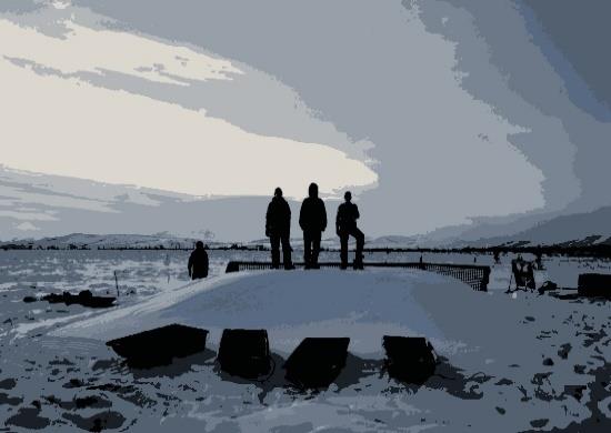 Figure 3. The insulating layer of snow that builds up in the winter must be shoveled off in the spring to prevent phonological delays and increased water input.
Carbon exchange is monitored during the growing season with automated chambers, and 13C and 14C are used to partition respiration fluxes into contributions from autotrophic, heterotrophic, young and old soil C. In order to better understand the mechanisms responsible for changes in C dynamics we also measure thaw depth, water table depth, plant growth and community composition, NDVI, plant phenology, plant tissue nitrogen (N) content and soil N cycling.
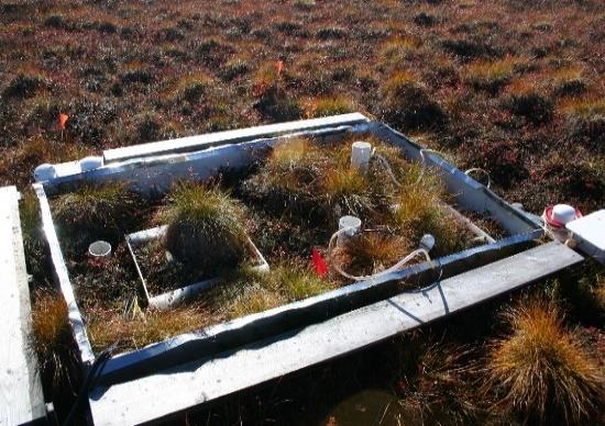 Figure 4. A water table manipulation plot from DryPEHR.
So far we have found that plant growth increased vigorously, initially only in response to air warming. After 3 years of soil warming a progressively deeper active layer and higher N availability stimulated plant growth more than elevated air temperatures. Although soil respiration also increased in response to thaw, the growing season remained a C sink because plant C uptake exceeded respiration losses. However, winter C losses estimated using soil temperature driven models suggest that on an annual basis the degradation of permafrost may have pushed the system from a C sink to a C source. This result supports other evidence that the arctic is increasingly an annual C source.
Large uncertainties still remain, however, particularly about the influence of winter respiration on the annual C balance, interactions between soil C and N cycling, the importance of autotrophic vs. heterotrophic contributions to respiration fluxes, and the influence of water table changes.
 Figure 5. A view of experimental plots, OTCs and C flux autochambers.
In 2011 CiPEHR was expanded to include DryPEHR, a water-table manipulation experiment, DryPEHR investigates CO2 and CH4 fluxes given the additional complexity that permafrost thaw can cause either surface subsidence and water-saturated soil or sudden drainage. Results from this study are forth coming.
We have manuscripts in review. One addresses improvements to our winter C model; a separate manuscript investigates how permafrost thaw affects the heterotrophic respiration of old soil C.
Ongoing soil incubation studies in the lab allow us to examine the decomposition dynamics of labile and recalcitrant C pools within active layer and permafrost soils. One study in progress looks at N dynamics throughout the soil profile while another explores the role of priming during the decomposition of the permafrost soil C pools. This summer we worked hard to erect a windmill to power our Eddy tower at the nearby Eight Mile Lake site to increase our sampling during dark winters. We conducted a pilot study using the Picarro G2121-i analyzer and in 2015 we will launch an extended sampling campaign to capture high-frequency seasonal 13C dynamics of ecosystem respiration.
 Figure 6. Measuring δ13C of ecosystem respiration using the Picarro G2121- i.
Individual Member Activities
Kristine de Leon (Ph.D. Student, Department of Soil, Water, and Environmental Sciences, University of Arizona): Before starting my first year in graduate school, I spent the summer in the High Arctic in Svalbard, Norway to study Arctic Microbiology at the University Centre at Svalbard. There, I gained useful theoretical and practical field knowledge on Arctic microbiology and ecosystems that I will apply to my graduate research. My graduate work focuses on utilizing metagenomic and metaproteomic methods to study carbon cycling in a permafrost thaw gradient in Stordalen Mire, Abisko, Sweden. I am interested in permafrost thaw, because in many parts of the Arctic, permafrost thaw due to rising temperatures results in the conversion of dry tundra to wetland bog and fen ecosystems. Such increases in anaerobic environments may have substantial feedbacks to the rate of climate change through the increased production of CH4, a greenhouse gas an order of magnitude more potent than the CO2 respired from aerobic soils. However, the controls on these decomposition processes are complex and include changes in hydrology, temperature, pH, plant community influences on the soil, and microbial community composition. As part of a large DOE-funded, international collaboration, we synthesize information gained from isotope biogeochemistry, organic carbon chemistry, geology, microbiology, and ecosystem science in order to characterize the controls on carbon cycling in a thawing permafrost peatland. The resulting picture of the ecosystem transition will allow us to better understand the potential feedbacks of Arctic permafrost thaw on the global climate system.
Daniel Fortier: In collaboration with Prof. Yuri Shur and Prof. Mikhail Kanevskiy of the University of Alaska Fairbanks, Prof. Daniel Fortier and M. Sc. student Lyna Lapointe-Elmrabti, pursued their work on yedoma deposits of the Alaska-Yukon sector of Beringia. Using pollen analysis and transfer function, we study changes in ecological conditions and climate during the Pleistocene/Holocene and evaluate paleo-environmental gradients between Northern Alaska and southern Yukon.
Reginald Muskett continues research investigations into the changes of the permafrost regions of the Northern Hemisphere with measurements from the Gravity Recovery and Climate Experiment (GRACE), the Phase Array L-band Synthetic Aperture Radar (PALSAR) and the Moderate Resolution Imaging Spectroradiometer (MODIS). This year he published two more papers on Arctic land-surface temperature nighttime and diurnal trends (Muskett, 2014a and b) in addition to the paper on the Lena Delta and Laptev Sea using measurements from the Ice, Cloud and land Elevation Satellite (ICESat), which was reported earlier (2014c), and is preparing a new paper on active layer soil moisture measurements and satellite-algorithm retrievals. He is also working with other members of the lab on new projects in Alaska’s permafrost regions and is preparing project proposals to NASA as well as joint-member proposals to NSF for 2015.
In 2014 Reginald continued and expanded his activity of convening and chairing permafrost science sessions at the European Geoscience Union (EGU) General Assembly, Vienna, Austria, and elsewhere internationally. At the EGU Reginald co-convened and co-shared again the session on “Assessing the effects of global warming on permafrost degradation.” Reginald was the convener and chair of the Open Session on Permafrost at the 4th European Conference on Permafrost held in Évora, Portugal during June 2014. He also submitted a permafrost session proposal to the American Geophysical Union Fall Meeting Near Surface Geophysics Focus Group committee. After collection of abstracts and negotiations with another interested group the combined session, “Applications of Near-Surface Geophysics in Cold Regions” was accepted for the AGU Fall Meeting in San Francisco during which he will be Chair and co-convener of the Oral and Poster sessions.
This year Reginald participated in the Jet Propulsion Laboratory – NASA workshop held at the USGS Headquarters, Reston, Virginia, on the new proposed satellite dual-band radar mission, NISAR, a joint mission proposed by NASA – Indian Space Research Organization. Other interested US Federal Agencies included USGS, Dept. of Navy, NOAA and DHS. He also attended the USGS Alaska Climate Science Center – Alaska and Canada-based Landscape Conservation Cooperative Services workshop/meeting in Anchorage, Alaska.
 Figure 7.
Muskett, R. (2014a) “MODIS-Derived Nighttime Arctic Land-Surface Temperature Nascent Trends and Non-Stationary Changes,” American Journal of Climate Change, Vol. 3, pp. 169-177. doi: 10.4236/ajcc.2014.32016.
Muskett, R. (2014b) “Arctic Diurnal Land-Surface Temperature Range Changes Derived by NASA MODIS-Terra and -Aqua 2000 through 2012,” Atmospheric and Climate Sciences, Vol. 4, pp. 231-240. doi: 10.4236/acs.2014.42026.
Muskett, R. (2014c) “ICESat-Derived Elevation Changes on the Lena Delta and Laptev Sea, Siberia,” Open Journal of Modern Hydrology, Vol. 4, No. 1, pp. 1-9. doi: 10.4236/ojmh.2014.41001.
Dave Swanson (National Park Service, Fairbanks, AK) completed a map of active-layer detachments (ALD) and retrogressive thaw slumps (RTS) in the 5 National Parks of northern Alaska based on high-resolution satellite imagery. There were over 2000 ALD, exposing about 300 ha of bare soil, and 700 RTS exposing about 235 ha of bare soil. Most of the ALD appear to have formed in the early- to mid-2000 decade and are now re-vegetating, while many of the RTS are still active. The NPS is monitoring the growth of selected RTS with 3D models constructed from 35 mm digital aerial photographs. For links to NPS reports on these and related topics see http://science.nature.nps.gov/im/units/arcn/vitalsign.cfm?vsid=9 and https://irma.nps.gov/App/Reference/Search?collectionId=618.
Gareth (Gary) Trubl (Ph.D. Student, Department of Soil, Water, and Environmental Sciences, University of Arizona): The microbial release of CO2 and CH4 from thawing permafrost is a major positive feedback that perpetuates permafrost thaw. Once permafrost has begun to thaw the juicy organic carbon becomes available for microbes. Viruses are the ultimate control on microbial populations and their function. Viruses are the most abundant biological entities on Earth and their impact on carbon cycling in permafrost habitats is poorly understood, because they have never been researched in permafrost! Viruses of microbes (i.e. phages) play central roles in C cycling in the oceans, through cellular lysis (phage drive the largest ocean C flux about 150 Gt yr-1, dwarfing all others by >5-fold), production of associated DOC, as well as transport and expression during infection (1029 transduction events day-1). Preliminary data from our lab shows phage are at least 100x more abundant in our field site (Stordalen mire, Abisko, Sweden), then in the oceans and therefore may play a larger role in carbon and nutrient cycling. Not only is this work novel, but any results can further the >100 years research that has been performed at the mire. Currently we are working on a model for the site to determine the overall impact of permafrost thaw, potential habitat transformations, and their effect on climate change. This work is key in making this model accurate. To address the potential role of phage in C cycling in these dynamic systems, we are examining phage from an arctic permafrost thaw gradient in northern Sweden. We have developed a protocol for successfully extracting phage from peat soils and are quantifying phage through epifluorescence microscopy and quantitative transmission electron microscopy analyses. Along with this we are constructing the first permafrost viromes for identification and to understand their role in this critical habitat. US Department of Energy Office of Biological and Environmental Research (DE-SC0004632 and DE-SC0010580).
Kenji Yoshikawa (University of Alaska Fairbanks) and Russian colleagues visiting indigenous communities around the Eastern Siberia including most of Sakha Republic (Yakutia), Baikal, Chukotka and Kamchatka for establishing community based permafrost /active layer network, which was covered 90 communities in Russia today. Data archived book “Permafrost in Our Time” published using our monitoring sites and data nearly 300 communities mainly in North America and will republish Russian version next a few years. Electric version is available at http://issuu.com/permafrostbook/docs/piots. The hard copy book was delivered to the communities for education and outreach purpose all of the Alaskan villages and some in others. For leading of the Thematic Network on Permafrost at the University of the Arctic, we keep updating IPA International University Courses on Permafrost (http://ipa.arcticportal.org/resources/courses-iucp.html) and operated the International Permafrost Summer Course with Hanne Christiansen at UNIS(more detail; see Education and outreach activities on this issue of Frozen Ground)(https://www.facebook.com/TNPermafrost).
 Figure 8. Permafrost education open house at Yakut.
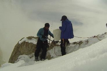
Figure 9. Denali (Mt. McKinley) monitoring site.
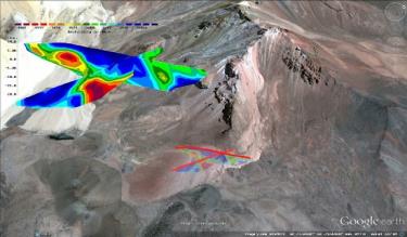
Figure 10. Image of DC resistivity survey results at Coropuna site, Peruvian Andes.

Figure 11. DC resistivity survey at Chachani (5350m).
For mountain permafrost, we did have a temperature monitoring boreholes in Chachani (6057m), Coropuna (6425m) Peru, Kilimanjaro (5895m) Tanzania, Iztaccihuatl (5230m) Mexico, Mauna Kea (4205m) Hawaii, USA and Denali (Mt. McKinley) (6168m) today including satellite based data logging system (https://www.facebook.com/Kilimanjaro2012). We had great success to operate DC resistivity survey at Peruvian Andes and Hawaii.
Deaths
We regret to announce the death on October 2, 2014 of Professor Emeritus John C.F. Tedrow, Rutgers University, at age 97. John was a pioneer in polar soil science, an advisor to more than 20 doctoral and masters students, long-time editor of the journal Soil Science, and author of over 100 publications. His textbook Soils of the Polar Landscapes is a lasting tribute to his knowledge and scholarship. A detailed obituary appears in the December 2014 issue of Arctic.
 Figure 12. Photo of John C.F. Tedrow.
Report prepared by Molly McGraw, Secretary US Permafrost Association ( molly.mcgraw@selu.edu)